Climate data Trends and Scenarios in Sri Lanka








- Slides: 30
Climate data, Trends and Scenarios in Sri Lanka AS-12 Senaka Basnayake Center for Climate Change Studies (CCCS) Department of Meteorology Colombo Sri Lanka
Outline of the Presentation ¬ Meteorological data required ¬ Trend analysis performed ¬ Encountered & anticipated problems of climate scenario development
Overall Objectives ¬Project the climate change scenarios in the coconut and tea growing areas based on the Global Circulation Model results relevant to South Asia.
CLIMATE DATA
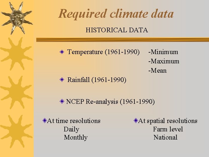
Required climate data HISTORICAL DATA Temperature (1961 -1990) -Minimum -Maximum -Mean Rainfall (1961 -1990) NCEP Re-analysis (1961 -1990) At time resolutions Daily Monthly At spatial resolutions Farm level National
Required climate data contd. FUTURE DATA Global Circulation Model outputs – 2020, 2050 At time resolutions Daily Monthly At spatial resolutions Regional level
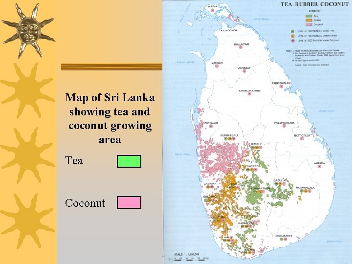
Map of Sri Lanka showing tea and coconut growing area Tea Coconut
TREND ANALYSIS
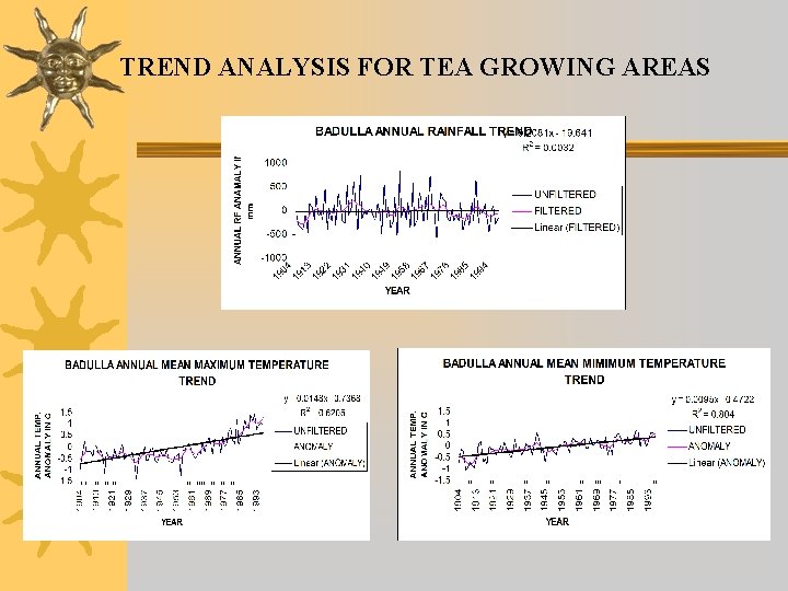
TREND ANALYSIS FOR TEA GROWING AREAS
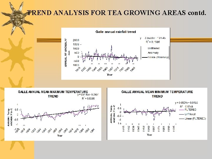
TREND ANALYSIS FOR TEA GROWING AREAS contd.
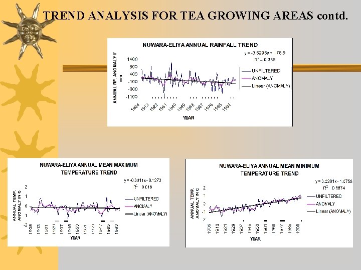
TREND ANALYSIS FOR TEA GROWING AREAS contd.
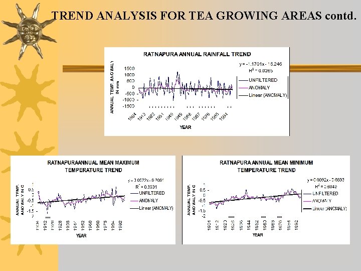
TREND ANALYSIS FOR TEA GROWING AREAS contd.
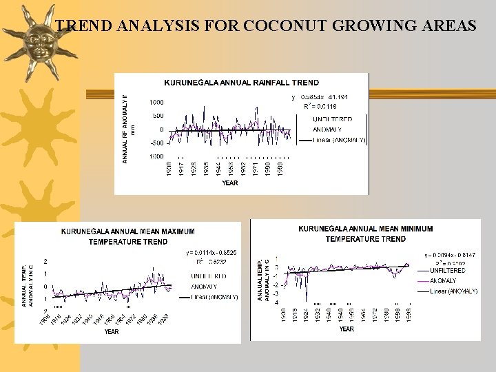
TREND ANALYSIS FOR COCONUT GROWING AREAS
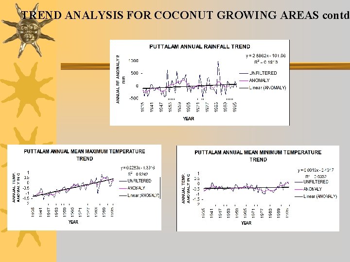
TREND ANALYSIS FOR COCONUT GROWING AREAS contd
SCENARIO DEVELOPMENT
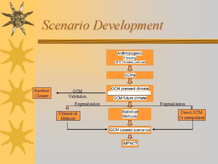
Scenario Development Baseline Climate GCM Validation Regenalisation Dynamical Methods Regenalisation Direct GCM Or interpolated
Downscaling in Brief
Criteria for selection of Downscaling method 1. Availability 2. Suitability/Feasibility Therefore SDSM has been selected
SDSM ( Statistical Downscaling Method) This has an ability to develop climate scenarios at a single-site of daily surface climate variables under current and future climate forcing.
Data input for SDSM ¬ Baseline Climatological data (1961 -1990) ¬ NCEP Reanalysis data (1961 -1990) ¬ Global Circulation Model (2020 and 2050)
Problems encountered • Lack of computerized data (some data still in hard copies) • Downloading of NCEP and GCM from other web sites was also not possible, Because it gives outputs for the whole globe but not for the area which we are interested. • Downloading NCEP and GCM data has to be postponed for about two months due to the delay of establishment of Canadian web site on NCEP/GCM data to the area which covers Sri Lanka. • These will be made available at http: //www. cics. uvic. ca in near future
Problems anticipated Since SDSM generates site specific scenarios, spatial interpolations will have to be carried out to get the spatial distribution over a particular area or country GIS/Surfer will be used to overcome this problem
Thank You