Assessing the utility of normalized rotation in detecting
- Slides: 21
Assessing the utility of normalized rotation in detecting tornado development in the Allegheny Front Northeast Regional Operational Workshop XVII 3 November 2016 Dylan T. Cooper – NOAA/NWS, WFO Charleston, WV Alex J. Vorst – Ohio University, Athens, OH 1 1 Present affiliation: Mechanicsburg High School, Mechanicsburg, OH
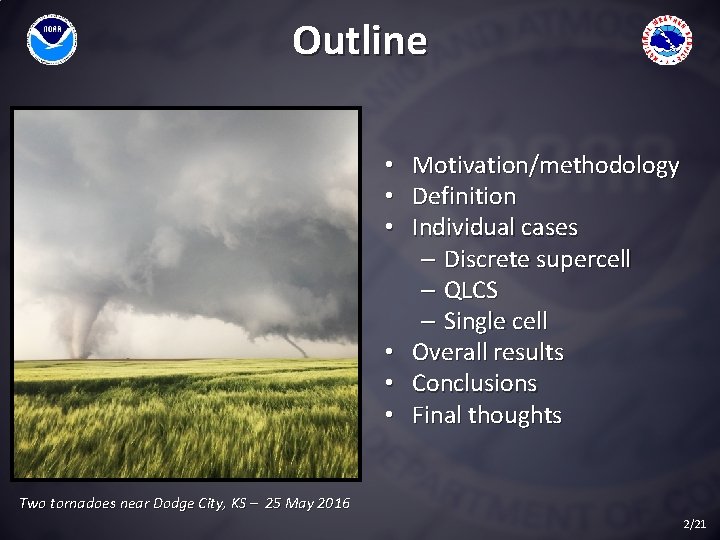
Outline • • • Motivation/methodology Definition Individual cases – Discrete supercell – QLCS – Single cell Overall results Conclusions Final thoughts Two tornadoes near Dodge City, KS – 25 May 2016 2/21
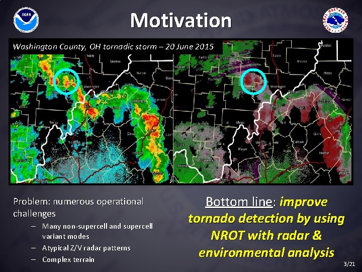
Motivation Washington County, OH tornadic storm – 20 June 2015 Problem: numerous operational challenges – Many non-supercell and supercell variant modes – Atypical Z/V radar patterns – Complex terrain Bottom line: improve tornado detection by using NROT with radar & environmental analysis 3/21
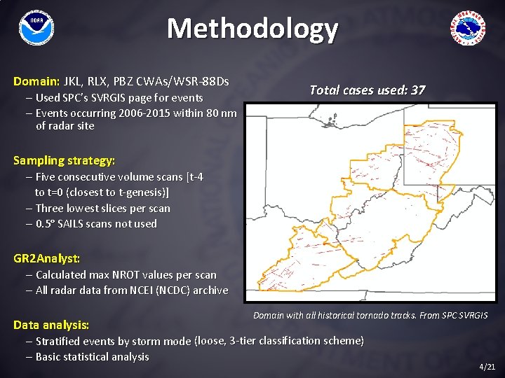
Methodology Domain: JKL, RLX, PBZ CWAs/WSR-88 Ds – Used SPC’s SVRGIS page for events – Events occurring 2006 -2015 within 80 nm of radar site Total cases used: 37 Sampling strategy: – Five consecutive volume scans [t-4 to t=0 (closest to t-genesis)] – Three lowest slices per scan – 0. 5° SAILS scans not used GR 2 Analyst: – Calculated max NROT values per scan – All radar data from NCEI (NCDC) archive Data analysis: Domain with all historical tornado tracks. From SPC SVRGIS – Stratified events by storm mode (loose, 3 -tier classification scheme) – Basic statistical analysis 4/21
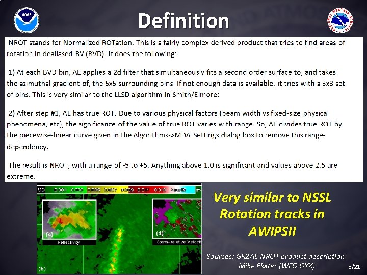
Definition Very similar to NSSL Rotation tracks in AWIPSII Sources: GR 2 AE NROT product description, Mike Ekster (WFO GYX) 5/21
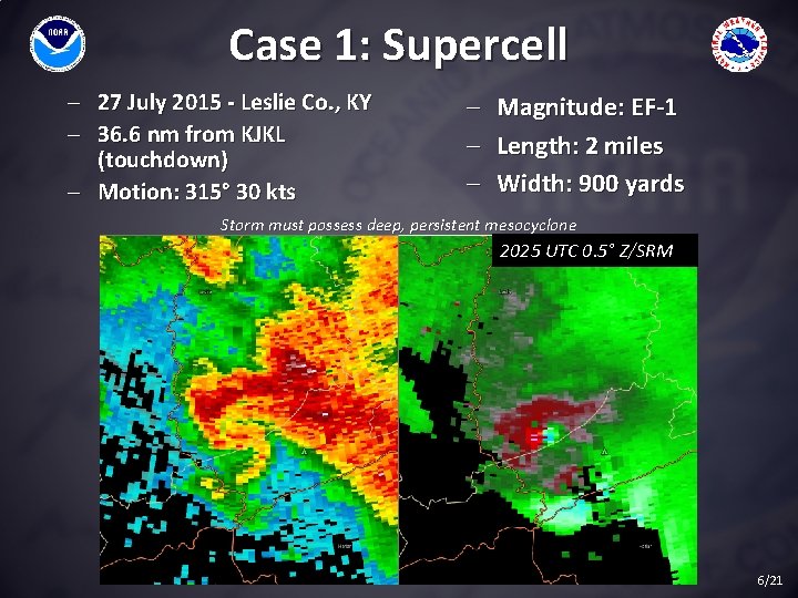
Case 1: Supercell - 27 July 2015 - Leslie Co. , KY - 36. 6 nm from KJKL (touchdown) - Motion: 315° 30 kts - Magnitude: EF-1 - Length: 2 miles - Width: 900 yards Storm must possess deep, persistent mesocyclone 2025 UTC 0. 5° Z/SRM 6/21
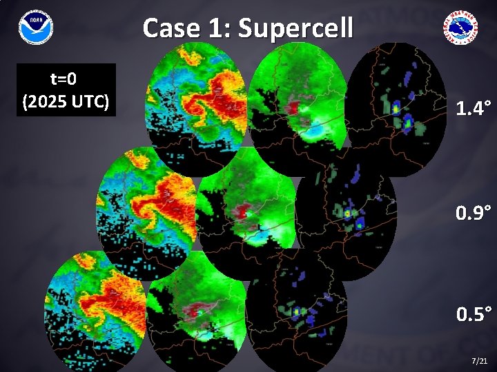
Case 1: Supercell t=0 (2025 UTC) 1. 4° 0. 9° 0. 5° 7/21
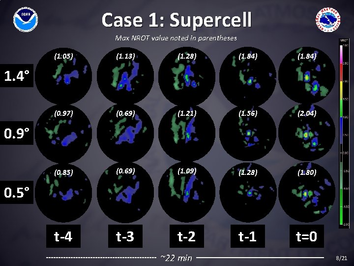
Case 1: Supercell Max NROT value noted in parentheses (1. 05) (1. 13) (1. 28) (1. 84) (0. 97) (0. 69) (1. 21) (1. 56) (2. 04) (0. 85) (0. 69) (1. 09) (1. 28) (1. 80) t-4 t-3 t-2 t-1 t=0 1. 4° 0. 9° 0. 5° ~22 min 8/21
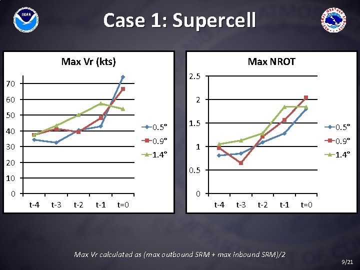
Case 1: Supercell Max Vr (kts) Max NROT 2. 5 70 60 2 50 0. 5° 40 0. 9° 30 1. 4° 20 0. 5° 0. 9° 1 1. 4° 0. 5 10 0 1. 5 t-4 t-3 t-2 t-1 t=0 0 t-4 t-3 t-2 t-1 Max Vr calculated as (max outbound SRM + max inbound SRM)/2 t=0 9/21
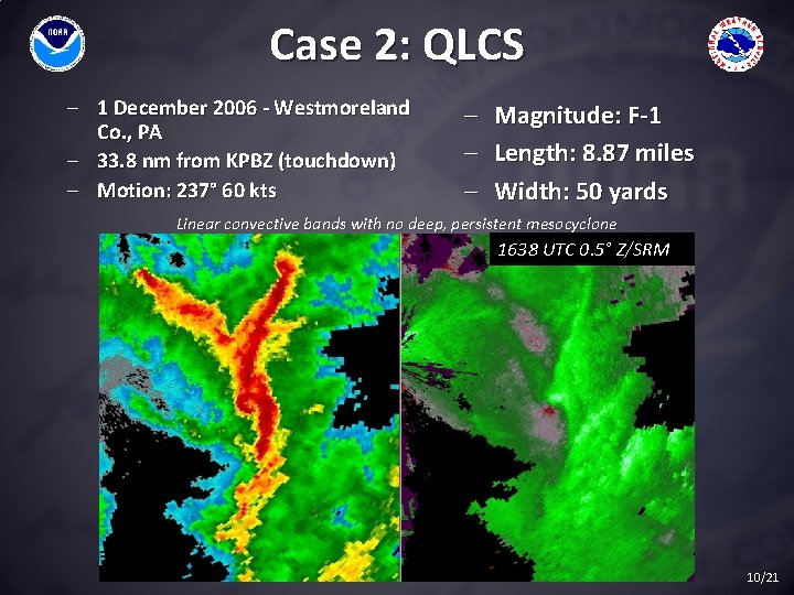
Case 2: QLCS - 1 December 2006 - Westmoreland Co. , PA - 33. 8 nm from KPBZ (touchdown) - Motion: 237° 60 kts - Magnitude: F-1 Length: 8. 87 miles Width: 50 yards Linear convective bands with no deep, persistent mesocyclone 1638 UTC 0. 5° Z/SRM 10/21
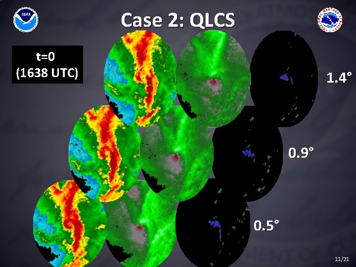
Case 2: QLCS t=0 (1638 UTC) 1. 4° 0. 9° 0. 5° 11/21
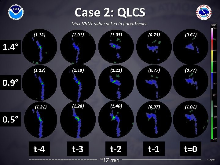
Case 2: QLCS Max NROT value noted in parentheses (1. 13) (1. 01) (1. 05) (0. 73) (0. 61) (1. 13) (1. 21) (0. 77) (1. 21) (1. 28) (1. 40) (0. 97) (1. 01) t-4 t-3 t-2 t-1 t=0 1. 4° 0. 9° 0. 5° ~17 min 12/21
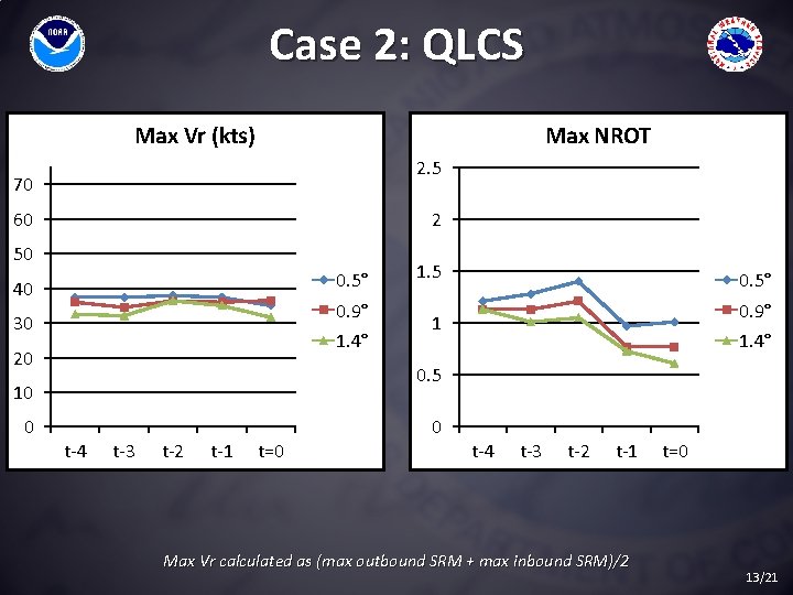
Case 2: QLCS Max Vr (kts) Max NROT 2. 5 70 60 2 50 0. 5° 40 0. 9° 30 1. 4° 20 0. 5° 0. 9° 1 1. 4° 0. 5 10 0 1. 5 t-4 t-3 t-2 t-1 t=0 0 t-4 t-3 t-2 t-1 Max Vr calculated as (max outbound SRM + max inbound SRM)/2 t=0 13/21
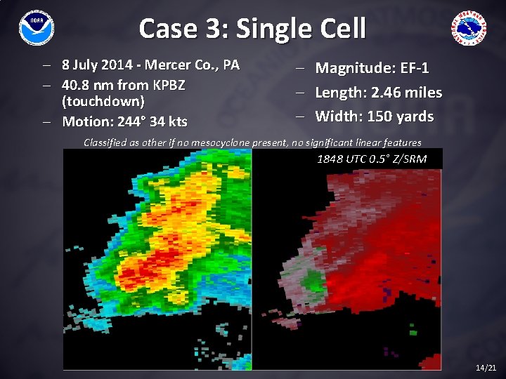
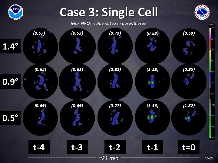
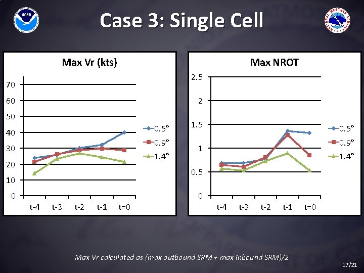
Case 3: Single Cell - 8 July 2014 - Mercer Co. , PA - 40. 8 nm from KPBZ (touchdown) - Motion: 244° 34 kts - Magnitude: EF-1 - Length: 2. 46 miles - Width: 150 yards Classified as other if no mesocyclone present, no significant linear features 1848 UTC 0. 5° Z/SRM 14/21
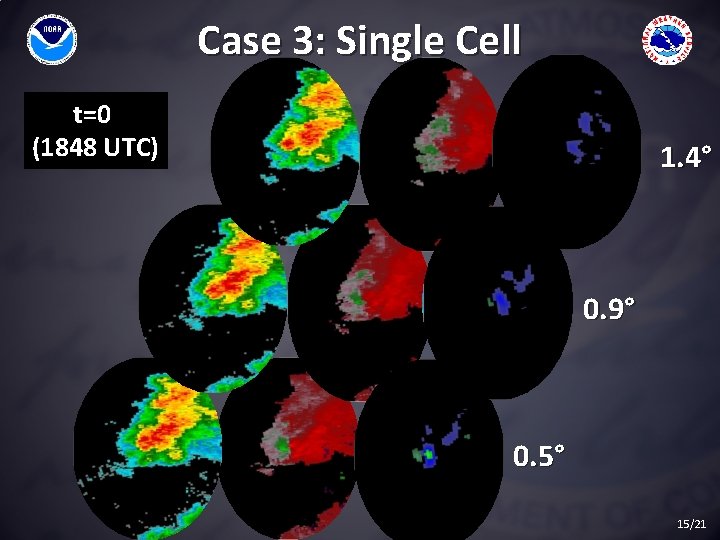
Case 3: Single Cell t=0 (1848 UTC) 1. 4° 0. 9° 0. 5° 15/21
Case 3: Single Cell Max NROT value noted in parentheses (0. 57) (0. 53) (0. 73) (0. 89) (0. 53) (0. 65) (0. 61) (0. 81) (1. 28) (0. 85) (0. 69) (0. 77) (1. 36) (1. 32) t-4 t-3 t-2 t-1 t=0 1. 4° 0. 9° 0. 5° ~21 min 16/21
Case 3: Single Cell Max Vr (kts) Max NROT 2. 5 70 60 2 50 0. 5° 40 0. 9° 30 1. 4° 20 0. 5° 0. 9° 1 1. 4° 0. 5 10 0 1. 5 t-4 t-3 t-2 t-1 t=0 0 t-4 t-3 t-2 t-1 Max Vr calculated as (max outbound SRM + max inbound SRM)/2 t=0 17/21
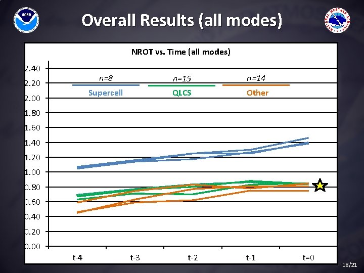
Overall Results (all modes) NROT vs. Time (all modes) 2. 40 2. 20 2. 00 n=8 n=15 n=14 Supercell QLCS Other 1. 80 1. 60 1. 40 1. 20 1. 00 0. 80 0. 60 0. 40 0. 20 0. 00 t-4 t-3 t-2 t-1 t=0 18/21
Conclusions PRELIMINARY! • Better correlation with positive NROT values • Look at upper/lower bounds and TRENDS – Different depending on storm mode? • • Better skill for supercells? Null cases? Good first step, more in depth study needed Other studies significance of values ≥ 0. 8 19/21
Final Thoughts Is there utility in using NROT for tornado prediction? Yes. Need to assess how much and best applications - Refine current data, add new data (statistical significance) Build conceptual understanding of NROT and its application Re-work with MRMS low-level rotation tracks Finally: • • • Develop training and guides to help forecasters Hands on familiarization via W 2 B/GR 2 AE simulations Full introduction to ops Only one of many tools. Still must use radar, env. data for decision-making! 20/21
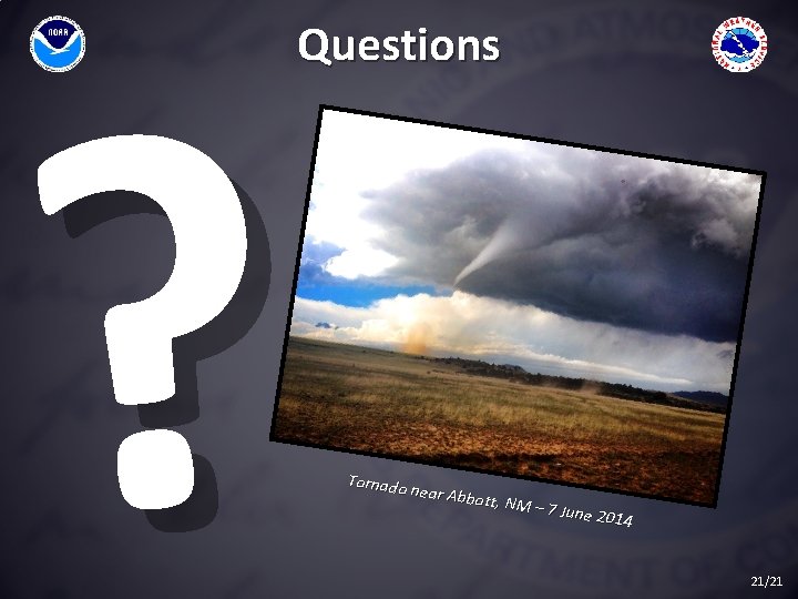
? Questions Tornado near Abb ott, NM – 7 June 20 14 21/21