Africa the Americas 300 1492 CE The Empires


 • Geography: – Located in the Rainforest")

 • Geography: Located in arid valley")

 Geography: Located in the Andes Mountains")

 = Paragraph Form/Complete Sentences 1. Describe how each of the 3")
- Slides: 15
Africa & the Americas 300 – 1492 CE The Empires of Meso-America TERMS for Quiz 1. The Bering Strait 2. Mesoamerica 3. The Maya 4. Raised Fields 5. Social Hierarchy 6. Chichen Itza 7. The Aztec 8. Tenochtitlan 9. Floating Gardens 10. The Inca 11. The Andes Mountains 12. Terrace Farming 13. Machu Picchu
I. Ancient Americans Label 1. Draw a path in color to show early man’s crossing into the Americas • People known as Native Americans originally came from Asia – Over thousands of years migrated (walked) across the Bering Strait – 1 st Americans settled all over North & South America, the most advanced civilizations developed along the equator (Label the Equator)
Bering Strait
I. Ancient Americans – Mesoamerica = “Middle” America • Modern day Mexico, Central America, & Peru • Without interaction w/ the rest of the world, 3 major empires came to dominate the region – The Maya (300 – 900 AD) – The Aztec (1200 – 1519) – The Inca (1438 – 1533) Label 2: Label the 3 civilizations on the map with dates
Label 2 Identify the 3 Native Civilizations & Color the areas 2 1 3
Effects of Geography of Meso-America • The Maya, Aztecs, & Inca will each have to overcome challenges created by the diverse topography of Meso-America to survive – Mountains, swamps, jungles • However the Meso-American empires share much in common with many of the Neolithic & Classical Era civilizations that had developed in Africa, Asia, & Europe – Centralized Governments – Social Classes, Belief Systems, & Written Languages – Traditional Economies based on Agriculture & Trade • Domesticated unique crops like Maize (corn), Potatoes,
II. The Maya Empire(300 – 900 AD) • Geography: – Located in the Rainforest (Jungles) & Swamps of Southern Mexico & Central America Social: – – Strict social classes (hierarchy) Polytheistic religion: Pyramids: Chichén Itzá 365 day calendar, understood the concept of zero Political: – City-states ruled by kings – Written records Economy – based on agriculture and trade – Create Raised Fields • change swamp land into farm land
Maya Achievements Chichen Itza
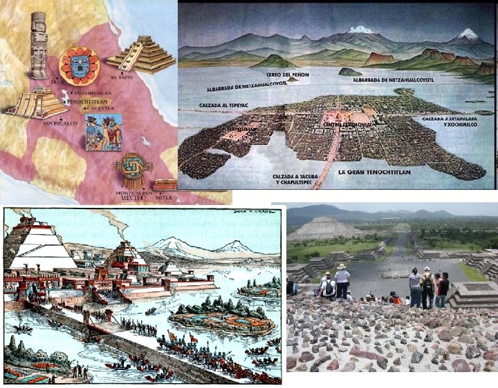
III. The Aztec Empire (1200 – 1521 AD) • Geography: Located in arid valley in central Mexico Political – Capital: Tenochtitlan-advanced island city • Ruled by an emperor • Creating Chinampas or Floating Gardens to farm in their capital city which was located on a lake Economy – based on agriculture and tribute (taxes) from conquered peoples & trade Social • Polytheistic religion: Pyramids, rituals
THE MAYA & AZTEC EMPIRES
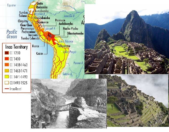
IV. The Inca Empire (1438 – 1535 AD) Geography: Located in the Andes Mountains of South America (Draw in the Andes Mountains) Political: – Capital city Machu Picchu (mtns) – Ruled by an emperor Economy – based on high-altitude agriculture (terrace farming) – Road system Social: Polytheistic religion
Inca Roads & Footbridges
Summative Assessment (P) = Paragraph Form/Complete Sentences 1. Describe how each of the 3 Mesoamerican empires adapt to challenging geography using the following terms: Maya – Swampland - Raised Fields – Aztec – Tenochtitlan – Chinampas (Floating Gardens) – Inca - Andes Mountains - Terrace Farming