The United States of America Geography of the


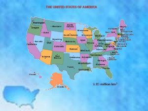
![Obrázek 1 The Map of the USA NTHURSTON. wikimedia. commons[online]. 29 November 2006 [cit. Obrázek 1 The Map of the USA NTHURSTON. wikimedia. commons[online]. 29 November 2006 [cit.](https://slidetodoc.com/presentation_image_h2/3b4b1d51f2efe10bfae970de6c0e44b0/image-15.jpg)
![Obrázek 10 All the Niagara Falls CIUJAUDE. Wikimedia commons[online]. 17. březen 2012 [cit. 11. Obrázek 10 All the Niagara Falls CIUJAUDE. Wikimedia commons[online]. 17. březen 2012 [cit. 11.](https://slidetodoc.com/presentation_image_h2/3b4b1d51f2efe10bfae970de6c0e44b0/image-16.jpg)
- Slides: 16

The United States of America – Geography of the country Název a adresa školy Střední škola zemědělská a přírodovědná Rožnov pod Radhoštěm nábřeží Dukelských Hrdinů 570 756 61 Rožnov pod Radhoštěm Název operačního programu OP Vzdělávání pro konkurence schopnost Registrační číslo projektu Označení vzdělávacího materiálu Stupeň a typ vzdělávání Vzdělávací oblast Vzdělávací obor CZ. 1. 07/1. 5. 00/34. 0441 Název tematické oblasti (sady) Reálie anglicky mluvících zemí Název vzdělávacího materiálu The USA – Geography of the country Druh učebního materiálu The Map of the USA Prezentace slouží k opakování zeměpisných znalostí země formou otázek, pravdivostních výroků a pomocí slepé mapy, což vede studenta k samostatnému výkladu toliko nezbytného pro zdárné zvládnutí maturitní zkoušky. Anotace VY_32_INOVACE_AJ 2. PYS. 04 Odborné vzdělávání Jazykové vzdělávání Anglický jazyk Klíčová slova Oregon, Alleghines, peak, plateaux, river, lakes, …. . Ročník Typická věková skupina Autor Datum zhotovení I. -IV. 16 - 19 let Ing. Zbyněk Pyš 29. 9. 2012 www. zlinskedumy. cz

ADE S rra a vad Ne Colorado App Alle ala c hia gheny Coa n M Mts sta. l Pl ts. ain s ange tal R CASC S AIN ts. U N T Sacramento M nges MO rn Ra Bigho KEY Coas ROC Sie P a c i f i c O c e a n s Missouri Gulf of Mexico Rio Grande Mississippi A t l a n t i c O c e a n

The United States of America is a federation of 50 states with the President as the head of states. It is said to be the fourth largest country in the world and it is aproximately as big as continental Europe. There are four different time zones, so when it is 8 p. m. in New York it is only 5 p. m. in Los Angeles. Obrázek 2 : The population - in 1994 was about 258, 000. President J. F. Kennedy The United States “a nation of immigrants. “ People from all over the world have come to the country and influenced its history and culture.

H H Obrázek 3 Oregon coast The USA stretches from the Atlantic Ocean in the east to the Pacific Ocean in the west. It is bordered in the north by Canada and in the south by Mexico. There are many mountains especially in the west and south-west. The Rockey Mountains extend all the way from Canada to New Mexico. The Appalachian Mountains are in the east. The highest mountain is Mt. Mc. Kinley with 6, 194 m. Obrázek 4 Shiprock. snodgrass, New Mexico

The Relief of the United States The continental U. S. consists of the Eastern Highland (i. e. the Appalachians), the Interior Plains, and the Western Highland. The Appalachians is a mountainous region stretching from the northeast as far south as Georgia. The best known are the Alleghenies with peaks like Mt. Mitchell in North Carolina, reaching 2 036 m. Between the Appalachians and the Atlantic Ocean there is a costal plain called the Atlantic Plain. The vast area stretching from the Appalachians in the east to the Rocky Mountains in the West is the Interior Plains. There is the Central Lowland – the territory of Ohio, Michigan, Indiana, Illinois, Minnesota, Iowa and Missouri, reaching the height of 450 metres above the sea level. The Great Plains uniform open space between the Central Lowland The Rockey Mountains, streatching from the Gulf of Mexico up to the Canadian border. One whole third of the United States´ territory is covered by the vast and generally rugged Western Highland. It is part of the Cordilleras. The Western Highland massive is divided into three main parts:

Lake Superior H Lake Michigan Rocky Mountains Lake Erie Lake Ontario Atlantic Ocean Pacific Ocean Obrázek 5 Map of USA topological Gulf of Mexico Lake Huron

Plains Obr. 7 H Plateaux Flat lands High flat lands In many parts of the country Usually between mountains Obr. 8 H Obr. 9

1. The Rockey Mountains – west of the Great Plains, with Mt. Elbert (4, 400 m) 2. The Pacific Mountain System in the west – stretching from Canada to California 3. along the Pacific coast, The Intermontane Plateaus – a sparsely vegetated region that spread about 3000 metres above sea level. The Plateaus are squeezed between the Rocky Mountains and the Pacific Mountain System. Obrázek 6 Mountains from westlands In the Continental United States, the highest mountain range is the Sierra Nevada. The famous Mt. Whitney with its 4, 418 m of height is the peak – overlooking the State of California.

RIVERS The Mississippi The longest river ? 3, 700 km long The Missouri meets …. at St. Louis The Rio Grande The Colorado forms the border between Mexico and the U. S. A. flows through the Grand Canyon

Lakes The five Great Lakes are situated in the north along the border with Canada. Their total area is the same as Great Britain. They are Lake Superior, Lake Michigan, Lake Huron, Lake. Erie and Lake Ontario. H H Obrázek 10 The Niagara Falls are between Lake Erie and Lake Ontario. Obrázek 11 Another important lake is the Great Salt Lake in Utah. It is saltier than the ocean.

Obr. 12: The CLIMATE The climate is very varied, from subartic in Alaska to subtropical in Hawaii. In the eastern and northern parts the summers are often very hot, the winters very cold. Along the western and southern coasts the climate is mild and there is not a big difference between winter and summer.

TRUE or FALSE ? ? 1. The USA is bordered by Canada in the south. 2. The Appalachian Mountains are in the west. 3. The longest river is Rio Grande. 4. The Colorado flows through the Grand Canyon. 5. The plateaux are high, flat lands usually between mountains. 6. Between Lake Erie and Lake Superior there are the Niagara Falls. 7. The Great Plains cover the area along the Atlantic Ocean. 8. The Mississippi is about 3, 700 km long. T F

v Results True or False ? ? 1. F, 2. F, 3. F, 4. T, 5. T, 6. F, 7. F, 8. T And now will you fill in the basic facts seen in this presentation into the blind map of the USA ? !

H Obrázek 13 : the blind map of the USA
![Obrázek 1 The Map of the USA NTHURSTON wikimedia commonsonline 29 November 2006 cit Obrázek 1 The Map of the USA NTHURSTON. wikimedia. commons[online]. 29 November 2006 [cit.](https://slidetodoc.com/presentation_image_h2/3b4b1d51f2efe10bfae970de6c0e44b0/image-15.jpg)
Obrázek 1 The Map of the USA NTHURSTON. wikimedia. commons[online]. 29 November 2006 [cit. 2. 7. 2012]. Dostupný pod licenci public domain. Volné dílo na WWW: <http: //commons. wikimedia. org/wiki/File: Census_Regions_and_Divisions. PNG>. Obrázek 2 Census-2000 -Data-Top-US-Ancestries-by-County. svg AUTOR NEUVEDEN. Wikimedia Commons[online]. 2000 [cit. 11. 7. 2012]. Dostupný pod licencí public domain. Volné dílo na WWW: <http: //en. wikipedia. org/wiki/File: Census-2000 -Data-Top-US-Ancestries-by-County. svg>. Obrázek 3 Oregon Coast CACOPHONY EDIT BY NOODLE SNACKS. wikimedia commons [online]. 09. 12. 07 [cit. 21. 10. 2012]. Dostupný pod licencí Creative Commons GNU Free Documentation License na WWW: <http: //ru. wikipedia. org/wiki/%D 0%A 4%D 0%B 0%D 0%B 9%D 0%BB: Oregon. Coast. Ecola_Edit. jpg>. Obrázek 4 Shiprock. snodgrass SNODGRASS, Bowie. Wikimedia commons [online]. 29 November 2006 [cit. 11. 7. 2012]. Dostupný pod licencí Creative Commons Attribution 2. 0 Generic na WWW: <http: //en. wikipedia. org/wiki/File: Shiprock. snodgrass 3. jpg Obrázek 5 Topographical map of the United States of America. BV, Demis. Wikimedia commons[online]. [cit. 11. 7. 2012]. Dostupný pod licencí public domain na WWW: http: //fr. wikipedia. org/wiki/Fichier: Map_of_USA_topological. png Obrázek 6 Mountains from westlands GINSBURG, Adam. Wikimedia commons[online]. 31. 12. 2005 [cit. 11. 7. 2012]. Dostupný pod licencí Creative Commons Attribution-Share Alike 3. 0 Unported na WWW: http: //en. wikipedia. org/wiki/File: Mountains_from_westlands. jpg Obrázek 7 Map of the Great Plains THEDARTHEGG. wikipedia. org [online]. 14 October 2010 [cit. 11. 7. 2012]. Dostupný pod licencí public domain na WWW: <http: //en. wikipedia. org/wiki/File: Map_of_the_Great_Plains. png>. Obrázek 8 Bison at tallgrass prairie preserve SMALLCHIEF. Wikimedia Commons[online]. March 2011 [cit. 11. 7. 2012]. Dostupný pod licencí Creative Commons Attribution-Share Alike 3. 0 Unported na WWW: <http: //en. wikipedia. org/wiki/File: Bison_at_tallgrass_prairie_preserve. jpg>. Obrázek 9 US Great Plains THESHIBBOLETH. Wikimedia Commons[online]. 2011 -03 -18 [cit. 11. 7. 2012]. Dostupný pod licencí Creative Commons Attribution-Share Alike 3. 0 Unported na WWW: <http: //en. wikipedia. org/wiki/File: US_Great_Plains_Map. svg>.
![Obrázek 10 All the Niagara Falls CIUJAUDE Wikimedia commonsonline 17 březen 2012 cit 11 Obrázek 10 All the Niagara Falls CIUJAUDE. Wikimedia commons[online]. 17. březen 2012 [cit. 11.](https://slidetodoc.com/presentation_image_h2/3b4b1d51f2efe10bfae970de6c0e44b0/image-16.jpg)
Obrázek 10 All the Niagara Falls CIUJAUDE. Wikimedia commons[online]. 17. březen 2012 [cit. 11. 7. 2012]. Dostupný pod licencí Creative Commons Genérica de Atribución/Compartir-Igual 3. 0 na WWW: <http: //cs. wikipedia. org/wiki/Soubor: Niagara_Falls_USA-CANADA. jpg>. Obrázek 11 Great Salt Lake BOBAK. Wikimedia commons[online]. 5 February 2006 [cit. 11. 7. 2012]. Dostupný pod licencí Creative Commons Attribution-Share Alike 2. 5 Generic na WWW: <http: //en. wikipedia. org/wiki/File: Great_Salt_Lake_2. jpg>. Obrázek 12: Climate zones in the USA QUIZIMODO. Wikimedia commons[online]. 2008 -02 -11 [cit. 11. 7. 2012]. Dostupný pod licencí public domain na WWW: <http: //en. wikipedia. org/wiki/File: Climatemapusa 2. PNG>. Obrázek 13 : the blind map of the USA KABOOM 88. wikimedia commons [online]. 29 October 2007 [cit. 20. 10. 2012]. Dostupný pod licencí public domain, volné dílo na WWW: <http: //commons. wikimedia. org/w/index. php? title=File: Blank_US_map_borders. svg&page=1>. Slide 9 : Vlčí vytí, Ostrý výbuch – poskytl Microsoft Slide 9: Obrázky – aligátoři, vlci, bizon-boj – poskytl Microsoft Slide 7: zvuk bison: a recording of a bison call ze souboru: NATIONAL PARK SERVICE. wikimedia commons [online]. unknown [cit. 21. 10. 2012]. Dostupný pod licencí public domain na WWW: <http: //commons. wikimedia. org/wiki/File: Bison. ogg? uselang=cs>.
 Expansion of the united states of america 1607 to 1853 map
 Products of the southeast
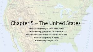
 Chapter 6 human geography of the united states
 Physical geography usa
 Chapter 5 lesson 1 physical geography of the united states
 Physical geography of the united states
 Slidetodoc.com
 United postmasters and managers of america
 Perceptual regions of the united states
 United states judicial branch
 World map with latitude and longitude lines printable
 Was the united states on the axis powers or allied powers?
 Battling over clayoquot big trees worksheet answers
 Heart of atlanta motel v. united states
 Melting pot
 Northern and southern states
 Contiguous united states land area
