STAVELEY STRATEGIC PLAN Staveley with Ings Parish PLAN


- Slides: 8

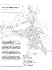
STAVELEY STRATEGIC PLAN Staveley with Ings Parish PLAN STAVELEY STRATEGIC Staveley with Ings Parish Council . Why have a Strategic Plan for Staveley? From the perspective of the Parish Council this plan is to provide a more strategic backdrop for prioritising effort and responding to opportunities as they arise. It will allow us to be more pro-active in terms of having a ‘to do list’ and assists in having a joined up approach to integrating different projects. The aim is to look 10 -15 years future at the needs of the Parish (in particular Staveley Village as it’s service centre). We have identified in this plan projects that are realistic and deliverable in that time frame. Delivering the Plan. The Parish Council is responsible for oversight of the plan however work and liaison with other agencies such as SLDC, LDNPA and Cumbria Highways is essential for moving towards the goals identified in the plan. Public Consultation: As representatives of the people of Staveley and Ings the Parish Council is keen to hear comments, ideas and opinions as to the future development of the area whether already in this plan or not. Contact can be made directly to the Chair of the Council, Mark Kidd at sunnyorchardfarm@yahoo. co. uk Contents: Page 2: Overview Page 3: Housing Page 4: Village Spaces Page 5: Transport Page 6: Pedestrian Routes Page 7: Green Areas Page 8: Car Parking

Staveley Strategic Plan OVERVIEW Barley Bridge weir Paved public viewing area. Possible hydro electric site. Old Cricket field Extra care (sheltered) housing. Village car park and relocated recycling facilities. Possible electric car charging points. Poor Field Council Storage Shed Allotments? Recycling area Monthly Market (Farmers? ) & Car Park Jacks Corner Birdcage Public area & Cycle Racks Village green Public green space Local Green Space Community asset Safe pedestrian movement demand Possible safe walking routes Community-led development Staveley village squares – 20 mph limit Station Relocated Platform with car parking Crook Road Footway Safe walkway from Bridge to Surgery Housing Development?

Staveley Strategic Plan HOUSING Poor Field 2 -3 Affordable Houses? Old Cricket field Extra care (sheltered) housing. Adjacent river. Old Cricket Field: the current local housing needs survey indicates there is a need for extra care housing. (this is for over 55’s to live independently but with warden assistance. Similar to Webster’s yard in Kendal). We propose to reallocate part of the field to residential planning use to allow this to happen. The most suitable area would be a block of apartments adjacent to the river. Housing Association Development: we are anticipating a planning application for 16+ new affordable homes on the field next to the Crookfield development. Individual Plots or Community Self Build: this field is currently allocated for housing but is unsuitable for a large developer due to numerous cables and pipes crossing it. We would encourage it’s use as small scale building sites for those people wanting to construct their own homes (subject to local occupancy clause). Poor Field: planners have indicated this site would be suitable for 2 -3 houses. Possibilities include working with a developer to create affordable housing for lower income people (the field was originally given to the council to help the poor, hence the name). Housing Association Development? Individual Plots or Community Self Build Plots

Staveley Strategic Plan VILLAGE SPACES Barley Bridge Viewing Point Recycling Area Jack’s Corner Recycling Area: With increased kerbside recycling there is less need for this facility. There is also the possibility of moving it elsewhere (Old cricket field? ) The land is owned by SLDC so Could be transferred to the Parish Council. It could be used as a car park, relieving parking on the main street. . Possibly pay and display and free for locals. Also would Be a good site for electric car charging point. The car park could be cleared once a month to hold a Farmer’s market type event and money raised from pitch fees invested back into the site. Jack’s Corner: Is available to be administered by the Parish Council. Trees and shrubs could be cut back and a level paved surface instated with seating and bike racks. A ‘bird cage’ feature (similar but smaller than the one in Kendal Town Centre could be installed and used as the focal point of the village as well as an area to gather/ hold local events. The pavement surrounding the corner would be dropped and widened improving wheelchair access and making it safer to cross the road to the butchers or Spar shop. Barley Bridge Viewing Area: To install a paved area adjacent to the river wall (currently mud and grass) with a raised concrete kerb to stop goods vehicles reversing over it. Viewing area would be suitable for wheelchairs and include seating and dog poo bin.

Staveley Strategic Plan TRANSPORT 20 mph limit: we try to gauge the feeling in the Parish and public opinion suggests most residents would welcome a 20 mph through Staveley Village. We would have to liaise with Cumbria Highways and perhaps gather speed evidence by way of traffic surveys and monitoring devices. There may also need to be pinch points built into the roads to slow traffic. Also possibly speed bumps and road surface changes. Funding is likely to be a challenge. Railway Station: a professional feasibility study has been conducted to solve the problems of access at the Staveley platform (steps with no ramp or lift). The suggested solution is to move the platform to where the Auto garage is. This would allow level access and some car parking. Costs would be approx £ 2. 3 Million! Funding would have to come from Department of Transport linked to a line passing loop near Burneside. . Station Relocated Platform with car parking

Staveley Strategic Plan PEDESTRIAN ROUTES Safe pedestrian movement demand Possible safe walking routes We have identified the main patterns of foot traffic in the Village and have suggested walkways we could concentrate on improving access to. Of note is the route across the ‘Big Field’. This is a possible ‘Safer route to School’ which would prevent school having to walk along Silver Street by the Fire Station where pavement access is very restricted. LDNPA will maintain a route but negotiation with landowners is still ongoing. Crook Road Footway: plans have been drawn by Cumbria Highways to install a footway from the railway bridge past the Surgery up to Crookfield. Some of which is a ‘Ghost path’ painted on the road due to restricted width. Funding is mostly in place from Two Castles Housing association community planning gain. Crook Road Footway Safe walkway from Bridge to Surgery

Staveley Strategic Plan GREEN AREAS . Poor Field Storage Shed, Allotments Village green Public green space Local Green Space Big Field: we have received overwhelming feedback that residents would like to keep this field undeveloped due to the open nature and character it gives the village. We have recommended this be protected with Local Green Space designation with the LDNPA. Wet Meadow: again we have recommended that this field is allocated as Local Green Space due to it’s natural beauty and protected from development. (Not the adjacent allocated employment land next to the furniture workshop). Poor Field: There is demand for allotments closer to the Village. Although steep the poor field may provide a few plots if the land is not to be used for other uses. There is also need for a storage shed close to the village for flood emergency equipment. Money is available and the field is on high ground and owned by the Parish Council so would make a suitable site. Regard for the appearance and security of the shed would need to be made. Allotments behind Crookfield: if a housing application is successful there will be some spare land on the site. As part of community planning gain it may be possible to acquire some allotment land. Cricket Field: we have asked LDNPA to consider allocating part of this field as a Village car park. This would accomodate a new recycling area and possible electric car charging. It would also have green areas and planting to improve it’s appearance. Possible Alloments

Staveley Strategic Plan CAR PARKING Park and Walk Residents Parking Old Cricket Field Village Car park Residents Parking Loading Bay Outside SPAR Car parking is often a problem in Staveley. Increasing trade, population, tourism and popular events bring more and more cars in. We feel that lack of adequate parking may restrict the business and life quality aspects of the Village. Old Cricket Field: already an occasional cap park for events in the Village. We have nominated it as a permanent cap park with recycling facilities moved there. Possibly it could be pay and display to help fund it’s development. Loading Bay outside the SPAR shop: often as lorries stop to deliver on Main Street it causes serious congestion. The current two parking spaces could be designated ‘loading only’ to save them for deliveries both to main Street and the Mill Yard (also bus drop offs to festivals). Residents Parking: On the housing side of Danes Terrace and behind Eclec on Back Lane. Park and Walk Scheme: two sites could be used for out of Village parking. Next to the A 591, the lay by as you come into Windermere Road. The current field on the Kendal Road used by Thomas Armstrong for the bridge replacement works. Visitors could park here for free (or a small donation) and go walking/cycling etc, for the day without using up Village centre spaces. Park and Walk


