Serving Iowa Mesonet data with U of Minnesotas


- Slides: 20

Serving Iowa Mesonet data with U of Minnesota’s Map. Server Daryl Herzmann Iowa Environmental Mesonet 31 Jul 2002

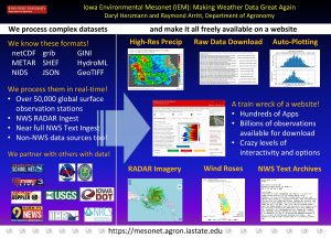
Background Info: Daryl Herzmann –BS Meteorology 2001 from Iowa State –Currently, Program Assistant, Department of Agronomy, Iowa State Iowa Environmental Mesonet –Gather, compare, disseminate, and archive observations in the state of Iowa. –Very interested in GIS as a vehicle to distribute / visualize / analyze data.

UNIDATA Affiliation • Weather data relayed over the Internet 2 via the IDD. LDM software manages. • GEMPAK provides decoders and visualization packages. • UNIDATA is a community, of which Iowa State is an active part of.

Why GIS? • Well, why not? : ) • Our goal is to not just provide data, but provide easily integratable data. GIS is invaluable for this task. • The difficult part is getting the data from our servers to their applications. Website is nice, but not the answer!

Enter Map. Server! • Work is done on the server side. • Easily integrate diverse local and remote data sources. • OGC compliant WMS server/client capability for easy CGI access. • Open-Source! Enough said.

What is Map. Server? From website, “Map. Server is an Open. Source development environment for building spatially enabled Internet applications. ” Features / Support: • Vector format ( ex: ESRI Shapefiles) • Raster format ( ex: PNG, GIF, TIFF) • Fully customizable output / Mapscript

Map. Server Data Flow

Basic Map. Server Layout • Map. Server binary somewhere in cgi-bin • A. map file provides the schema and data sources for the application. Referenced via CGI (&map=path_to_mapfile) • A template HTML file for how the application should be presented • A query template file for results of queries

#1: Spatial Precip Viewer • NEXRAD Storm Total (STP) and one hour precip (N 1 P) products are gridded, plotted and geo-referenced. • Surface precip observations are ingested and placed in the spatial database. • Great way to qualitatively compare NEXRAD estimates with “ground-truth”

Web Interface

#2: Iowa Tornado Database • The tornado database was the first step in putting together an “All Hazards” database for Iowa. • Compiled by Chris Anderson at ISU • Entries are placed in a spatial database and queried out by Map. Server. • We look to expand the meta-data held in this system. (News clippings, stories…)

Iowa Tornado Database Interface

#3: NWS Warnings with National RADAR • Geo-reference a national RADAR mosaic • Wrote a text to spatial database decoder for the SVR and TOR products. Polygon and county based warnings are saved. • Combine these data sources with Map. Server

Example

#4: 3 -4 June 2002 Flooding • Heavy rainfall event in Eastern Iowa. Localized flooding. • Geo-referenced NEXRAD Storm Totals. • Included surface observations • Used by Iowa Emergency managers as a baseline to identify locations that may have experienced flooding.

Example Image

PHP Map. Script • Provides a Map. Script interface in PHP • Mostly objection oriented (OO) !! • Provides much needed flexibility from the somewhat cumbersome basic Map. Server CGI interface. • IEM will migrate most web GIS applications to this development platform.

PHP Map. Script Example • Dynamically generate a variable plot based on user selected stations.

Conclusions • The Open. Source GIS world has come a long way! Please investigate it before dumping thousands of dollars into closed-source, proprietary systems. http: //www. opengis. org http: //www. freegis. org http: //mapserver. gis. umn. edu

Questions? I am always willing to help, if I can! Daryl Herzmann akrherz@iastate. edu 515. 294. 5978
 Iowa mesonet
 Daryl herzmann
 Iowa mesonet
 Solution mesonet
 Iowa environmental mesonet
 Nys mesonet now
 Mesonet.agron.iastate.edu
 National mesonet program
 Data serving platform
 Wine label
 What is serving
 Ritz-carlton motto
 Whom having not seen you love
 Self serving bias definition psychology
 1 oz cheese
 How to carry two plates in one hand
 Crumbing down is a task carried out
 Service sequence in serving food and beverage
 Poem of helping others
 Servings per container 60
 Serving measuring spoons


