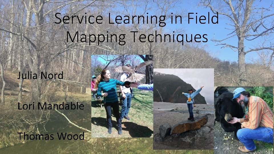
Service Learning in Field Mapping Techniques Julia Nord
- Slides: 18
Service Learning in Field Mapping Techniques Julia Nord Lori Mandable Thomas Wood
Undergraduate Research • High impact educational practice • Improve student success • Recruiting and retaining students in STEM fields • GMU – Students as Scholars (2009). QEP • OSCAR – Office of Student Scholarship, Creative Activities, and Research • A base-level understanding of research and inquiry processes are needed for students to succeed in these experiences • Students as Scholars (Sas. S) courses (OSCAR)
Students as Scholars Courses 3 levels • Discovery of Scholarship • Scholarly Inquiry • “In these mid-level courses, you learn about the process of scholarly inquiry, either through studying previous scholarship or as preparation for your participation in an original project. • You will learn content in your field and skills so that you are capable of evaluating scholarly work and are prepared to conduct your own scholarly project. • Examples of Scholarly Inquiry classes are usually in your major, and may be a research methods course or a topical course that uses inquiry-guided learning. ” • OSCAR. gmu. edu • Research and Scholarship Intensive
Field Mapping Techniques Student learning Outcomes (Sas. S Inquiry) • Articulate a question or problem that is relevant and appropriate; • Communicate knowledge from that scholarly project through writing, or presenting, appropriate to the audience and context; and, • Demonstrate attention to ethical principles. • Design and execute a project plan • Acquire information or data using credible and applicable strategies. • experiential learning (EL), service learning, and team-focused course.
Field Mapping Techniques GEOL 306, 503, GEOG 308 • 3 credits, 6 hours • 1. 5 Wednesday, 4. 5 Friday • Basic techniques for collecting, recording, and plotting spatial field data including use of topographic maps, compasses, transit, global positioning systems (GPS) and tablet/mobile applications • Green Leaf Course, Scholarly Inquiry • Learn skill on Wednesday, implement on Friday
Field Mapping Techniques GEOL 306, 503, GEOG 308 • Prepare for data collection • Data collection • Analyze and synthesize • Communicative Map Product • Reflect (Kolb, Dewey) (repetitive, reflective practice) • Scale • Title • Author • North Arrow • Date Made
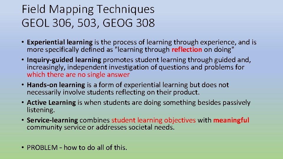
Field Mapping Techniques GEOL 306, 503, GEOG 308 • Experiential learning is the process of learning through experience, and is more specifically defined as "learning through reflection on doing" • Inquiry-guided learning promotes student learning through guided and, increasingly, independent investigation of questions and problems for which there are no single answer • Hands-on learning is a form of experiential learning but does not necessarily involve students reflecting on their product. • Active Learning is when students are doing something besides passively listening. • Service-learning combines student learning objectives with meaningful community service or addresses societal needs. • PROBLEM – how to do all of this.
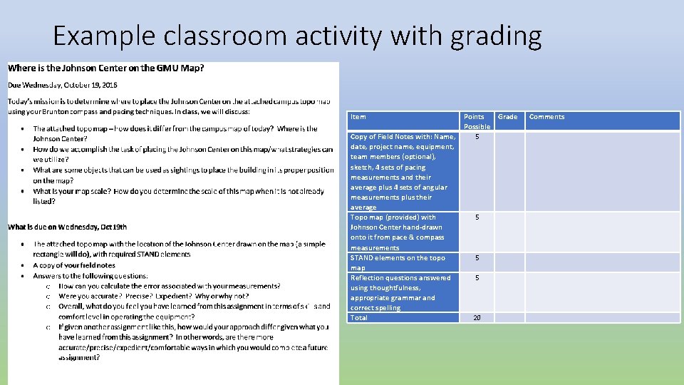
Example classroom activity with grading Item Copy of Field Notes with: Name, date, project name, equipment, team members (optional), sketch, 4 sets of pacing measurements and their average plus 4 sets of angular measurements plus their average Topo map (provided) with Johnson Center hand-drawn onto it from pace & compass measurements STAND elements on the topo map Reflection questions answered using thoughtfulness, appropriate grammar and correct spelling Total Points Grade Possible 5 Comments 5 5 5 20
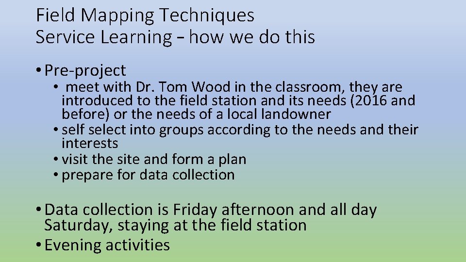
Field Mapping Techniques Service Learning – how we do this • Pre-project • meet with Dr. Tom Wood in the classroom, they are introduced to the field station and its needs (2016 and before) or the needs of a local landowner • self select into groups according to the needs and their interests • visit the site and form a plan • prepare for data collection • Data collection is Friday afternoon and all day Saturday, staying at the field station • Evening activities
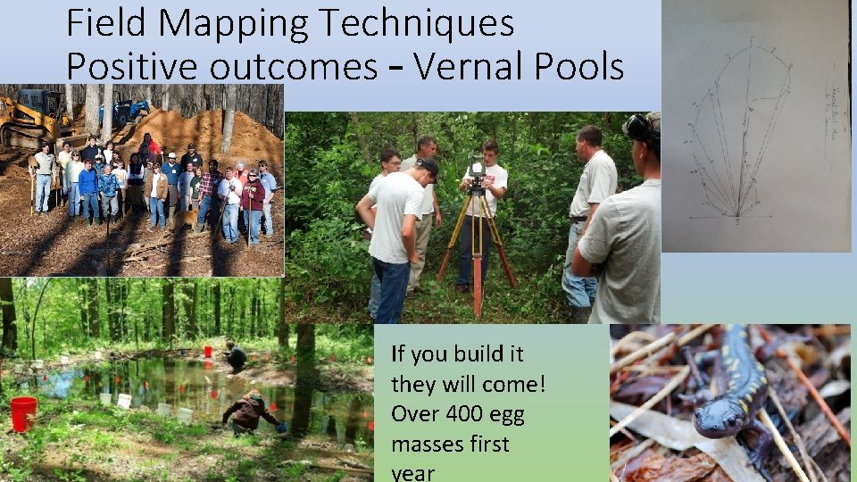
Field Mapping Techniques Positive outcomes – Vernal Pools If you build it they will come! Over 400 egg masses first year
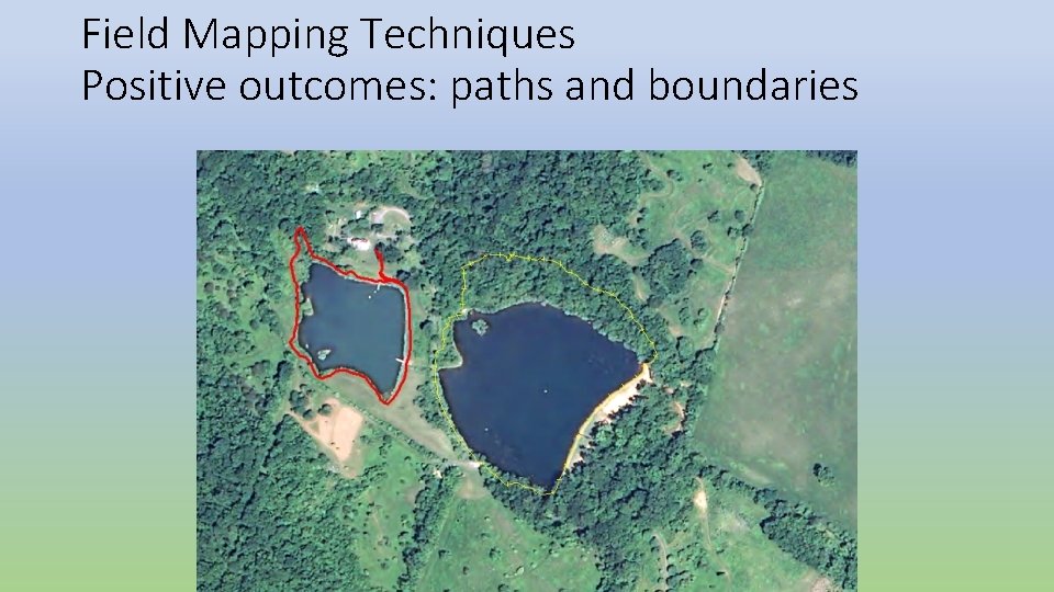
Field Mapping Techniques Positive outcomes: paths and boundaries
Field Mapping Techniques Directors comments. • “Student engagement increases dramatically when the final product is unique and meaningful as opposed to routine” • “Students are expected to produce accurate, useful products to aid in trail development, and they do! “ • “The course is mutually beneficial for the students and the field station. ” • “Problems that arise in the field are real, and provide opportunities for problem solving that is simply not available in a more traditional lab setting. ”
Field Mapping Techniques Lori’s comments • Engaged in projects that enable them to not only utilize the equipment, but also task them with creating a map that has context relevant to that project’s requirements. • Using techniques currently employed in field work, then to place that knowledge and data into a map. • The map becomes a communication vehicle based on the client’s needs. • The service learning component allows students to practice projects that are not “canned” experiences, giving them the full ability to troubleshoot issues and deliver a product that benefits both their learning and the clients we partner with.
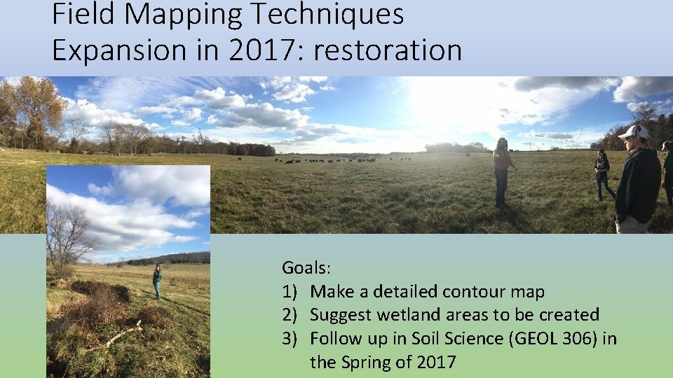
Field Mapping Techniques Expansion in 2017: restoration Goals: 1) Make a detailed contour map 2) Suggest wetland areas to be created 3) Follow up in Soil Science (GEOL 306) in the Spring of 2017
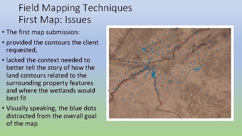
Field Mapping Techniques First Map: Issues • The first map submission: • provided the contours the client requested, • lacked the context needed to better tell the story of how the land contours related to the surrounding property features and where the wetlands would best fit • Visually speaking, the blue dots distracted from the overall goal of the map
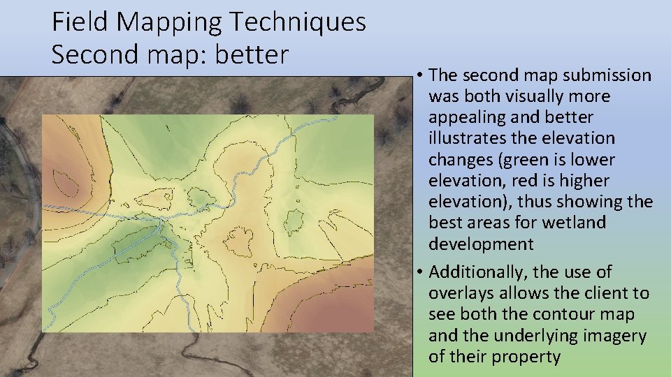
Field Mapping Techniques Second map: better • The second map submission was both visually more appealing and better illustrates the elevation changes (green is lower elevation, red is higher elevation), thus showing the best areas for wetland development • Additionally, the use of overlays allows the client to see both the contour map and the underlying imagery of their property
Field Mapping Techniques Problems. Revisions. Plans • This project was the first undertaking at this site • Required additional field work and site knowledge (finding benchmarks) prior to doing the work required by the client • The project’s scope was also large, requiring multiple semesters of work to fully map the area
Field Mapping Techniques Problems. Revisions. Plans • Despite these issues, students commented • that they felt they had gained a considerable amount of knowledge in terms of learning the mapping project lifecycle, • how to problem solve in the field what is required to produce a map that contextually communicates the project’s objectives • felt this experience gave them the capabilities they would need to work in the field, • enabled them to describe to future professors and employers the knowledge gained, reflective commentary and communication skills acquired by completing this service learning project