Satellite Proving Ground for Marine Precipitation and Satellite
- Slides: 5

Satellite Proving Ground for Marine, Precipitation, and Satellite Analysis Ocean Prediction Center, Weather Prediction Center, Tropical Analysis and Forecast Branch (NHC), and NESDIS Satellite Analysis Branch Michael J. Folmer

2015 Proving Ground Activities Wrap-up • Evaluations ran from 02/01/15 in two phases (winter/spring and summer) and ended on 11/30/15. • Major points: • Air Mass RGB was re-introduced (better training courtesy of EUMETSAT – Jochen Kerkmann) • CIRA Layered PW introduced (unofficial, but got into operations) • Nearcast was postponed due to training questions • Fog/Low Stratus introduced to OPC and TAFB • Himawari introduced and all 16 channels made available in NAWIPS • Air Mass RGB Collaboration with AK region in October • Final Report should be ready by March 2016

2016 Proving Ground Activities • Evaluations will start around 02/01/16 and run in two phases (winter/spring and summer) until 11/30/16. • Products to be evaluated (mix of GOES-R/JPSS): • RGBs: Day-time Microphysics, Night-time Microphysics, Day-time Convection, Fire Detection, and Volcanic Ash • QPE/Rain Rate • Nearcast (heavy precipitation) • CIRA Layered PW • Himawari Baseline Products • NUCAPS • Snowfall Rate

AWIPS II: National Centers Perspective • Legacy satellite products are ingested (AREA format) and work is being done to get NESDIS derived products to display correctly. • Color table working group (lead by Bill Ward) has been formed to address bit depth issues that were identified when transitioning from legacy satellites to next generation. • RGB “on-the-fly” working group has halted activities due to lack of funds and time. Future direction is being discussed and will be coordinated with the NCEP AWIPS II testbed. • First Himawari-8 images have been tested and will be displayed in netcdf 4 format. Any RGBs and derived products will initially be displayed using AREA format. • (Some) VIIRS (NCP) and NUCAPS (D 2 D) products are available to forecasters in operations, but limited use for now.

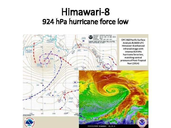
Himawari-8 924 h. Pa hurricane force low