GISSY and Win CC OA Lukasz Goralczyk 2018


 would be")
![Effort Estimation No Task Time Estimate [h] Comment 1 Map manager 12 2 Device](https://slidetodoc.com/presentation_image_h2/c477a30c9b4cab40f9f234bb104cba89/image-10.jpg "Effort Estimation No Task Time Estimate [h] Comment 1 Map manager 12 2 Device")

- Slides: 11
GISSY and Win. CC OA Lukasz Goralczyk 2018 -09 -14 Technical Committee GISSY Implementation
Summary • Introduction – Motivation • Introduction – GIS • GIS and Win. CC OA • Fulfilling the Requirements • Conclusions
Introduction – Motivation • First step was to create a technological proof of concept to fulfill initial requirements of (proto)GISSY (EDMS) • Next step was to create a proper application that could be used in real-life environment • Win. CC OA solution (GIS module) is able to fulfill the requirements
Introduction – What is GIS • GIS – Geographic Information System • Esri – Environmental Systems Research Institute - company making GIS software, notably Arc. GIS is used at CERN • (Esri) shapefile – GIS file format • Maps can be vector (GPS Navigation software) or raster (Google Maps) • Maps can be distributed as a file or through network • Many GIS data formats (vector, raster, elevation) • Many software solutions commercial and open source • CERN maps can be provided as a file and through network
Current status: GIS and Win. CC OA 1/2 • Win. CC OA contains a module which can display layered interactive maps • As input it will accept vector map files in Esri shapefile format • Currently "networked" maps are not supported. Future releases (3. 17, 3. 16) will have an updated GIS module that will allow "networked" maps • GIS module is able to handle current CERN maps with tens of thousands of objects with ease
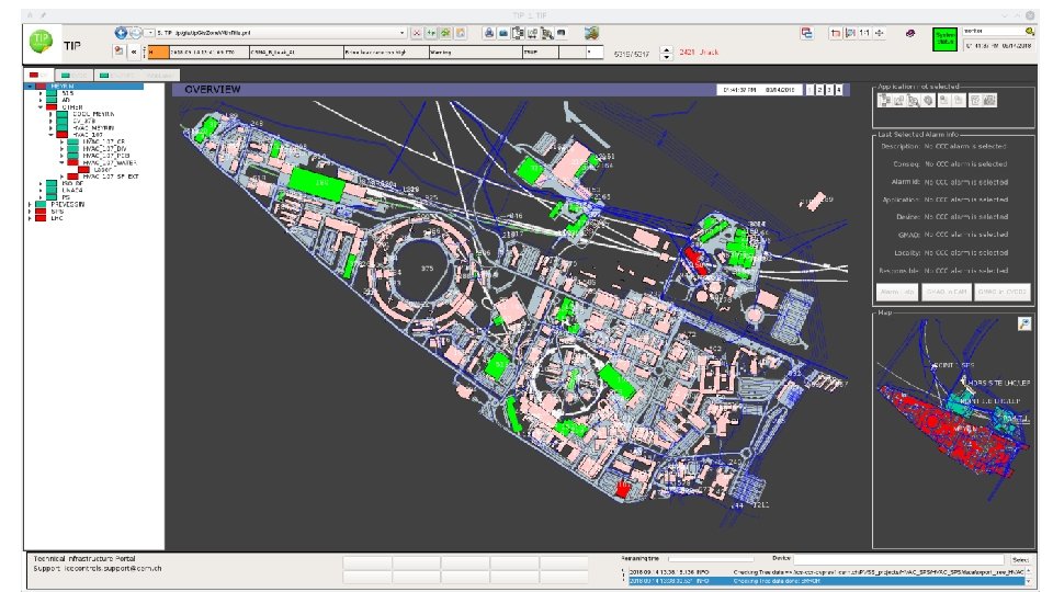
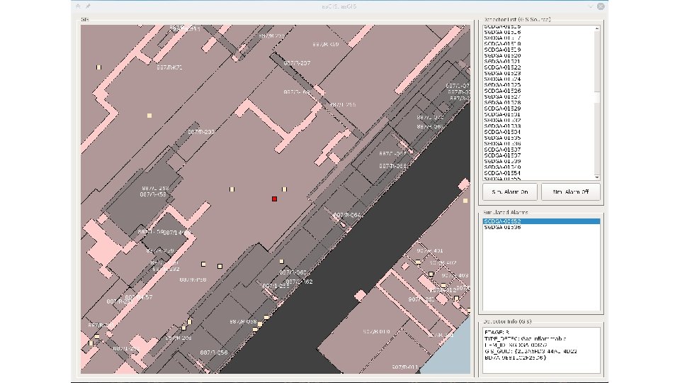
Current status: GIS and Win. CC OA 2/2 • GIS module (+ some "glue" code) is already used in TIP (Technical Infrastructure Portal) application to show alarms coming from CV (Cooling and Ventilation) • RACMONBI is also using GIS module • A static GISSY prototype was built as a proof of concept • Both solutions are custom and not bounded to JCOP/UNICOS, they can be reused but with some effort • Cases such as GISSY show that there is a need for generic integration of GIS data in our control systems (example: JCOP/UNICOS)
Fulfilling the Requirements • Each gas sensor (or other type of device) would be represented as UNICOS device to reuse already existing functionality • Devices would have to be updated automatically which would require extra development • As a source of alarm data (is alarm on or off for a given device) any standard CERN protocol (example: DIP) • Since maps are accepted only as files there's a need for a periodic update of map files (already discussed with CERN map provider)
Effort Estimation No Task Time Estimate [h] Comment 1 Map manager 12 2 Device synchronisation 8 3 User interface 24 4 Application testing 24 Check functionality of the application (acceptance tests) 5 Documentation 8 Basic how to use the application 6 Application deployment 8 Finding new machine, machine setup, project creation, etc. 7 Administrative tasks 24 Meetings, requirements refining, software configuration setup, etc. If other procedure than a manual action. Otherwise no effort.
Conclusions • Native solution allows reuse of existing Win. CC OA/JCOP/UNICOS environment (easy integration with other systems) • GIS module already used in existing Win. CC OA projects and one prototype • There are prospects for new projects (cryogenics, building management) • Best case scenario would be to use a generic solution but it would require extra time and work