Fluvial Geomorphic Analyses of the Llano River and


 of 2. 3. 4. 5. the study")


")


- Slides: 31
Fluvial Geomorphic Analyses of the Llano River and Sandy Creek Basins, Central Texas, using GIS and Arc Hydro Tools Franklin T. Heitmuller CE 394 K November 29, 2005
Study Area
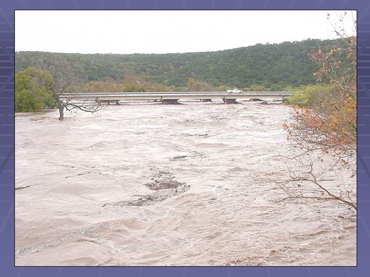
Flood Regime
Objectives 1. Obtain digital elevation models (DEMs) of 2. 3. 4. 5. the study area Obtain 1: 24, 000 NHD hydrography for study area Use Arc Hydro Tools to generate GIS datasets for study area Generate longitudinal profiles (plot of elevation and distance downstream) of selected rivers/streams in study area Assess the potential of modeling stream power in study area
Digital Elevation Models § 30 -meter and 10 -meter § http: //seamless. usgs. gov § Problems with 10 -meter in study area; vertical stripes of no data; obtained from contact at USGS in Austin § 30 -meter mosaic: 110 mb/2 panels § 10 -meter mosaic: 1. 81 gb/12 panels
National Hydrography Dataset http: //nhd. usgs. gov
Arc Hydro Datasets
Arc Hydro Datasets
Arc Hydro Datasets
Arc Hydro Datasets
Arc Hydro Datasets
Arc Hydro Datasets
Longitudinal Profiles Export of selected features from 1: 24, 000 NHD hydrography data (1) Need distance downstream. (2) Need elevation data.
Longitudinal Profiles
Longitudinal Profiles http: //www. xtoolspro. com/ Allows point features to be created along a line at a user-specified interval (100 meters)
Longitudinal Profiles
Longitudinal Profiles
Longitudinal Profiles
Longitudinal Profiles
Longitudinal Profiles
Longitudinal Profiles
Longitudinal Profiles
Longitudinal Profiles
Longitudinal Profiles
Longitudinal Profiles
Stream Power Modeling § τ0 = ρgd. S, § where τ0 is boundary shear stress in newtons per square meter, ρ is density of water in kilograms per cubic meter, g is the acceleration of gravity in meters per second squared, d is average flow depth in meters, and S is channel slope. § ω = Uτ0, § where ω is stream power per unit bed area in watts per square meter and U is average flow velocity in meters per second. Can stream power be modeled using GIS?
Stream Power Modeling § Start off with channel slope……
Stream Power Modeling
Stream Power Modeling
Stream Power Modeling North Llano River near Junction, Texas