DLR IPY Data Portfolio Terra SARX High Resolution
- Slides: 16
DLR IPY Data Portfolio: Terra. SAR-X High Resolution SAR Data from Space Erhard Diedrich Head of Division International Ground Segment DLR – German Remote Sensing Data Center
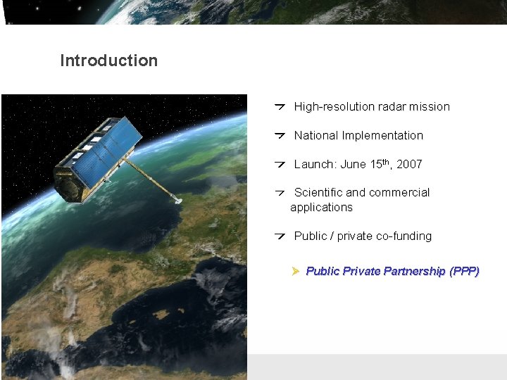
Introduction High-resolution radar mission National Implementation Launch: June 15 th, 2007 Scientific and commercial applications Public / private co-funding Ø Public Private Partnership (PPP) Folie 2 Institut für Methodik der Fernerkundung bzw. Deutsches Fernerkundungsdatenzentrum
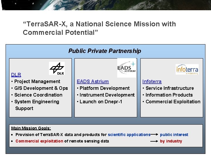
“Terra. SAR-X, a National Science Mission with Commercial Potential” Public Private Partnership DLR • Project Management • G/S Development & Ops • Science Coordination • System Engineering Support EADS Astrium • Platform Development • Instrument Development • Launch on Dnepr-1 Infoterra • Service Infrastructure • Information Products • Commercial Exploitation Main Mission Goals: · Provision of Terra. SAR-X data and products for scientific applications public interest · Commercial exploitation of remote sensing data by industry Folie 3 Institut für Methodik der Fernerkundung bzw. Deutsches Fernerkundungsdatenzentrum
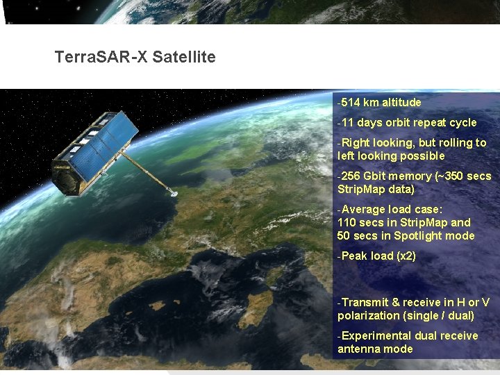
Terra. SAR-X Satellite -514 km altitude -11 days orbit repeat cycle -Right looking, but rolling to left looking possible -256 Gbit memory (~350 secs Strip. Map data) -Average load case: 110 secs in Strip. Map and 50 secs in Spotlight mode -Peak load (x 2) -Transmit & receive in H or V polarization (single / dual) -Experimental dual receive antenna mode Folie 4 Institut für Methodik der Fernerkundung bzw. Deutsches Fernerkundungsdatenzentrum
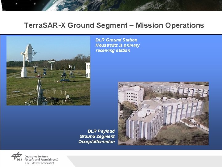
Terra. SAR-X Ground Segment – Mission Operations DLR Ground Station Neustrelitz is primary receiving station DLR Payload Ground Segment Oberpfaffenhofen Folie 5 Institut für Methodik der Fernerkundung bzw. Deutsches Fernerkundungsdatenzentrum
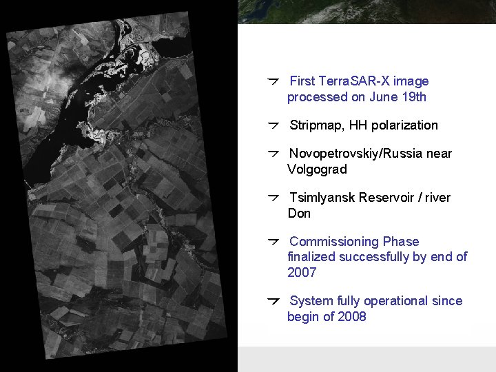
First Terra. SAR-X image processed on June 19 th Stripmap, HH polarization Novopetrovskiy/Russia near Volgograd Tsimlyansk Reservoir / river Don Commissioning Phase finalized successfully by end of 2007 System fully operational since begin of 2008 Folie 6 Institut für Methodik der Fernerkundung bzw. Deutsches Fernerkundungsdatenzentrum
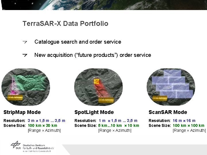
Terra. SAR-X Data Portfolio Catalogue search and order service New acquisition (“future products”) order service Strip. Map Mode Spot. Light Mode Scan. SAR Mode Resolution: 3 m ´ 1, 5 m. . . 3, 5 m Scene Size: 100 km ´ 30 km [Range ´ Azimuth] Resolution: 1 m ´ 1, 5 m. . . 3, 5 m Scene Size: 5 km. . . 10 km ´ 10 km [Range ´ Azimuth] Resolution: 16 m ´ 16 m Scene Size: 100 km ´ 100 km [Range ´ Azimuth] Folie 7 Institut für Methodik der Fernerkundung bzw. Deutsches Fernerkundungsdatenzentrum
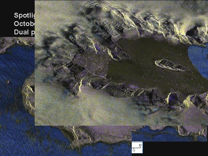
Spotlight Image: King George Island October 9, 2007 Dual pol HH/VV Folie 8 Institut für Methodik der Fernerkundung bzw. Deutsches Fernerkundungsdatenzentrum
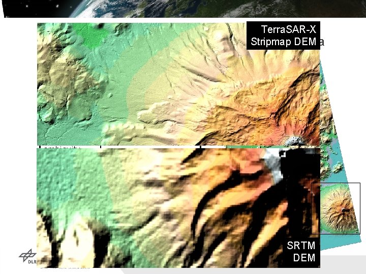
Digital Elevation Model Salar Uyuni DEM spacing Terra. SAR-X DEM &Stripmap Mt. Tunupa ~8 mx 8 m av. coherence 0. 7 Eff. baseline 270 m Height ambiguity 17. 2 m / cycle DEM accuracy ~ 0. 8 m (+ atmosphere TBD) SRTM DEM Folie 9 Institut für Methodik der Fernerkundung bzw. Deutsches Fernerkundungsdatenzentrum
Access to Terra. SAR-X data Mission data policy basics Commercial exploitation: Infoterra / EADS-Astrium Scientific utilization: DLR Both parties equally share the satellite resources Infoterra Commercial order service and customer support Catalogue and future products Direct Access service and value added products DLR Science coordination Management of data access via scientific proposals (like Cat 1 use of ESA) Catalogue and future products Folie 10 Institut für Methodik der Fernerkundung bzw. Deutsches Fernerkundungsdatenzentrum
Access to Terra. SAR-X data for scientific use I The status is gained via a selection process proposal submission evaluation (mission objectives, data requirements, scientific use criteria) General proposal submission (since October 2007): Submission at any time Data provision for the costs of fulfilling the user request / specific IPY handle Announcement of Opportunity Related to specific topics Special conditions Next AOs planned for synergistic use with Rapid Eye other SAR frequencies Folie 11 Institut für Methodik der Fernerkundung bzw. Deutsches Fernerkundungsdatenzentrum
Access to Terra. SAR-X data for scientific use II Accepted proposals: Creation of a proposal specific user account quota of products for the agreed purpose. priority The provision of data requires the signature of the user license agreement the list of people having access to the Terra. SAR-X data the confirmation of the corresponding funding Folie 12 Institut für Methodik der Fernerkundung bzw. Deutsches Fernerkundungsdatenzentrum
Access to Terra. SAR-X data for scientific use in IPY Join accepted proposals (requires agreement with PI): A number of proposals referring to IPY existing with different status Detailed overview within presentation of Dana Floricioiu (DLR) Submission of new proposals Further proposals possible at any time IPY proposals still without cost One coordinated proposal - to be discussed ? ? Acquisition plan is set up by Proposals and the respective ordering of acquisitions Background mission Folie 13 Institut für Methodik der Fernerkundung bzw. Deutsches Fernerkundungsdatenzentrum
Data Policy National security regulations established due to needs for international harmonization, e. g. for ITAR related issues German law providing regulations in force Satellitendatensicherheitsgesetz (Sat DSi. G) Definition for EO missions etc to be regulated by this law Need for permissions of data distribution for DLR and Infoterra Need for permission of operating mission Defining regulations about users / people having access to the data Defining “sensitive data” depending on resolution and phase information Regulating urgency of the product provision (<10 days) Folie 14 Institut für Methodik der Fernerkundung bzw. Deutsches Fernerkundungsdatenzentrum
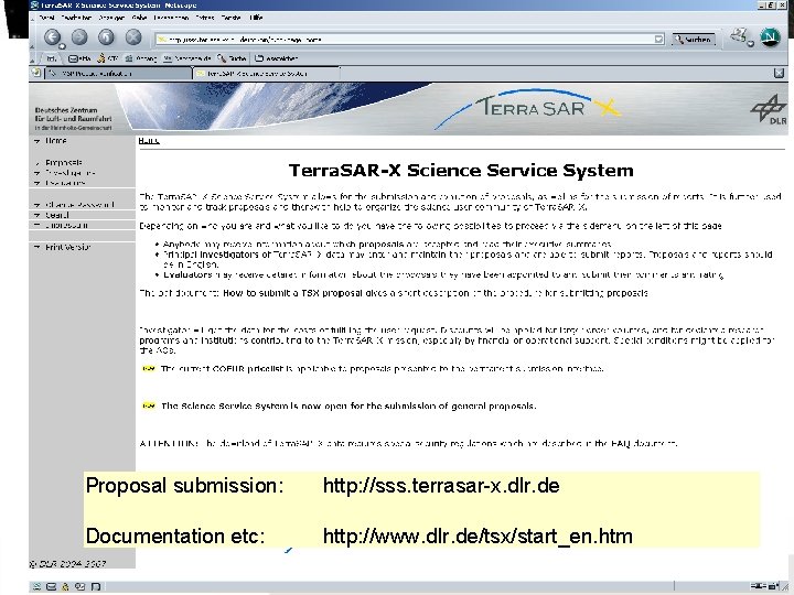
Science Service System Proposal submission: http: //sss. terrasar-x. dlr. de Documentation etc: http: //www. dlr. de/tsx/start_en. htm Folie 15 Institut für Methodik der Fernerkundung bzw. Deutsches Fernerkundungsdatenzentrum
Conclusion Data acquisition plan Is set up indirectly by scientific proposal and the corresponding ordering of data Your ordering drives what is acquired! IPY proposal and intensified use is possible and welcome Data Policy Equal share of scientific and commercial use Security regulations by law to be obeyed Folie 16 Institut für Methodik der Fernerkundung bzw. Deutsches Fernerkundungsdatenzentrum