
Committee on Earth Observation Satellites Agency Updates DLR
Committee on Earth Observation Satellites Agency Updates - DLR K. Schmidt DLR, German Space Administration CEOS Plenary 2018 Agenda Item 4. 3 Brussels, Belgium 17 – 18 October 2018
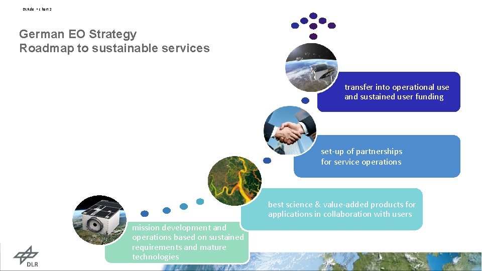
DLR. de • c hart 2 German EO Strategy Roadmap to sustainable services transfer into operational use and sustained user funding set-up of partnerships for service operations best science & value-added products for applications in collaboration with users mission development and operations based on sustained requirements and mature technologies
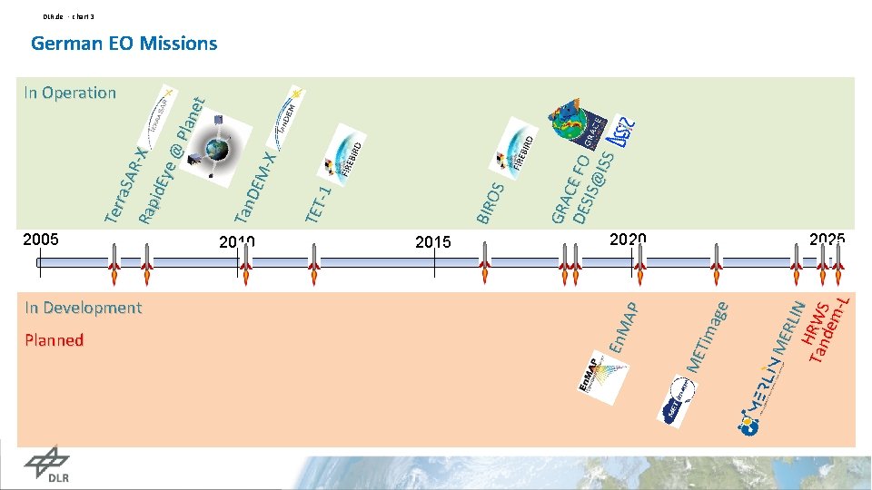
In Development Planned 2020 ME RLIN Tan. HRWS dem -L 2015 ME Tim age 2010 En. M AP 2005 GRA DES CE FO IS@ ISS BIR OS TET -1 Tan DEM -X Ter ra. S ARX Rap id. E ye @ Pla net DLR. de • chart 3 German EO Missions In Operation 2025
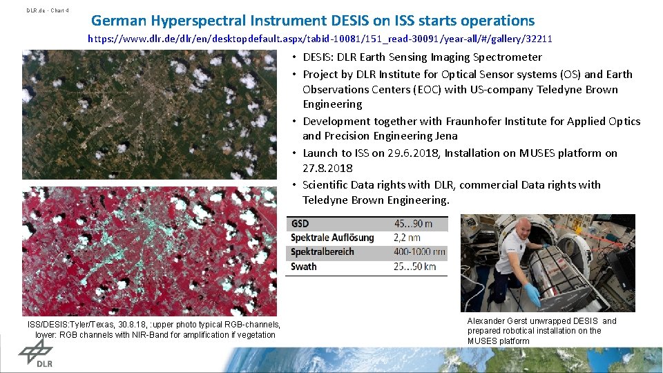
DLR. de • Chart 4 German Hyperspectral Instrument DESIS on ISS starts operations https: //www. dlr. de/dlr/en/desktopdefault. aspx/tabid-10081/151_read-30091/year-all/#/gallery/32211 • DESIS: DLR Earth Sensing Imaging Spectrometer • Project by DLR Institute for Optical Sensor systems (OS) and Earth Observations Centers (EOC) with US-company Teledyne Brown Engineering • Development together with Fraunhofer Institute for Applied Optics and Precision Engineering Jena • Launch to ISS on 29. 6. 2018, Installation on MUSES platform on 27. 8. 2018 • Scientific Data rights with DLR, commercial Data rights with Teledyne Brown Engineering. ISS/DESIS: Tyler/Texas, 30. 8. 18, : upper photo typical RGB-channels, lower: RGB channels with NIR-Band for amplification if vegetation Alexander Gerst unwrapped DESIS and prepared robotical installation on the MUSES platform
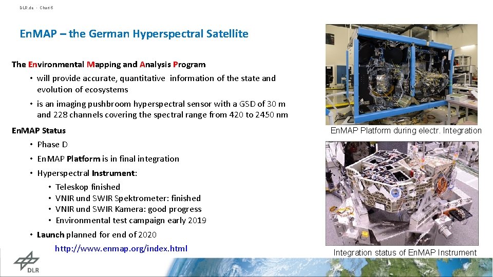
DLR. de • Chart 5 En. MAP – the German Hyperspectral Satellite The Environmental Mapping and Analysis Program • will provide accurate, quantitative information of the state and evolution of ecosystems • is an imaging pushbroom hyperspectral sensor with a GSD of 30 m and 228 channels covering the spectral range from 420 to 2450 nm En. MAP Status • Phase D • En. MAP Platform is in final integration • Hyperspectral Instrument: • Teleskop finished • VNIR und SWIR Spektrometer: finished • VNIR und SWIR Kamera: good progress • Environmental test campaign early 2019 • Launch planned for end of 2020 http: //www. enmap. org/index. html En. MAP Platform during electr. Integration status of En. MAP Instrument
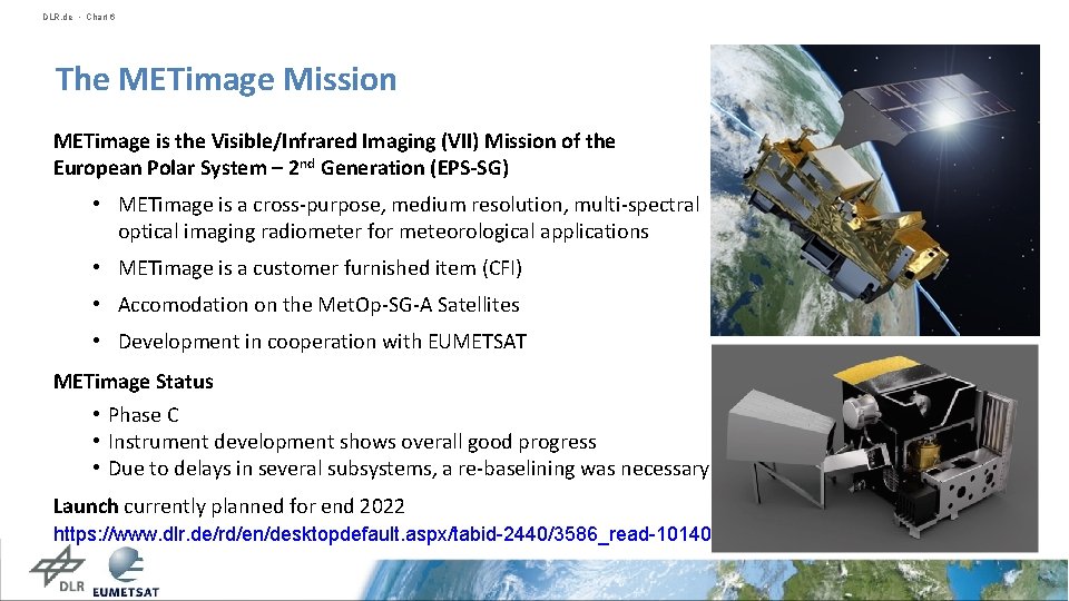
DLR. de • Chart 6 The METimage Mission METimage is the Visible/Infrared Imaging (VII) Mission of the European Polar System – 2 nd Generation (EPS-SG) • METimage is a cross-purpose, medium resolution, multi-spectral optical imaging radiometer for meteorological applications • METimage is a customer furnished item (CFI) • Accomodation on the Met. Op-SG-A Satellites • Development in cooperation with EUMETSAT METimage Status • Phase C • Instrument development shows overall good progress • Due to delays in several subsystems, a re-baselining was necessary Launch currently planned for end 2022 https: //www. dlr. de/rd/en/desktopdefault. aspx/tabid-2440/3586_read-10140
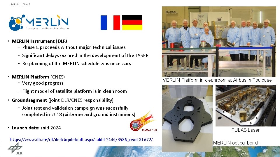
DLR. de • Chart 7 • MERLIN Instrument (DLR) • Phase C proceeds without major technical issues • Significant delays occured in the development of the LASER • Re-planning of the MERLIN schedule was necessary • MERLIN Platform (CNES) • Very good progress • Flight model of satellite platform is in clean room MERLIN Platform in cleanroom at Airbus in Toulouse • Groundsegment (joint DLR/CNES responsibility) • Joint test and validation campaign was sucessfully completed in 2018 (airborne and ground instrumens) • Launch date: mid 2024 https: //www. dlr. de/rd/desktopdefault. aspx/tabid-2440/3586_read-31672/ FULAS Laser MERLIN optical bench
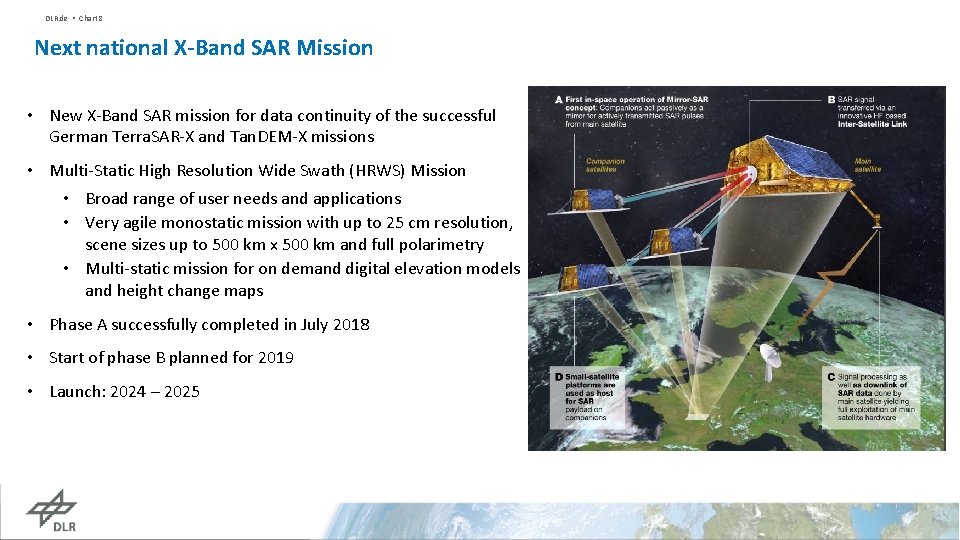
DLR. de • Chart 8 Next national X-Band SAR Mission • New X-Band SAR mission for data continuity of the successful German Terra. SAR-X and Tan. DEM-X missions • Multi-Static High Resolution Wide Swath (HRWS) Mission • Broad range of user needs and applications • Very agile monostatic mission with up to 25 cm resolution, scene sizes up to 500 km x 500 km and full polarimetry • Multi-static mission for on demand digital elevation models and height change maps • Phase A successfully completed in July 2018 • Start of phase B planned for 2019 • Launch: 2024 – 2025
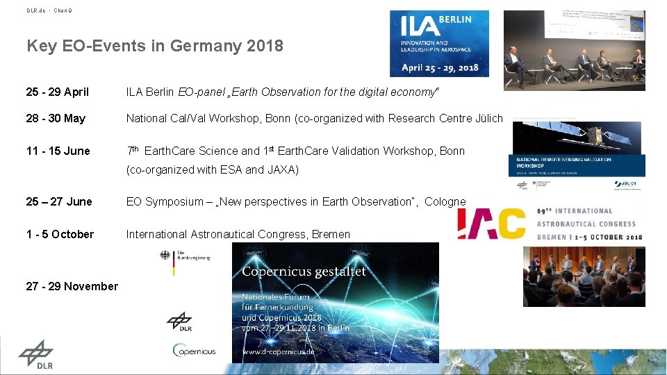
DLR. de • Chart 9 Key EO-Events in Germany 2018 25 - 29 April ILA Berlin EO-panel „Earth Observation for the digital economy“ 28 - 30 May National Cal/Val Workshop, Bonn (co-organized with Research Centre Jülich 11 - 15 June 7 th Earth. Care Science and 1 st Earth. Care Validation Workshop, Bonn (co-organized with ESA and JAXA) 25 – 27 June EO Symposium – „New perspectives in Earth Observation“, Cologne 1 - 5 October International Astronautical Congress, Bremen 27 - 29 November
DLR. de • Chart 10 Working Group on Calibration and Validation • DLR supports the implementation of CEOS and WGCV work plan items by - Continuous serving in sub-groups & exchanging Cal/Val know-how WGCV level - Contributing to the overall action plan - Serving as link to Joint CEOS/CGMS WGClimate and for GHG actions • DLR / Research Centre Jülich: National Validation Workshop in Bonn (May 2018) - To derive the „Opportunities, Needs & Gaps, Future perspectives“ - Based on a comprehensive survey about German validation means (to be published as brochure in 2019) - Inclusion of representatives from CEOS WGCV (Chair et al. ) Remote Sensing from space Validation Infrastructure
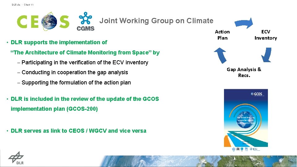
DLR. de • Chart 11 Joint Working Group on Climate • DLR supports the implementation of Action Plan ECV Inventory “The Architecture of Climate Monitoring from Space” by - Participating in the verification of the ECV inventory - Conducting in cooperation the gap analysis - Supporting the formulation of the action plan • DLR is included in the review of the update of the GCOS implementation plan (GCOS-200) • DLR serves as link to CEOS / WGCV and vice versa Gap Analysis & Recs.
DLR. de • Chart 12 DLR Contributions to WGCap. D Workplan 2018 -2020 • Global activities (CB- 19, 21, 28, 29, 30, 31) • DLR Grant to SAREDU/EO-College Portal infrastructure to provide EO Training material (SAR & Hyperspectral) and to support development and implementation of MOOCS in cooperation with ESA and other Agencies: • MOOCs on Radar Backscatter (DLR / FSU Jena), Q 1 2019 • MOOC on SAR Applications: Echoes in Space (ESA / CSA / FSU Jena), Q 1 2019 • MOOC on Land applications (tbc, ESA Tender), • MOOC targeting SDG 2 (Zero Hunger) and 13 (Climate Actions), funding applied for via Copernicus Framework Partnership Framework Project (2019 -2020) • Support to Webinar series on multiple topics, e. g. GEOGLAM and disasters (2019 -2020, tbc) • Portal-based access to CB and training resources via Installation of Calender API at EO –College (2019) • Support to establish E-Learning Best practices and guidelines • DLR Grant to development of free SAR operation system • Regional activities – training in GEO regions (CB 26) • DLR to support Afri. GEOSS training activities in 2019 and 2020 via SAREDU/EO-College Grant
DLR. de • Chart 13 GFOI and GEOGLAM @ DLR • Support with data • Providing Terra. SAR-X and Tan. DEM-X data for GFOI and GEOGLAM (JECAM, Asia. Rice) R&D sites/teams • Engaging in CEOS SDCG for GFOI from the start • Funding R&D • Funding German research teams contributing to GFOI R&D and JECAM programmes. • Linking to users/donors • Working with German Development Agency (GIZ) and relevant German Ministries BMZ/BMEL • BMEL now funding GEOGLAM Programme Office • BMZ considering to join GFOI Leads group and provide funding • GIZ collaborating in various GFOI components at technical level
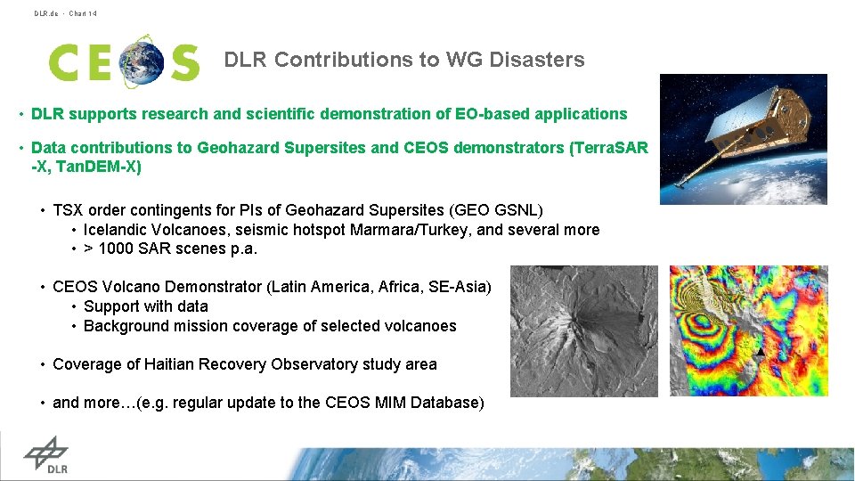
DLR. de • Chart 14 DLR Contributions to WG Disasters • DLR supports research and scientific demonstration of EO-based applications • Data contributions to Geohazard Supersites and CEOS demonstrators (Terra. SAR -X, Tan. DEM-X) • TSX order contingents for PIs of Geohazard Supersites (GEO GSNL) • Icelandic Volcanoes, seismic hotspot Marmara/Turkey, and several more • > 1000 SAR scenes p. a. • CEOS Volcano Demonstrator (Latin America, Africa, SE-Asia) • Support with data • Background mission coverage of selected volcanoes • Coverage of Haitian Recovery Observatory study area • and more…(e. g. regular update to the CEOS MIM Database)
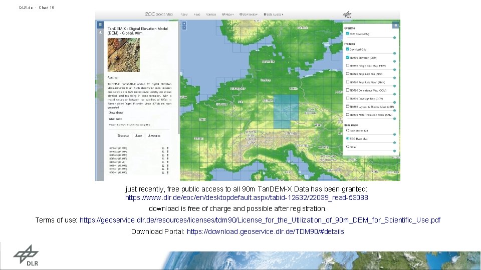
DLR. de • Chart 15 just recently, free public access to all 90 m Tan. DEM-X Data has been granted: https: //www. dlr. de/eoc/en/desktopdefault. aspx/tabid-12632/22039_read-53088 download is free of charge and possible after registration. Terms of use: https: //geoservice. dlr. de/resources/licenses/tdm 90/License_for_the_Utilization_of_90 m_DEM_for_Scientific_Use. pdf Download Portal: https: //download. geoservice. dlr. de/TDM 90/#details
- Slides: 15