CLOUDS Types formation and characteristics TALKS IN A



- Slides: 25
CLOUDS Types, formation and characteristics TALKS IN A BOX Royal Meteorological Society
INTRODUCTION TO CLOUDS • Clouds are very common, with 50% of Earth covered in cloud at any given time. • Only 1 to 2% raining. • Clouds classified by height and nature. • In middle latitudes: – Low clouds: base 0 -2 km – Medium clouds: base 2 -7 km – High clouds: base above 5 km Royal Meteorological Society 1
WHAT ARE CLOUDS MADE OF? • Most clouds are made up of large numbers of water droplets, each droplet about a hundredth of a millimetre (10μm) in diameter. • Typically, about 100 droplets in each cubic centimetre of cloud. • High clouds composed of ice crystals, in a variety of shapes and each about 100μm long. • Typically, about ten ice crystals in every cubic centimetre of cloud. • … and supercooling occurs … Royal Meteorological Society 2
SUPERCOOLING • Water can exist in the atmosphere at temperatures well below 0°C, a condition known as ‘supercooling’. • Even at temperatures below -30°C, clouds may contain supercooled water droplets. • Medium-level clouds are composed mainly of supercooled water droplets. • High clouds composed entirely of ice crystals. Royal Meteorological Society 3
TYPES OF CLOUD • Cumulus (cauliflower appearance) • Stratus (flat, grey and dull) • Cirrus (wispy mares’ tails) If a cloud produces rain, then (from nimbus, meaning ‘rainy cloud’), the prefix nimbo- is added or the suffix -nimbus appended, e. g. nimbostratus, cumulonimbus. Medium-level clouds have the prefix alto-, e. g. altocumulus, altostratus. Royal Meteorological Society 4
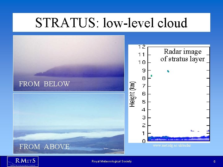
STRATUS: low-level cloud Radar image of stratus layer FROM BELOW FROM ABOVE www. met. rdg. ac. uk/radar Royal Meteorological Society 5
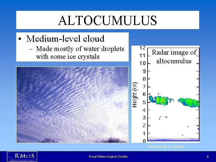
ALTOCUMULUS • Medium-level cloud – Made mostly of water droplets with some ice crystals Radar image of altocumulus www. met. rdg. ac. uk/radar Royal Meteorological Society 6
CIRRUS • High-level cloud made of ice crystals Radar image of cirrus www. met. rdg. ac. uk/radar Royal Meteorological Society 7
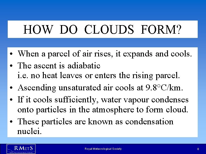
HOW DO CLOUDS FORM? • When a parcel of air rises, it expands and cools. • The ascent is adiabatic i. e. no heat leaves or enters the rising parcel. • Ascending unsaturated air cools at 9. 8°C/km. • If it cools sufficiently, water vapour condenses onto particles in the atmosphere to form cloud. • These particles are known as condensation nuclei. Royal Meteorological Society 8
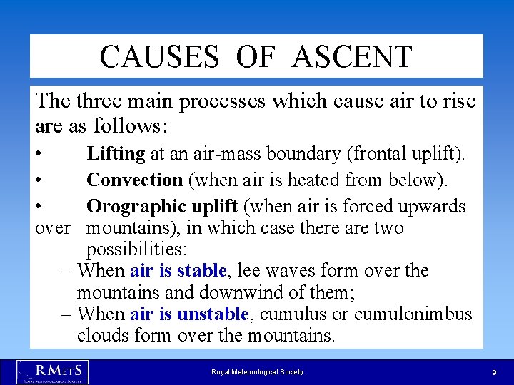
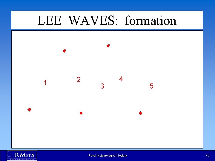
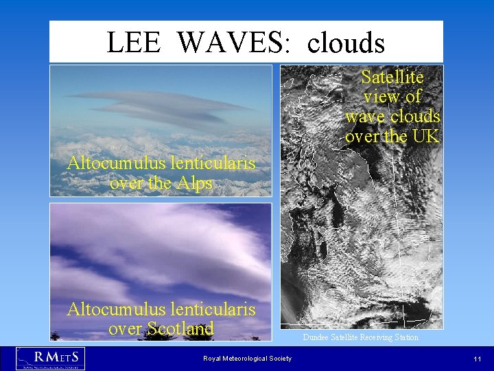
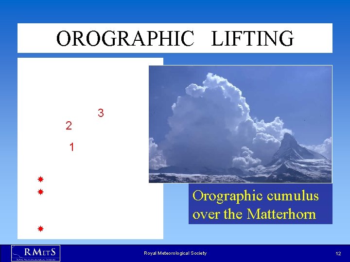
CAUSES OF ASCENT The three main processes which cause air to rise are as follows: • • • over Lifting at an air-mass boundary (frontal uplift). Convection (when air is heated from below). Orographic uplift (when air is forced upwards mountains), in which case there are two possibilities: – When air is stable, lee waves form over the mountains and downwind of them; – When air is unstable, cumulus or cumulonimbus clouds form over the mountains. Royal Meteorological Society 9
LEE WAVES: formation 1 2 3 4 5 Royal Meteorological Society 10
LEE WAVES: clouds Satellite view of wave clouds over the UK Altocumulus lenticularis over the Alps Altocumulus lenticularis over Scotland Royal Meteorological Society Dundee Satellite Receiving Station 11
OROGRAPHIC LIFTING 2 3 1 Orographic cumulus over the Matterhorn Royal Meteorological Society 12
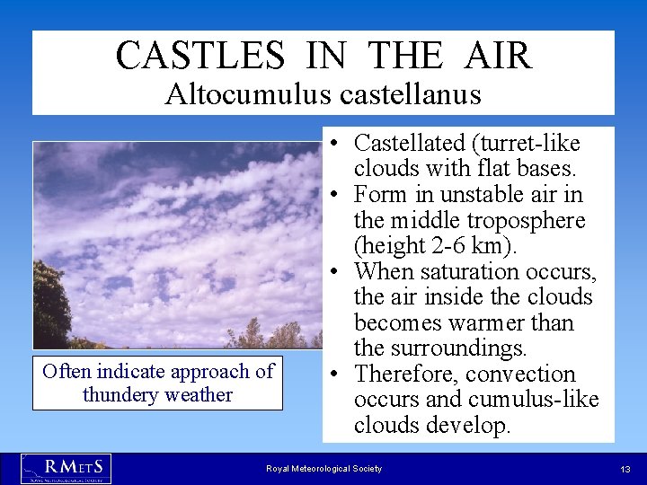
CASTLES IN THE AIR Altocumulus castellanus Often indicate approach of thundery weather • Castellated (turret-like clouds with flat bases. • Form in unstable air in the middle troposphere (height 2 -6 km). • When saturation occurs, the air inside the clouds becomes warmer than the surroundings. • Therefore, convection occurs and cumulus-like clouds develop. Royal Meteorological Society 13
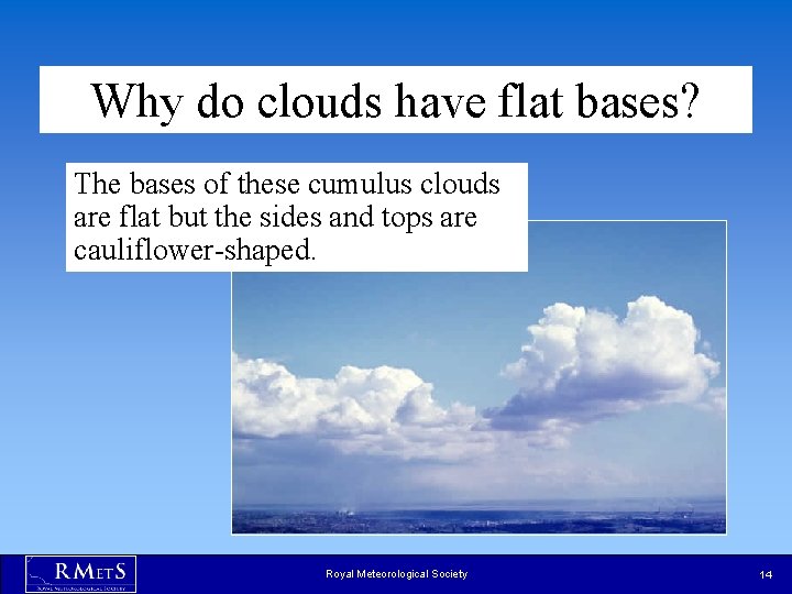
Why do clouds have flat bases? The bases of these cumulus clouds are flat but the sides and tops are cauliflower-shaped. Royal Meteorological Society 14
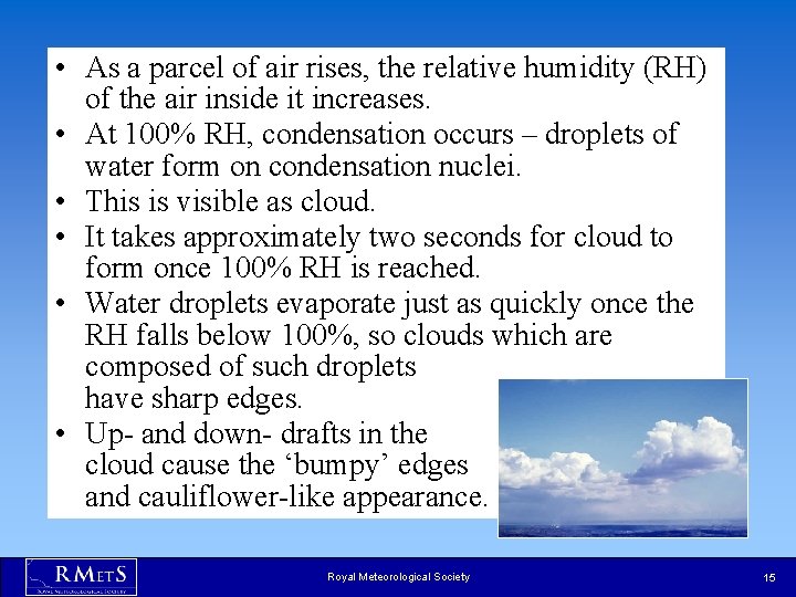
• As a parcel of air rises, the relative humidity (RH) of the air inside it increases. • At 100% RH, condensation occurs – droplets of water form on condensation nuclei. • This is visible as cloud. • It takes approximately two seconds for cloud to form once 100% RH is reached. • Water droplets evaporate just as quickly once the RH falls below 100%, so clouds which are composed of such droplets have sharp edges. • Up- and down- drafts in the cloud cause the ‘bumpy’ edges and cauliflower-like appearance. Royal Meteorological Society 15
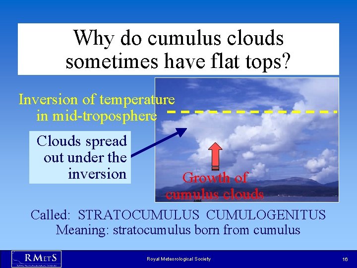
Why do cumulus clouds sometimes have flat tops? Inversion of temperature in mid-troposphere Clouds spread out under the inversion Growth of cumulus clouds Called: STRATOCUMULUS CUMULOGENITUS Meaning: stratocumulus born from cumulus Royal Meteorological Society 16
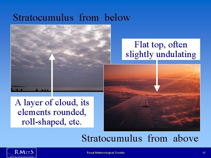
Stratocumulus from below Flat top, often slightly undulating A layer of cloud, its elements rounded, roll-shaped, etc. Stratocumulus from above Royal Meteorological Society 17
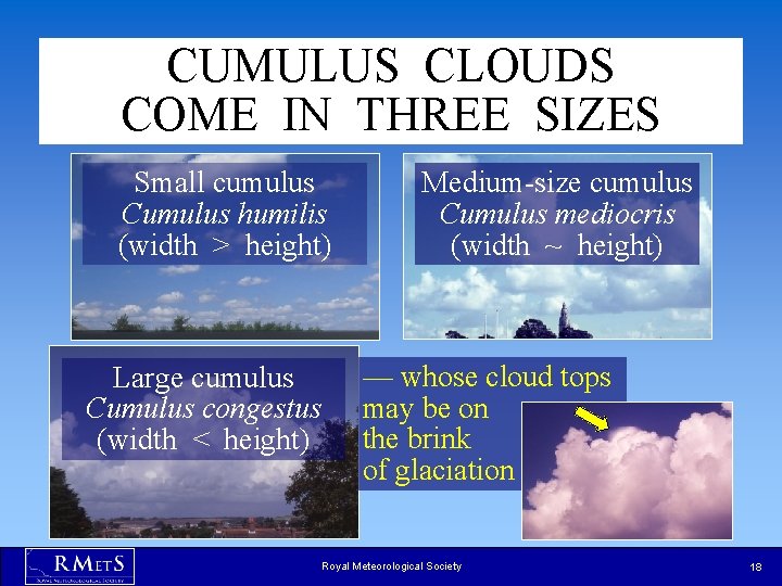
CUMULUS CLOUDS COME IN THREE SIZES Small cumulus Cumulus humilis (width > height) Large cumulus Cumulus congestus (width < height) Medium-size cumulus Cumulus mediocris (width ~ height) — whose cloud tops may be on the brink of glaciation Royal Meteorological Society 18
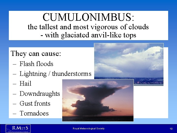
CUMULONIMBUS: the tallest and most vigorous of clouds - with glaciated anvil-like tops They can cause: – – – Flash floods Lightning / thunderstorms Hail Downdraughts Gust fronts Tornadoes Royal Meteorological Society 19
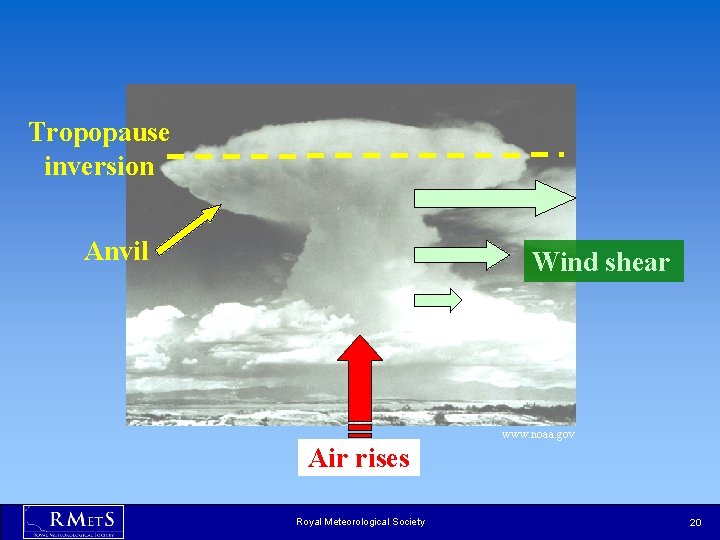
Tropopause inversion Anvil Wind shear www. noaa. gov Air rises Royal Meteorological Society 20
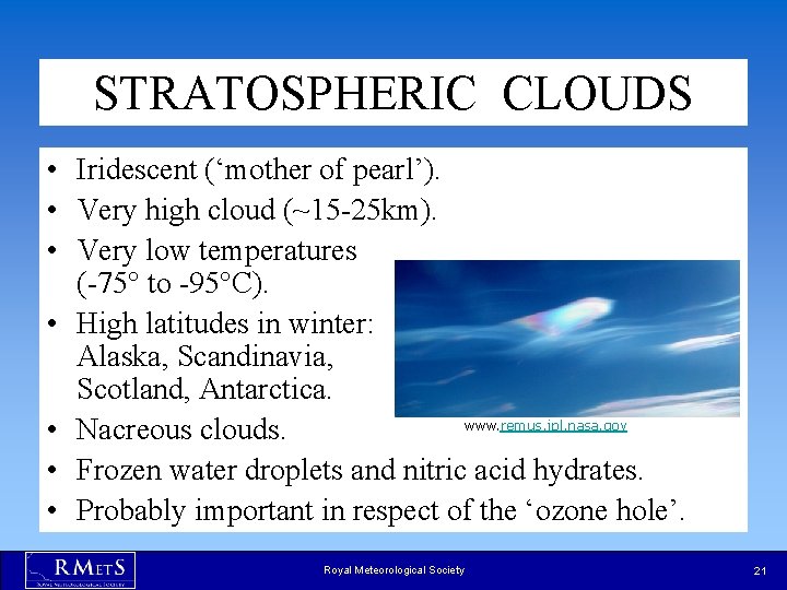
STRATOSPHERIC CLOUDS • Iridescent (‘mother of pearl’). • Very high cloud (~15 -25 km). • Very low temperatures (-75° to -95°C). • High latitudes in winter: Alaska, Scandinavia, Scotland, Antarctica. www. remus. jpl. nasa. gov • Nacreous clouds. • Frozen water droplets and nitric acid hydrates. • Probably important in respect of the ‘ozone hole’. Royal Meteorological Society 21
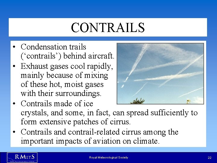
CONTRAILS • Condensation trails (‘contrails’) behind aircraft. • Exhaust gases cool rapidly, mainly because of mixing of these hot, moist gases with their surroundings. • Contrails made of ice crystals, and some, in fact, can spread sufficiently to form extensive patches of cirrus. • Contrails and contrail-related cirrus among the important impacts of aviation on climate. Royal Meteorological Society 22
PREDICTING CLOUDS • Very important to predict them accurately. • Clouds reflect solar (short-wave) radiation and absorb long-wave radiation. • Low cloud acts to cool Earth’s surface during the day and warm it during the night. • Warmer climate = more cloud? • Could Earth self-regulate its temperature? Royal Meteorological Society 23
SUMMARY • Clouds are very common. • They are classified by height and shape. • They are caused by water vapour condensing onto condensation nuclei. • They can cause severe weather hazards. • Amounts of cloud very difficult to predict. Royal Meteorological Society 24