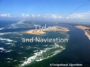
Tides and Navigation Navigational Algorithms The importance of


- Slides: 27
Tides and Navigation ©Navigational Algorithms
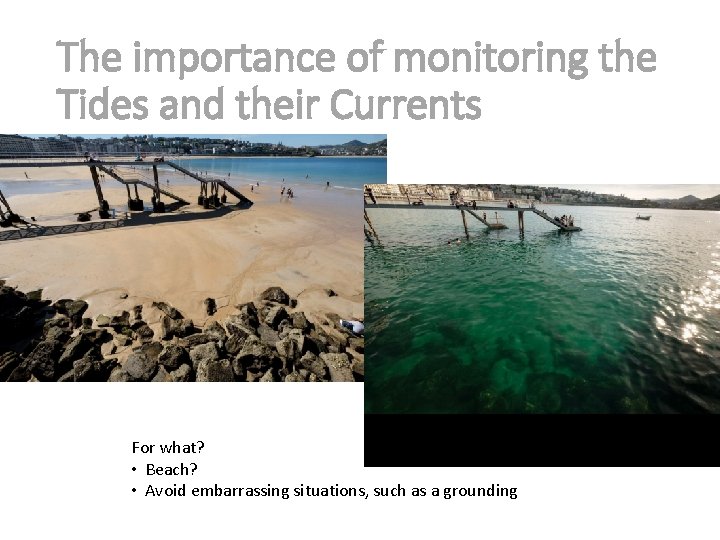
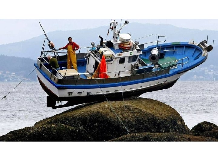
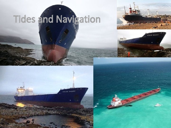
The importance of monitoring the Tides and their Currents For what? • Beach? • Avoid embarrassing situations, such as a grounding
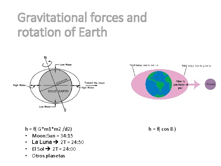
Gravitational forces and rotation of Earth h = f( G*m 1*m 2 /d 2) • Moon: Sun = 34: 15 • La Luna 2 T = 24: 50 • El Sol 2 T = 24: 00 • Otros planetas h = f( cos B )
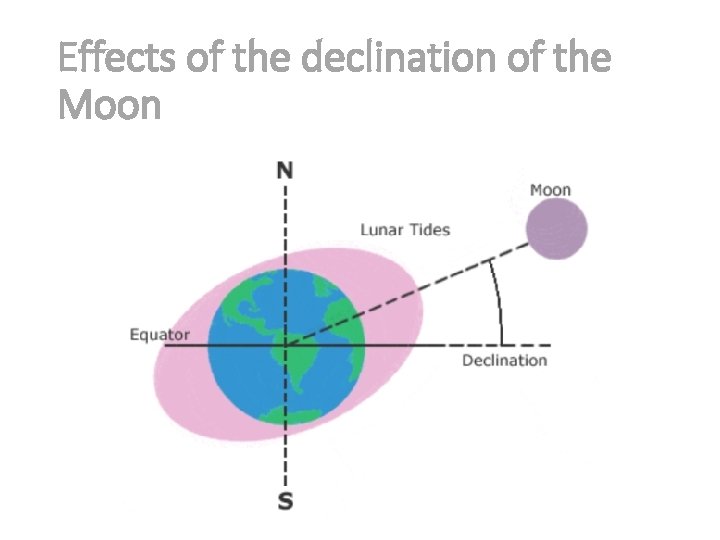
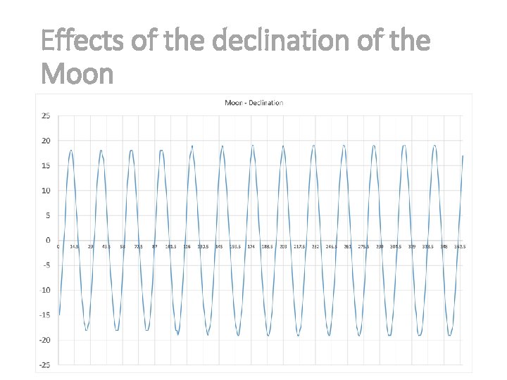
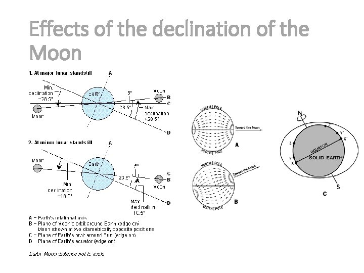
Effects of the declination of the Moon
Effects of the declination of the Moon
Effects of the declination of the Moon
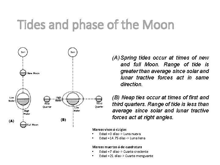
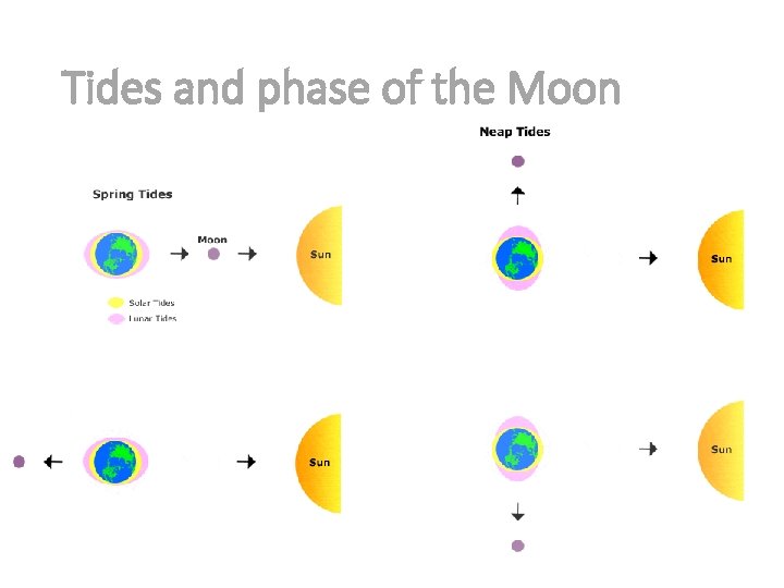
Tides and phase of the Moon (A) Spring tides occur at times of new and full Moon. Range of tide is greater than average since solar and lunar tractive forces act in same direction. (B) Neap ties occur at times of first and third quarters. Range of tide is less than average since solar and lunar tractive forces act at right angles. Mareas vivas ó sizigias • Edad = 0 días -> Luna nueva • Edad = 14. 75 días -> Luna llena Mareas muertas ó de cuadratura • Edad = 7 días -> Cuarto creciente • Edad = 21 días -> Cuarto menguante
Tides and phase of the Moon
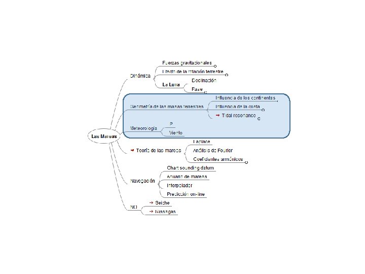
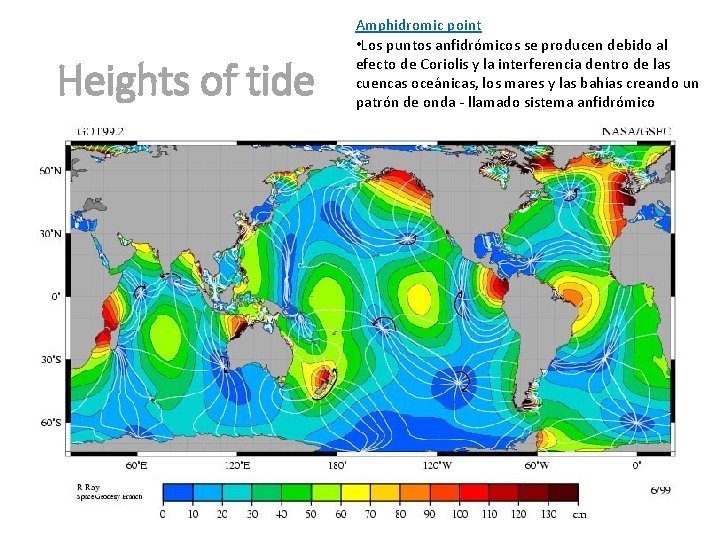
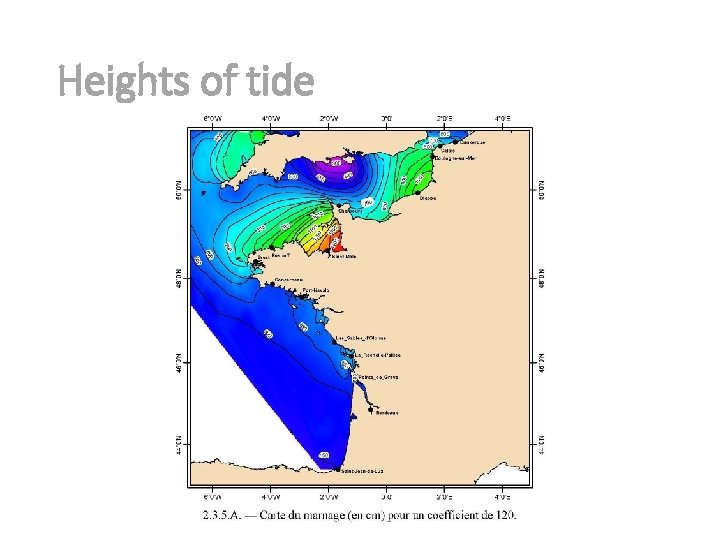
What Else Affects Tides? The shape of bays and estuaries, geographic location and weather patterns all can affect local tidal intensity. The relative distances and positions of the sun, moon and Earth all affect the size and magnitude of the Earth’s two tidal bulges. At a smaller scale, the magnitude of tides can be strongly influenced by the shape of the shoreline. When oceanic tidal bulges hit wide continental margins, the height of the tides can be magnified. Conversely, mid-oceanic islands not near continental margins typically experience very small tides of 1 meter or less. The shape of bays and estuaries also can magnify the intensity of tides. Funnel-shaped bays in particular can dramatically alter tidal magnitude. The Bay of Fundy in Nova Scotia is the classic example of this effect, and has the highest tides in the world – over 15 meters. Narrow inlets and shallow water also tend to dissipate incoming tides. Inland bays such as Laguna Madre, Texas, and Pamlico Sound, North Carolina, have areas classified as non-tidal even though they have ocean inlets. In estuaries with strong tidal rivers, such as the Delaware River and Columbia River, powerful seasonal river flows in the spring can severely alter or mask the incoming tide. Local wind and weather patterns also can affect tides. Strong offshore winds can move water away from coastlines, exaggerating low tide exposures. Onshore winds may act to pile up water onto the shoreline, virtually eliminating low tide exposures. High – pressure systems can depress sea levels, leading to clear sunny days with exceptionally low tides. Conversely, low-pressure systems that contribute to cloudy, rainy conditions typically are associated with tides than are much higher than predicted.
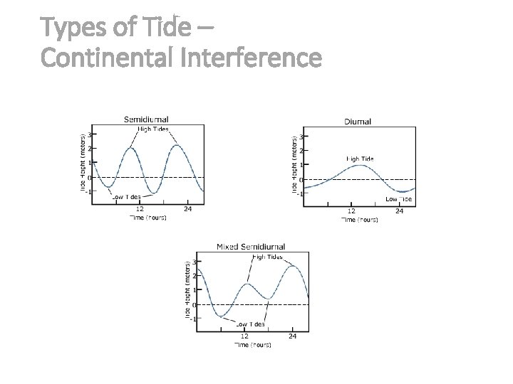
Types of Tide – Continental Interference
Heights of tide Amphidromic point • Los puntos anfidrómicos se producen debido al efecto de Coriolis y la interferencia dentro de las cuencas oceánicas, los mares y las bahías creando un patrón de onda - llamado sistema anfidrómico
Heights of tide
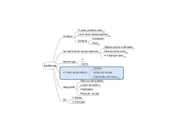
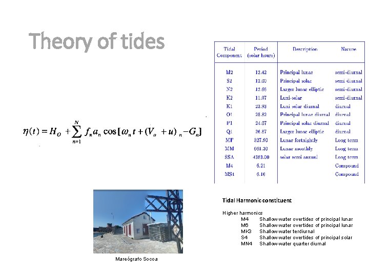
Theory of tides Tidal Harmonic constituent Higher harmonics M 4 Shallow water overtides of principal lunar M 6 Shallow water overtides of principal lunar MK 3 Shallow water terdiurnal S 4 Shallow water overtides of principal solar MN 4 Shallow water quarter diurnal Mareógrafo Socoa
Tides and Navigation
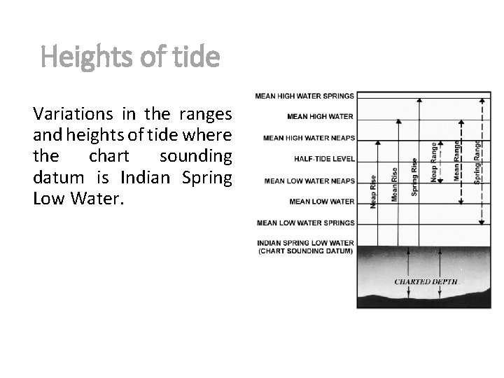
Heights of tide Variations in the ranges and heights of tide where the chart sounding datum is Indian Spring Low Water.
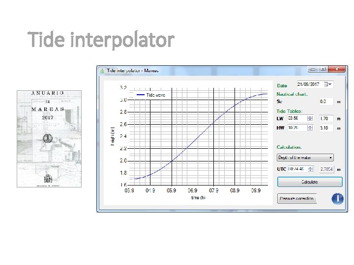
Tide interpolator
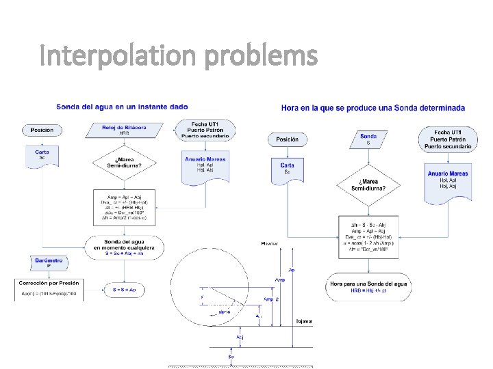
Interpolation problems
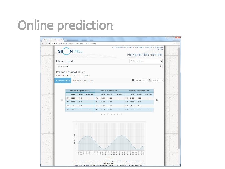
Online prediction
Thank you so much for your time and attention ESKERRIK ASKO 27 https: //sites. google. com/site/navigationalalgorithms/