Strategic Priorities Center for Operational Oceanographic Products and

- Slides: 25
Strategic Priorities Center for Operational Oceanographic Products and Services (CO-OPS) Richard Edwing, Director 2019 Hydrographic Services Review Panel Washington, DC March 2019
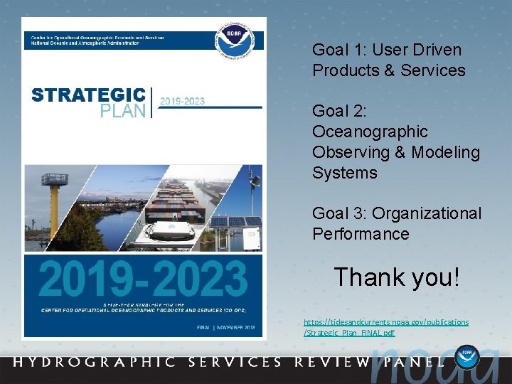
Goal 1: User Driven Products & Services Goal 2: Oceanographic Observing & Modeling Systems Goal 3: Organizational Performance Thank you! https: //tidesandcurrents. noaa. gov/publications /Strategic_Plan_FINAL. pdf
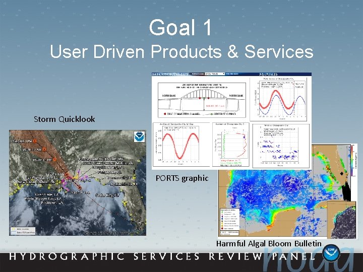
Goal 1 User Driven Products & Services Storm Quicklook PORTS graphic Harmful Algal Bloom Bulletin
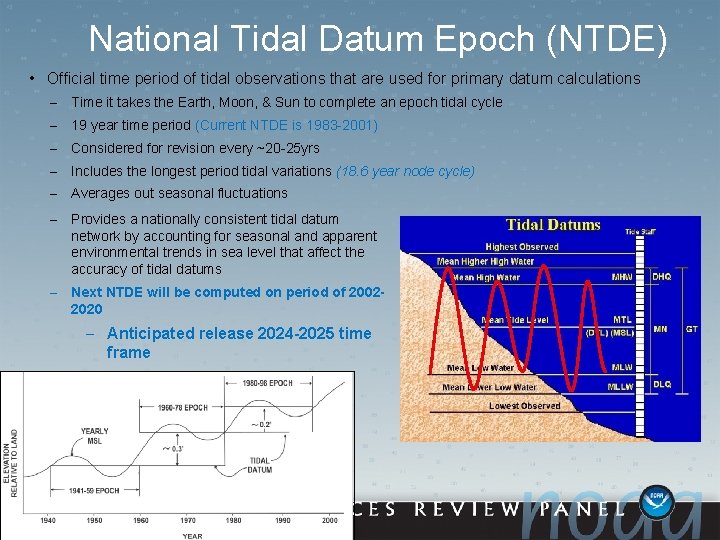
National Tidal Datum Epoch (NTDE) • Official time period of tidal observations that are used for primary datum calculations – Time it takes the Earth, Moon, & Sun to complete an epoch tidal cycle – 19 year time period (Current NTDE is 1983 -2001) – Considered for revision every ~20 -25 yrs – Includes the longest period tidal variations (18. 6 year node cycle) – Averages out seasonal fluctuations – Provides a nationally consistent tidal datum network by accounting for seasonal and apparent environmental trends in sea level that affect the accuracy of tidal datums – Next NTDE will be computed on period of 20022020 – Anticipated release 2024 -2025 time frame 1983 -2001 EPOCH
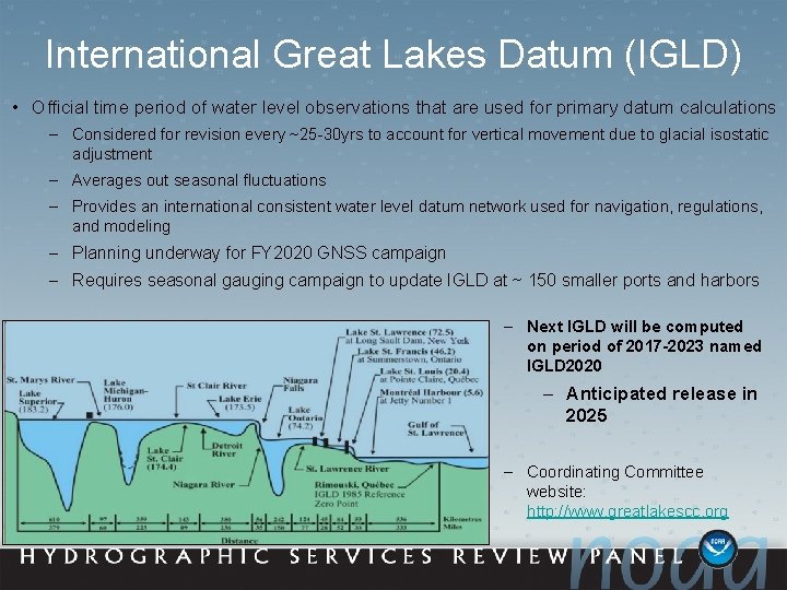
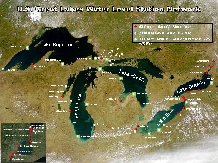
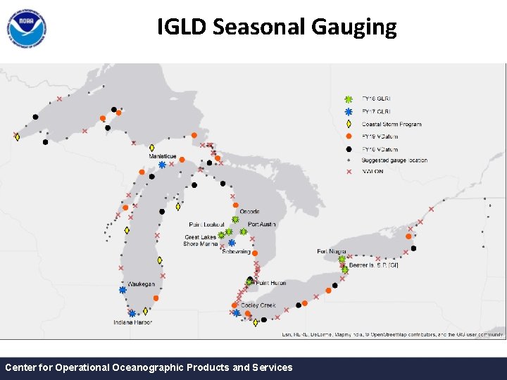
International Great Lakes Datum (IGLD) • Official time period of water level observations that are used for primary datum calculations – Considered for revision every ~25 -30 yrs to account for vertical movement due to glacial isostatic adjustment – Averages out seasonal fluctuations – Provides an international consistent water level datum network used for navigation, regulations, and modeling – Planning underway for FY 2020 GNSS campaign – Requires seasonal gauging campaign to update IGLD at ~ 150 smaller ports and harbors – Next IGLD will be computed on period of 2017 -2023 named IGLD 2020 – Anticipated release in 2025 – Coordinating Committee website: http: //www. greatlakescc. org
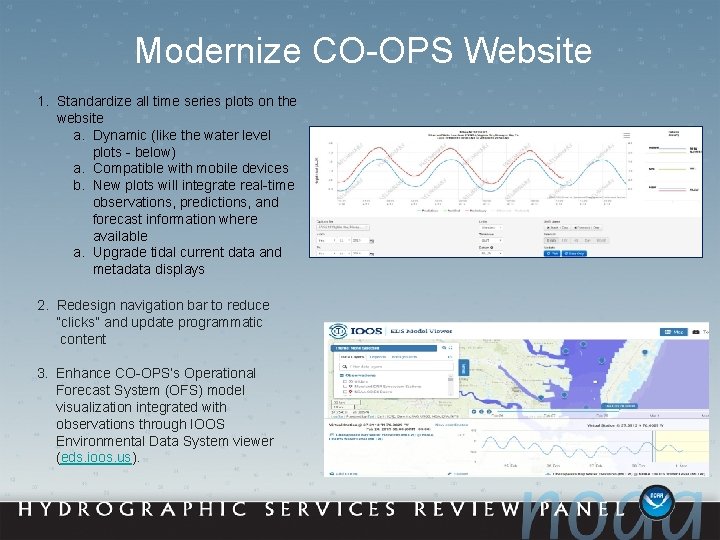
Modernize CO-OPS Website 1. Standardize all time series plots on the website a. Dynamic (like the water level plots - below) a. Compatible with mobile devices b. New plots will integrate real-time observations, predictions, and forecast information where available a. Upgrade tidal current data and metadata displays 2. Redesign navigation bar to reduce “clicks” and update programmatic content 3. Enhance CO-OPS’s Operational Forecast System (OFS) model visualization integrated with observations through IOOS Environmental Data System viewer (eds. ioos. us).
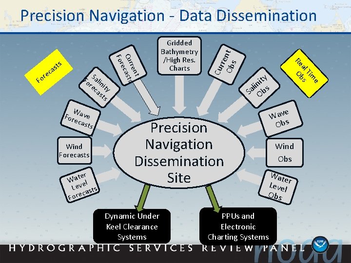
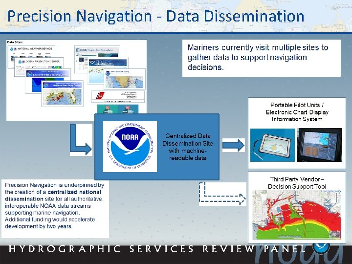
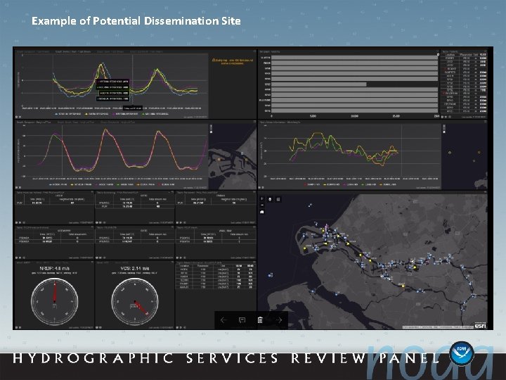
W Fore ave cast s Wind Forecasts er Wat el Lev sts ca Fore Precision Navigation Dissemination Site Dynamic Under Keel Clearance Systems e Tim al s Re Ob Fo Salin re it ca y sts t ren Cur casts e For re Fo ts s ca Gridded Bathymetry /High Res. Charts Cur re Ob nt s Precision Navigation - Data Dissemination ity n li Sa Obs e Wav Obs Wind Obs Wat e Leve r l Obs PPUs and Electronic Charting Systems
Precision Navigation - Data Dissemination
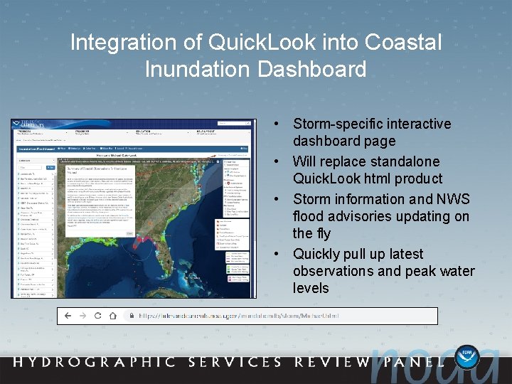
Integration of Quick. Look into Coastal Inundation Dashboard • Storm-specific interactive dashboard page • Will replace standalone Quick. Look html product • Storm information and NWS flood advisories updating on the fly • Quickly pull up latest observations and peak water levels
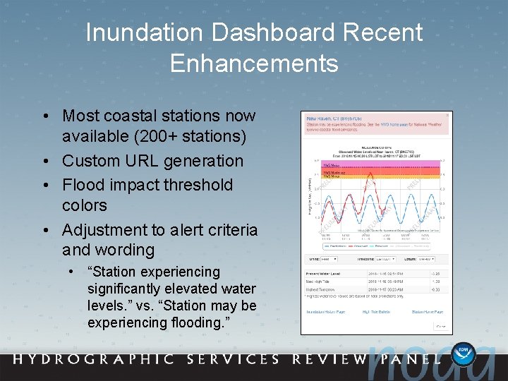
Inundation Dashboard Recent Enhancements • Most coastal stations now available (200+ stations) • Custom URL generation • Flood impact threshold colors • Adjustment to alert criteria and wording • “Station experiencing significantly elevated water levels. ” vs. “Station may be experiencing flooding. ”
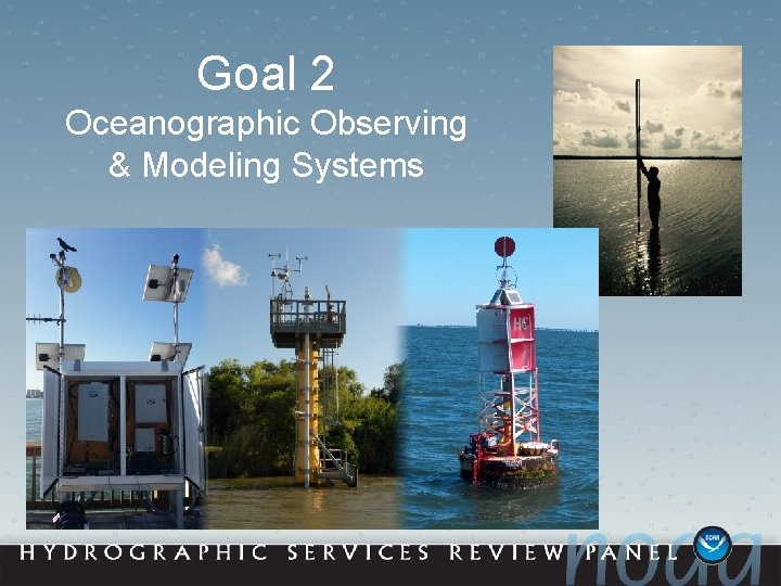
Goal 2 Oceanographic Observing & Modeling Systems
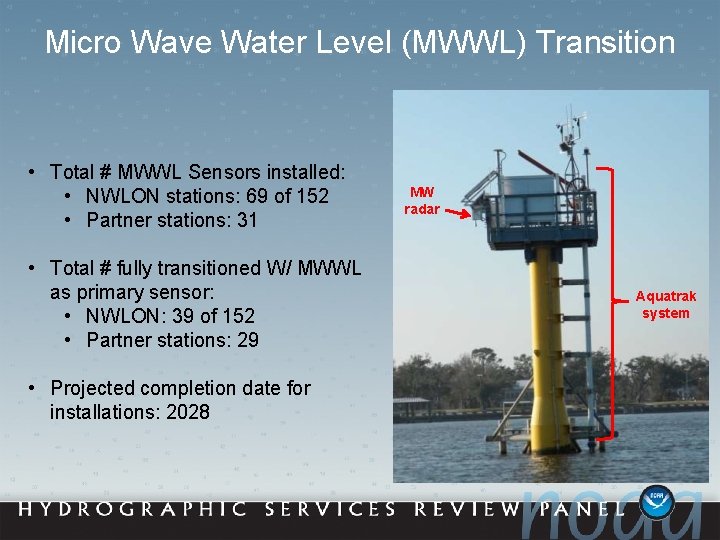
Micro Wave Water Level (MWWL) Transition • Total # MWWL Sensors installed: • NWLON stations: 69 of 152 • Partner stations: 31 • Total # fully transitioned W/ MWWL as primary sensor: • NWLON: 39 of 152 • Partner stations: 29 • Projected completion date for installations: 2028 MW radar Aquatrak system
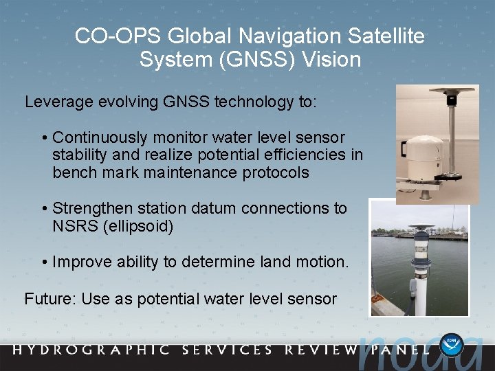
CO-OPS Global Navigation Satellite System (GNSS) Vision Leverage evolving GNSS technology to: • Continuously monitor water level sensor stability and realize potential efficiencies in bench mark maintenance protocols • Strengthen station datum connections to NSRS (ellipsoid) • Improve ability to determine land motion. Future: Use as potential water level sensor
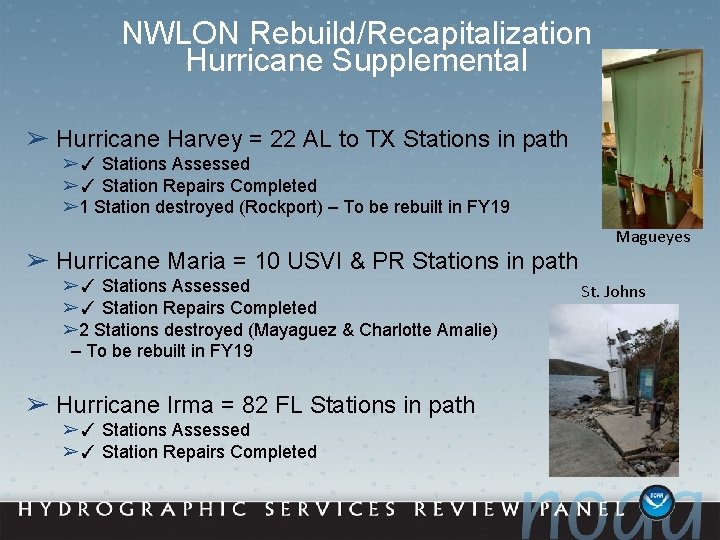
NWLON Rebuild/Recapitalization Hurricane Supplemental ➢ Hurricane Harvey = 22 AL to TX Stations in path ➢✓ Stations Assessed ➢✓ Station Repairs Completed ➢ 1 Station destroyed (Rockport) – To be rebuilt in FY 19 Magueyes ➢ Hurricane Maria = 10 USVI & PR Stations in path ➢✓ Stations Assessed ➢✓ Station Repairs Completed ➢ 2 Stations destroyed (Mayaguez & Charlotte Amalie) – To be rebuilt in FY 19 ➢ Hurricane Irma = 82 FL Stations in path ➢✓ Stations Assessed ➢✓ Station Repairs Completed St. Johns
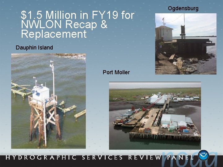
$1. 5 Million in FY 19 for NWLON Recap & Replacement Dauphin Island Port Moller Ogdensburg
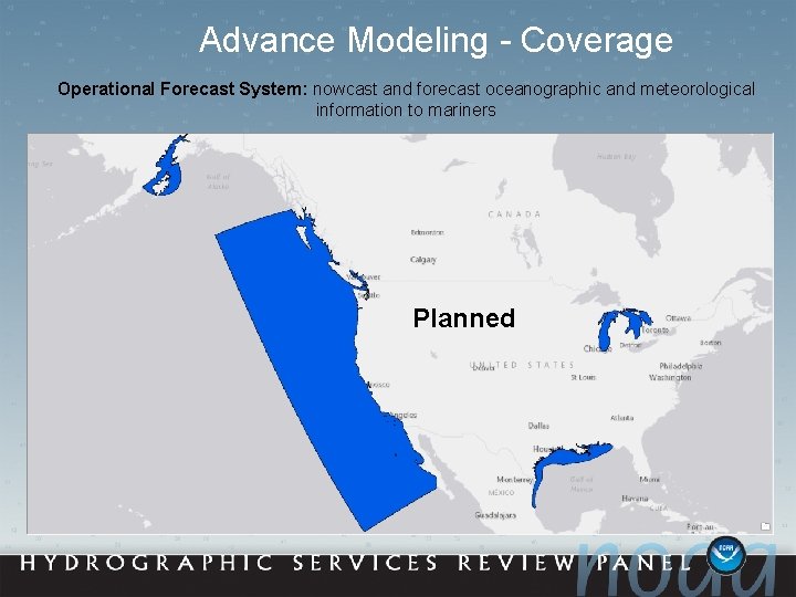
Advance Modeling - Coverage Operational Forecast System: nowcast and forecast oceanographic and meteorological information to mariners Existing Planned
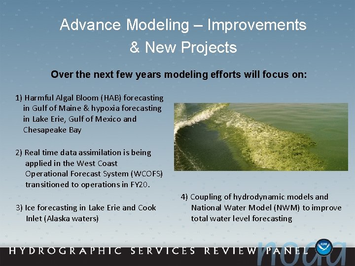
Advance Modeling – Improvements & New Projects Over the next few years modeling efforts will focus on: 1) Harmful Algal Bloom (HAB) forecasting in Gulf of Maine & hypoxia forecasting in Lake Erie, Gulf of Mexico and Chesapeake Bay 2) Real time data assimilation is being applied in the West Coast Operational Forecast System (WCOFS) transitioned to operations in FY 20. 3) Ice forecasting in Lake Erie and Cook Inlet (Alaska waters) 4) Coupling of hydrodynamic models and National Water Model (NWM) to improve total water level forecasting
Thank You!
Extra Slides Center for Operational Oceanographic Products and Services
U. S. Great Lakes Water Level Station Network 53 Great Lakes WL Stations 23 Water Level Stations w/Met Marquette C. G. Ontonagon S. W U. . P S. ie Lit Sli r t p W le R es ap R De oc t N ids To k C eeb ur ut is h Vi lla ge Lake Superior Point Iroquois Ogdensburg Alexandria Bay Port Inland Duluth Lak Mackinaw Alpena e. H Cape Vincent uro n o Menominee Sturgeon Bay Canal Green Bay Kewaunee Milwaukee e Lake Mich igan Grand Marais 14 Great Lakes WL Stations w/Met & GPS (CORS) Lak Harbor Beach Ashland Ave American Falls Essexville Fermi Power Plant Gibraltar Rochester k a L E rie Sturgeon Point Erie Fairport Cleveland Toledo Calumet Harbor Olcott Buffalo e Holland ari Ont Niagara Intake Lakeport Ludington Oswego Marblehead 6/11
IGLD Seasonal Gauging Center for Operational Oceanographic Products and Services
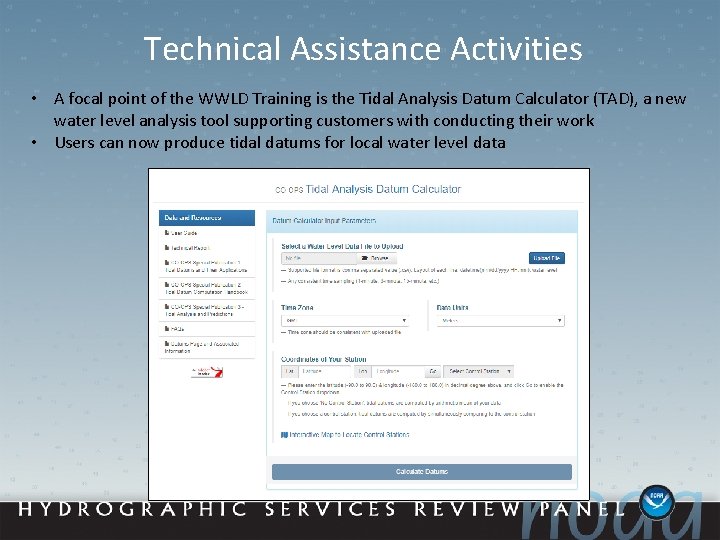
Technical Assistance Activities • A focal point of the WWLD Training is the Tidal Analysis Datum Calculator (TAD), a new water level analysis tool supporting customers with conducting their work • Users can now produce tidal datums for local water level data
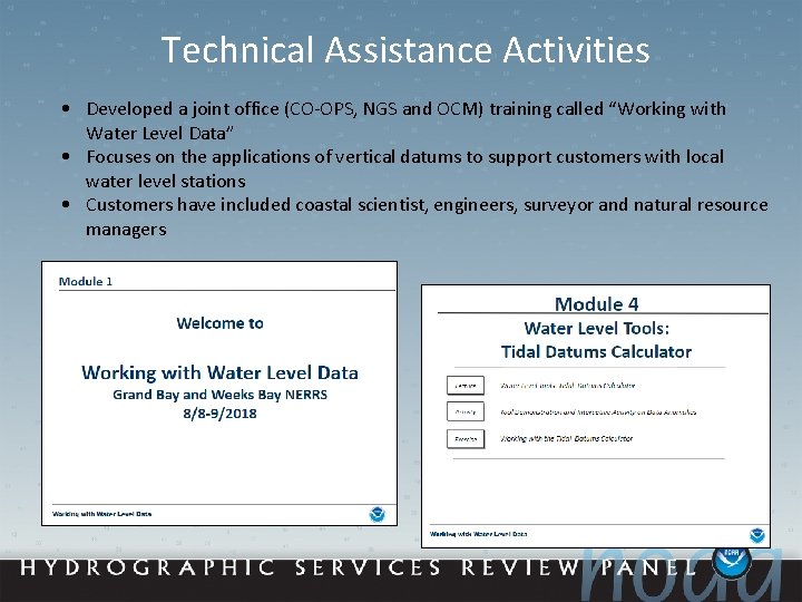
Technical Assistance Activities • Developed a joint office (CO-OPS, NGS and OCM) training called “Working with Water Level Data” • Focuses on the applications of vertical datums to support customers with local water level stations • Customers have included coastal scientist, engineers, surveyor and natural resource managers
Example of Potential Dissemination Site