NASA HighAltitude PrecipitationWind Radars for Hurricane Research Gerald
- Slides: 17
NASA High-Altitude Precipitation/Wind Radars for Hurricane Research Gerald Heymsfield NASA/Goddard Space Flight Center (Gerald. Heymsfield@nasa. gov) Lihua Li /University of Maryland Baltimore/GEST James Carswell /Remote Sensing Solutions, Inc. Outline: • Current high-altitude radars for hurricane research with NASA ER-2 • Future directions with tropospheric wind measurements and surface winds from highaltitude aircraft and high-altitude long endurance UAS (HALE). GODDARD SPACE FLIGHT CENTER
Science Drivers ØTargeted observations and real-time information from hurricanes & other extreme weather events in remote regions. ØTropospheric wind measurements with higher spatial and temporal resolution than currently available from lower altitude aircraft ØHALE such as Global Hawk currently provide long-duration (>24 hours), high-altitude (>18 km) capability. ØMore than a decade of high-altitude Doppler wind measurements from ER-2 aircraft over weather systems including tropical storms GODDARD SPACE FLIGHT CENTER 2
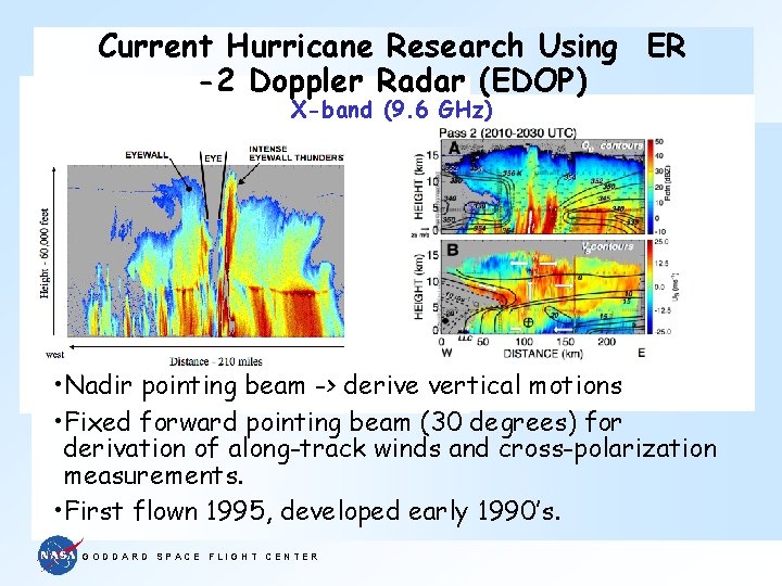
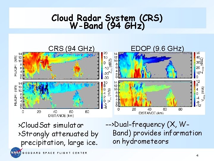
Current Hurricane Research Using ER -2 Doppler Radar (EDOP) X-band (9. 6 GHz) • Nadir pointing beam -> derive vertical motions • Fixed forward pointing beam (30 degrees) for derivation of along-track winds and cross-polarization measurements. • First flown 1995, developed early 1990’s. GODDARD SPACE FLIGHT CENTER
Cloud Radar System (CRS) W-Band (94 GHz) CRS (94 GHz) EDOP (9. 6 GHz) -->Dual-frequency (X, W>Cloud. Sat simulator Band) provides information >Strongly attenuated by on hydrometeors precipitation, large ice. GODDARD SPACE FLIGHT CENTER 4
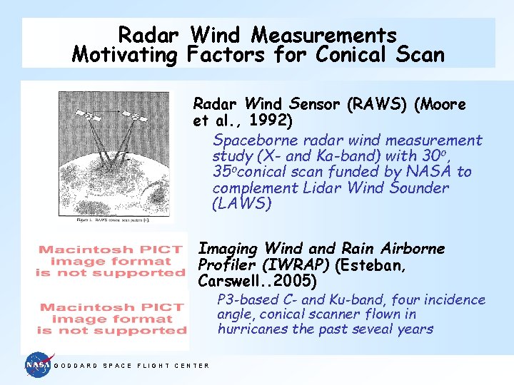
Radar Wind Measurements Motivating Factors for Conical Scan Radar Wind Sensor (RAWS) (Moore et al. , 1992) Spaceborne radar wind measurement study (X- and Ka-band) with 30 o, 35 oconical scan funded by NASA to complement Lidar Wind Sounder (LAWS) Imaging Wind and Rain Airborne Profiler (IWRAP) (Esteban, Carswell. . 2005) P 3 -based C- and Ku-band, four incidence angle, conical scanner flown in hurricanes the past seveal years GODDARD SPACE FLIGHT CENTER
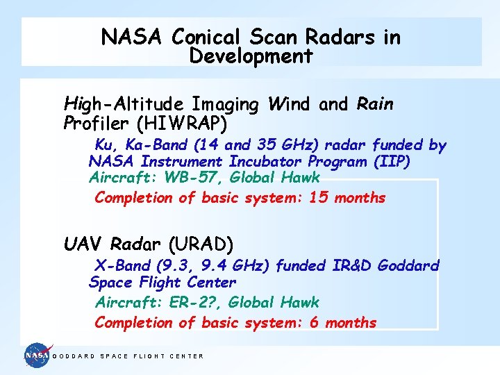
NASA Conical Scan Radars in Development High-Altitude Imaging Wind and Rain Profiler (HIWRAP) Ku, Ka-Band (14 and 35 GHz) radar funded by NASA Instrument Incubator Program (IIP) Aircraft: WB-57, Global Hawk Completion of basic system: 15 months UAV Radar (URAD) X-Band (9. 3, 9. 4 GHz) funded IR&D Goddard Space Flight Center Aircraft: ER-2? , Global Hawk Completion of basic system: 6 months GODDARD SPACE FLIGHT CENTER
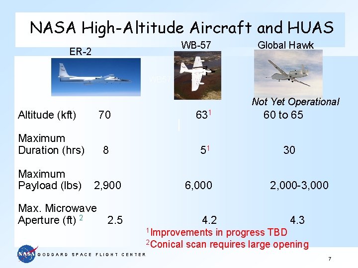
NASA High-Altitude Aircraft and HUAS WB-57 ER-2 Global Hawk WB 57 Not Yet Operational Altitude (kft) 70 631 Maximum Duration (hrs) 8 51 Maximum Payload (lbs) 2, 900 Max. Microwave Aperture (ft) 2 2. 5 6, 000 4. 2 60 to 65 30 2, 000 -3, 000 4. 3 1 Improvements in progress TBD 2 Conical scan requires large opening GODDARD SPACE FLIGHT CENTER 7
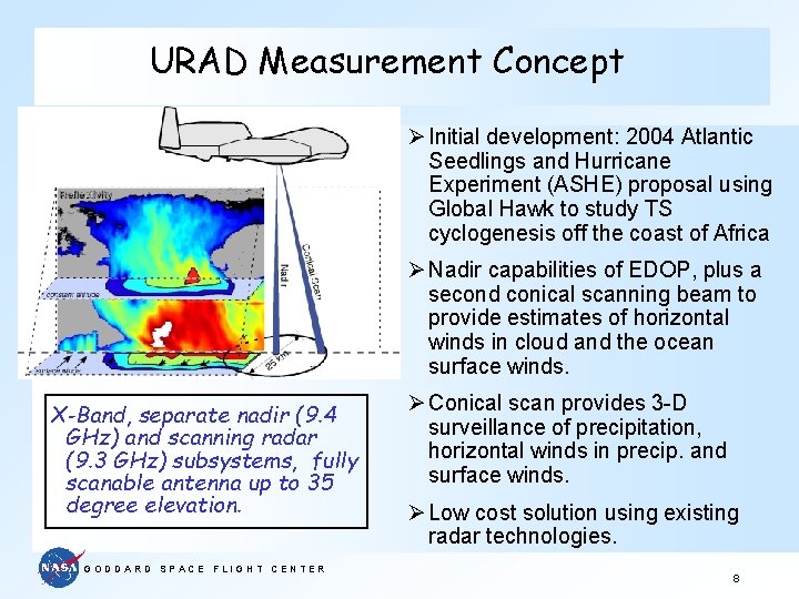
URAD Measurement Concept Ø Initial development: 2004 Atlantic Seedlings and Hurricane Experiment (ASHE) proposal using Global Hawk to study TS cyclogenesis off the coast of Africa Ø Nadir capabilities of EDOP, plus a second conical scanning beam to provide estimates of horizontal winds in cloud and the ocean surface winds. X-Band, separate nadir (9. 4 GHz) and scanning radar (9. 3 GHz) subsystems, fully scanable antenna up to 35 degree elevation. GODDARD SPACE FLIGHT CENTER Ø Conical scan provides 3 -D surveillance of precipitation, horizontal winds in precip. and surface winds. Ø Low cost solution using existing radar technologies. 8
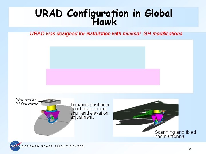
URAD Configuration in Global Hawk URAD was designed for installation with minimal GH modifications Interface for Global Hawk Two-axis positioner to achieve conical scan and elevation adjustment. Scanning and fixed nadir antenna GODDARD SPACE FLIGHT CENTER 9
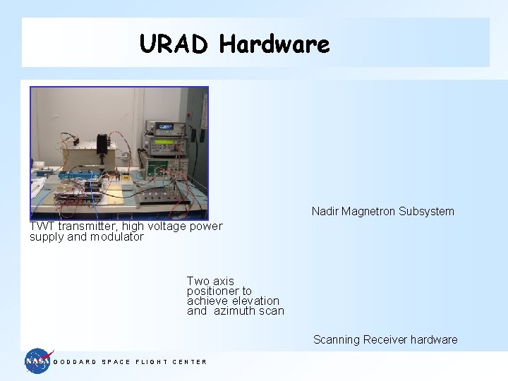
URAD Hardware Nadir Magnetron Subsystem TWT transmitter, high voltage power supply and modulator Two axis positioner to achieve elevation and azimuth scan Scanning Receiver hardware GODDARD SPACE FLIGHT CENTER
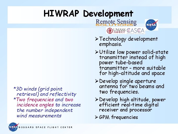
HIWRAP Development *3 D winds (grid point retrieval) and reflectivity *Two frequencies and two incidence angles to increase the number independent wind measurements GODDARD SPACE FLIGHT CENTER Ø Technology development emphasis. Ø Utilize low power solid-state transmitter instead of high power tube-based transmitter - more suitable for high-altitude and space Ø Develop single aperture antenna for two beams and two frequencies. Ø Develop high altitude, power efficient real-time digital receiver and processor Ø GPM frequencies
HIWRAP Measurement Concept Two look angles and two frequencies Many independent radial wind measurements within grid volume are used to calculate wind vector GODDARD SPACE FLIGHT CENTER
HIWRAP Measurement /Accuracy Requirements Based on 10 W Ka-band 30 W Ku-band power amplifiers GODDARD SPACE FLIGHT CENTER 13
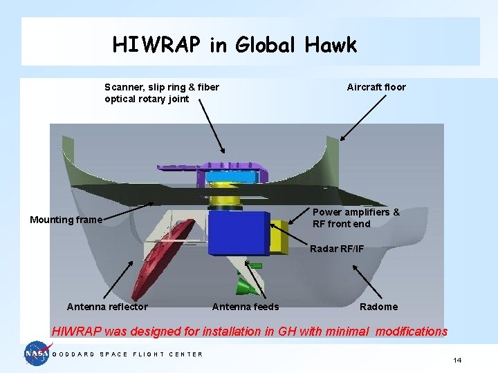
HIWRAP in Global Hawk Scanner, slip ring & fiber optical rotary joint Aircraft floor Power amplifiers & RF front end Mounting frame Radar RF/IF Antenna reflector Antenna feeds Radome HIWRAP was designed for installation in GH with minimal modifications GODDARD SPACE FLIGHT CENTER 14
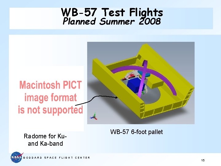
WB-57 Test Flights Planned Summer 2008 Radome for Kuand Ka-band GODDARD SPACE FLIGHT CENTER WB-57 6 -foot pallet 15
Summary ØRadar-based winds using conical scan from above hurricanes and other extreme weather events is promising approach for high-altitude aircraft, HALE, and space. ØHIWRAP hardware completion and flight testing on WB-57 aircraft -> Summer 2008. ØCompletion of basic URAD system by Fall 2007 ØMigrate both radars to Global Hawk when one becomes available. ØLidar-based wind instrument (TWi. Li. TE) due for completion for WB-57 about same time as HIWRAP---> opportunity to remotely measure winds in precipitation-filled and clear regions. GODDARD SPACE FLIGHT CENTER 16
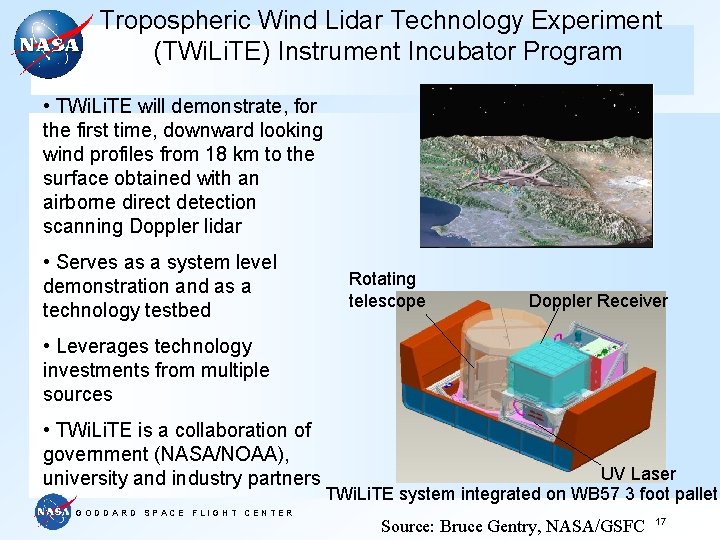
Tropospheric Wind Lidar Technology Experiment (TWi. Li. TE) Instrument Incubator Program • TWi. Li. TE will demonstrate, for the first time, downward looking wind profiles from 18 km to the surface obtained with an airborne direct detection scanning Doppler lidar • Serves as a system level demonstration and as a technology testbed Rotating telescope Doppler Receiver • Leverages technology investments from multiple sources • TWi. Li. TE is a collaboration of government (NASA/NOAA), university and industry partners GODDARD SPACE FLIGHT CENTER UV Laser TWi. Li. TE system integrated on WB 57 3 foot pallet Source: Bruce Gentry, NASA/GSFC 17