Mangrove Conservation and Restoration in South Clarendon STUDY


- Slides: 22

Mangrove Conservation and Restoration in South Clarendon

STUDY AREA Carlisle Bay Jackson’s Bay

Boggy Pond West(1984) Satellite imagery from 1984 showing healthy Mangrove Forest.

Boggy Pond West (2005) Satellite imagery from 2005 showing degraded and desiccated mangrove forest.

Change in Coastal Morphology 2012 2014 Satellite imagery in 2012 showing open water ways facilitating natural tidal flows Satellite imagery in 2014 showing sand deposition and resulting blockage of natural water channels

Boggy Pond West (2018) Satellite imagery from 2018 showing degraded and desiccated Mangrove Forest

Boggy Pond West-January 15, 2019

CARLISLE BAY Satellite imagery in 2003 showing healthy Mangrove Forests prior to Shrimp Farm operations (2003)

CARLISLE BAY Satellite imagery in 2018 showing dead and desiccated Mangrove Forest post Shrimp Farm operations (2018)

Soil coring at Carlisle Bay Soil core samples showing evidence of clay deposition in degraded Mangrove Forest.

Carlisle Bay March 2, 2019

Rhizophora mangle in Carlisle Bay A dwarfed red mangrove plant Rhizophora mangle showing signs of reproduction at approximately 2 feet in height. A mature red mangrove can grow up to approximately 30 meters in height

BOGGY POND EAST(2018) Satellite imagery from 2018 showing desiccated and degraded Mangrove Forest.

Boggy Pond April 18, 2019

Transects & Monitoring Sites A faunal/faunal survey was conducted in the Boggy Pond Mangrove Forest. Monitoring plots were also established.

TRANSECT 6

MONITORING PLOT #1

MONITORING PLOT #4

MONITORING PLOT # 5

Next Steps…. �Topographical Study in all three areas of interest �Hydrological study as well as consultations with coastal engineers. �Monitoring of rehabilitated sites & monitoring plots

Project Progress to date… �Interim Mangrove Restoration Plan for East Boggy Pond Produced � 2 baseline studies conducted - CMS-veg/fauna study - Dr. Rahanna Juman – IMA, T&T �Survey of area from Jackson’s Bay to Milk River �Training of 3 community field guides �Stakeholder buy-in �Culvert installation

Stakeholders Counterpart Contribution during first quarter was in excess of JMD$16 million Projections for counterpart contributions was JMD$10 million throughout entire project
 Chapter 56 conservation biology and restoration ecology
 Mason river clarendon
 Clarendon road primary school
 Mangrove tree adaptations
 Mangrove food web
 What are pelvic fins
 Mangrove watch online
 White mangrove
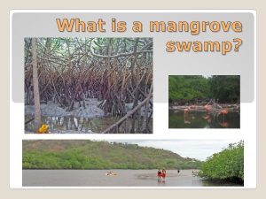
 Mangrove introduction
 Mangrove abiotic factors
 Centro de estudios avanzados de blanes
 What is a lagoon
 Mangrove
 South bay salt pond restoration project
 A1 flow equalization basin
 Chapter 11 study guide conservation of energy
 Old south vs new south streetcar named desire
 Work study and method study
 Work study objectives
 Time and motion study example ppt
 Restoration drama and prose
 Enlighten about image noise and restoration
 Phosphorus cycle pearson education

