Locating Points Finding Distances Looking for Pythagoras Investigation

- Slides: 12
Locating Points & Finding Distances Looking for Pythagoras = Investigation 1. 1
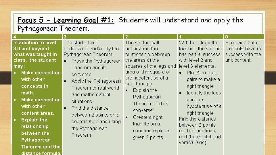
Focus 5 - Learning Goal #1: Students will understand apply the Pythagorean Theorem. 4 In addition to level 3. 0 and beyond what was taught in class, the student may: Make connection with other concepts in math. Make connection with other content areas. Explain the relationship between the Pythagorean Theorem and the 3 The student will understand apply the Pythagorean Theorem. Prove the Pythagorean Theorem and its converse. Apply the Pythagorean Theorem to real world and mathematical situations. Find the distance between 2 points on a coordinate plane using the Pythagorean Theorem. 2 The student will understand the relationship between the areas of the squares of the legs and area of the square of the hypotenuse of a right triangle. Explain the Pythagorean Theorem and its converse. Create a right triangle on a coordinate plane, given 2 points. 1 With help from the teacher, the student has partial success with level 2 and level 3 elements. Plot 3 ordered pairs to make a right triangle Identify the legs and the hypotenuse of a right triangle Find the distance between 2 points on the coordinate grid (horizontal and vertical axis). 0 Even with help, students have no success with the unit content.
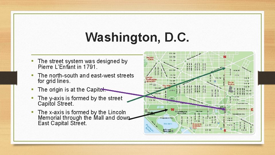
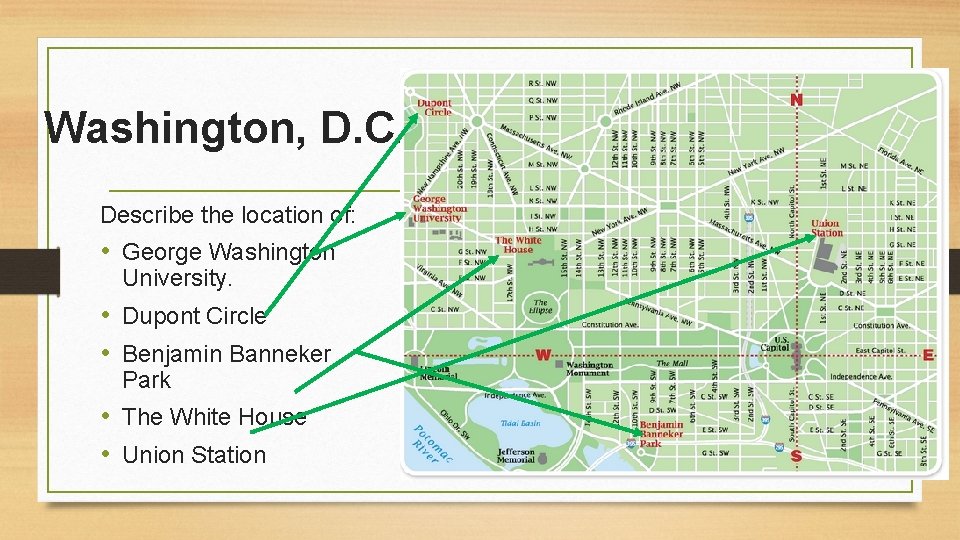
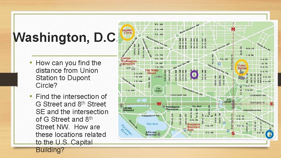
Washington, D. C. • The street system was designed by Pierre L’Enfant in 1791. • The north-south and east-west streets for grid lines. • The origin is at the Capitol. • The y-axis is formed by the street Capitol Street. • The x-axis is formed by the Lincoln Memorial through the Mall and down East Capital Street.
Washington, D. C. Describe the location of: • George Washington University. • Dupont Circle • Benjamin Banneker Park • The White House • Union Station
Washington, D. C. • How can you find the distance from Union Station to Dupont Circle? • Find the intersection of G Street and 8 th Street SE and the intersection of G Street and 8 th Street NW. How are these locations related to the U. S. Capital Building?
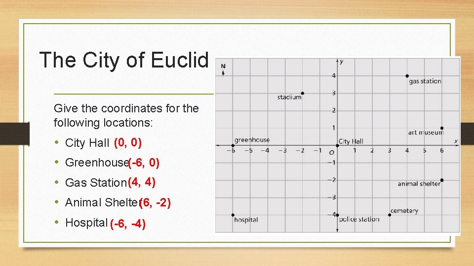
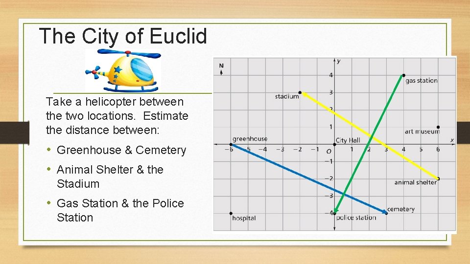
The City of Euclid • The founders of Euclid LOVED math! • They named their city after the famous mathematician Euclid of Alexandria. • They designed their street system to look like a coordinate grid. • They Euclidians describe the locations of buildings and other landmarks by giving coordinates. Picture from:
The City of Euclid Give the coordinates for the following locations: • • • City Hall (0, 0) Greenhouse(-6, 0) Gas Station (4, 4) Animal Shelter(6, -2) Hospital (-6, -4)
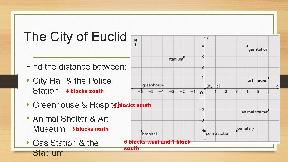
The City of Euclid Find the distance between: • City Hall & the Police Station 4 blocks south • Greenhouse & Hospital • Animal Shelter & Art Museum 3 blocks north • Gas Station & the Stadium 6 blocks west and 1 block south
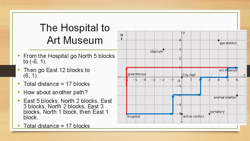
The Hospital to Art Museum • From the Hospital go North 5 blocks • • • to (-6, 1). Then go East 12 blocks to (6, 1). Total distance = 17 blocks How about another path? East 5 blocks, North 2 blocks, East 3 blocks, North 1 block, then East 1 block. Total distance = 17 blocks
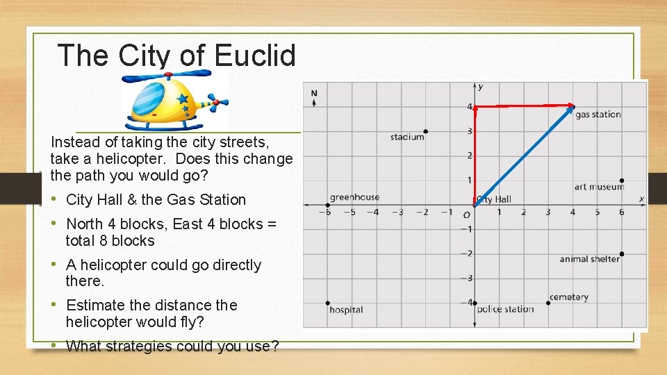
The City of Euclid Instead of taking the city streets, take a helicopter. Does this change the path you would go? • City Hall & the Gas Station • North 4 blocks, East 4 blocks = total 8 blocks • A helicopter could go directly there. • Estimate the distance the helicopter would fly? • What strategies could you use?
The City of Euclid Take a helicopter between the two locations. Estimate the distance between: • Greenhouse & Cemetery • Animal Shelter & the Stadium • Gas Station & the Police Station