g La ti e tud in d a


- Slides: 19
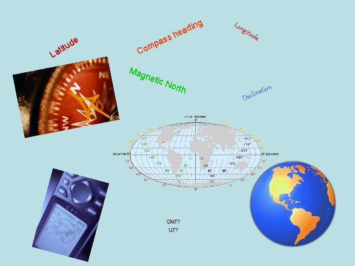
g La ti e tud in d a e s h s a p om Lon gitu d e C Mag neti c N orth GMT? UT? on D ati n i l c e
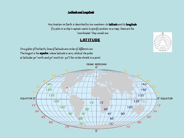
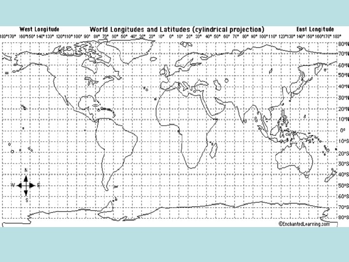
Latitude and Longitude Any location on Earth is described by two numbers--its latitude and its longitude. If a pilot or a ship's captain wants to specify position on a map, these are the "coordinates" they would use. LATITUDE On a globe of the Earth, lines of latitude are circles of different size. The longest is the equator, whose latitude is zero, while at the poles at latitudes 90° north and 90° south (or -90°) the circles shrink to a point.
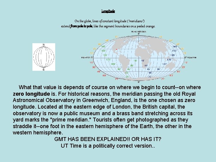
Longitude On the globe, lines of constant longitude ("meridians") extend from pole to pole, like the segment boundaries on a peeled orange. What that value is depends of course on where we begin to count--on where zero longitude is. For historical reasons, the meridian passing the old Royal Astronomical Observatory in Greenwich, England, is the one chosen as zero longitude. Located at the eastern edge of London, the British capital, the observatory is now a public museum and a brass band stretching across its yard marks the "prime meridian. " Tourists often get photographed as they straddle it--one foot in the eastern hemisphere of the Earth, the other in the western hemisphere. GMT HAS BEEN EXPLAINED!! OR HAS IT? UT Time is a politically correct version. .
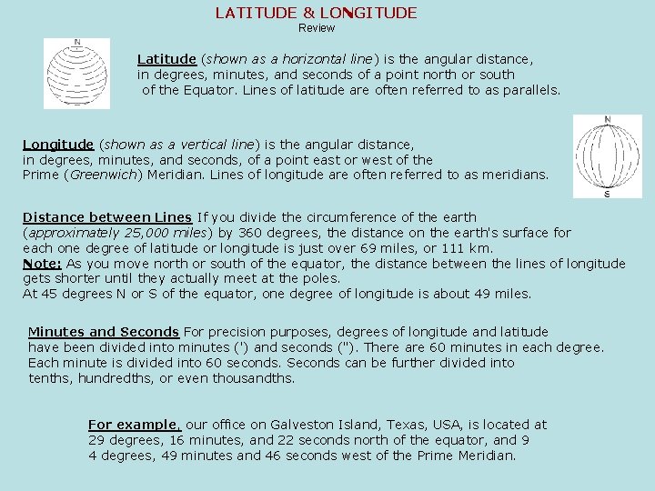
LATITUDE & LONGITUDE Review Latitude (shown as a horizontal line) is the angular distance, in degrees, minutes, and seconds of a point north or south of the Equator. Lines of latitude are often referred to as parallels. Longitude (shown as a vertical line) is the angular distance, in degrees, minutes, and seconds, of a point east or west of the Prime (Greenwich) Meridian. Lines of longitude are often referred to as meridians. Distance between Lines If you divide the circumference of the earth (approximately 25, 000 miles) by 360 degrees, the distance on the earth's surface for each one degree of latitude or longitude is just over 69 miles, or 111 km. Note: As you move north or south of the equator, the distance between the lines of longitude gets shorter until they actually meet at the poles. At 45 degrees N or S of the equator, one degree of longitude is about 49 miles. Minutes and Seconds For precision purposes, degrees of longitude and latitude have been divided into minutes (') and seconds ("). There are 60 minutes in each degree. Each minute is divided into 60 seconds. Seconds can be further divided into tenths, hundredths, or even thousandths. For example, our office on Galveston Island, Texas, USA, is located at 29 degrees, 16 minutes, and 22 seconds north of the equator, and 9 4 degrees, 49 minutes and 46 seconds west of the Prime Meridian.
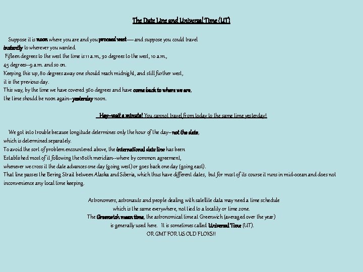
The Date Line and Universal Time (UT) Suppose it is noon where you are and you proceed west— and suppose you could travel instantly to wherever you wanted. Fifteen degrees to the west the time is 11 a. m. , 30 degrees to the west, 10 a. m. , 45 degrees--9 a. m. and so on. Keeping this up, 80 degrees away one should reach midnight, and still further west, it is the previous day. This way, by the time we have covered 360 degrees and have come back to where we are, the time should be noon again--yesterday noon. Hey--wait a minute! You cannot travel from today to the same time yesterday! We got into trouble because longitude determines only the hour of the day--not the date, which is determined separately. To avoid the sort of problem encountered above, the international date line has been Established most of it following the 180 th meridian--where by common agreement, whenever we cross it the date advances one day (going west) or goes back one day (going east). That line passes the Bering Strait between Alaska and Siberia, which thus have different dates, but for most of its course it runs in mid-ocean and does not inconvenience any local time keeping. Astronomers, astronauts and people dealing with satellite data may need a time schedule which is the same everywhere, not tied to a locality or time zone. The Greenwich mean time, the astronomical time at Greenwich (averaged over the year) is generally used here. It is sometimes called Universal Time (UT). OR GMT FOR US OLD FLOKS!!
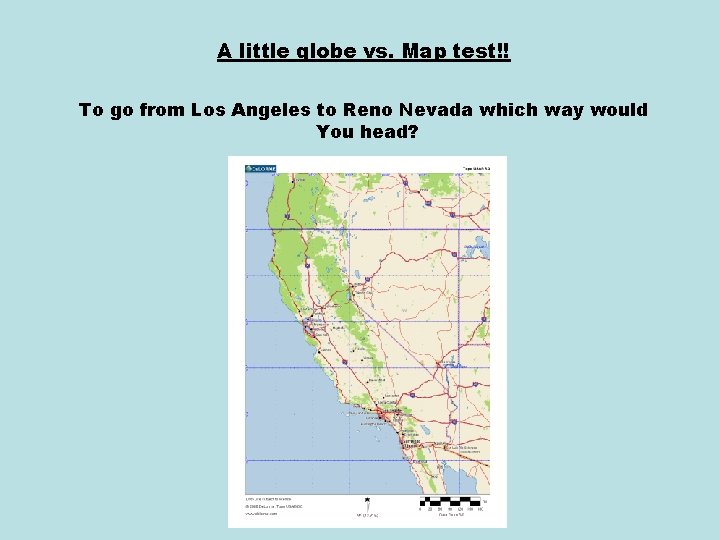
A little globe vs. Map test!! To go from Los Angeles to Reno Nevada which way would You head?
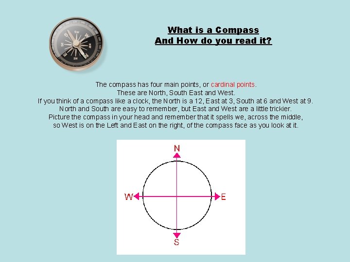
What is a Compass And How do you read it? The compass has four main points, or cardinal points. These are North, South East and West. If you think of a compass like a clock, the North is a 12, East at 3, South at 6 and West at 9. North and South are easy to remember, but East and West are a little trickier. Picture the compass in your head and remember that it spells we, across the middle, so West is on the Left and East on the right, of the compass face as you look at it.
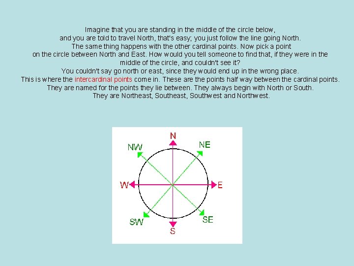
Imagine that you are standing in the middle of the circle below, and you are told to travel North, that's easy; you just follow the line going North. The same thing happens with the other cardinal points. Now pick a point on the circle between North and East. How would you tell someone to find that, if they were in the middle of the circle, and couldn't see it? You couldn't say go north or east, since they would end up in the wrong place. This is where the intercardinal points come in. These are the points half way between the cardinal points. They are named for the points they lie between. They always begin with North or South. They are Northeast, Southwest and Northwest.
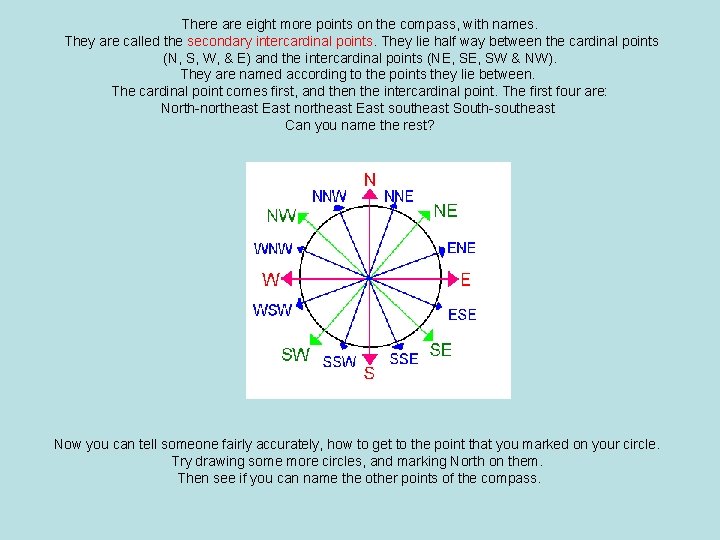
There are eight more points on the compass, with names. They are called the secondary intercardinal points. They lie half way between the cardinal points (N, S, W, & E) and the intercardinal points (NE, SW & NW). They are named according to the points they lie between. The cardinal point comes first, and then the intercardinal point. The first four are: North-northeast East southeast South-southeast Can you name the rest? Now you can tell someone fairly accurately, how to get to the point that you marked on your circle. Try drawing some more circles, and marking North on them. Then see if you can name the other points of the compass.
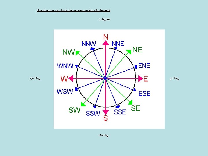
How about we just divide the compass up into 360 degrees? 0 degrees 270 Deg. 90 Deg 180 Deg
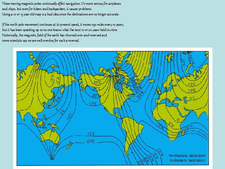
I'm sorry to be the one to tell you that your compass doesn't work quite right. It doesn't really point to the north pole or the south pole. Not only that, next year it will point someplace different than it does this year! And, someday it may be completely backwards! There actually two north poles… The Geographic north pole which is the axis around which the earth spins, and the Magnetic north pole which is where compass needles point. Magnetic Declination The difference between the north geographic pole and the north magnetic pole is called magnetic declination or usually just declination.
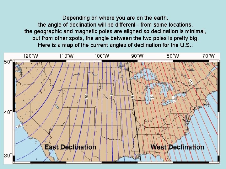
Depending on where you are on the earth, the angle of declination will be different - from some locations, the geographic and magnetic poles are aligned so declination is minimal, but from other spots, the angle between the two poles is pretty big. Here is a map of the current angles of declination for the U. S. :
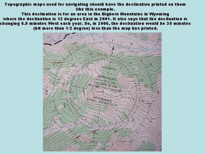
Topographic maps used for navigating should have the declination printed on them like this example. This declination is for an area in the Bighorn Mountains in Wyoming where the declination is 12 degrees East in 2001. It also says that the declination is changing 6. 9 minutes West each year. So, in 2006, the declination would be 35 minutes (bit more than 1/2 degree) less than the map has printed.
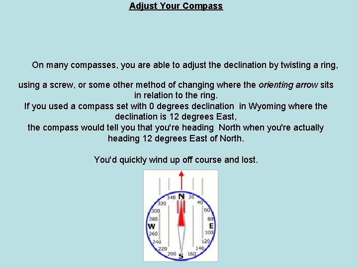
Adjust Your Compass On many compasses, you are able to adjust the declination by twisting a ring, using a screw, or some other method of changing where the orienting arrow sits in relation to the ring. If you used a compass set with 0 degrees declination in Wyoming where the declination is 12 degrees East, the compass would tell you that you're heading North when you're actually heading 12 degrees East of North. You'd quickly wind up off course and lost.
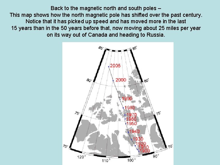
Back to the magnetic north and south poles – This map shows how the north magnetic pole has shifted over the past century. Notice that it has picked up speed and has moved more in the last 15 years than in the 50 years before that, now moving about 25 miles per year on its way out of Canada and heading to Russia.
These moving magnetic poles continually effect navigation. It's more serious for airplanes and ships, but even for hikers and backpackers, it causes problems. Using a 10 or 15 year old map is a bad idea since the declinations are no longer accurate. If the north pole movement continues at its present speed, it moves 250 miles every 10 years, but it has been speeding up so no one knows what the next 10 or 20 years hold in store. Historically, the magnetic field of the earth has churned over and reversed and some scientists say we are well overdue for such a reversal.