Does it make sense SURE There is a

- Slides: 19
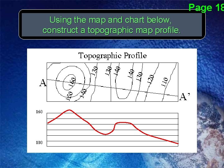
Does it make sense? SURE! There is a creek flowing through this region. Think about where it would flow on your profile. We also recognize the V shaped contour lines that indicate the direction of water flow.
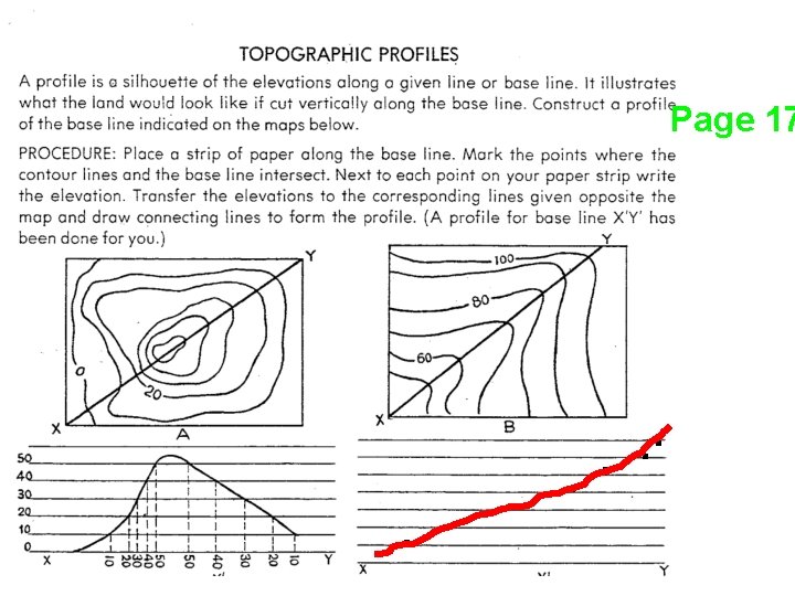
Page 17 . . . .
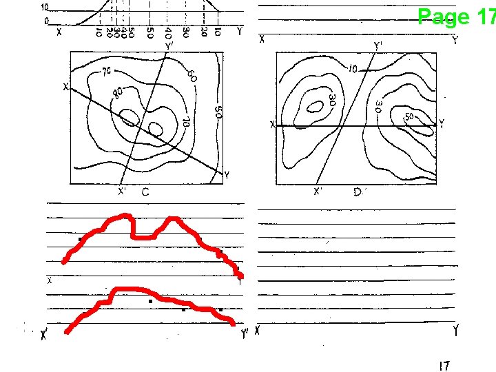
Page 17 . . . .
Page 18 Using the map and chart below, construct a topographic map profile.
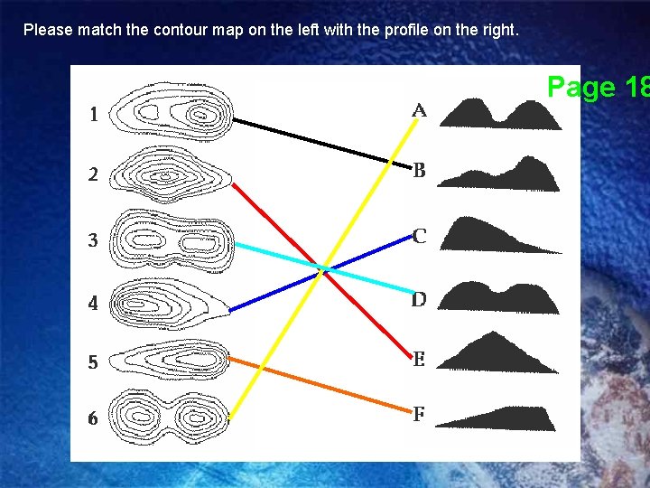
Please match the contour map on the left with the profile on the right. Page 18
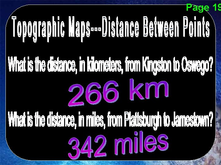
Page 19
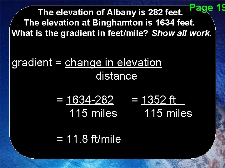
Page 19 The elevation of Albany is 282 feet. The elevation at Binghamton is 1634 feet. What is the gradient in feet/mile? Show all work. gradient = change in elevation distance = 1634 -282 115 miles = 11. 8 ft/mile = 1352 ft 115 miles
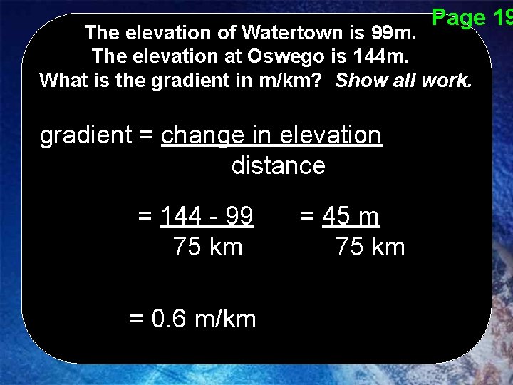
Page 19 The elevation of Watertown is 99 m. The elevation at Oswego is 144 m. What is the gradient in m/km? Show all work. gradient = change in elevation distance = 144 - 99 75 km = 0. 6 m/km = 45 m 75 km
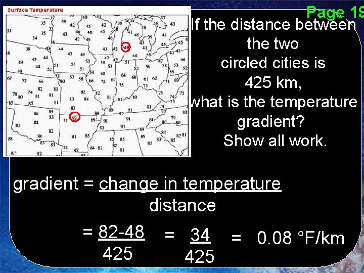
Page 19 If the distance between the two circled cities is 425 km, what is the temperature gradient? Show all work. gradient = change in temperature distance = 82 -48 = 34 = 0. 08 °F/km 425
Page 20
Page 20
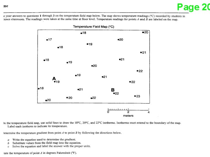
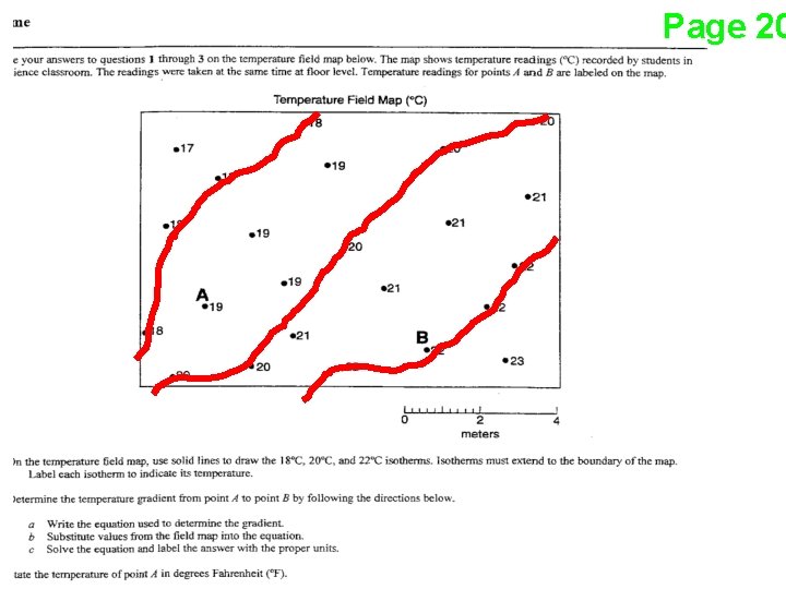
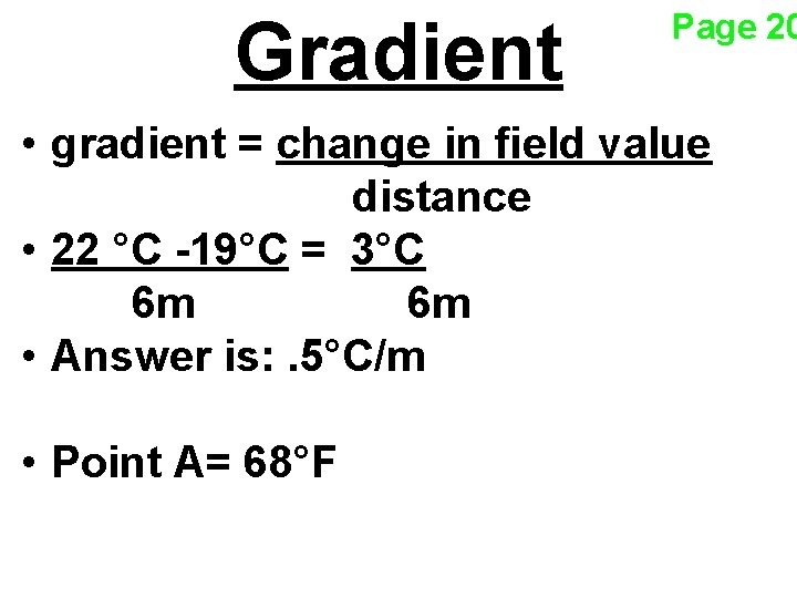
Gradient Page 20 • gradient = change in field value distance • 22 °C -19°C = 3°C 6 m 6 m • Answer is: . 5°C/m • Point A= 68°F
Page 21
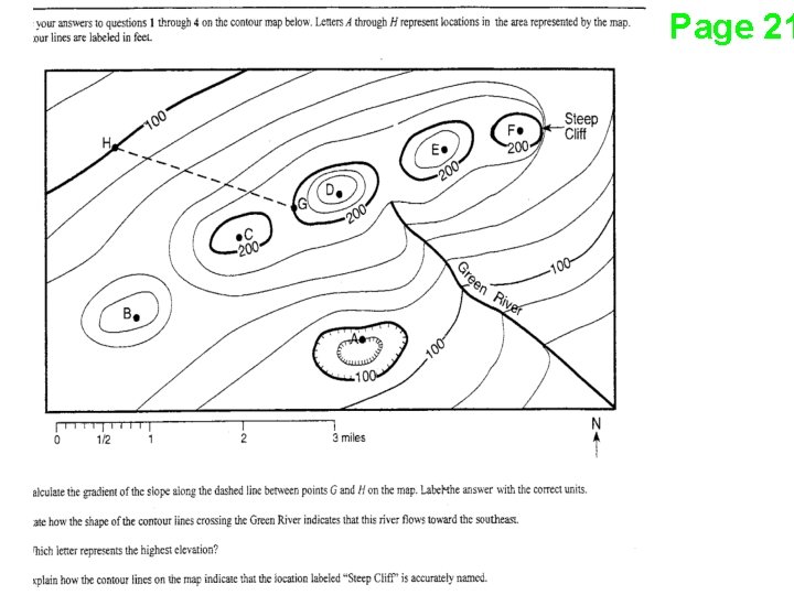
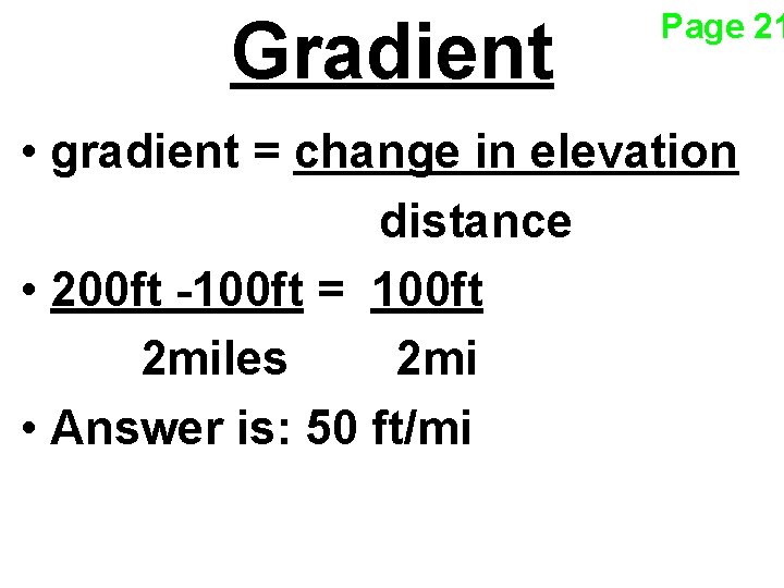
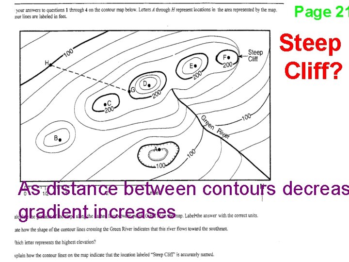
Gradient Page 21 • gradient = change in elevation distance • 200 ft -100 ft = 100 ft 2 miles 2 mi • Answer is: 50 ft/mi
Page 21 Contours and River Flow • Contour lines always bend upstream or • Rivers flow opposite the “V”s
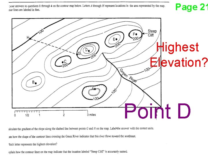
Page 21 Highest Elevation? Point D
Page 21 Steep Cliff? As distance between contours decreas gradient increases
Page 22