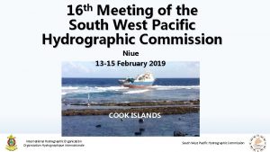
th 17 Meeting of the South West Pacific


- Slides: 12

th 17 Meeting of the South West Pacific Hydrographic Commission National Report by FRANCE South West Pacific Hydrographic Commission

Main achievements during the year • Numerous hydrographic surveys carried out in New Caledonia, French Polynesia and Wallis and Futuna, planned in close cooperation with local authorities in support to maritime surveillance, commercial and cruise activities Raivavae Rikitea Futuna Rangiroa 2 South West Pacific Hydrographic Commission

Main achievements during the year • The switch to an all-MBES capacity in New Caledonia has made it possible to speed up the conduct of the surveys considerably Recommended track between Houaïlou and Touho Tanlé to Paagoumène tracks Grand Lagon Sud • The hydrographic unit in Papeete will be equipped with portable MBES at the second semester 2020 3 South West Pacific Hydrographic Commission

Main challenges and/or obstructions • The means of acquisition at sea in French Polynesia remain limited in view of the size of the area and of the logistical constraints linked to the projection of teams and equipment • The maintenance of the French tide gauge network in the Pacific remains a challenge 4 South West Pacific Hydrographic Commission

Progress on surveys, charting and MSI • Surveys: Area of responsibility Depth < 200 m Survey Status Updated December 2019 C French Polynesia L New Caledonia Wallis & Futuna Depth > 200 m A B C 26. 2 13. 0 60. 8 19. 1 0. 2 80. 7 13. 8 20. 9 65. 3 16. 4 3. 3 80. 3 16. 6 31. 0 52. 4 12. 5 0. 0 87. 5 Coastline: 7 900 km EEZ: 6. 4 M km² Large lagoon areas (NC: 24 000 km²) 5 South West Pacific Hydrographic Commission

Progress on surveys, charting and MSI • Charting: Charting Status Updated January 2020 French Polynesia L New Caledonia Wallis & Futuna Small Medium Large (<1 M) (1 M < / < 100 000) (> 100 000) Metric WGS 84 A B C 100 0 100 60 0 72 100 96 100 0 100 92 0 100 100 0 NA 75 0 100 100 • ENCs : 41 new cells produced since the last conference 207 cells currently available for the region L 50 new cells planned for 2020 INT Charts 5 new or limited editions since the last conference • • National charts 1 new chart (FR 7459 Tikehau), 14 new or limited editions since the last conference • FR 6686 (INT 6843 Loyauté islands) and FR 6768 (INT 6844 Osle of Pines) are planned for 2020 -2021 6 South West Pacific Hydrographic Commission

Progress on surveys, charting and MSI • MSI: no change, no NAVTEX station in French overseas territories, MSI warnings are broadcast through Safety. Net network 7 South West Pacific Hydrographic Commission

Contributions to the IHO DCDB and GEBCO • Shom does not provide directly to the DCDB bathymetric data on waters under French jurisdiction. These data (in the form of bathymetric datasets : soundings) are accessible online: http: //diffusion. shom. fr/pro/amenagement/bathymetrie/lots-bathy. html Distributed under Creative Commons « CC-BY-SA 4. 0 » licence • Bathymetric datasets collected in international waters are provided regularly for integration in the GEBCO products • Distribution of coverage survey polygons along with associated metadata on the IHO DCDB website, is ensured for Shom, trough the EMODnet Bathymetry WFS webservice 8 South West Pacific Hydrographic Commission

Contributions to the IHO DCDB and GEBCO 9 South West Pacific Hydrographic Commission

Progress on MSDI • Shom’s maritime and coastal geographic information portal data. shom. fr diffusion. shom. fr Regularly updated with new product and services • French maritime limits portal https: //limitesmaritimes. gouv. fr https: //maritimelimits. gouv. fr • New national portal (Marine Environment Information System – SIMM https: //www. milieumarinfrance. fr) to facilitate the sharing and dissemination of data on the marine environment. Extension to overseas territories in the future. 10 South West Pacific Hydrographic Commission

Plans that affect the region • Reinforcement of the acquisition capacity at sea: reinforcement of the team based in Papeete, changeover to “full-MBES” • New nautical means for the French Navy (planned for the end of 2022): Oversea Patrol Boat (Patrouilleur d’Outre-Mer), equipped with a Travocean moonpool • Remote sensing : SDB performance improvement and possible lidar projects • Shom tide gauge network should start its renovation at the end of 2020 11 South West Pacific Hydrographic Commission

Save the date ! You are all invited to Paris on November 19 th 2020 to celebrate the 300 th anniversary of French hydrography https: //www. shom. fr/fr/300_ans 12 South West Pacific Hydrographic Commission
 Passed in several western states granger laws
 For today's meeting
 Today meeting or today's meeting
 What is meeting and types of meeting
 Types of meeting
 East is east and west is west
 Horizontal movement of air
 Old west vs new west
 What creates wind
 West oost zuid noord
 South west nuclear hub
 The south and west transformed
 Cathedral 50 miles southwest of paris completed in 1220
