Tectonic Hazards LO understand the structure of the


- Slides: 8

Tectonic Hazards LO: understand the structure of the Earth and how this influences plate tectonics. Key terms – convection currents, plate boundaries, Pangea. Skill – be able to show and explain the distribution of volcanoes and earthquakes on a map

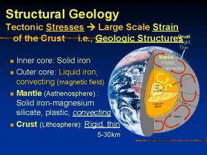
The Earth is made up of four distinct layers: Structure of the Earth The inner core is in the centre and is the hottest part of the Earth. It is solid and made up of iron and nickel with temperatures of up to 5, 500°C. The outer core is the layer surrounding the inner core. It is a liquid layer, also made up of iron and nickel. It is still extremely hot, with temperatures similar to the inner core. The mantle is the widest section of the Earth. It has a thickness of 2, 900 km. The mantle is made up of semimolten rock called magma. The crust is the outer layer of the earth. It is a thin layer between 0 -60 km thick. The crust is the solid rock layer upon which we live. LO: understand the structure of the Earth and how this influences plate tectonics. Key terms – convection currents, plate boundaries, Pangea. Skill – be able to show and explain the distribution of volcanoes and earthquakes on a map

Pangea Watch the following – Video In 1912, a German, Alfred Wegener, published his theory that a single continent existed about 300 million years ago. He named this super-continent Pangaea, and maintained that it had later split into to the two continents of Laurasia in the north and Gondwanaland in the south. Today's continents were formed from further splitting of these two masses. LO: understand the structure of the Earth and how this influences plate tectonics. Key terms – convection currents, plate boundaries, Pangea. Skill – be able to show and explain the distribution of volcanoes and earthquakes on a map

Tectonic plates The Earths crust is broken into large slabs of rock called tectonic plates. There are two different types of plates continental plates and oceanic plates. Continental plates – they are less dense, cannot sink into the mantle and they form land. Oceanic plates – they are dense, can sink into the mantle and be destroyed and they form the sea bed. Watch the following - video LO: understand the structure of the Earth and how this influences plate tectonics. Key terms – convection currents, plate boundaries, Pangea. Skill – be able to show and explain the distribution of volcanoes and earthquakes on a map

LO: understand the structure of the Earth and how this influences plate tectonics. VIDEO Key terms – convection currents, plate boundaries, Pangea. Skill – be able to show and explain the distribution of volcanoes and earthquakes on a map

Distribution – volcanoes and earthquakes Is there a relationship between plate tectonic boundaries and the location of earthquakes and hazards? LO: understand the structure of the Earth and how this influences plate tectonics. Key terms – convection currents, plate boundaries, Pangea. Skill – be able to show and explain the distribution of volcanoes and earthquakes on a map

Movement of the plates Convection currents The cores temperature causes magma to rise in the mantle and sink towards the core when it cools. A current flows beneath the lithosphere (crust) and drags the plate along LO: understand convection currents and the accompanying plate boundaries. Be able to with them. explain the different plate boundaries and the hazard/s associated to that plate. Key terms – convection currents, plate boundaries - constructive, destructive and conservative . Skill –summarise key information from the text, use the information to draw appropriate diagrams. Map work - link the associated hazard with the plate boundary on a world map.

Plate boundaries There are 3 board categories of plate boundaries, namely: Constructive plate margins Destructive plate margins Conservative plate margins Using the textbook (pages 6 – 11) provide a detail account of each. Images to the right depict a constructive plate boundary – Iceland.

