Municipal GIS Pilot Project NH Department of Transportation
- Slides: 1
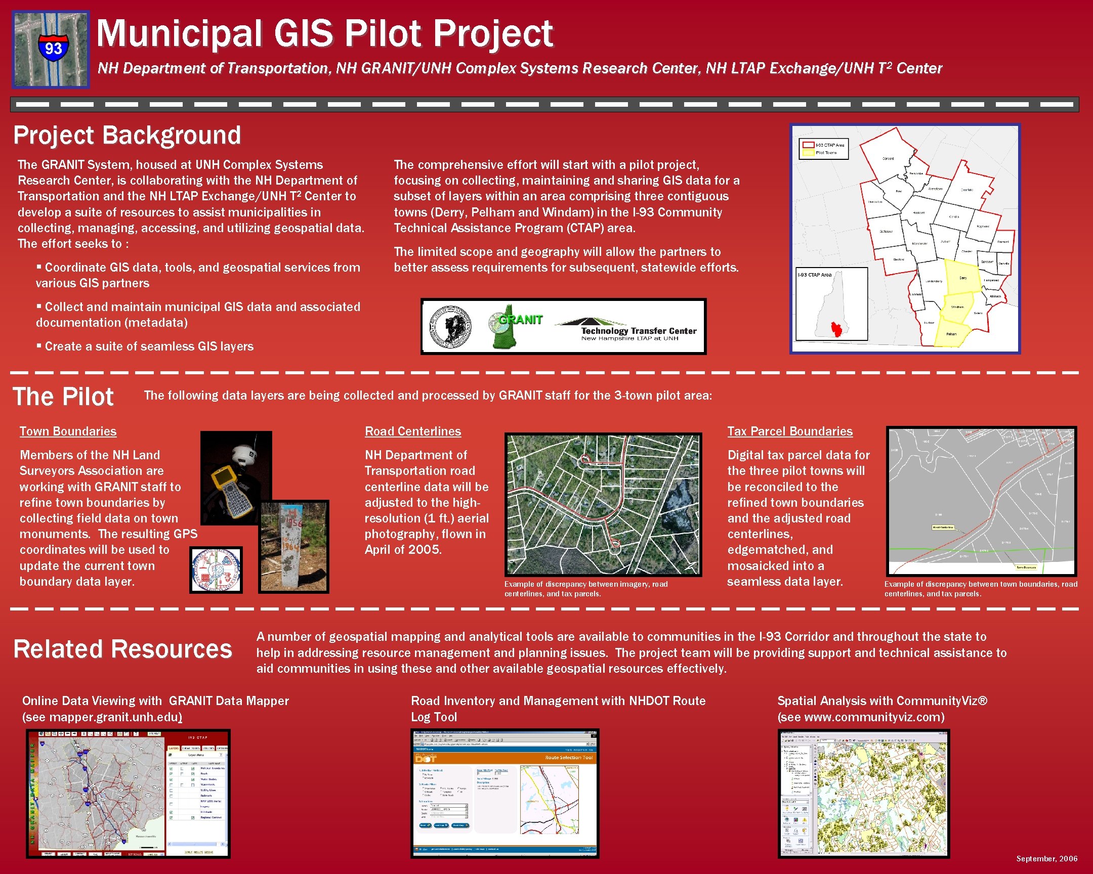
Municipal GIS Pilot Project NH Department of Transportation, NH GRANIT/UNH Complex Systems Research Center, NH LTAP Exchange/UNH T 2 Center Project Background The GRANIT System, housed at UNH Complex Systems Research Center, is collaborating with the NH Department of Transportation and the NH LTAP Exchange/UNH T 2 Center to develop a suite of resources to assist municipalities in collecting, managing, accessing, and utilizing geospatial data. The effort seeks to : § Coordinate GIS data, tools, and geospatial services from various GIS partners The comprehensive effort will start with a pilot project, focusing on collecting, maintaining and sharing GIS data for a subset of layers within an area comprising three contiguous towns (Derry, Pelham and Windam) in the I-93 Community Technical Assistance Program (CTAP) area. The limited scope and geography will allow the partners to better assess requirements for subsequent, statewide efforts. § Collect and maintain municipal GIS data and associated documentation (metadata) § Create a suite of seamless GIS layers The Pilot The following data layers are being collected and processed by GRANIT staff for the 3 -town pilot area: Town Boundaries Road Centerlines Tax Parcel Boundaries Members of the NH Land Surveyors Association are working with GRANIT staff to refine town boundaries by collecting field data on town monuments. The resulting GPS coordinates will be used to update the current town boundary data layer. NH Department of Transportation road centerline data will be adjusted to the highresolution (1 ft. ) aerial photography, flown in April of 2005. Digital tax parcel data for the three pilot towns will be reconciled to the refined town boundaries and the adjusted road centerlines, edgematched, and mosaicked into a seamless data layer. Related Resources Example of discrepancy between imagery, road centerlines, and tax parcels. Example of discrepancy between town boundaries, road centerlines, and tax parcels. A number of geospatial mapping and analytical tools are available to communities in the I-93 Corridor and throughout the state to help in addressing resource management and planning issues. The project team will be providing support and technical assistance to aid communities in using these and other available geospatial resources effectively. Online Data Viewing with GRANIT Data Mapper (see mapper. granit. unh. edu) Road Inventory and Management with NHDOT Route Log Tool Spatial Analysis with Community. Viz® (see www. communityviz. com) September, 2006