
WSR 88 D Characteristics of Significant Tornadoes in
- Slides: 46
WSR - 88 D Characteristics of Significant Tornadoes in New York and New England Lance Franck University of Massachusetts Lowell Hayden Frank NOAA/NWS/Weather Forecast Office, Taunton Massachusetts
This study utilized WSR-88 D Level II Data to examine the characteristics of significant tornadoes over the New York– New England area, dating back to 1995. Some of the radar features studied included: q The Mesocyclone q Gate to Gate Shear q Storm Mode The authors also examined: q Climatology q Three cases in-depth q The Long Island & Block Island (non-significant) tornadoes of Aug 10 th, 2012
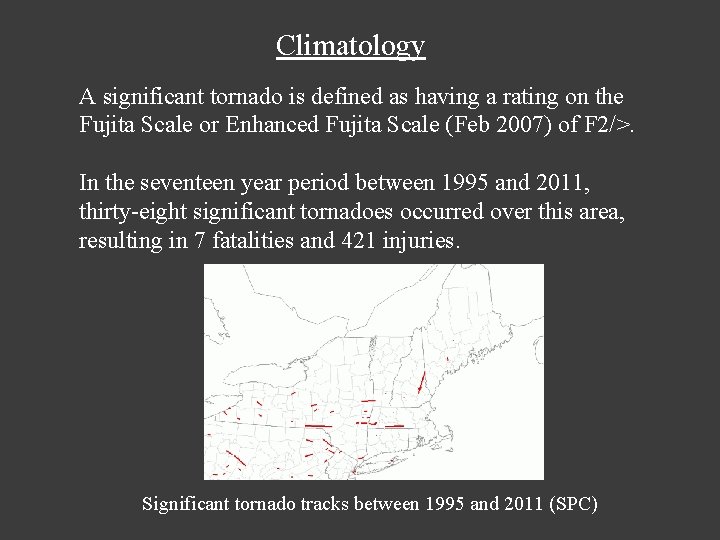
Climatology A significant tornado is defined as having a rating on the Fujita Scale or Enhanced Fujita Scale (Feb 2007) of F 2/>. In the seventeen year period between 1995 and 2011, thirty-eight significant tornadoes occurred over this area, resulting in 7 fatalities and 421 injuries. Significant tornado tracks between 1995 and 2011 (SPC)
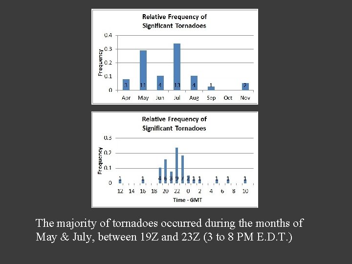
The majority of tornadoes occurred during the months of May & July, between 19 Z and 23 Z (3 to 8 PM E. D. T. )
The Mesocyclone q A storm-scale vertical column of rotating air that develops in the updraft of a severe thunderstorm. It covers a much larger area than the tornado that may develop within it. It is the hallmark of a supercell. Does it meet Mesocyclone criteria? q At least ten-thousand feet (KFT) in depth. q Persisting for at least two concurrent volume scans (about 10 minutes). q Diameter of 5 miles or less. q Rotational Velocity of at least 25 knots.
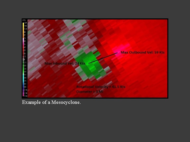
Example of a Mesocyclone.
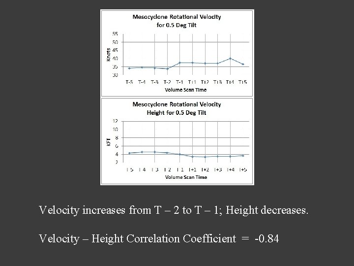
Velocity increases from T – 2 to T – 1; Height decreases. Velocity – Height Correlation Coefficient = -0. 84
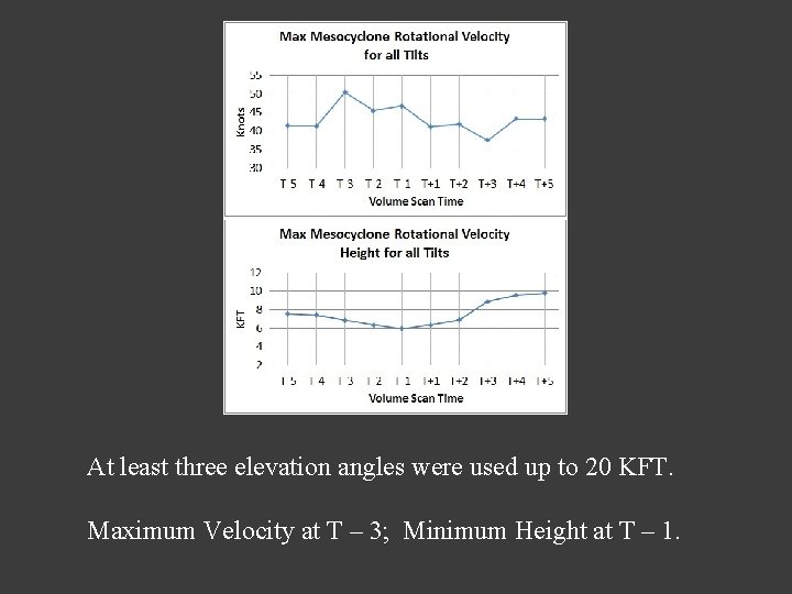
At least three elevation angles were used up to 20 KFT. Maximum Velocity at T – 3; Minimum Height at T – 1.
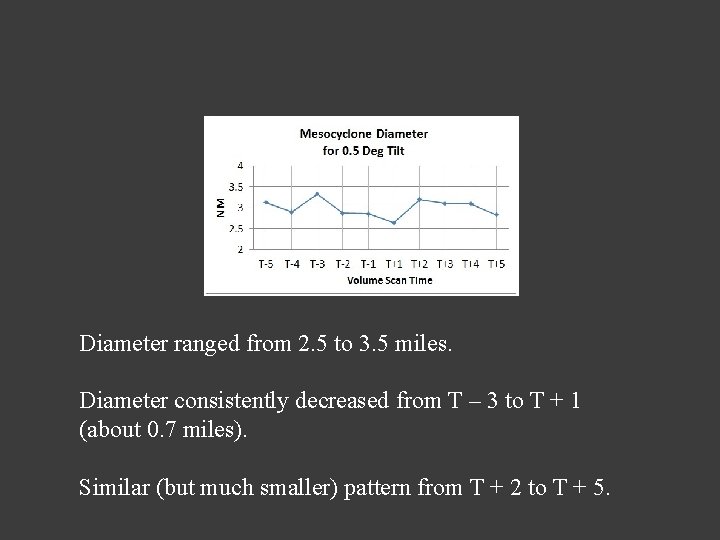
Diameter ranged from 2. 5 to 3. 5 miles. Diameter consistently decreased from T – 3 to T + 1 (about 0. 7 miles). Similar (but much smaller) pattern from T + 2 to T + 5.
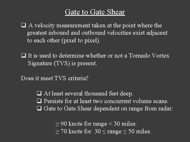
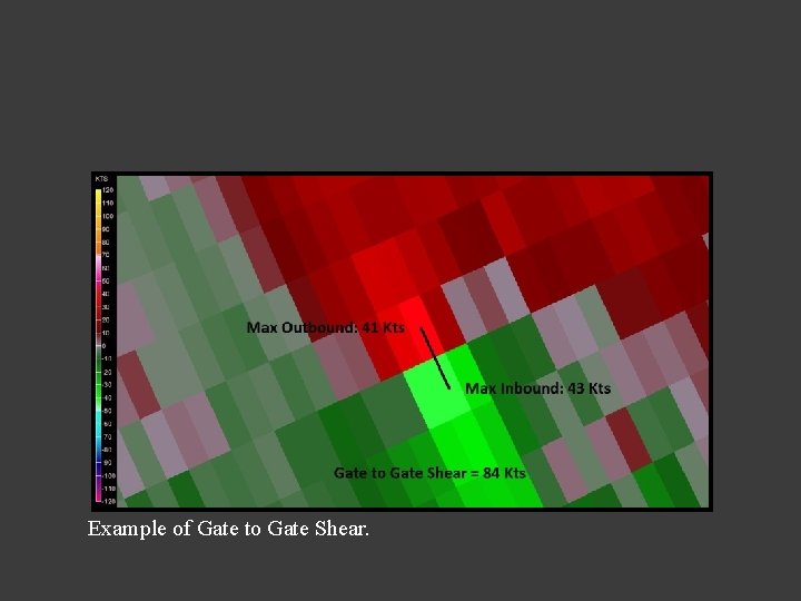
Gate to Gate Shear q A velocity measurement taken at the point where the greatest inbound and outbound velocities exist adjacent to each other (pixel to pixel). q It is used to determine whether or not a Tornado Vortex Signature (TVS) is present. Does it meet TVS criteria? q At least several thousand feet deep. q Persists for at least two concurrent volume scans. q Gate to Gate Shear dependent on range from radar: ≥ 90 knots for range < 30 miles. ≥ 70 knots for 30 ≤ range ≤ 50 miles.
Example of Gate to Gate Shear.
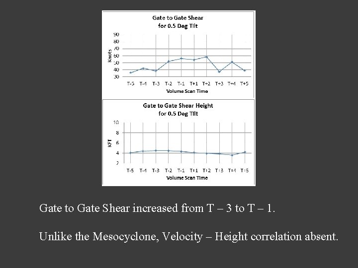
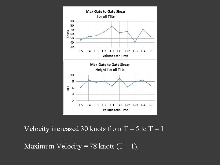
Gate to Gate Shear increased from T – 3 to T – 1. Unlike the Mesocyclone, Velocity – Height correlation absent.
Velocity increased 30 knots from T – 5 to T – 1. Maximum Velocity = 78 knots (T – 1).
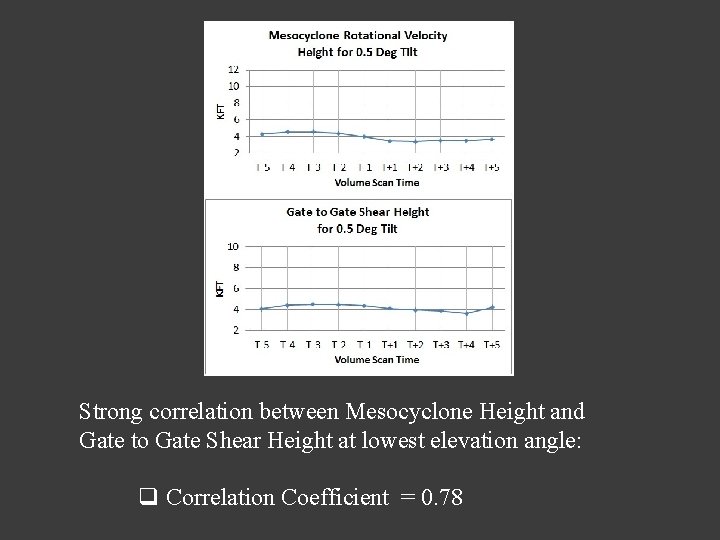
Strong correlation between Mesocyclone Height and Gate to Gate Shear Height at lowest elevation angle: q Correlation Coefficient = 0. 78
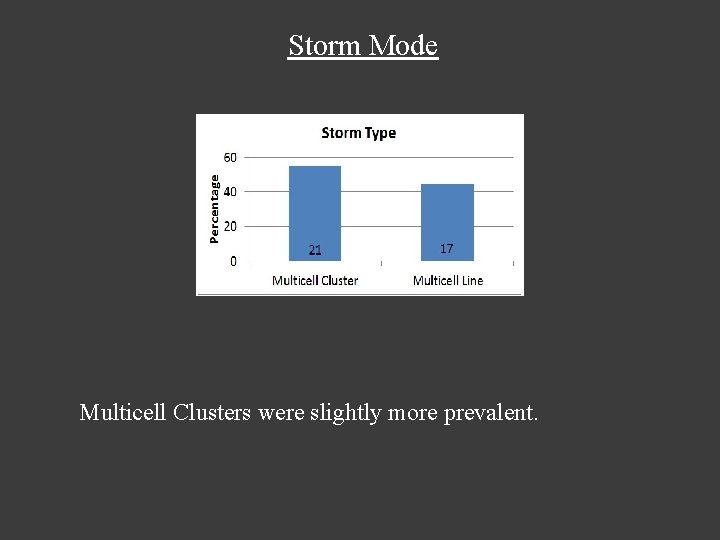
Storm Mode Multicell Clusters were slightly more prevalent.
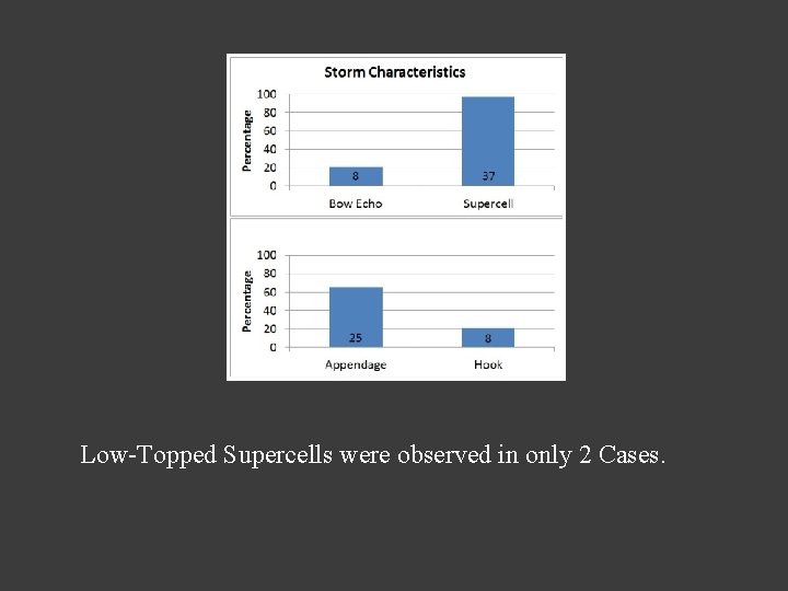
Low-Topped Supercells were observed in only 2 Cases.
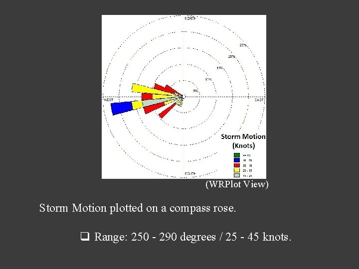
(WRPlot View) Storm Motion plotted on a compass rose. q Range: 250 - 290 degrees / 25 - 45 knots.
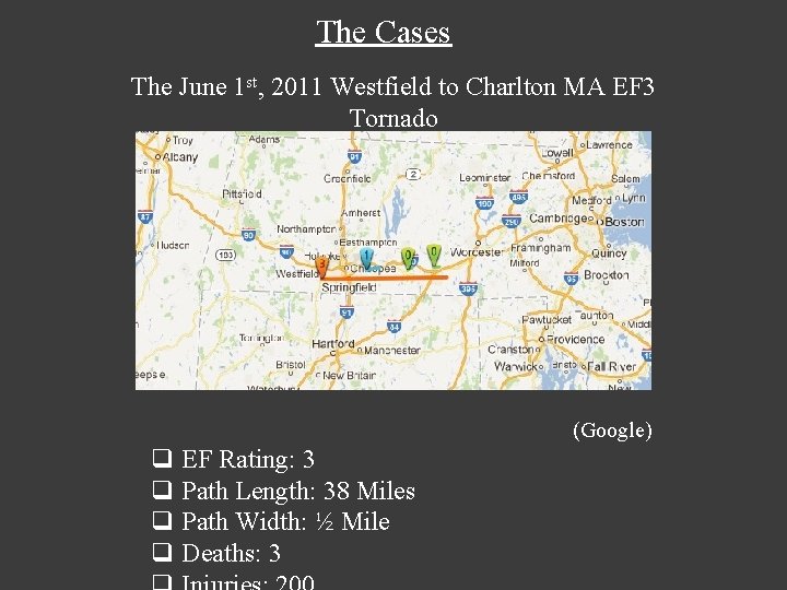
The Cases The June 1 st, 2011 Westfield to Charlton MA EF 3 Tornado (Google) q EF Rating: 3 q Path Length: 38 Miles q Path Width: ½ Mile q Deaths: 3
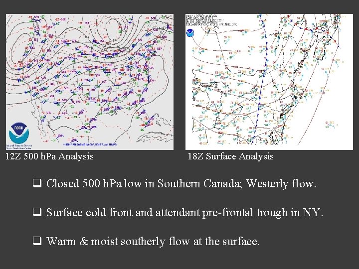
12 Z 500 h. Pa Analysis 18 Z Surface Analysis q Closed 500 h. Pa low in Southern Canada; Westerly flow. q Surface cold front and attendant pre-frontal trough in NY. q Warm & moist southerly flow at the surface.
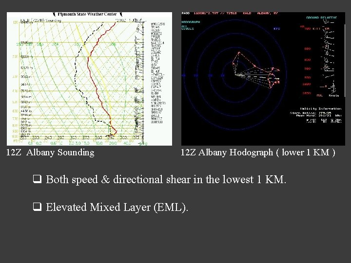
X 12 Z Albany Sounding 12 Z Albany Hodograph ( lower 1 KM ) q Both speed & directional shear in the lowest 1 KM. q Elevated Mixed Layer (EML).
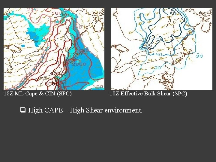
18 Z ML Cape & CIN (SPC) 18 Z Effective Bulk Shear (SPC) q High CAPE – High Shear environment.
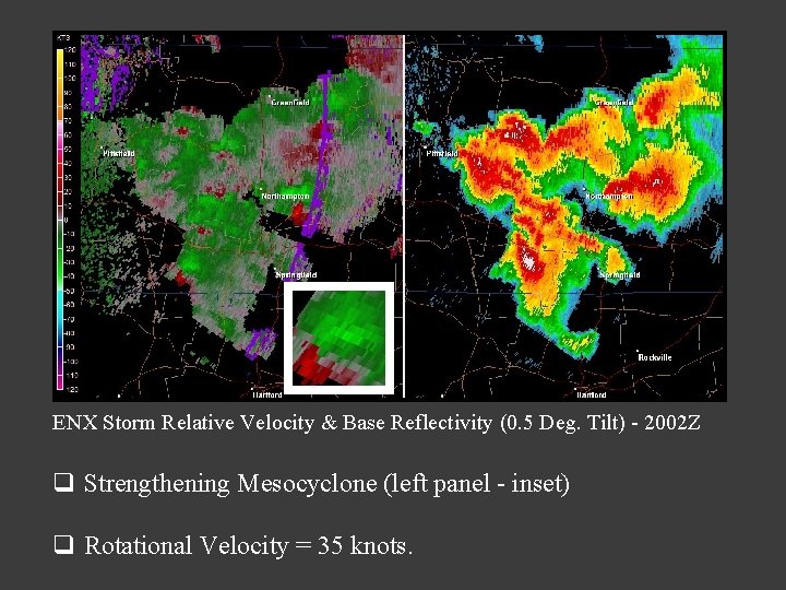
ENX Storm Relative Velocity & Base Reflectivity (0. 5 Deg. Tilt) - 2002 Z q Strengthening Mesocyclone (left panel - inset) q Rotational Velocity = 35 knots.
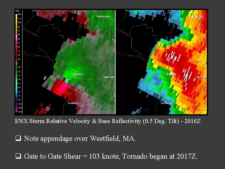
ENX Storm Relative Velocity & Base Reflectivity (0. 5 Deg. Tilt) - 2016 Z q Note appendage over Westfield, MA. q Gate to Gate Shear = 103 knots; Tornado began at 2017 Z.
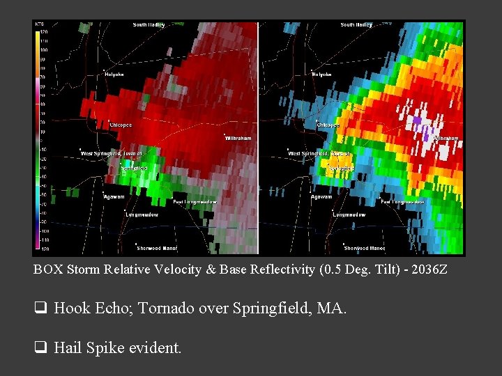
BOX Storm Relative Velocity & Base Reflectivity (0. 5 Deg. Tilt) - 2036 Z q Hook Echo; Tornado over Springfield, MA. q Hail Spike evident.
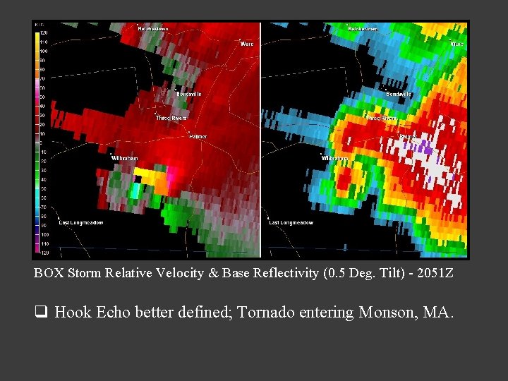
BOX Storm Relative Velocity & Base Reflectivity (0. 5 Deg. Tilt) - 2051 Z q Hook Echo better defined; Tornado entering Monson, MA.
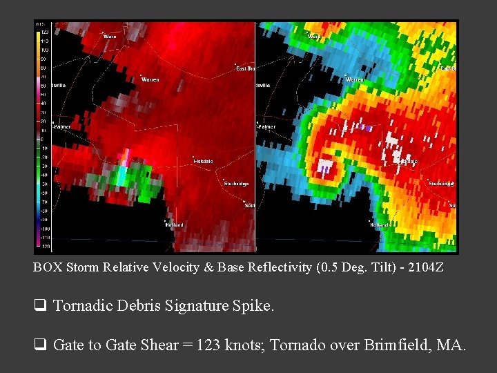
BOX Storm Relative Velocity & Base Reflectivity (0. 5 Deg. Tilt) - 2104 Z q Tornadic Debris Signature Spike. q Gate to Gate Shear = 123 knots; Tornado over Brimfield, MA.
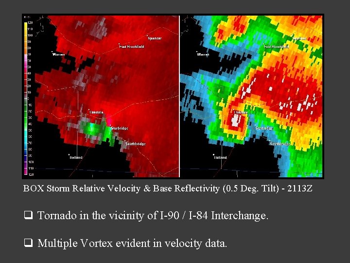
BOX Storm Relative Velocity & Base Reflectivity (0. 5 Deg. Tilt) - 2113 Z q Tornado in the vicinity of I-90 / I-84 Interchange. q Multiple Vortex evident in velocity data.
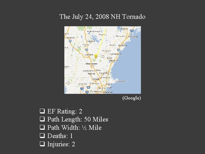
The July 24, 2008 NH Tornado (Google) q EF Rating: 2 q Path Length: 50 Miles q Path Width: ½ Mile q Deaths: 1 q Injuries: 2
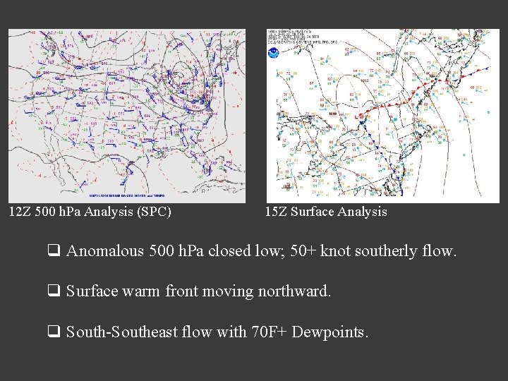
12 Z 500 h. Pa Analysis (SPC) 15 Z Surface Analysis q Anomalous 500 h. Pa closed low; 50+ knot southerly flow. q Surface warm front moving northward. q South-Southeast flow with 70 F+ Dewpoints.
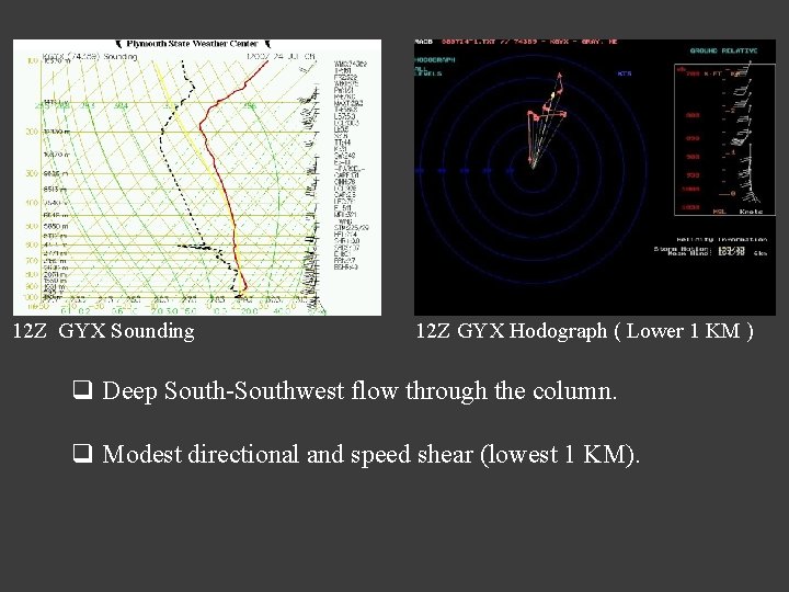
12 Z GYX Sounding 12 Z GYX Hodograph ( Lower 1 KM ) q Deep South-Southwest flow through the column. q Modest directional and speed shear (lowest 1 KM).
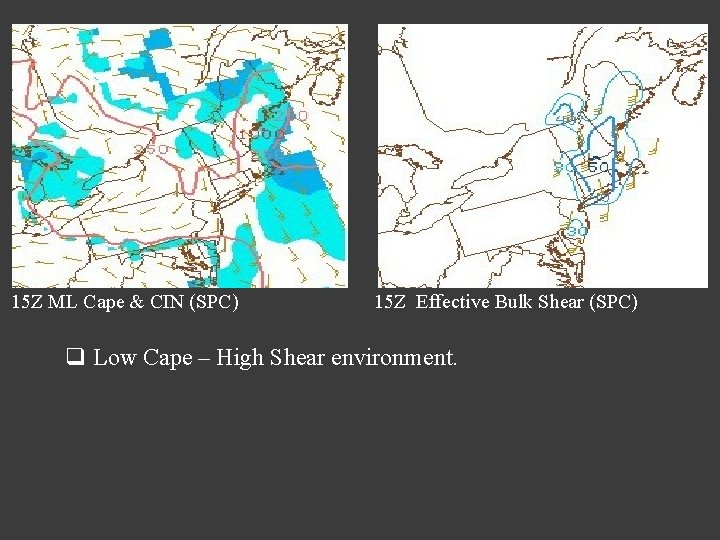
15 Z ML Cape & CIN (SPC) 15 Z Effective Bulk Shear (SPC) q Low Cape – High Shear environment.
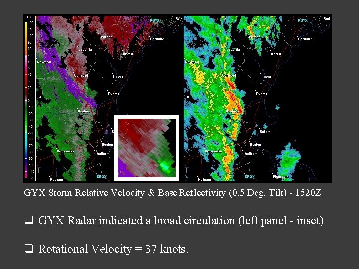
GYX Storm Relative Velocity & Base Reflectivity (0. 5 Deg. Tilt) - 1520 Z q GYX Radar indicated a broad circulation (left panel - inset) q Rotational Velocity = 37 knots.
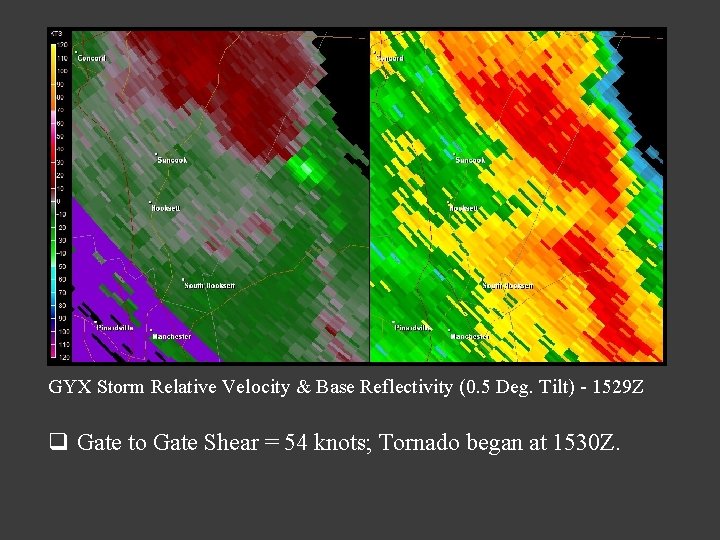
GYX Storm Relative Velocity & Base Reflectivity (0. 5 Deg. Tilt) - 1529 Z q Gate to Gate Shear = 54 knots; Tornado began at 1530 Z.
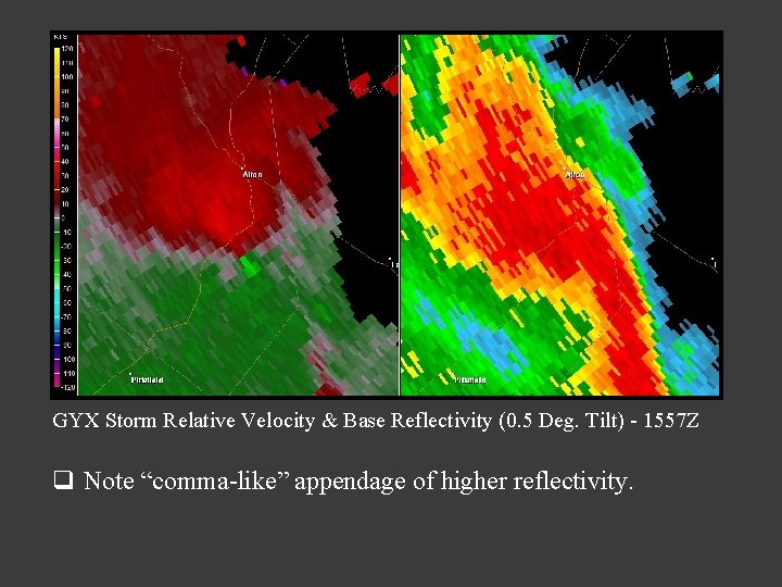
GYX Storm Relative Velocity & Base Reflectivity (0. 5 Deg. Tilt) - 1557 Z q Note “comma-like” appendage of higher reflectivity.
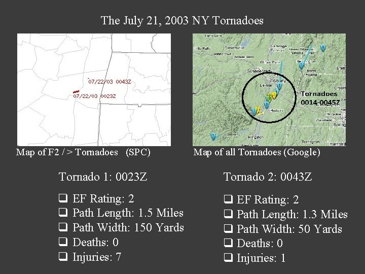
The July 21, 2003 NY Tornadoes Map of F 2 / > Tornadoes (SPC) Map of all Tornadoes (Google) Tornado 1: 0023 Z Tornado 2: 0043 Z q EF Rating: 2 q Path Length: 1. 5 Miles q Path Width: 150 Yards q Deaths: 0 q Injuries: 7 q EF Rating: 2 q Path Length: 1. 3 Miles q Path Width: 50 Yards q Deaths: 0 q Injuries: 1
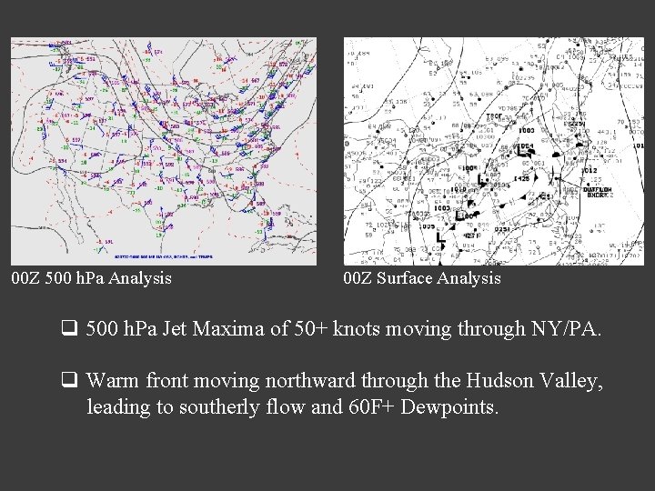
00 Z 500 h. Pa Analysis 00 Z Surface Analysis q 500 h. Pa Jet Maxima of 50+ knots moving through NY/PA. q Warm front moving northward through the Hudson Valley, leading to southerly flow and 60 F+ Dewpoints.
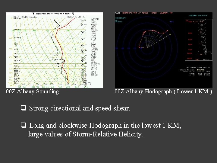
00 Z Albany Sounding 00 Z Albany Hodograph ( Lower 1 KM ) q Strong directional and speed shear. q Long and clockwise Hodograph in the lowest 1 KM; large values of Storm-Relative Helicity.
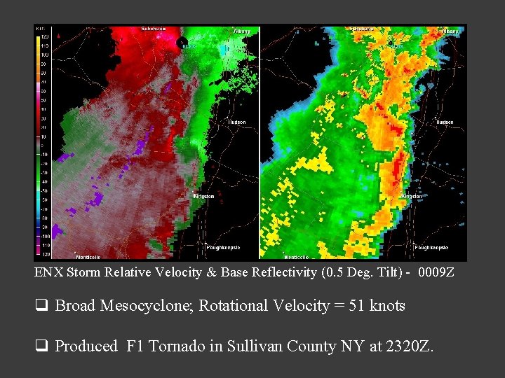
ENX Storm Relative Velocity & Base Reflectivity (0. 5 Deg. Tilt) - 0009 Z q Broad Mesocyclone; Rotational Velocity = 51 knots q Produced F 1 Tornado in Sullivan County NY at 2320 Z.
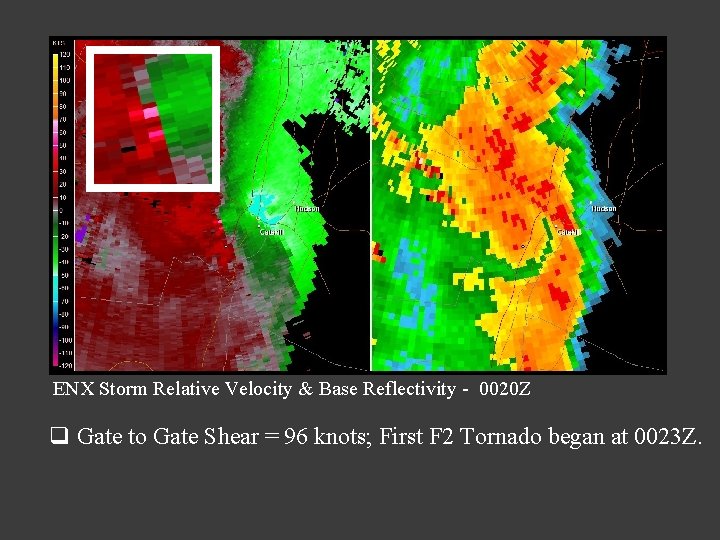
ENX Storm Relative Velocity & Base Reflectivity - 0020 Z q Gate to Gate Shear = 96 knots; First F 2 Tornado began at 0023 Z.
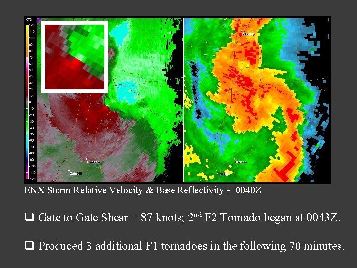
ENX Storm Relative Velocity & Base Reflectivity - 0040 Z q Gate to Gate Shear = 87 knots; 2 nd F 2 Tornado began at 0043 Z. q Produced 3 additional F 1 tornadoes in the following 70 minutes.
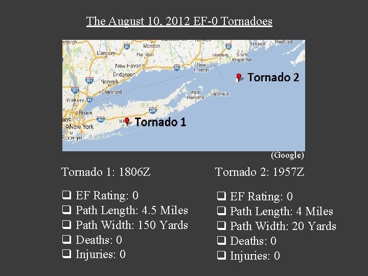
The August 10, 2012 EF-0 Tornadoes (Google) Tornado 1: 1806 Z Tornado 2: 1957 Z q EF Rating: 0 q Path Length: 4. 5 Miles q Path Width: 150 Yards q Deaths: 0 q Injuries: 0 q EF Rating: 0 q Path Length: 4 Miles q Path Width: 20 Yards q Deaths: 0 q Injuries: 0
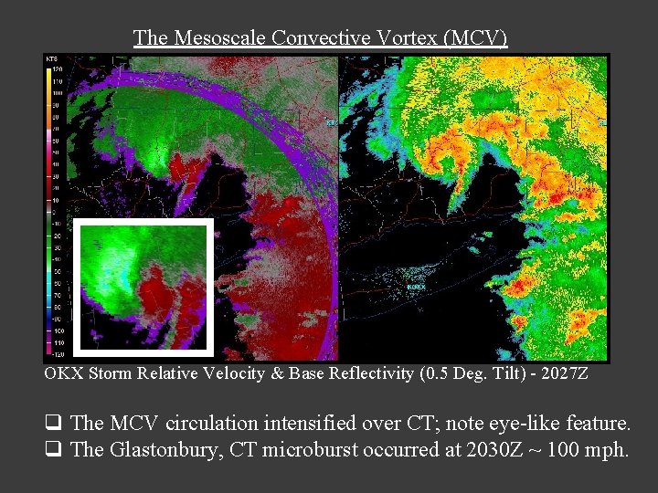
These tornadoes were associated with a Mesoscale Convective System (MCS) and an attendant Mesoscale Convective Vortex (MCV). There was also a microburst in Glastonbury, CT. What is an MCV? q A cyclone within an MCS. q Ranges from 30 to 180 Miles in Diameter. q May persist even after the MCS itself has dissipated. Essentially, the MCS develops the characteristics of a warm-core system, similar to that of a tropical cyclone. But the strongest circulation is in the mid-levels of the atmosphere. It may also be reflected at the surface as a small area of low pressure.
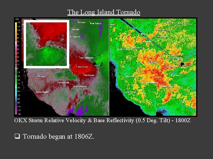
The Long Island Tornado OKX Storm Relative Velocity & Base Reflectivity (0. 5 Deg. Tilt) - 1800 Z q Tornado began at 1806 Z.
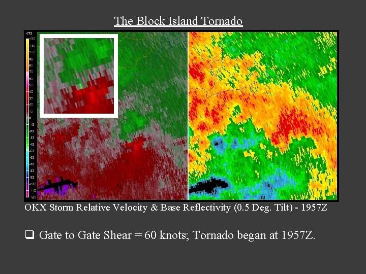
The Block Island Tornado OKX Storm Relative Velocity & Base Reflectivity (0. 5 Deg. Tilt) - 1957 Z q Gate to Gate Shear = 60 knots; Tornado began at 1957 Z.
The Mesoscale Convective Vortex (MCV) OKX Storm Relative Velocity & Base Reflectivity (0. 5 Deg. Tilt) - 2027 Z q The MCV circulation intensified over CT; note eye-like feature. q The Glastonbury, CT microburst occurred at 2030 Z ~ 100 mph.
WSR - 88 D Characteristics of Significant Tornadoes in New York and New England Lance Franck University of Massachusetts Lowell Hayden Frank NOAA/NWS/Weather Forecast Office, Taunton Massachusetts