Wind Hazard Modeling and the HAZUS Wind Model


 Slides Courtesy of Dr. Andrew Curtis, Dept. of Geography")


 Level 2 (User-Supplied Data) Wind Model")


- Slides: 43
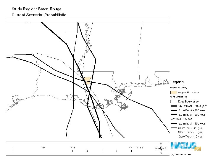
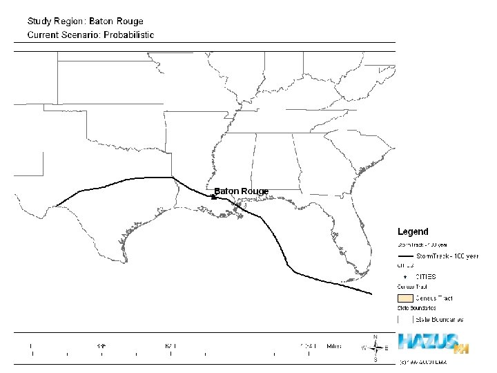
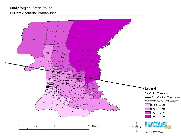
Wind Hazard Modeling and the HAZUS Wind Model Carol Hill Louisiana State University November 5, 2004
“The HAZUS-MH Hurricane Model is designed to produce loss estimates for use by federal, state, regional and local governments in planning for hurricane risk mitigation, emergency preparedness, response and recovery. ” -HAZUS Technical Manual
About HAZUS • HAZards United States • Product of National Institute of Building Sciences (NIBS) and Federal Emergency Management Agency (FEMA) • Earthquake Model released in 1997 • HAZUS-MH released in 2003 • Flood Model and Hurricane Model • Geographical Information System (GIS)Based Model
Geographical Information Systems (GIS) Slides Courtesy of Dr. Andrew Curtis, Dept. of Geography
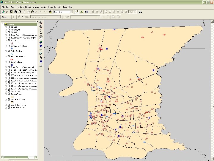
What is a GIS? Investigate and Manipulate Spatial Data Store spatial Data Visualize Spatial Data Analyze Spatial Data
Investigate and Manipulate Spatial Data
1990 1992 1991 Raccoon Rabies in New York State 2500 1993 1500 1994 1995 500 0 1996 1997 82 85 90 9192 93 94 95 96 97 98 75 -768 25 -74 10 -24 1 -9 0
Store Spatial Data
Density of White Oak 0 0. 01 -2 >2 Number of trees per acre
Density of Yellow Poplar 0 0. 01 -2 >2 Number of trees per acre surface
MOREHEAD LANDUSE MAP 64 Eagle Lake 60 32 Mile 519 0. 5 1. 0 R-1: Single R-2: Single, Double B-1: General B-2: Highway I-1: Light industries P-1: Public, Semi-Public R-3: Single, Double, Multi B-3: Central A-1: Agriculture
Types of Data Attribute Data Geo-coded Geographic Imagery Layers
TIGER Data Allocation-Location
MOREHEAD LANDUSE MAP Mile Cartographer: Kevin Calhoun, 1995 0. 2 0. 4 R-1: Single R-2: Single, Double B-1: General B-2: Highway I-1: Light P-1: Public, Semi-Public R-3: Single, Double, Multi B-3: Central A-1: Agriculture
Visualize Spatial Data
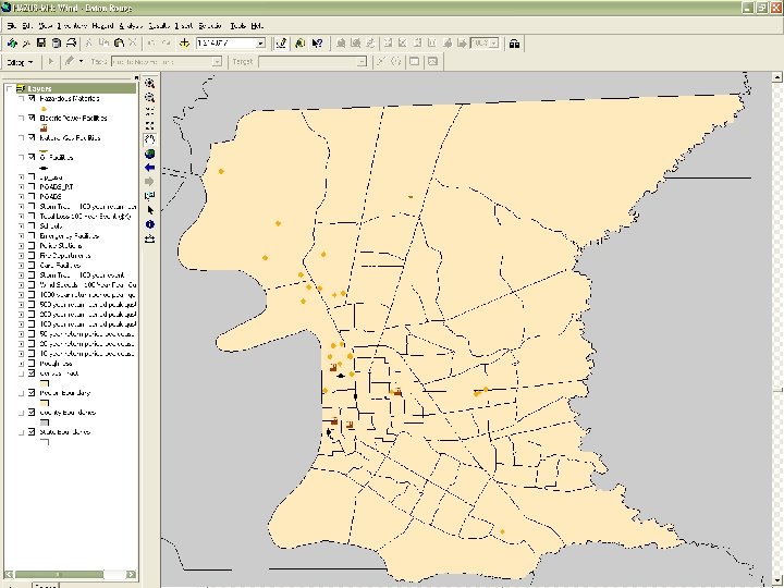
Analyze Spatial Data
Geographic Layers or Themes
Site Location of Landfills
What else? Cancer Deaths and African American Proportion Per Census Tract
…arrests?
Wind Modeling What does this mean?
Why Model Wind Damage? • Understand/Prepare for Building Damage • Understand/Prepare for Sheltering Requirements • Understand/Prepare for Emergency Management Response • Understand Economic Ramifications • Provide Justification for Building Code Changes
Roof Shingle and Sheathing Damage Photo: Carol Hill
Windborne Debris Damage Photo: Carol Hill
Debris and Tree Blowdown Photo: Carol Hill
Wall Failure Due to Increased Internal Pressure Photo: Carol Hill
Roof Failure Caused by Failure of Front Wall Photo: Carol Hill
Assumed Roof Connection Failure Photo: Carol Hill
Major Stakeholders • Local, state and federal government agencies • Humanitarian organizations • Insurance industry • Businesses and private citizens
Building Damage Mechanisms • • Wind Pressure Airborne Debris Tree Fall Combinations www. totalhomeremodeling. net
Wind Hazards Throughout the U. S.
Requirements for Running HAZUS Software MINIMAL Pentium® III 1 GHz core speed 512 MB RAM MODERATE PREFERRED Pentium® 4 2 GHz core speed 512 MB RAM Pentium® 4 with 800 MHz system bus and 2. 6 GHz (or better) core speed 1 GB RAM Note: Allows fast analysis of medium -sized communities and realtime analysis for small communities Note: Allows fast analysis of large urban areas and real-time analysis for all communities 40 GB Allows installation of HAZUS-MH and storage of three scenarios for large urban areas 80 GB Allows installation of HAZUS-MH and storage of 25 or more scenarios for large urban areas Computer Speed Note: Allows moderately fast analysis of small communities only Computer Storage: Free Hard Disk Space 10 GB Allows installation of HAZUS -MH and storage of three scenarios for a mediumsized community Hardware Accessories CD-ROM reader with 32 x minimum read speed DVD-ROM reader with 12 x minimum read speed Graphics Card with 800 x 600 minimum resolution Mouse, Keyboard and 17" Monitor Supporting Software Microsoft Windows 2000 SP 2 or Microsoft Windows XP SP 1 Arc. View 8. 3 Spatial Analyst extension required with flood model http: //www. fema. gov/hazus/rq_haz 99. shtm#sr 2
HAZUS Availability and Requirements • http: //www. fema. gov/hazus/pdf/order_form _mh. pdf • Software is free, but requires Arc. GIS to operate
Hurricane Model Capabilities Parameter/Data Level 1 (Default Data) Level 2 (User-Supplied Data) Wind Model Default Probabilistic User-Defined Scenario Building Inventory Default Probabilistic User-Supplied Facilities and Building Classes Residential Commercial Industrial Essential Facilities Utility, Transportation and High Potential Loss Facilities Level 3 (Advanced Data) Display/Edit Locations Only - No Damage or Loss Estimation Terrain Default Loss Functions Default Damage Functions Default Shelter Requirements Default Debris Default Expert Supplied User-Supplied Parameters
HAZUS Wind Model Framework Elements shown in bold are implemented in the current version of the Hurricane Model