WIND FORECASTING 1 FORECASTING VALUES OF DIRECTION SPEED



- Slides: 49

WIND FORECASTING 1

FORECASTING VALUES OF DIRECTION & SPEED Persistence from latest observations. Extrapolation. Detailed measurements. Statistical forecasts. Direct model output (bulletins, charts, prog tephigram). 2

1. PERSISTENCE n. Maintain same wind velocity as the latest observation(s). n. Only for a short period (1 -3 hours) until change is expected. May be longer period in stagnant situations. 3

2. EXTRAPOLATION n. Extrapolation of values from upstream stations n While extrapolation is good for timing a change to the wind, it is not often a good method for actual values since many variables can cause changes to wind velocity from values at upstream stations. Useful to see coming trends however. 4

3. DETAILED MEASUREMENT u Forecast wind must be measured for as many points in the valid period as required, depending on how fast the situation is changing. u Charts are available on a 6 hourly basis. GEM GRIB high resolution isobars are available 3 hourly, but not isallobars. u Ideal prog chart includes both isobars and isallobars. 5

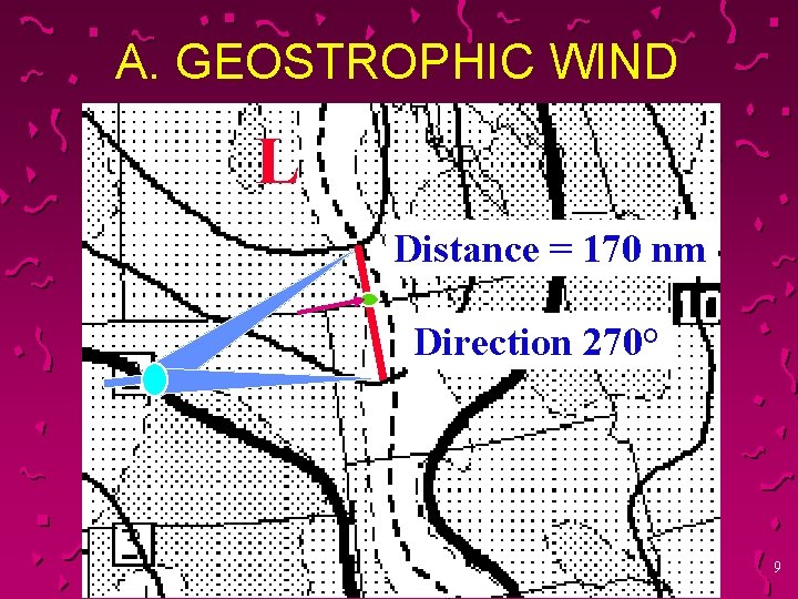
3. DETAILED MEASUREMENT A Measurement of geostrophic wind. B Addition of isallobaric effect. C Reduction by friction. D Local terrain effects. E Local thermal effects. F Curvature effect. 6

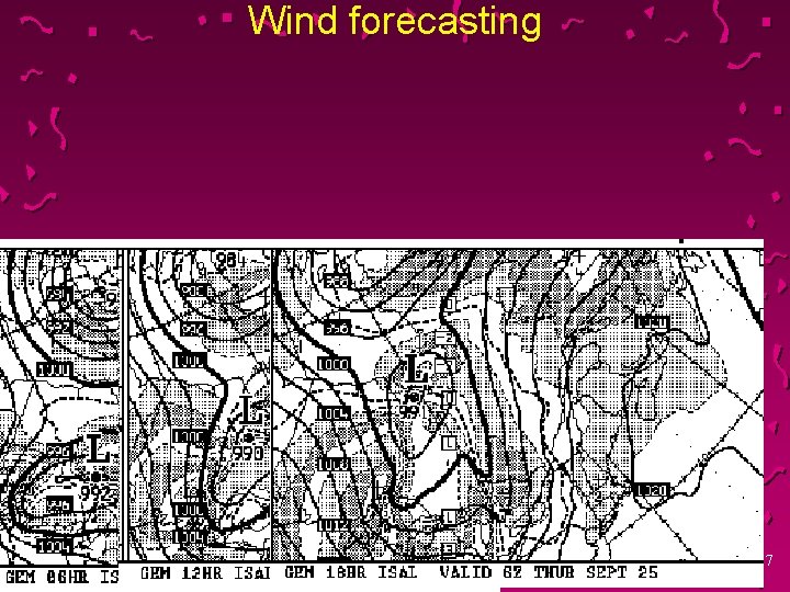
Wind forecasting 7

Winds u Severe weather charts summer and winter u http: //www. weatheroffice. gc. ca/model_fore cast/severe_weather_e. html 8

A. GEOSTROPHIC WIND L Distance = 170 nm Direction 270° 9

Wind u Remember that the tighter the gradient the stronger the winds u The wider the gradient (or flatter) the lighter the winds 10

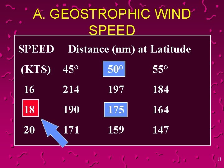
A. GEOSTROPHIC WIND SPEED Distance (nm) at Latitude (KTS) 45° 50° 55° 16 214 197 184 18 190 175 164 20 171 159 147 11

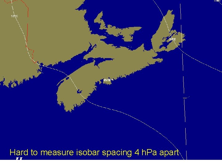
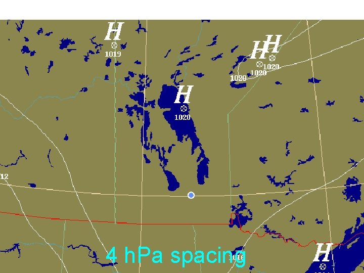
Hard to measure isobar spacing 4 h. Pa apart

4 h. Pa spacing

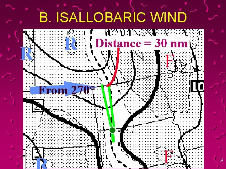
B. ISALLOBARIC WIND R R Distance = 30 nm F From 270° F 14

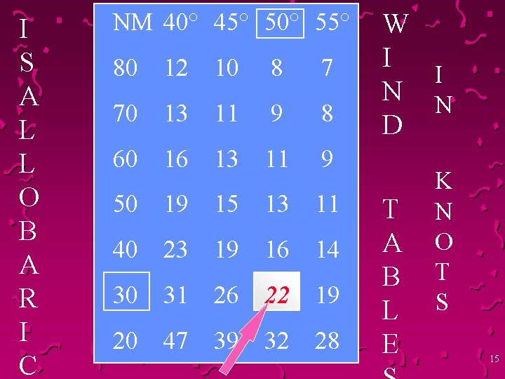
I S A L L O B A R I C NM 40° 45° 50° 55° 80 12 10 8 7 70 13 11 9 8 60 16 13 11 9 50 19 15 13 11 40 23 19 16 14 30 31 26 22 19 20 47 39 32 28 W I I N N D T A B L E K N O T S 15

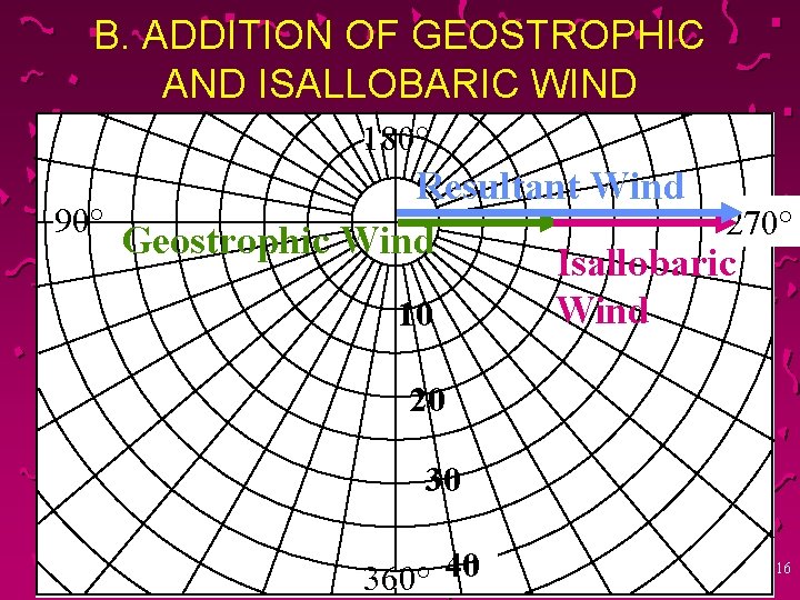
B. ADDITION OF GEOSTROPHIC AND ISALLOBARIC WIND 180° Resultant Wind 90° 270° Geostrophic Wind Isallobaric Wind 10 20 30 360° 40 16

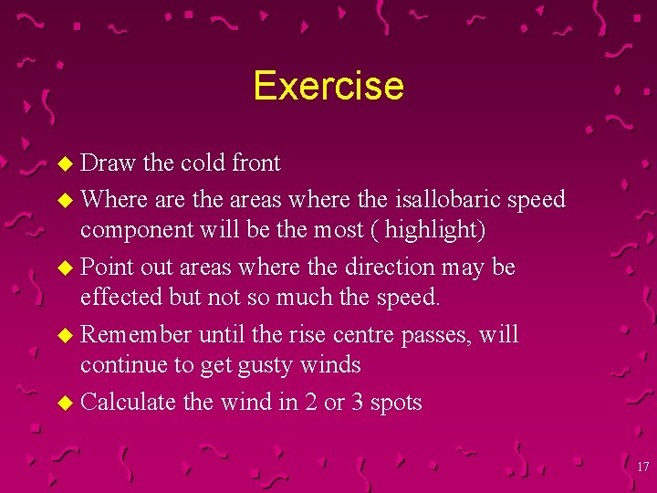
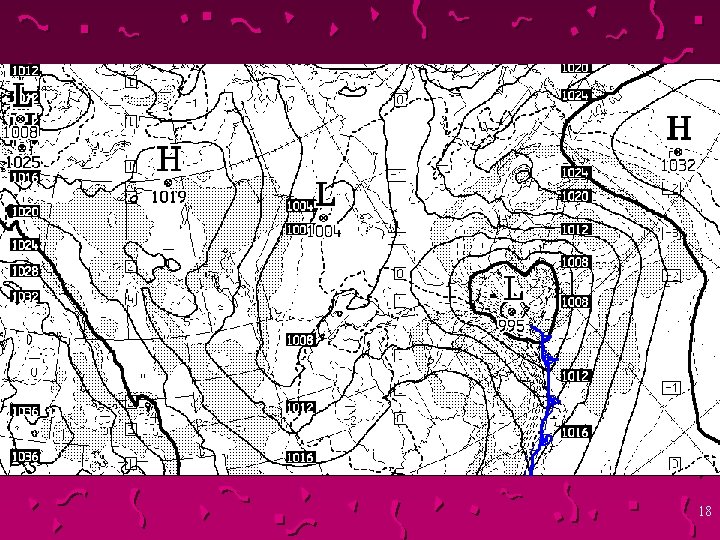
Exercise u Draw the cold front u Where are the areas where the isallobaric speed component will be the most ( highlight) u Point out areas where the direction may be effected but not so much the speed. u Remember until the rise centre passes, will continue to get gusty winds u Calculate the wind in 2 or 3 spots 17

18

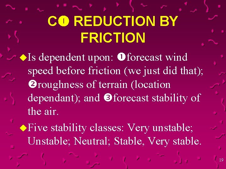
C REDUCTION BY FRICTION dependent upon: forecast wind speed before friction (we just did that); roughness of terrain (location dependant); and forecast stability of the air. u. Five stability classes: Very unstable; Unstable; Neutral; Stable, Very stable. u. Is 19

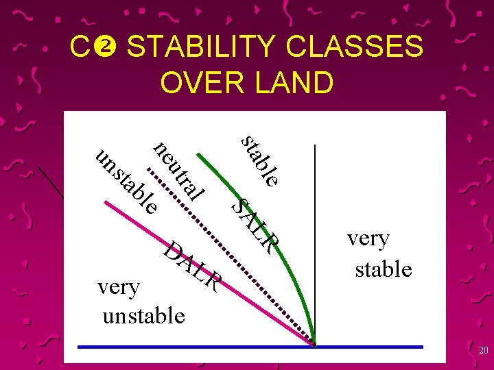
C STABILITY CLASSES OVER LAND ble sta tra u ne l bl sta un SA e very unstable LR LR DA very stable 20

FORECASTS STATISTICAL FORECASTS Ø FOCN 10 (6 Hourly). Ø FXCN 50 (3 Hourly). DIRECT MODEL OUTPUT Ø PROG HODO (3 Hourly). Ø FOCN 03 CWAO (6 Hourly). 21

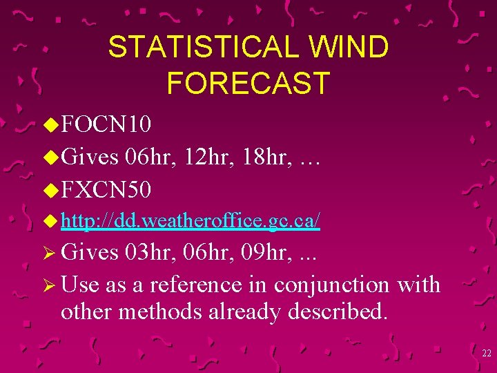
STATISTICAL WIND FORECAST u. FOCN 10 u. Gives 06 hr, 12 hr, 18 hr, … u. FXCN 50 u http: //dd. weatheroffice. gc. ca/ Ø Gives 03 hr, 06 hr, 09 hr, . . . Ø Use as a reference in conjunction with other methods already described. 22

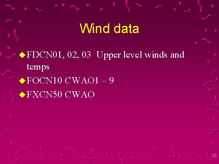
Wind data u FDCN 01, 02, 03 Upper level winds and temps u FOCN 10 CWAO 1 – 9 u FXCN 50 CWAO 23

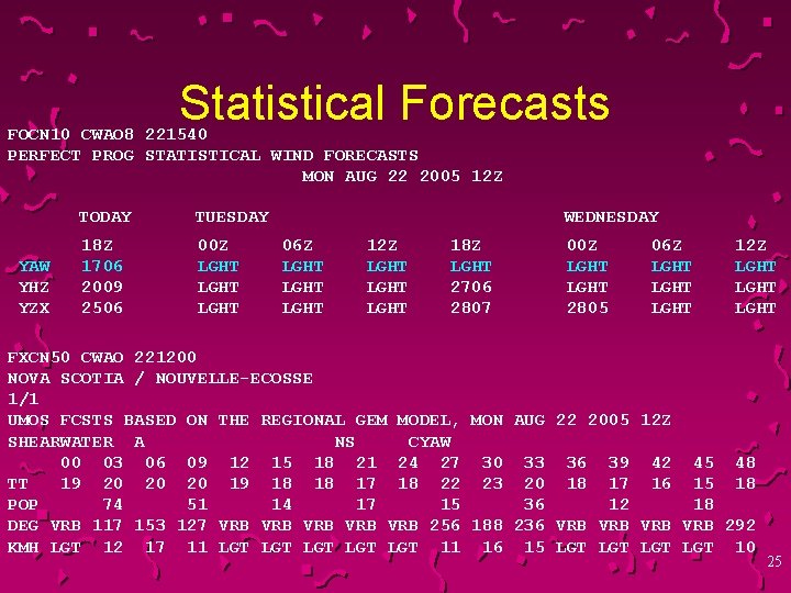
UMOS WINDS u u u FXCN 50 UMOS FCSTS BASED ON THE REGIONAL GEM MODEL The following link describes the FXCN 50 and UMOS http: //collaboration. cmc. ec. gc. ca/cmc/CMOI/product_guid e/product-pages/alpha_reg_stat_fxcn 50 -umos_gen_e. html The following link lists all of the products. You can find them in French too. http: //collaboration. cmc. ec. gc. ca/cmc/CMOI/product_guid e/product-pages/ 24

Statistical Forecasts FOCN 10 CWAO 8 221540 PERFECT PROG STATISTICAL WIND FORECASTS MON AUG 22 2005 12 Z YAW YHZ YZX TODAY TUESDAY 18 Z 1706 2009 2506 00 Z LGHT WEDNESDAY 06 Z LGHT 12 Z LGHT 18 Z LGHT 2706 2807 00 Z LGHT 2805 06 Z LGHT 12 Z LGHT FXCN 50 CWAO 221200 NOVA SCOTIA / NOUVELLE-ECOSSE 1/1 UMOS FCSTS BASED ON THE REGIONAL GEM MODEL, MON AUG 22 2005 12 Z SHEARWATER A NS CYAW 00 03 06 09 12 15 18 21 24 27 30 33 36 39 42 45 48 TT 19 20 20 20 19 18 18 17 18 22 23 20 18 17 16 15 18 POP 74 51 14 17 15 36 12 18 DEG VRB 117 153 127 VRB VRB VRB 256 188 236 VRB VRB 292 KMH LGT 12 17 11 LGT LGT LGT 11 16 15 LGT LGT 10 25

Stability u Stability of the boundary layer affects the strength of the friction force. u A very stable layer suppresses turbulence and friction is weak except near the surface u In a superadiabatic layer, convective turbulence is strong and the friction force will be strong. 26

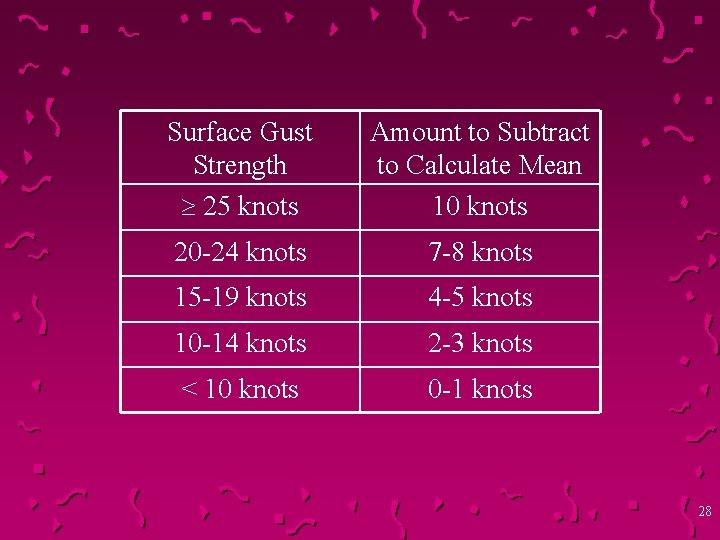
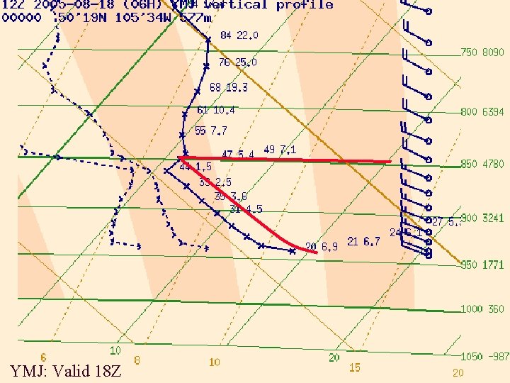
C FOR UNSTABLE AND VERY UNSTABLE CASES u This assumes daytime surface heating, or advective surface heating. u Determine depth of the unstable layer from the surface and highest wind speed aloft within the unstable layer. u Use the following table to determine percentage of upper wind brought down to calculate gust value. Mean is 10 knots less (for 25 knots). 27

Surface Gust Strength 25 knots Amount to Subtract to Calculate Mean 10 knots 20 -24 knots 7 -8 knots 15 -19 knots 4 -5 knots 10 -14 knots 2 -3 knots < 10 knots 0 -1 knots 28

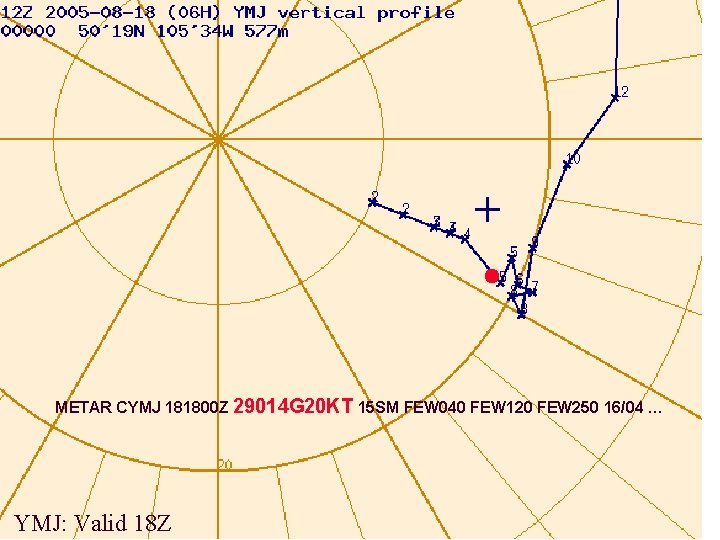
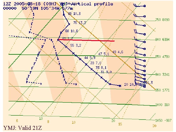
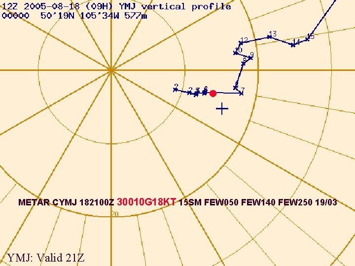
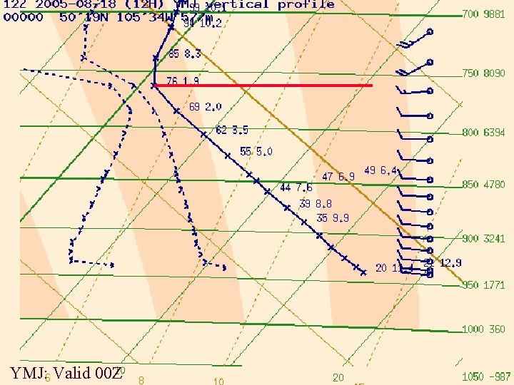
C FOR UNSTABLE AND VERY UNSTABLE CASES To forecast winds with daytime heating (sunny day: spring, summer or fall): Use prog tephigram valid at appropriate time(s). Adjust T/Td for any anticipated differences for that(those) time(s). Unstable layer is top of the extent of the ELR along a dry adiabat. Determine highest wind speed within that layer on prog hodograph valid at same time. Adjust this gust value with friction table according to height. Mean is less, but depends on the gust value. Leave direction roughly the same as that aloft, with perhaps slight backing. u 29

YMJ: Valid 18 Z

METAR CYMJ 181800 Z 29014 G 20 KT 15 SM FEW 040 FEW 120 FEW 250 16/04 … YMJ: Valid 18 Z

YMJ: Valid 21 Z

METAR CYMJ 182100 Z 30010 G 18 KT 15 SM FEW 050 FEW 140 FEW 250 19/03 YMJ: Valid 21 Z

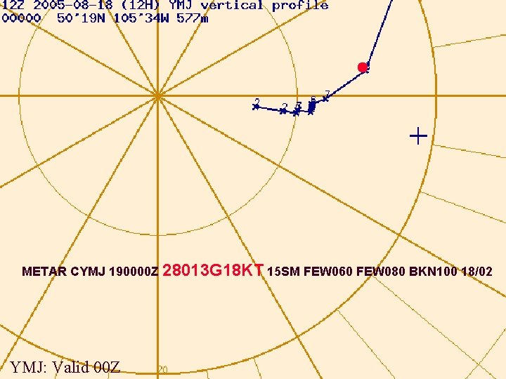
YMJ: Valid 00 Z

METAR CYMJ 190000 Z 28013 G 18 KT 15 SM FEW 060 FEW 080 BKN 100 18/02 YMJ: Valid 00 Z

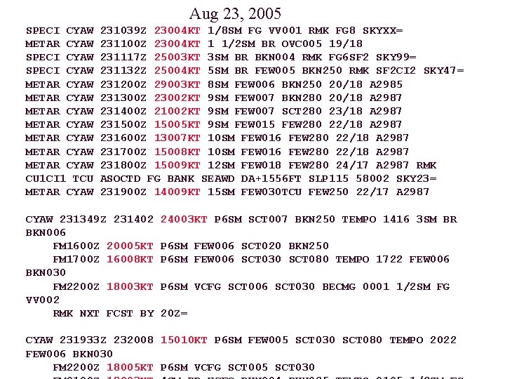
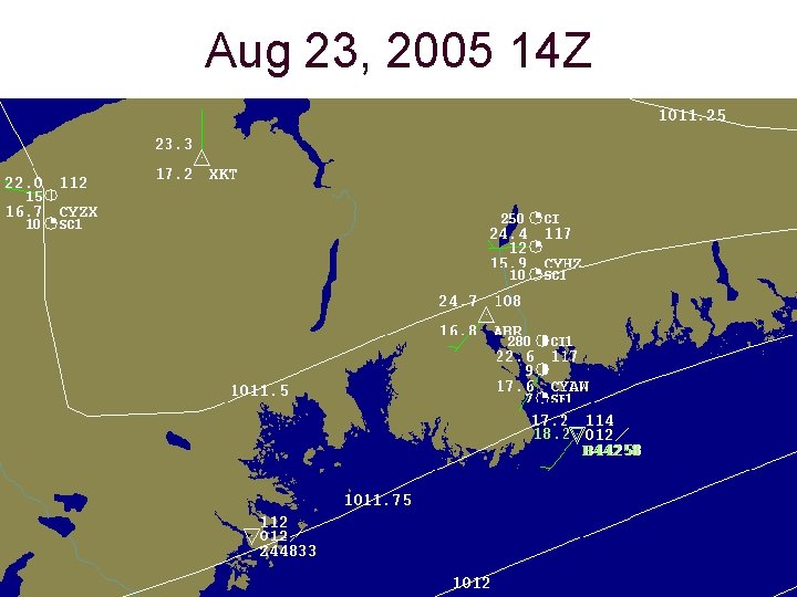
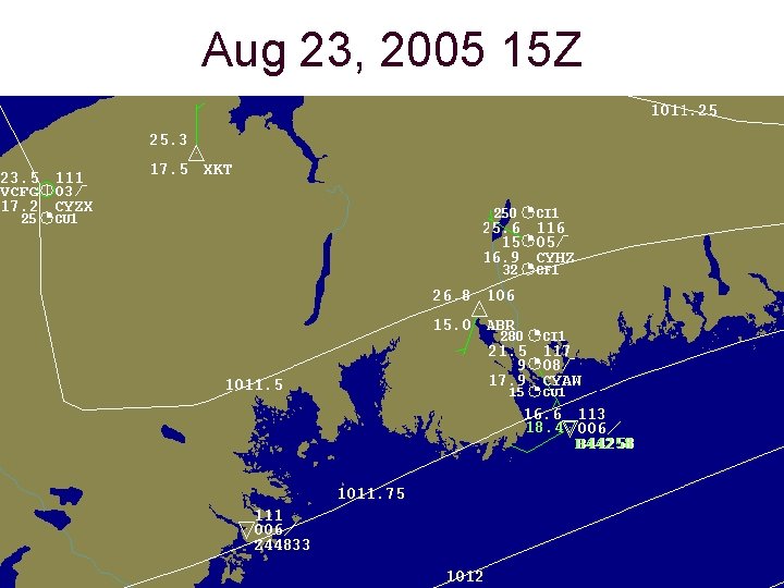
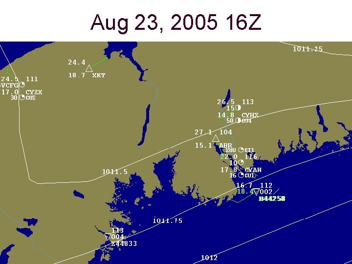
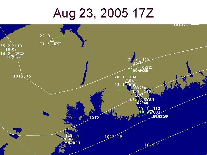
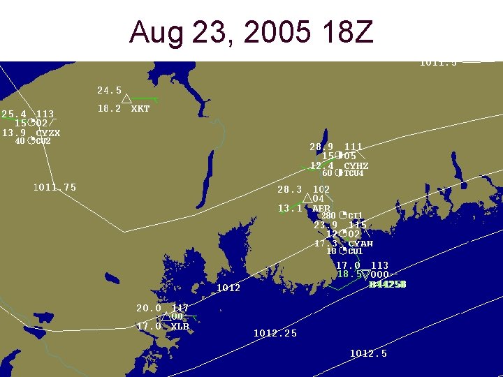
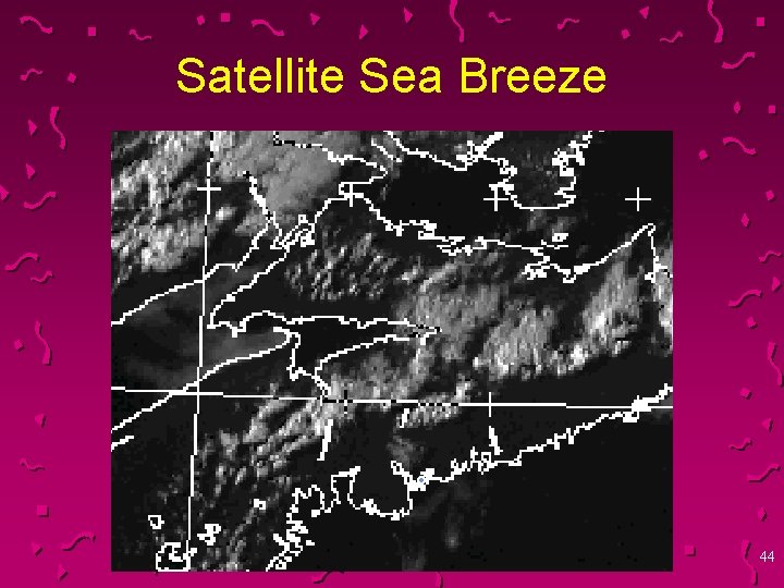
D & E. ADJUSTMENT FOR MESOSCALE EFFECTS u. Local terrain features (valley etc) or thermal effects (sea breeze, thunderstorm) may affect actual wind, causing a difference from calculated value, and must be taken into account. u. In spring, summer, YAW tends to get a sea breeze. 36

Aug 23, 2005 SPECI CYAW METAR CYAW METAR CYAW METAR CYAW CU 1 CI 1 TCU METAR CYAW 231039 Z 23004 KT 1/8 SM FG VV 001 RMK FG 8 SKYXX= 231100 Z 23004 KT 1 1/2 SM BR OVC 005 19/18 231117 Z 25003 KT 3 SM BR BKN 004 RMK FG 6 SF 2 SKY 99= 231132 Z 25004 KT 5 SM BR FEW 005 BKN 250 RMK SF 2 CI 2 SKY 47= 231200 Z 29003 KT 8 SM FEW 006 BKN 250 20/18 A 2985 231300 Z 23002 KT 9 SM FEW 007 BKN 280 20/18 A 2987 231400 Z 21002 KT 9 SM FEW 007 SCT 280 23/18 A 2987 231500 Z 15005 KT 9 SM FEW 015 FEW 280 22/18 A 2987 231600 Z 13007 KT 10 SM FEW 016 FEW 280 22/18 A 2987 231700 Z 15008 KT 10 SM FEW 016 FEW 280 22/18 A 2987 231800 Z 15009 KT 12 SM FEW 018 FEW 280 24/17 A 2987 RMK ASOCTD FG BANK SEAWD DA+1556 FT SLP 115 58002 SKY 23= 231900 Z 14009 KT 15 SM FEW 030 TCU FEW 250 22/17 A 2987 CYAW 231349 Z 231402 BKN 006 FM 1600 Z 20005 KT FM 1700 Z 16008 KT BKN 030 FM 2200 Z 18003 KT VV 002 RMK NXT FCST BY 24003 KT P 6 SM SCT 007 BKN 250 TEMPO 1416 3 SM BR P 6 SM FEW 006 SCT 020 BKN 250 P 6 SM FEW 006 SCT 030 SCT 080 TEMPO 1722 FEW 006 P 6 SM VCFG SCT 006 SCT 030 BECMG 0001 1/2 SM FG 20 Z= CYAW 231933 Z 232008 15010 KT P 6 SM FEW 005 SCT 030 SCT 080 TEMPO 2022 FEW 006 BKN 030 FM 2200 Z 18005 KT P 6 SM VCFG SCT 005 SCT 030

Aug 23, 2005 13 Z

Aug 23, 2005 14 Z

Aug 23, 2005 15 Z

Aug 23, 2005 16 Z

Aug 23, 2005 17 Z

Aug 23, 2005 18 Z

Satellite Sea Breeze 44

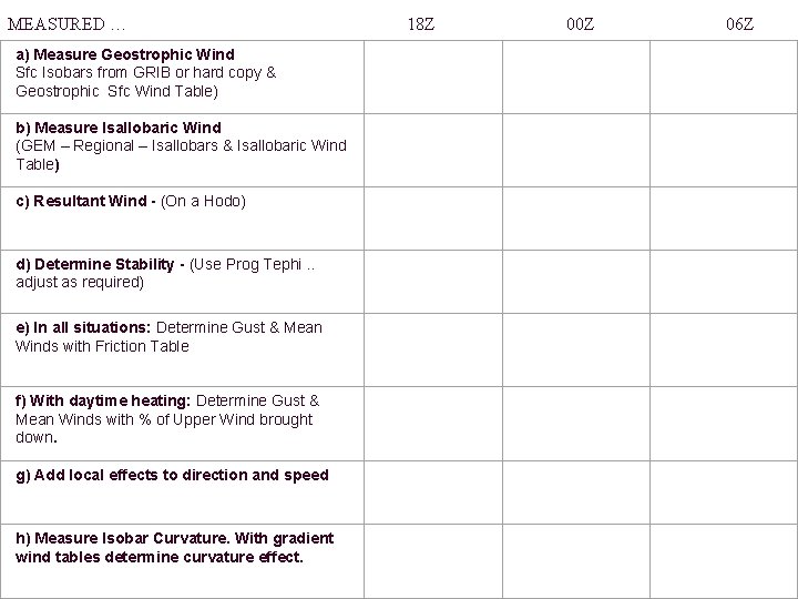
MEASURED … a) Measure Geostrophic Wind Sfc Isobars from GRIB or hard copy & Geostrophic Sfc Wind Table) b) Measure Isallobaric Wind (GEM – Regional – Isallobars & Isallobaric Wind Table) c) Resultant Wind - (On a Hodo) d) Determine Stability - (Use Prog Tephi. . adjust as required) e) In all situations: Determine Gust & Mean Winds with Friction Table f) With daytime heating: Determine Gust & Mean Winds with % of Upper Wind brought down. g) Add local effects to direction and speed h) Measure Isobar Curvature. With gradient wind tables determine curvature effect. 18 Z 00 Z 06 Z

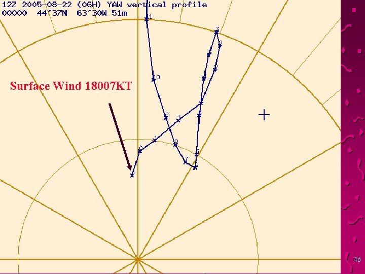
Surface Wind 18007 KT 46

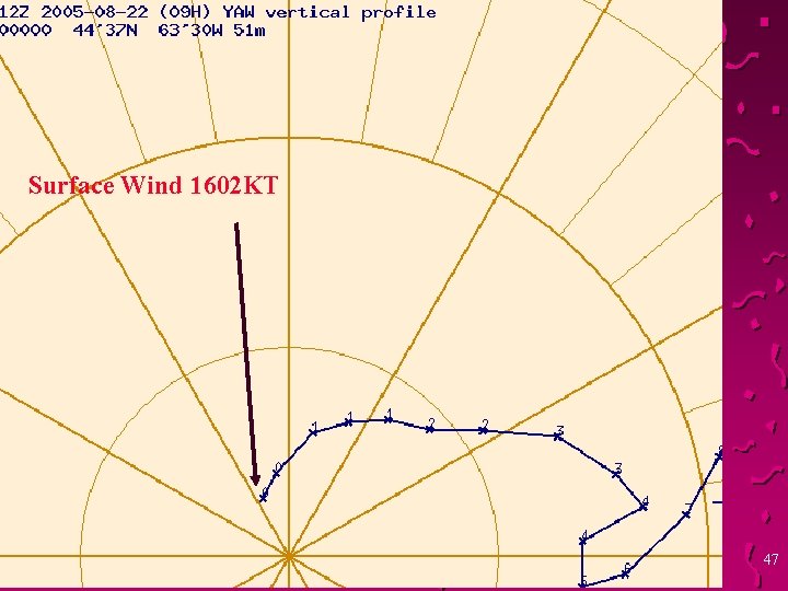
Surface Wind 1602 KT 47

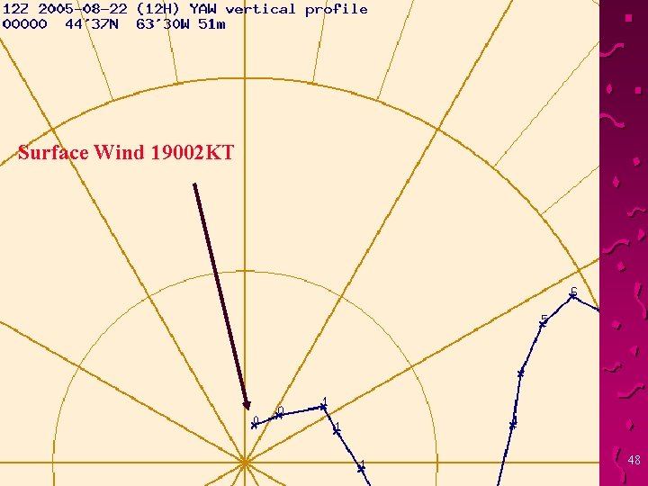
Surface Wind 19002 KT 48

THE END 49