Which map shows the two correctly labeled air

Which map shows the two correctly labeled air masses that frequently converge in the central plains to cause tornadoes?
 Sandy as seen from ISS.")
Hurricane (Superstorm) Sandy as seen from ISS.

Cold Front • Cold dense air • Moves quickly • Warm air rises = thick clouds • Heavy storms (thunderstorms)

This satellite image shows cloud patterns associated with weather fronts over the United States on a certain day. Nebraska (NE) and New York (NY) are labeled. Which type of front was producing the weather in Nebraska when this image was taken? (1) cold front (3) stationary front (2) warm front (4) occluded front

Warm Front • Warm low density air • Moves slowly • Warm air filters over cold = Long thin clouds • Light steady precipitation
 CONTOUR (from above)")
PROFILE (side) CONTOUR (from above)

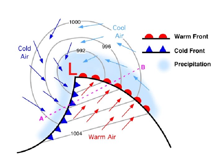
The map shows a high-pressure center, a low-pressure center, and two fronts extending from the low-pressure center. Points X and Y are locations on the map connected by a reference line Which cross section best represents the fronts and air movements along line XY?

Which front is faster?

Occluded Front Faster moving cold front “catches up to” warm front.

Occluded Front Faster moving cold front “catches up to” warm front.

Occluded Front Faster moving cold front “catches up to” warm front.

All are mentioned here!

The map shows 2 weather fronts moving across N Y State. Lines X and Y represent frontal boundaries. The large arrows show the general direction the air masses are moving. The smaller arrows show the general direction warm, moist air is moving over the frontal boundaries. 57 Which type of front is represented by letter X? [1] COLD 59 Which type of front forms when front X catches and overtakes front Y? [1] OCCLUDED

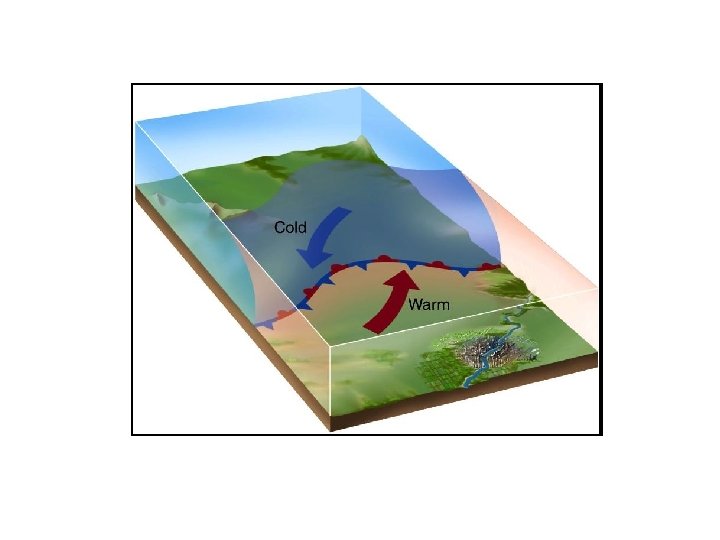
Which type of frontal boundary is represented here? Why does the m. T air rise at this frontal boundary? Less Dense
- Slides: 16