
What is the arrow pointing to A Andes
- Slides: 69
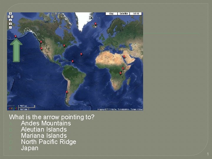
What is the arrow pointing to? A. Andes Mountains B. Aleutian Islands C. Mariana Islands D. North Pacific Ridge E. Japan 1
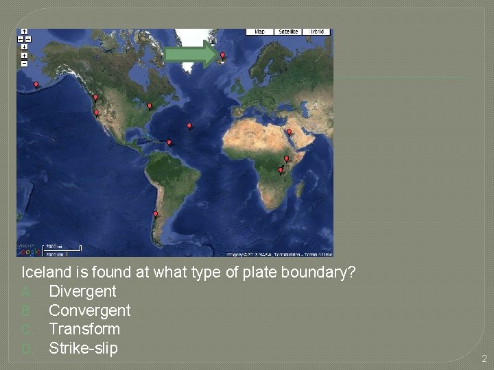
Iceland is found at what type of plate boundary? A. Divergent B. Convergent C. Transform D. Strike-slip 2
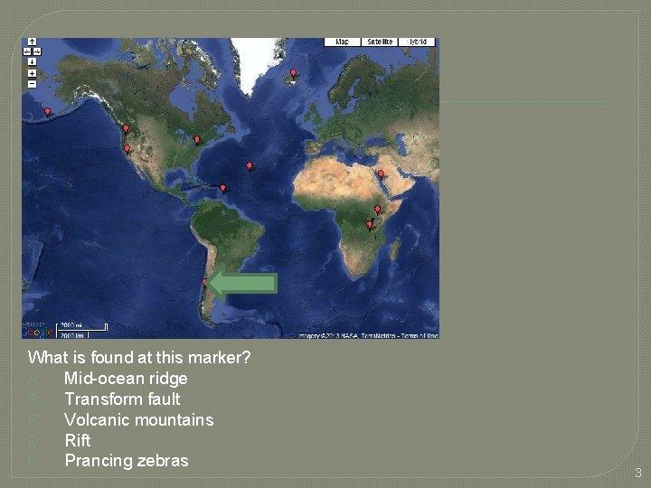
What is found at this marker? A. Mid-ocean ridge B. Transform fault C. Volcanic mountains D. Rift E. Prancing zebras 3
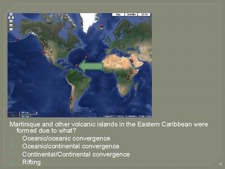
Martinique and other volcanic islands in the Eastern Caribbean were formed due to what? A. Oceanic/oceanic convergence B. Oceanic/continental convergence C. Continental/Continental convergence D. Rifting 4
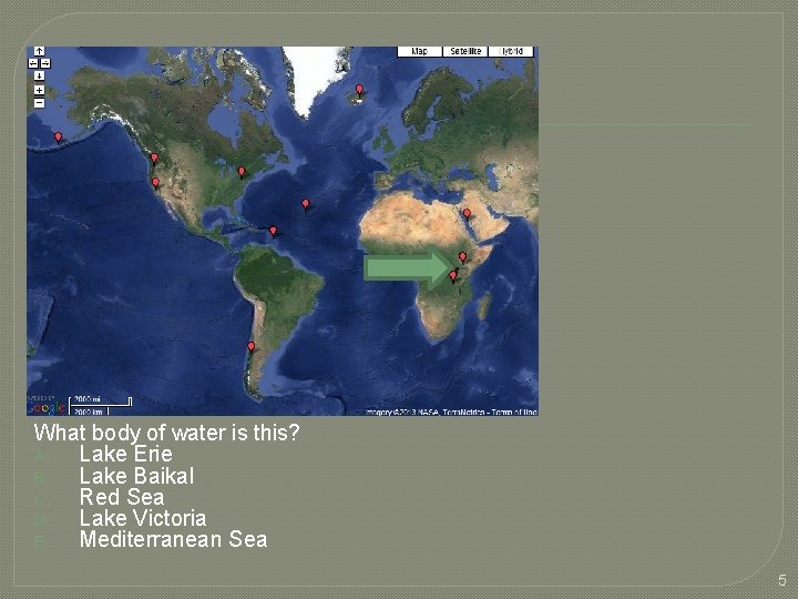
What body of water is this? A. Lake Erie B. Lake Baikal C. Red Sea D. Lake Victoria E. Mediterranean Sea 5
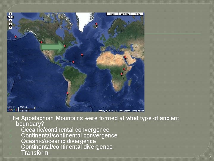
The Appalachian Mountains were formed at what type of ancient boundary? A. Oceanic/continental convergence B. Continental/continental convergence C. Oceanic/oceanic divergence D. Continental/continental divergence E. Transform 6
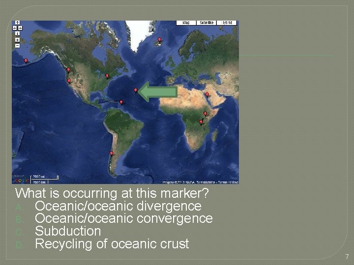
What is occurring at this marker? A. Oceanic/oceanic divergence B. Oceanic/oceanic convergence C. Subduction D. Recycling of oceanic crust 7
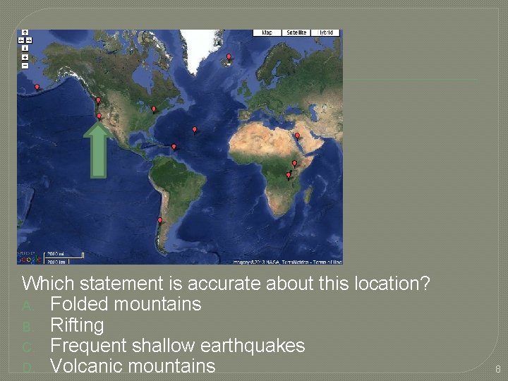
Which statement is accurate about this location? A. Folded mountains B. Rifting C. Frequent shallow earthquakes D. Volcanic mountains 8
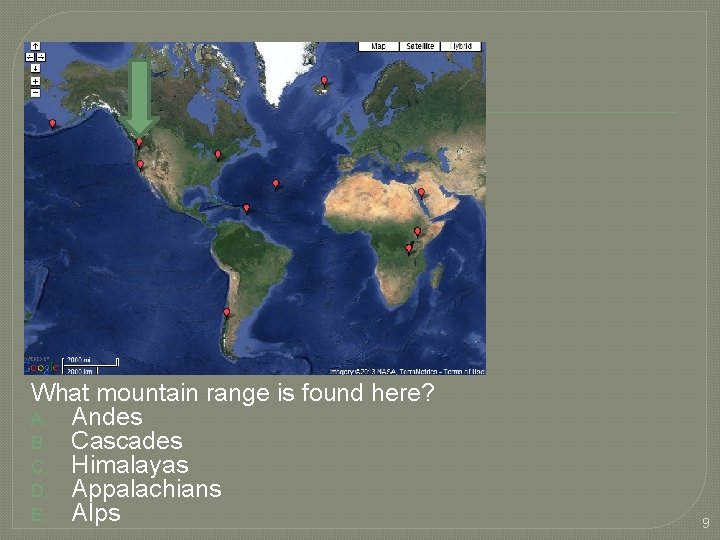
What mountain range is found here? A. Andes B. Cascades C. Himalayas D. Appalachians E. Alps 9
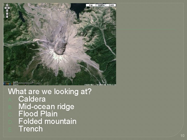
What are we looking at? A. Caldera B. Mid-ocean ridge C. Flood Plain D. Folded mountain E. Trench 10
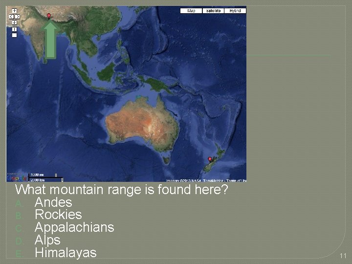
What mountain range is found here? A. Andes B. Rockies C. Appalachians D. Alps E. Himalayas 11
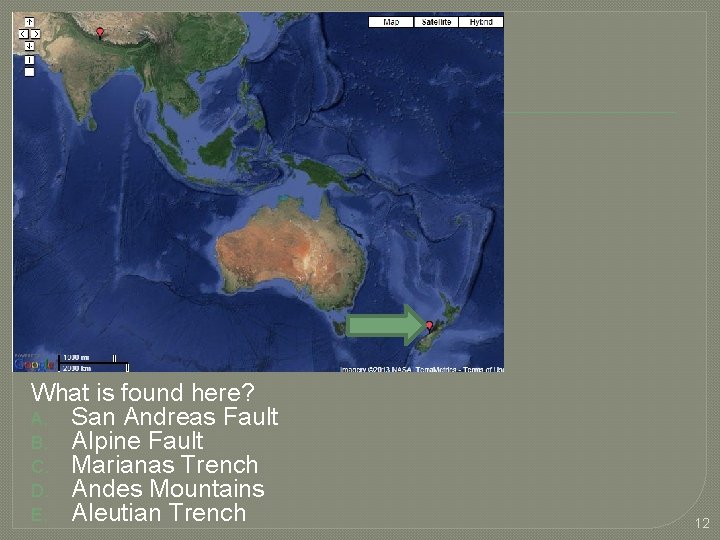
What is found here? A. San Andreas Fault B. Alpine Fault C. Marianas Trench D. Andes Mountains E. Aleutian Trench 12
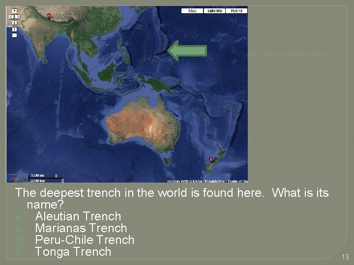
The deepest trench in the world is found here. What is its name? A. Aleutian Trench B. Marianas Trench C. Peru-Chile Trench D. Tonga Trench 13
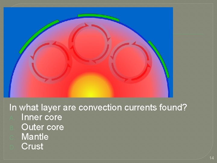
In what layer are convection currents found? A. Inner core B. Outer core C. Mantle D. Crust 14
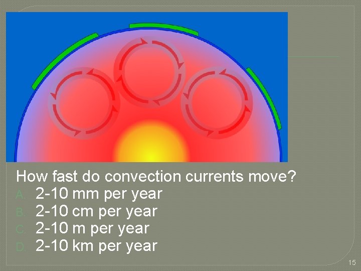
How fast do convection currents move? A. 2 -10 mm per year B. 2 -10 cm per year C. 2 -10 m per year D. 2 -10 km per year 15
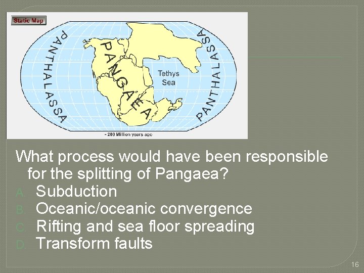
What process would have been responsible for the splitting of Pangaea? A. Subduction B. Oceanic/oceanic convergence C. Rifting and sea floor spreading D. Transform faults 16
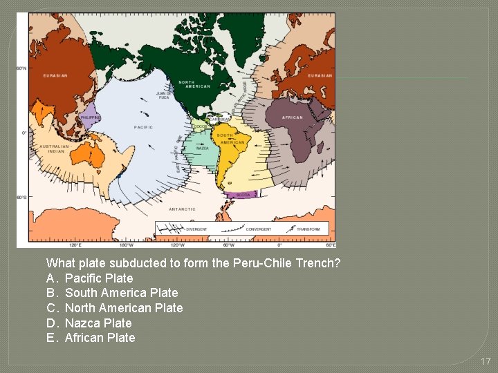
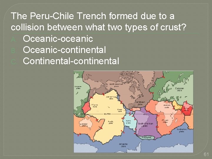
What plate subducted to form the Peru-Chile Trench? A. Pacific Plate B. South America Plate C. North American Plate D. Nazca Plate E. African Plate 17
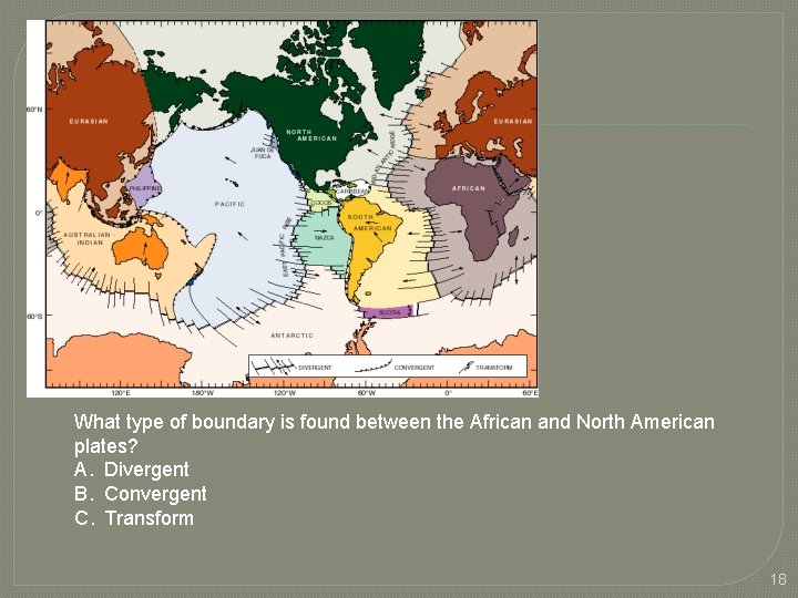
What type of boundary is found between the African and North American plates? A. Divergent B. Convergent C. Transform 18
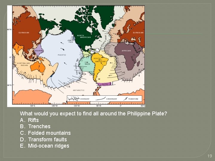
What would you expect to find all around the Philippine Plate? A. Rifts B. Trenches C. Folded mountains D. Transform faults E. Mid-ocean ridges 19
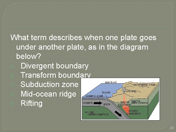
What term describes when one plate goes under another plate, as in the diagram below? A. Divergent boundary B. Transform boundary C. Subduction zone D. Mid-ocean ridge E. Rifting 20
What type of crust always goes “down” into the mantle? Why? A. Oceanic crust because it’s denser B. Oceanic crust because it’s less dense C. Continental crust because it’s denser D. Continental crust because it’s less dense 21
What two features should you expect to find whenever one plate goes under another plate? A. Volcanoes and mid-ocean ridges B. Trenches and mid-ocean ridges C. Mid-ocean ridges and abyssal plains D. Volcanoes and a trench 22
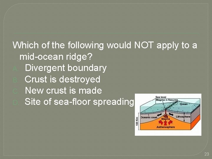
Which of the following would NOT apply to a mid-ocean ridge? A. Divergent boundary B. Crust is destroyed C. New crust is made D. Site of sea-floor spreading 23
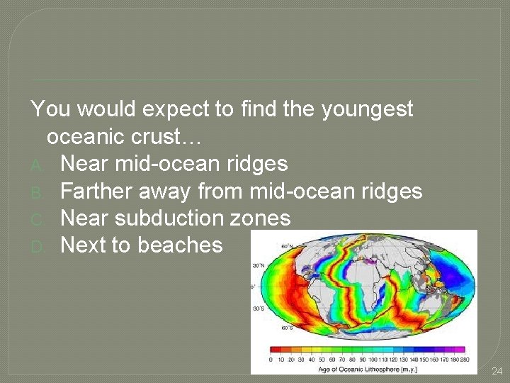
You would expect to find the youngest oceanic crust… A. Near mid-ocean ridges B. Farther away from mid-ocean ridges C. Near subduction zones D. Next to beaches 24
Which of the following is found along a transform boundary? A. Andes Mountains B. Himalaya Mountains C. San Andreas Fault D. Mid-Atlantic Ridge 25
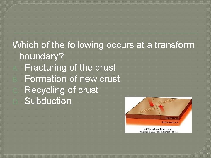
Which of the following occurs at a transform boundary? A. Fracturing of the crust B. Formation of new crust C. Recycling of crust D. Subduction 26
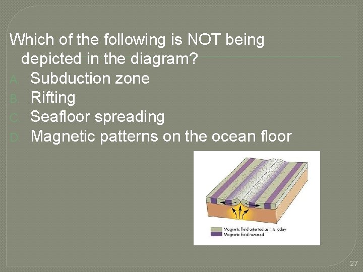
Which of the following is NOT being depicted in the diagram? A. Subduction zone B. Rifting C. Seafloor spreading D. Magnetic patterns on the ocean floor 27
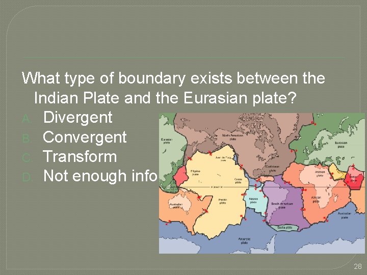
What type of boundary exists between the Indian Plate and the Eurasian plate? A. Divergent B. Convergent C. Transform D. Not enough info 28
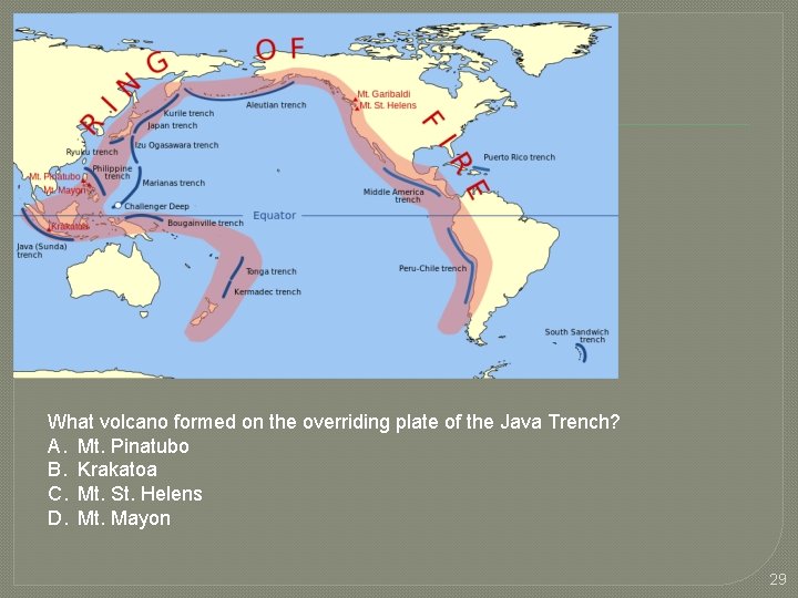
What volcano formed on the overriding plate of the Java Trench? A. Mt. Pinatubo B. Krakatoa C. Mt. St. Helens D. Mt. Mayon 29
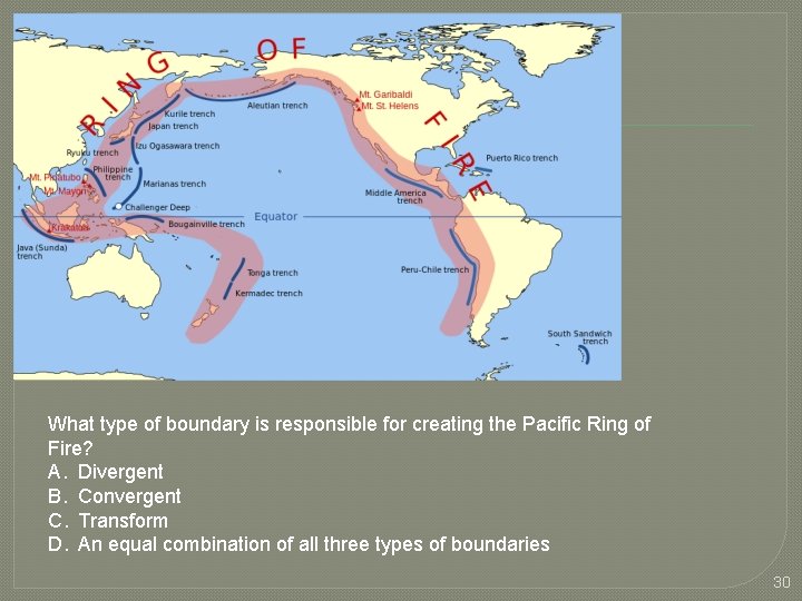
What type of boundary is responsible for creating the Pacific Ring of Fire? A. Divergent B. Convergent C. Transform D. An equal combination of all three types of boundaries 30
Which statement is accurate about the Himalayan Mountains? A. They are folded mountains. B. They are volcanic mountains. C. They formed due to rifting. D. They formed as a result of subduction. E. They are decreasing in elevation each year due to erosion. 31
What is the only boundary where crust is neither created nor destroyed? A. Convergent B. Divergent C. Transform 32
The Red Sea in Africa will eventually become __________. A. An ocean B. A folded mountain C. A trench D. A great plain 33
Tsunamis are typically generated along what type of boundary? A. Convergent B. Divergent C. Transform 34
All of the following support theory of sea floor spreading EXCEPT… A. Discovery of a 40, 000 mile long midocean ridge system B. A “Ring of Fire” surrounding the Pacific Ocean C. Analysis of the age of ocean crust D. Magnetic patterns on the ocean floor 35
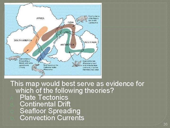
This map would best serve as evidence for which of the following theories? A. Plate Tectonics B. Continental Drift C. Seafloor Spreading D. Convection Currents 36
Alfred Wegener died in the 1930’s before his idea of continental drift was accepted by the global scientific community. Which of the following allowed his idea to eventually become a theory? A. Identification of the Pacific Ring of Fire B. Discovery of trenches C. Development of theory of sea floor spreading D. Identifying a pattern of earthquakes around the world 37
Which of the following theories states that large pieces of lithosphere are moving at different speeds and in different directions all over the surface of the Earth? A. Plate Tectonics B. Continental Drift C. Seafloor Spreading 38
Which seismic waves are the fastest moving? A. P waves B. S waves C. Surface waves D. Sonar waves 39
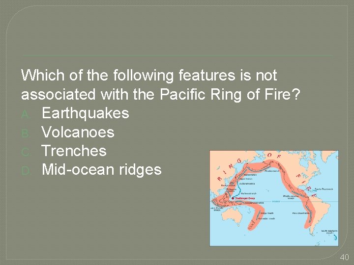
Which of the following features is not associated with the Pacific Ring of Fire? A. Earthquakes B. Volcanoes C. Trenches D. Mid-ocean ridges 40
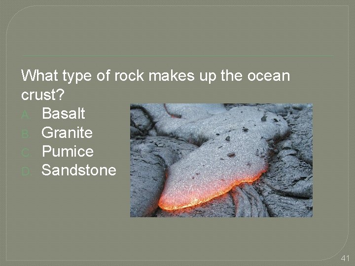
What type of rock makes up the ocean crust? A. Basalt B. Granite C. Pumice D. Sandstone 41
What is the main thing used to study Earth's layers? A. Sonar B. Seismic waves C. Drilling D. Satellites 42
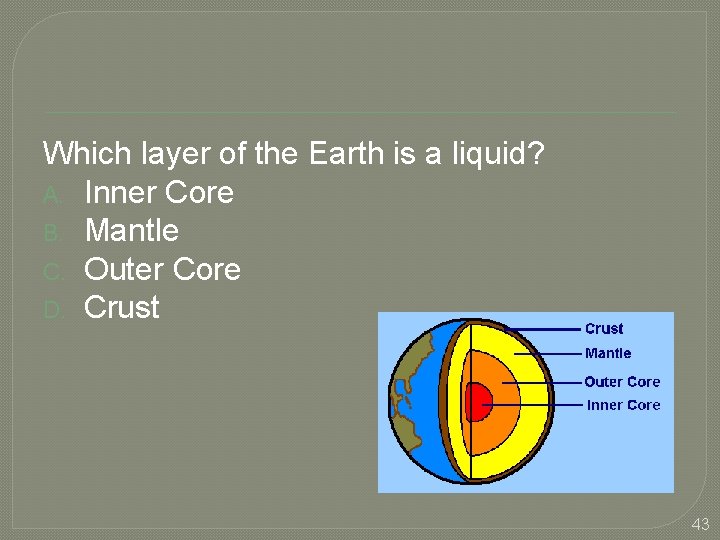
Which layer of the Earth is a liquid? A. Inner Core B. Mantle C. Outer Core D. Crust 43
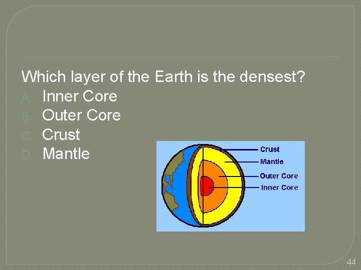
Which layer of the Earth is the densest? A. Inner Core B. Outer Core C. Crust D. Mantle 44
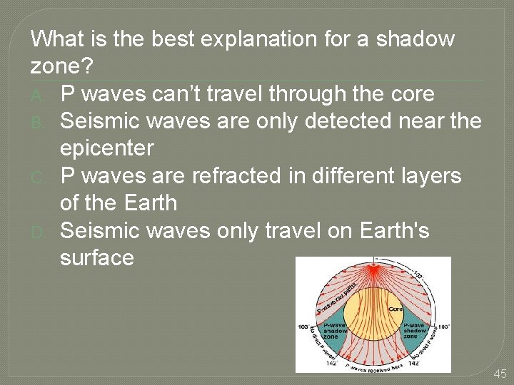
What is the best explanation for a shadow zone? A. P waves can’t travel through the core B. Seismic waves are only detected near the epicenter C. P waves are refracted in different layers of the Earth D. Seismic waves only travel on Earth's surface 45
Generally 3 -4 miles thick and mafic (contains magnesium and iron) A. Continental crust B. Oceanic crust C. Mantle D. Core 46
Generally 20 -30 miles thick and felsic (contains silica and feldspar) A. Continental crust B. Oceanic crust C. Mantle D. Core 47
Comprised of 85% iron and 15% nickel, the same as meteorites. A. Continental crust B. Oceanic crust C. Mantle D. Core 48
Which layer of the Earth behaves like a plastic and flows very slowly? A. Inner core B. Outer core C. Lithosphere D. Asthenosphere 49
Which layer of the Earth is brittle and is broken into plates? A. Inner core B. Outer core C. Lithosphere D. Asthenosphere 50
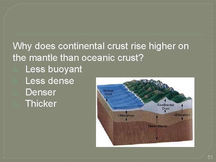
Why does continental crust rise higher on the mantle than oceanic crust? A. Less buoyant B. Less dense C. Denser D. Thicker 51
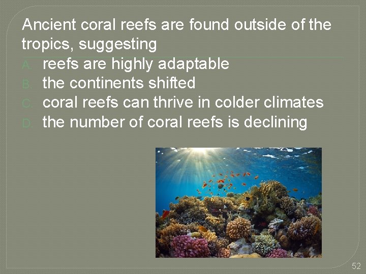
Ancient coral reefs are found outside of the tropics, suggesting A. reefs are highly adaptable B. the continents shifted C. coral reefs can thrive in colder climates D. the number of coral reefs is declining 52
Who proposed the continental drift hypothesis? A. Wegner B. Einstein C. Newton D. Kepler 53
Why was the continental drift hypothesis initially rejected? A. Lack of rock evidence B. Lack of fossil evidence C. Lack of climate shift evidence D. Lack of plate movement mechanism 54
All of the following were used as evidence for sea floor spreading except A. Magnetic polarity of sea floor rocks B. Age of seafloor C. thickness of the ocean floor sediments D. depth of the ocean floor 55
Which of the following is not one of the major features of the ocean floor? A. Craters B. Mid-ocean ridges C. Abyssal Plains D. Trenches 56
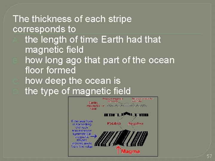
The thickness of each stripe corresponds to A. the length of time Earth had that magnetic field B. how long ago that part of the ocean floor formed C. how deep the ocean is D. the type of magnetic field 57
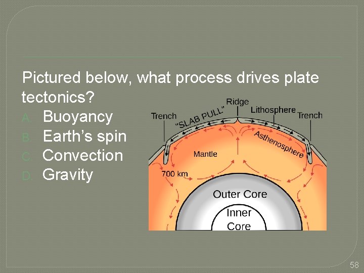
Pictured below, what process drives plate tectonics? A. Buoyancy B. Earth’s spin C. Convection D. Gravity 58
What did scientists use to determine all of the plate boundaries? A. Location of trenches B. Location of mid-ocean ridges C. Location of volcanoes D. Earthquake data 59
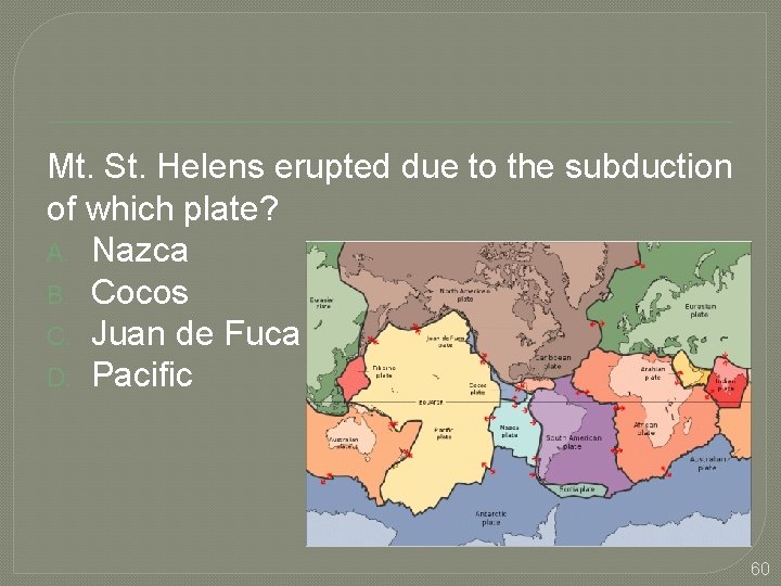
Mt. St. Helens erupted due to the subduction of which plate? A. Nazca B. Cocos C. Juan de Fuca D. Pacific 60
The Peru-Chile Trench formed due to a collision between what two types of crust? A. Oceanic-oceanic B. Oceanic-continental C. Continental-continental 61
What type of rock mainly makes up the continents? A. Granite B. Basalt C. Limestone D. Sandstone 62
While most divergent boundaries are found underwater, what continent is an exception? A. Australia B. Asia C. Africa D. North America 63
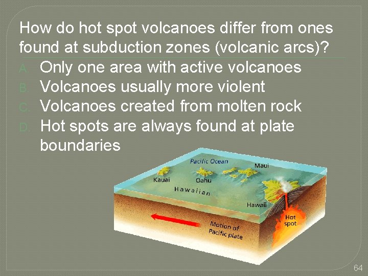
How do hot spot volcanoes differ from ones found at subduction zones (volcanic arcs)? A. Only one area with active volcanoes B. Volcanoes usually more violent C. Volcanoes created from molten rock D. Hot spots are always found at plate boundaries 64
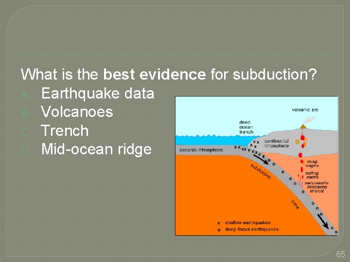
What is the best evidence for subduction? A. Earthquake data B. Volcanoes C. Trench D. Mid-ocean ridge 65
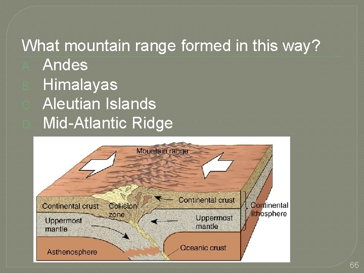
What mountain range formed in this way? A. Andes B. Himalayas C. Aleutian Islands D. Mid-Atlantic Ridge 66
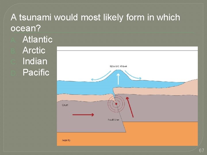
A tsunami would most likely form in which ocean? A. Atlantic B. Arctic C. Indian D. Pacific 67
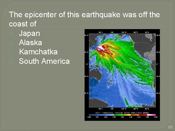
The epicenter of this earthquake was off the coast of A. Japan B. Alaska C. Kamchatka D. South America 68
The best way to monitor the formation of a tsunami is by using A. Seismometers B. Satellites C. Sonar D. Boats 69