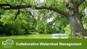
Welcome to Watershed Management Watershed Management ENVC 101


- Slides: 60

Welcome to Watershed Management

Watershed Management ENVC 101 2

Material Covered: • Part I Watersheds and People • 1 Watersheds and People Through Time • 2 Watershed Resources in the 21 st Century 3

Material Covered: • Part II Basic Geological Processes and Geomorphology • 3 Weathering and soils • 4 Mass Wasting • 5 Erosion – sediment routing and delivery • 6 Glaciers and Glaciation 4

• • • Part III The Hydrological System 7 The Hydrological Cycle 8 Generation of Watershed Runoff 9 Moisture and Precipitation 10 Soil Moisture Movement, Storage, and Budget 11 Energy Exchange 12 Water Losses 13 Snow Accumulation, Melt, and Evaporation 14 Functions of Large Woody Debris 5

And Finally: • Part IV Management of Watersheds • 15 Channel Processes and Classification • 16 Natural Resource Adaptive Management Practices • 17 Watershed Management Policy and Planning • 18 Watershed Case Studies 6

North America 7

Watersheds and Landscapes • Humans have dramatically influenced landscapes for > 10, 000 years: • North Africa - extinctions • Greenland - extinctions • North America – extinctions • Influenced the climate for last 8000 years • Future: ever accelerating human population 8

The Early Years • Palestine, Anatolia, and Mesopotamia around 8 to 7, 000 BC • Rice fields SE Asia • Irrigation canals • Reservoirs • Sri Lanka 5, 500 BC • South America; acequias 9

Nilometers 10

North America • Holokam Indians developed almost 500 km of irrigation canals providing water for around 102, 000 ha of desert land • Anasazi Indians, southwest Colorado reservoirs and check dams • 400 -1300 years ago 11

Qanats 12

Noria 13

14

• King Solomon was said to have demanded that 80, 000 lumberjacks be deployed to the forests to log a 518, 000 ha area of cypress Cupressus sp. and cedar Cedrus libani 15

Pragmatism and Speculation • • • Plato insightful Aristotle totally wrong No concept of evaporation & precipitation China and India parallel developments Rain measures early on 16

Roman Époque - Engineering 34 cm km-1 17

Written Records Appear • 1215 Louis VI of France issued a decree on forests and water • 1342 Swiss community issued the first forest protection measure • Leonardo da Vinci (1452 -1519 ) – measurements • Paulini brothers of Venice – accounted for flooding and silting of the lagoons 18

Measurements • 1563 Bernard Palissy (1510 -1590) of France – first correct hydrological cycle • 1670's, Pierre Perrault: measured and correctly accounted for all the major elements of the hydrological cycle such as precipitation, evapotranspiration, and runoff in the Seine River Basin 19

North American Experience • 1626 ordinances regulating the cutting and selling of timber on Plymouth Colony lands • 1811 the Commissioners of the Erie Canal were reporting fears of the effects of forest cutting on the supply of water for the canal • 1864, a US Senator from Vermont, George Perkins Marsh book on the effects of Man on the Earth 20

Township & Range 21

Effects of Land Clearing • 1872 New York appointed commissioners timbered regions of the state, especially the Adirondacks • 1877 first national report were prepared for the Congress; noted that streamflow were reduced due to clearing of forests, which reduced available hydropower and navigable waterways 22

Reserves and Clearing • 1862 Homestead Act • 1891 National Forests established • 1908 first forest experimental stations were established in the west • End of World War II, most of the ancient Sitka spruce along the Oregon and Washington coast and Puget Sound had been cut down 23

Modernization • Increase in harvest and greater densities of forest roads on steeper slopes • Portable sawmill and the chainsaw introduced • Almost 800, 000 km of logging roads on NF • ESA listings: Northern spotted owl, Chinook salmon, marbled murrelet • New forestry, changes in forest practices 24

Simplification of Rivers 25

26

Snags (logs) removed by the U. S. Army Corps of Engineers, 1891 - 1917 a River Number of snags removed Related activities Tillamook River, 9. 3 km of river +9, 829 86+ overhanging trees cut Coos River, 35. 4 km of river +8, 591 1, 751 boulders blasted Coquille River, 64. 4 km of river +6, 407 81 scow loads of drift (1891 -1893) a Reports of the Secretary of War (1891 -1921). 27

Mississippi River • Planter A tree trunk buried in the sand on one end but floating free at the other end. • Raft A snag that almost completely blocked a channel. • Sawyer A snag balanced so delicately that a breeze caused it to bob up and down. • Sleeper A water-logged tree floating just beneath the surface of the water. 28

Snagboats 29

Europe 30

Splash Dams 31

32

33

34

35

36

Range & Grassland • • • Overgrazing Exotic grazers – horse, donkey Exotic plants (>850 exotic plants) Bureau of Reclamation Urban sprawl 37

Water Rights • Measure of water rights: Acre-foot amount of water required to cover 1 acre (0. 4 ha) of land to a depth of 1 foot. • equivalent to 43, 560 ft 3 or 1235 m 3 38

Surface Water • Riparian system of water rights • Appropriative system of water rights • Mix of the two • Web of laws regulate not only the water but also the land uses that may affect streams, lakes, and groundwater. 39

Riparian System • Owners of land adjacent to a natural stream or other water body share the right to make reasonable use of the water resource. The rights are not quantified and generally appear nebulous. • Single user • No transferability 40

How it works: B A B has no water rights 41

Appropriative • This right is strictly defined regarding the quantity of water, which the claimant is entitled to. • Which time of the year. • Point of diversion. • Priority ranking of that right. • Oldest rights are granted the highest priority. • When water shortages occur any given right may not be fully exercised or even cancelled altogether. • All claims standing senior must be fully satisfied first. 42

Appropriative (Cont. ) • Appropriative water rights are claimed through an application process. • Perfected by actual use of the claim. • It then becomes transferable private property. 43

Restrictions: • Water duty standards to prevent wasteful water use. • Statutory preferences of use regardless of non-preferred senior rights. • Restrictions on the sale of water or the water rights themselves. 44

Federal Rights • Federally reserved water rights • Extends to navigable waters • Extend into nonnavigable waters to ensure ample water supply 45

Origin • The appropriative doctrine of water rights evolved in the mining camps of California's gold rush days • The earliest arrivers received rights superior to claimants arriving later and often received larger claims as well • The principle that a right could be forfeited as a result of discontinued use 46

Later Developments • Three faceted state water right system in 18 Western states • In many states, the beneficial uses have been prioritized in later years to provide a ranking during water shortages • Domestic and municipal uses are given preferences over agricultural uses, and irrigation is given priority over industrial and hydropower 47

<20, 000 CFS Jun. -Oct. (1973 -2002) 8, 500 CFS low Max 4, 173 CFS Low 911 CFS (1908 -2002) Willamette River <300 CFS Jun. -Oct. (1928 -2002) 74 CFS low Low 497 CFS (1910 -2002) 48

Water Rights for Env. Purposes State Water rights price ($/acre foot) Average quant. bought (acre foot) Annual water lease price ($/acre foot) Average quantity leased (acre foot) 42 (4) 1, 157 41 (1) 2, 000 California 2, 817 (1) 399 48 (24) 40, 109 Colorado 1, 088 (10) 91 11 (6) 2, 298 131 (3) 8, 258 19 (7) 84, 586 Montana 2 (1) 72, 270 Nebraska 794 (1) 1, 288 Nevada 995 (5) 7, 315 6. 5 (2) 23, 500 243 (5) 3, 858 114 (6) 4, 463 1, 200 (2) 316 830 (1) 361 34 (5) 1, 869 Arizona Idaho New Mexico Oregon Utah Washington 49

Environmental Purchases • Instream flow • T & E species • Riparian • Fish • Recreation • Water quality • Wetlands • Wildlife • Ecosystem services 50

Ground Water • • • Critical in the West Overlying owner the right Courts had no knowledge of hydrology Riparian rights system Appropriative system 51

Dam Building • • • for : Irrigation Hydroelectric 1920 Federal Power Act (FPA) U. S. Army Corps of Engineers The Northwest Power Planning Council 52

st 21 Century • WAU’s – Water Administrative Units • TFW – Timber Fish & Wildlife • Watershed Councils 53

Dam Construction and Removal • More than 80, 000 dams >1. 8 m constructed in the US alone (Graf 2003). • Mostly 1950’s and 1960’s • With a pace of a new dam being constructed every 6 minutes 54

Dam Removal Indicator Gold Hill Dam, Oregon Savage Rapids Dam, Glines Canyon Dam, Oregon Washington, L. Mills Distance from mouth 121 km 107. 6 km 13. 7 km Width of active channel 45. 7 m 61 m Hydraulic height 0. 3 -2. 4 m 9 -12. 5 m 64 m Dam crest length 306 m 140 m 46 m Reservoir length 1. 6 km 0. 9 km 3. 7 km Reservoir width 46 -107 m 88 -113 m 305 -610 m Reservoir capacity 123, 400 m 3 357, 700 m 3 17, 641, 800 m 3 Reservoir area 1. 7 ha 174 -436 ha 168 ha Sediment percent 0. 05% 0. 01% 4. 5% Relative reservoir sediment volume Negligible 1 -2 year supply of sand gravel 75 year supply of sand gravel Magnitude of sediment management Negligible Moderate Major 55

56

57

58

59

https: //www. youtube. com/watch? v=b. UZE 7 kg XKJc https: //www. youtube. com/watch? v=4 Lx. MHm w 3 Z-U 60
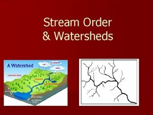
 Watershed management meaning
 Integrated watershed management
 Watershed management
 Importance of water resource management
 Watershed characteristics slideshare
 Atlanta watershed management
 Wise men three clever are we
 South river watershed alliance
 Gabion structure watershed
 Components of a watershed
 Contour map watershed delineation
 Genesee river watershed
 Difference between watershed and river basin
 North bay watershed association
 Segmentation by morphological watersheds
 Brain watershed areas
 Watershed poster ideas
 Local watershed definition
 Watershed segmentation
 Watershed development programme ppt
 Green river (duwamish river tributary)
 Dry creek experimental watershed
 Watershed matlab
 Crew land and water trust
 Computer vision ppt
 Watershed poster ideas
 Watershed vocabulary
 Red lake watershed district
 Rebecca hug
 Watershed segmentation
 Gis watershed analysis
 Chatfield watershed authority
 Athabasca watershed council
 Rice creek watershed
 The watershed game
 Epa watershed academy
 Watershed
 Rocky river watershed
 Sujala watershed project
 Watershed stream order
 The dog river watershed covers
 Micro watershed
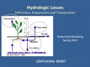
 Infiltration curve
 Coca cola watershed
 Geography paper 1 a level notes
 Watershed delineation pdf
 Big darby creek watershed
 Bjork creek cabin
 Records management 101
 Records management 101
 Records management 101
 Pmi project charter definition
 Product management 101
 Change management 101
 Global force management implementation guidance
 Public agencies are up tools
 Top management and middle management
 Top management middle management first line management
 Top level management
 Kevin bohli
 Wipo dl-101 final exam questions
