
Week at a Glance November 18 22 Mr
Week at a Glance November 18 -22 Mr. Johnson 7 th Grade Social Studies
Dear Parents, This week at a glance (WAG) is designed to give parents a brief idea of what their child is learning at school. It will have the subject standards (Georgia Standards of Excellence), the main topics covered, and some sample problems with links to videos and worksheets. We encourage parents and students to review this presentation together and to stay informed on the weekly learning objectives. *** students can earn extra credit if they copy or print the sample problems or worksheets and show the teacher. If the worksheet or PDF has several pages (5 or more), you don’t have to print every page. Print at your own discretion.
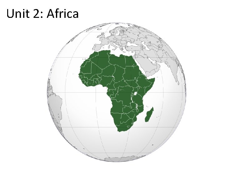
Unit 2: Africa
Africa SS 7 H 1 Analyze continuity and change in Africa. a. Explain how the European partitioning across Africa contributed to conflict, civil war, and artificial political boundaries in Africa today. b. Explain how the Pan-African movement and nationalism led to independence in Kenya and Nigeria. c. Explain the creation and end of apartheid in South Africa and the roles of Nelson Mandela and F. W. de Klerk. Geographic Understandings SS 7 G 1 Locate selected features of Africa. a. Locate on a world and regional political-physical map: Sahara, Sahel, savanna, tropical rain forest, Congo River, Niger River, Nile River, Lake Victoria, Great Rift Valley, Mt. Kilimanjaro, Atlas Mountains, and Kalahari Desert. b. Locate on a world and regional political-physical map the countries of Democratic Republic of the Congo, Egypt, Kenya, Nigeria, South Africa, and Sudan. SS 7 G 2 Explain environmental issues across the continent of Africa. a. Explain how water pollution and unequal access to water impacts irrigation, trade, industry, and drinking water. b. Explain the relationship between poor soil and deforestation in Sub-Saharan Africa. c. Explain the impact of desertification on the environment of Africa.
Africa Powerpoint Slides
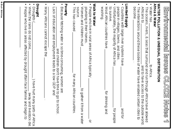
Environmental Issues CLOZE Notes 1 WATER POLLUTION & UNEQUAL DISTRIBUTION Africa & Water • Water has ___________ to Africa. • The oceans, rivers, & seas that surround and run through Africa have allowed Africans to ___________ and to have access to the outside world. • The interactions around these bodies of water have enabled certain cities to become ___________. Limited Supply • Countries with large river systems have ___________ and for people in villages, towns, and cities. • Unfortunately, the majority of Africa has ___________ for people to survive. • Most African countries have ___________ for drinking and washing. Walk to Water • People who live in rural areas of Africa typically ___________ or plumbing in their homes. • Women and children must ___________ to gather it from a water source. • This has caused ___________ for many African countries. Poverty • Because fetching water is so time-consuming, women are ___________ and children don’t have time to go to school. • Lack of education and employment leads to a low GDP and ___________. • Many Africans cannot escape the ___________. Drought • Droughts (_______________ ) have hurt many parts of Africa. • When the rains do not come, ___________ away and livestock die. • People who live in areas affected by drought often face famine and begin to ___________. © Brain Wrinkles
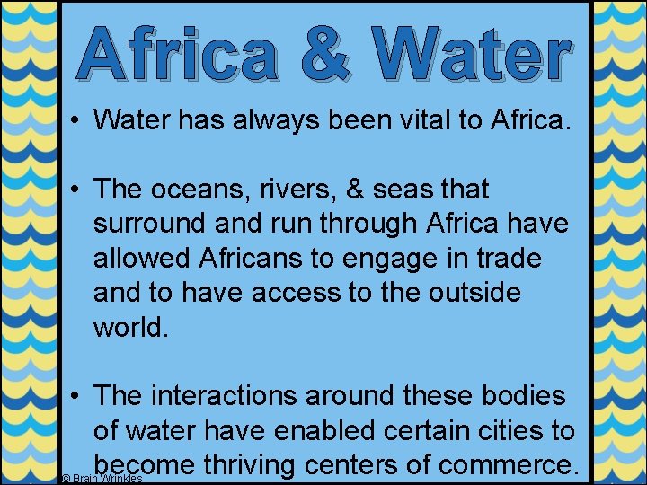
Africa & Water • Water has always been vital to Africa. • The oceans, rivers, & seas that surround and run through Africa have allowed Africans to engage in trade and to have access to the outside world. • The interactions around these bodies of water have enabled certain cities to become thriving centers of commerce. © Brain Wrinkles
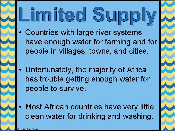
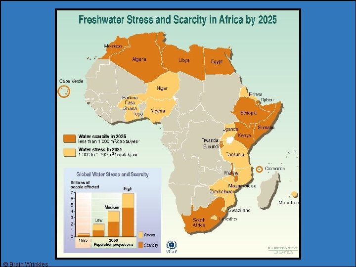
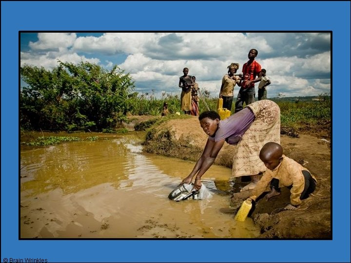
Limited Supply • Countries with large river systems have enough water for farming and for people in villages, towns, and cities. • Unfortunately, the majority of Africa has trouble getting enough water for people to survive. • Most African countries have very little clean water for drinking and washing. © Brain Wrinkles
© Brain Wrinkles
© Brain Wrinkles
Diseases • Clean water is needed for basic health and sanitation. • Lack of clean water to wash with increases the frequency of skin and eye infections. • People who are not able to have access to clean water are at risk for many water -borne diseases that spread by parasites living in standing water. © Brain Wrinkles
Clean Up • Overpopulation and poor sanitation regulations have made life along Africa’s water sources difficult. • Some countries in Africa have tried to improve their economies by building factories. • Unfortunately, government officials often ignore the industrial wastes that are being flushed into rivers and streams as long as the factories are profitable. © Brain Wrinkles
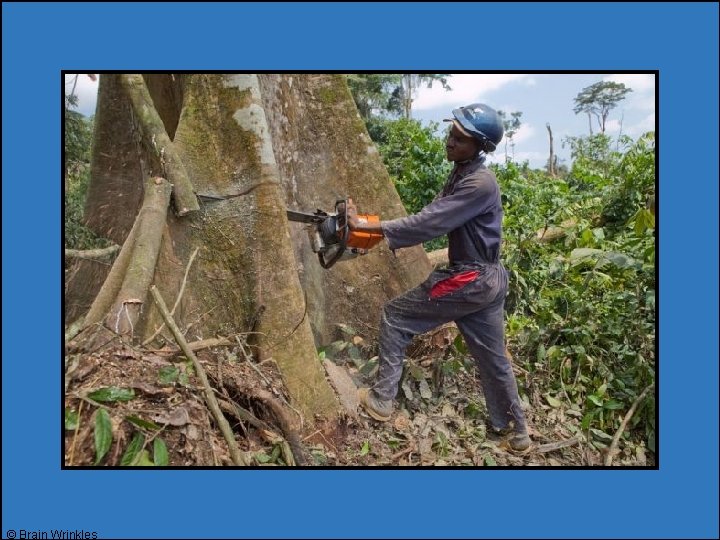
Deforestation • As Africa’s population increases and nations try to develop economically, deforestation has become a growing concern. • Deforestation is the process of forests being destroyed to make way for human development. • Deforestation is a major issue in many African nations. © Brain Wrinkles
© Brain Wrinkles
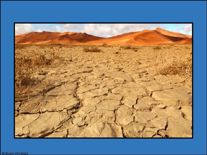
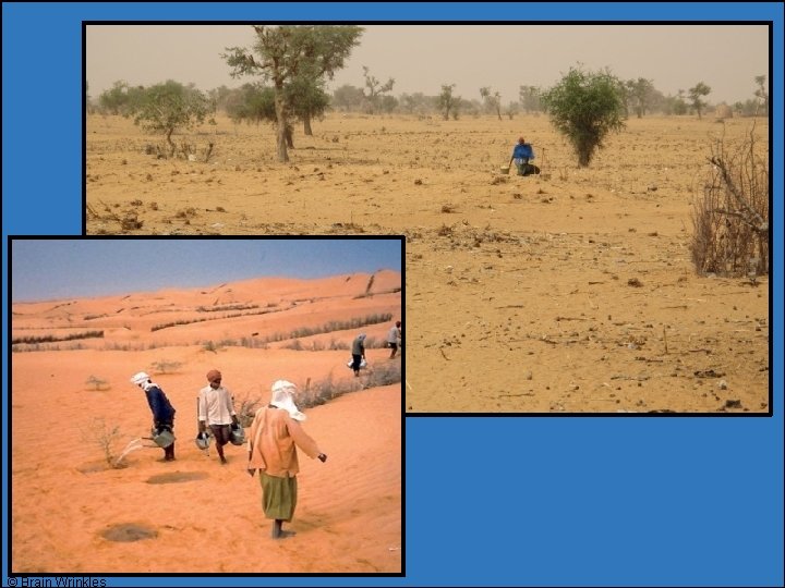
Desertification • The Sahel is one part of Africa that is experiencing severe problems with desertification, the process of the desert expanding into areas that had formerly been farmland. • As the land is overused, the soil becomes poor and powdery. • The winds coming from the Sahara gradually blow the dry topsoil away, leaving a barren and rocky land that loses its ability to hold water. © Brain Wrinkles
© Brain Wrinkles
Growing Desert • A majority of the desertification is the result of the actions of people rather than climate. • Desertification in Africa is caused by: • Poor farming practices. • People cutting down the trees that help hold the soil in place. • Animals being allowed to graze too heavily in an area and stripping all of the vegetation from the soil. • Draining the surface & underground water for industrial & home use. © Brain Wrinkles
© Brain Wrinkles
STANDARDS: SS 7 G 1 Locate selected features of Africa. a. Locate on a world and regional politicalphysical map: Sahara, Sahel, savanna, tropical rain forest, Congo River, Niger River, Nile River, Lake Victoria, Great Rift Valley, Mt. Kilimanjaro, Atlas Mountains, and Kalahari Desert. b. Locate on a world and regional politicalphysical map the countries of Democratic Republic of the Congo, Egypt, Kenya, Nigeria, South Africa, and Sudan © Brain Wrinkles
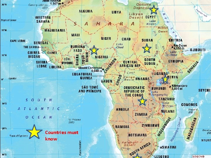
Countries must know
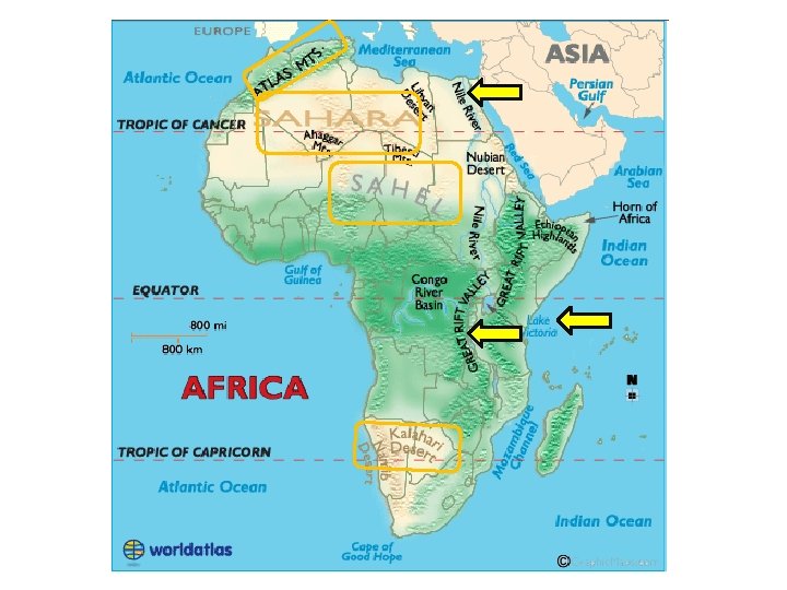
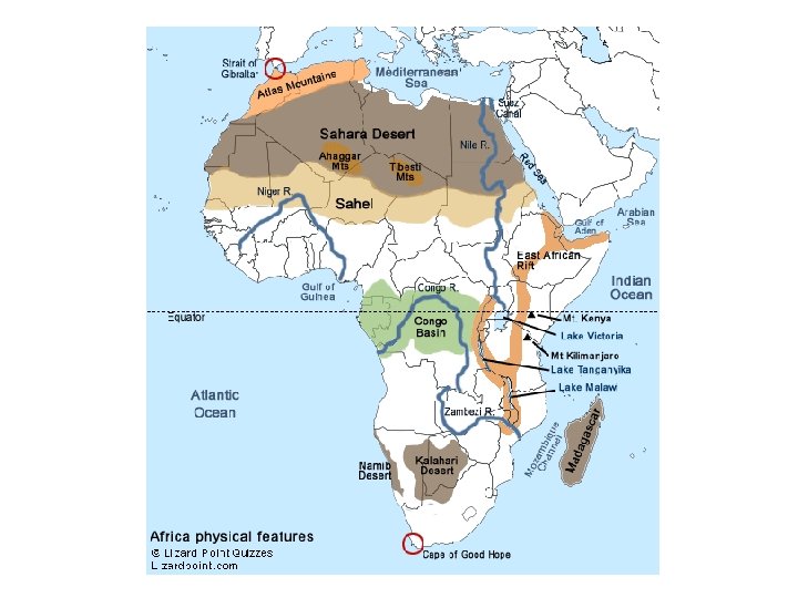
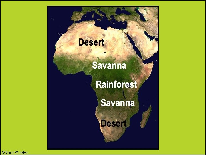
© Brain Wrinkles
African Geography Click link to open powerpoint
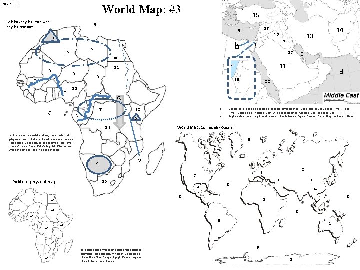
10 -28 -19 World Map: #3 15 a Political-physical map with physical features a u P P R R M M g 83 C N 82 a. x b. d cc Locate on a world and regional political-physical map: Euphrates River, Jordan River, Tigris River, Suez Canal, Persian Gulf, Straight of Hormuz, Arabian Sea, and Red Sea. Afghanistan, Iraq, Israel, Kuwait, Saudi Arabia, Syria, Turkey, Gaza Strip, and West Bank. World Map: Continents/ Oceans a. Locate on a world and regional politicalphysical map: Sahara, Sahel, savanna, tropical rain forest, Congo River, Niger River, Nile River, Lake Victoria, Great Rift Valley, Mt. Kilimanjaro, Atlas Mountains, and Kalahari Desert. B V S 85 C A a 9 8 10 D 80 2 4 7 D 3 E 81 83 6 85 k 11 16 84 84 e Q T N Political-physical map h 17 a L 14 13 80 81 R 12 b L f 18 1 82 b. Locate on a world and regional politicalphysical map the countries of Democratic Republic of the Congo, Egypt, Kenya, Nigeria, South Africa, and Sudan. F 5
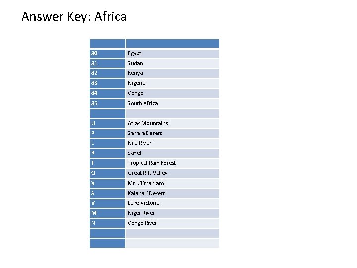
Answer Key: Africa 80 Egypt 81 Sudan 82 Kenya 83 Nigeria 84 Congo 85 South Africa U Atlas Mountains P Sahara Desert L Nile River R Sahel T Tropical Rain Forest Q Great Rift Valley X Mt Kilimanjaro S Kalahari Desert V Lake Victoria M Niger River N Congo River
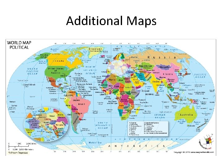
Additional Maps
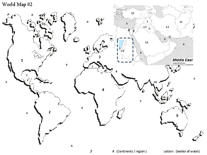
World Map #2 15 D D f k e 13 g 11 12 h d 14 j 3 1 B 16 c a b F 8 E A A 10 4 10 C A B 2 6 G 7 # (Continents / region ) Letters (bodies of water)
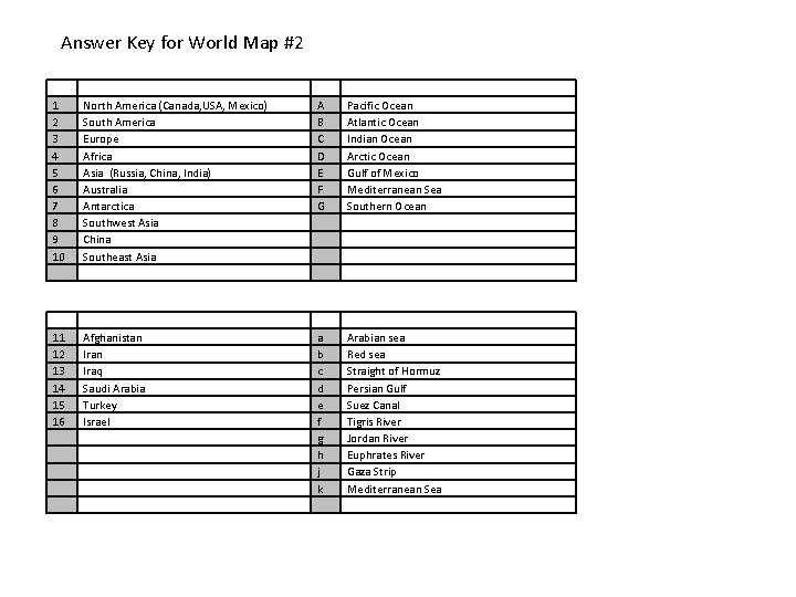
Answer Key for World Map #2 1 2 3 4 5 6 7 8 9 10 North America (Canada, USA, Mexico) South America Europe Africa Asia (Russia, China, India) Australia Antarctica Southwest Asia China Southeast Asia A B C D E F G Pacific Ocean Atlantic Ocean Indian Ocean Arctic Ocean Gulf of Mexico Mediterranean Sea Southern Ocean 11 12 13 14 15 16 Afghanistan Iraq Saudi Arabia Turkey Israel a b c d e f g h j k Arabian sea Red sea Straight of Hormuz Persian Gulf Suez Canal Tigris River Jordan River Euphrates River Gaza Strip Mediterranean Sea
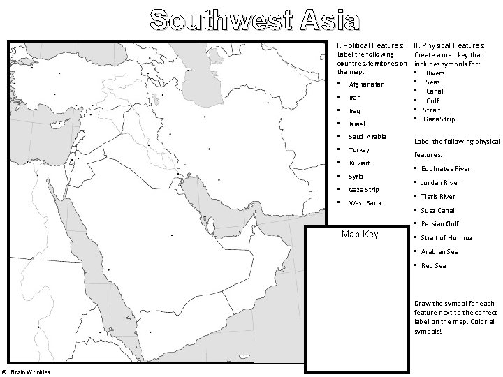
Southwest Asia I. Political Features: Label the following countries/territories on the map: • Afghanistan • Iraq • Israel • Saudi Arabia • Turkey • Kuwait • Syria • Gaza Strip • West Bank II. Physical Features: Create a map key that includes symbols for: • Rivers • Seas • Canal • Gulf • Strait • Gaza Strip Label the following physical features: • Euphrates River • Jordan River • Tigris River • Suez Canal • Persian Gulf Map Key • Strait of Hormuz • Arabian Sea • Red Sea Draw the symbol for each feature next to the correct label on the map. Color all symbols! © Brain Wrinkles
- Slides: 30