
Weathering Erosion Deposition Landscapes Breaking down rocks Moving
Weathering, Erosion, Deposition, & Landscapes Breaking down rocks… Moving those sediments to new places… Leaving the sediments behind. New features, new landscapes…
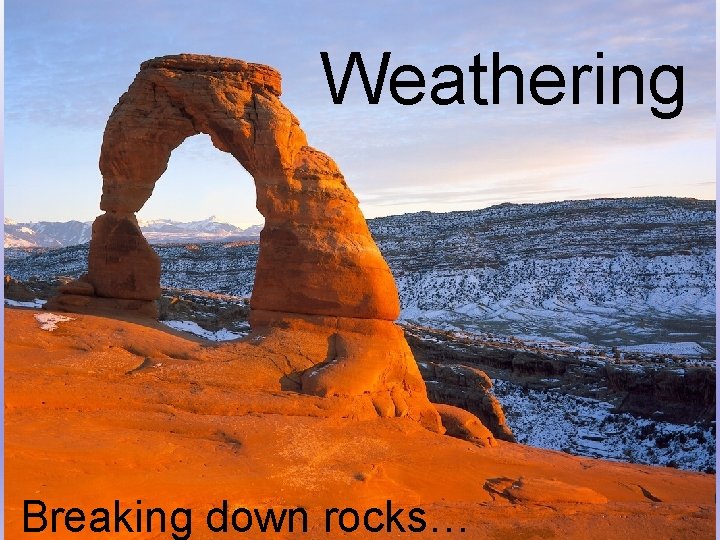
Weathering Breaking down rocks…

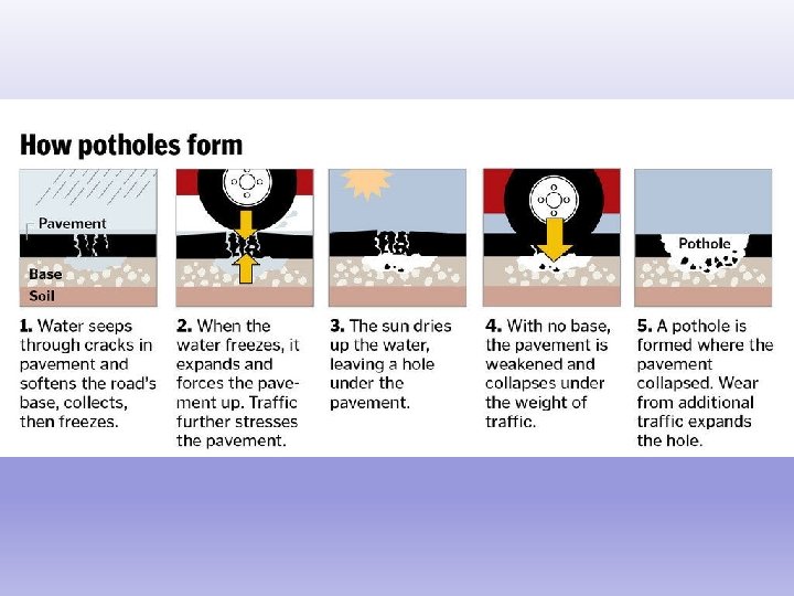
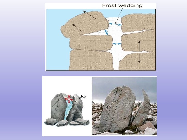
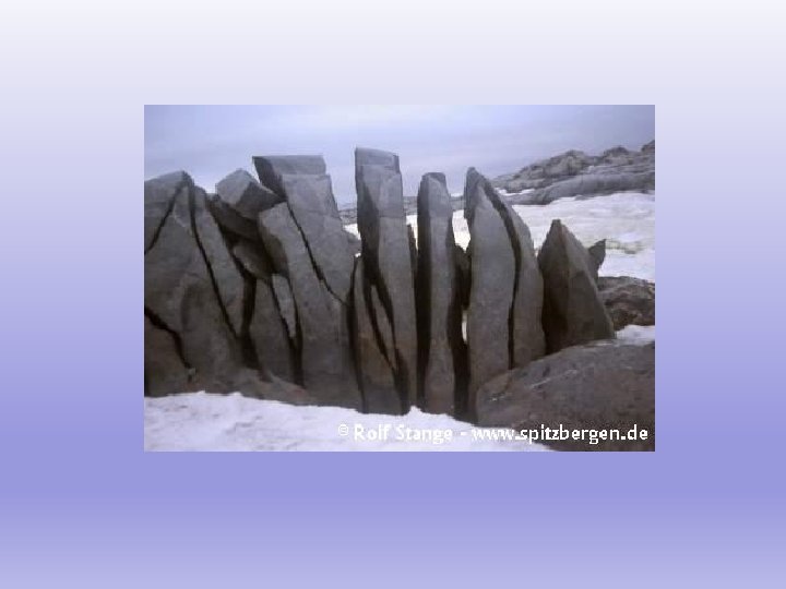
Physical weathering— the breakdown of rock WITHOUT changing its chemical composition Examples: Frost Action— when water freezes, it expands so when water freezes in a crack in the rock the crack gets bigger. This is how potholes form.
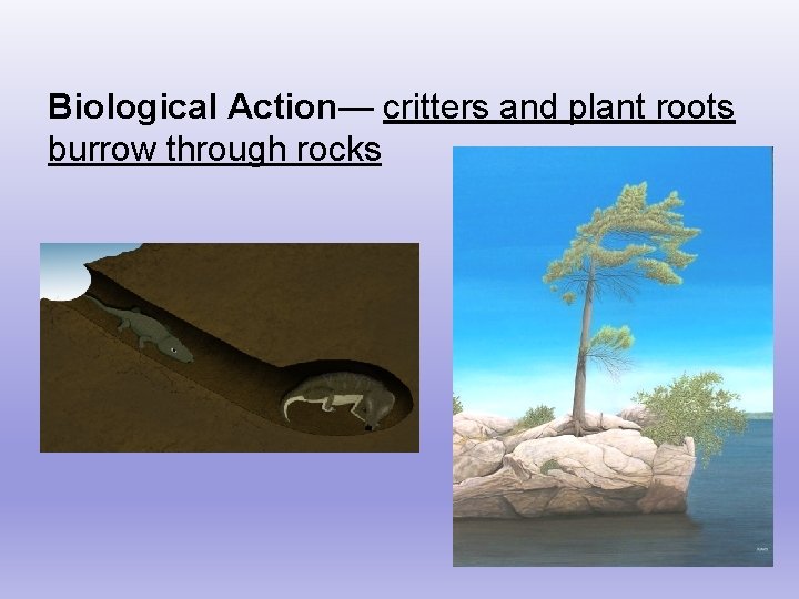
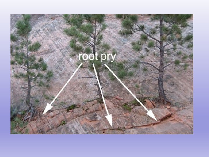
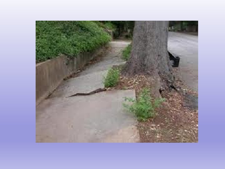
Biological Action— critters and plant roots burrow through rocks
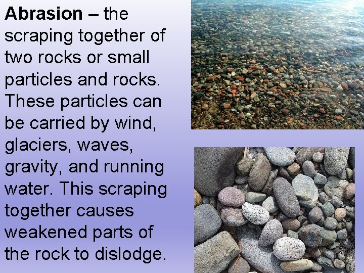
Abrasion – the scraping together of two rocks or small particles and rocks. These particles can be carried by wind, glaciers, waves, gravity, and running water. This scraping together causes weakened parts of the rock to dislodge.
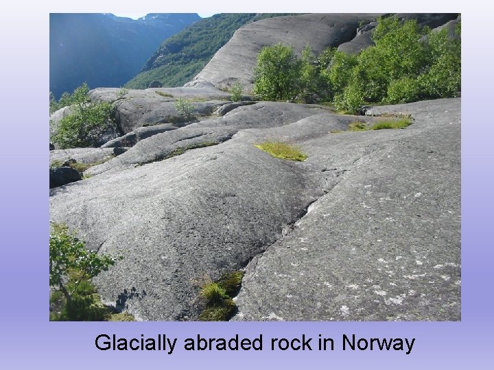
Glacially abraded rock in Norway
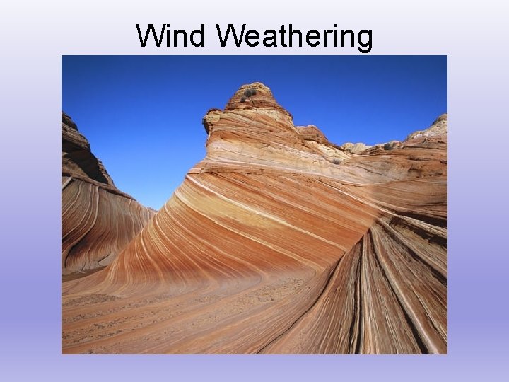
Wind Weathering
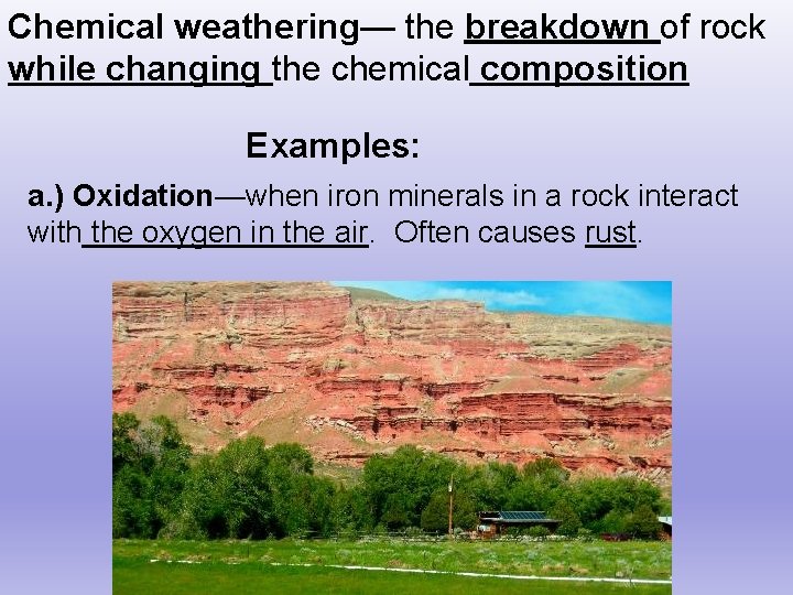
Chemical weathering— the breakdown of rock while changing the chemical composition Examples: a. ) Oxidation—when iron minerals in a rock interact with the oxygen in the air. Often causes rust.
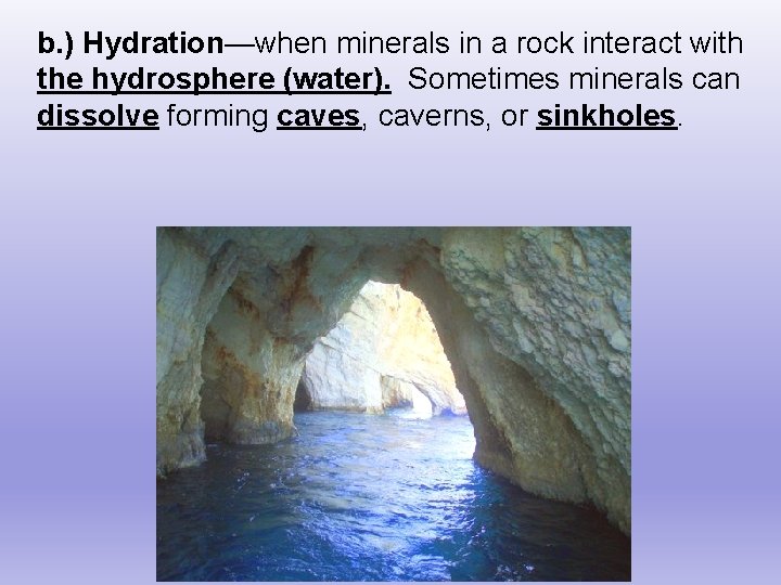
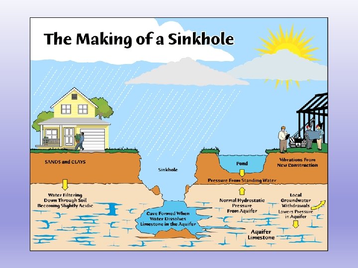
b. ) Hydration—when minerals in a rock interact with the hydrosphere (water). Sometimes minerals can dissolve forming caves, caverns, or sinkholes.
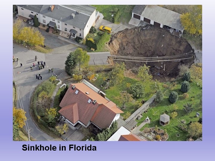
Sinkhole in Florida
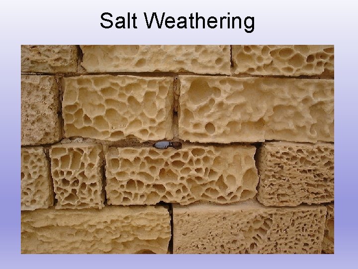
Salt Weathering
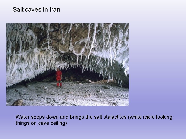
Salt caves in Iran Water seeps down and brings the salt stalactites (white icicle looking things on cave ceiling)
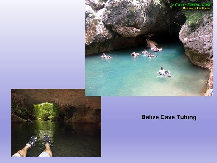
Belize Cave Tubing
Factors that Affect Rate of Weathering 1. ) Mineral Composition—some minerals are more resistant to weathering. Harder minerals weather slower than soft minerals. 2. ) Particle Size—The smaller the particles, the faster it will weather Smaller particles = MORE surface area = MORE weathering!
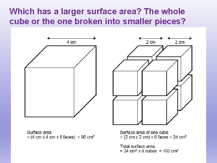
Which has a larger surface area? The whole cube or the one broken into smaller pieces?
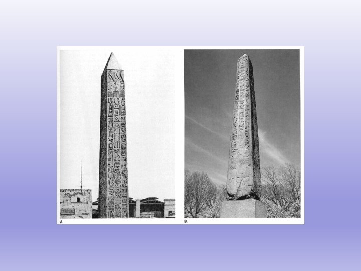
Factors that Affect Rate of Weathering 3. ) Climate: Temperature: Warmer temperatures cause a faster weathering rate. Chemical weathering occurs more in warm, humid climates Hint: You WILL need to memorize this!!!
What is soil? The top layer of the earth's surface consisting of weathered rock and mineral particles mixed with humus and having the capability of retaining water in pore spaces. Humus– decayed organic matter Pore space—the empty space between mineral particles
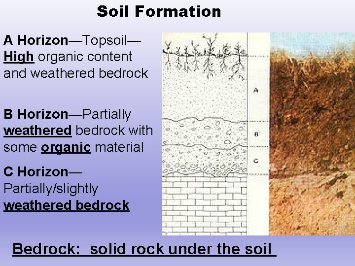
Soil Formation A Horizon—Topsoil— High organic content and weathered bedrock B Horizon—Partially weathered bedrock with some organic material C Horizon— Partially/slightly weathered bedrock Bedrock: solid rock under the soil
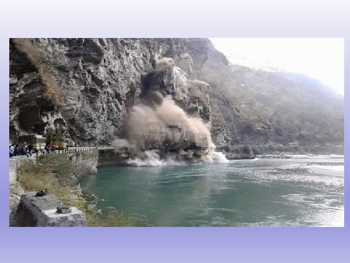
Erosion—the removal of sediment The 4 natural agents of erosion are: §Gravity §Glaciers § Wind § Water (includes running water, waves, & currents)
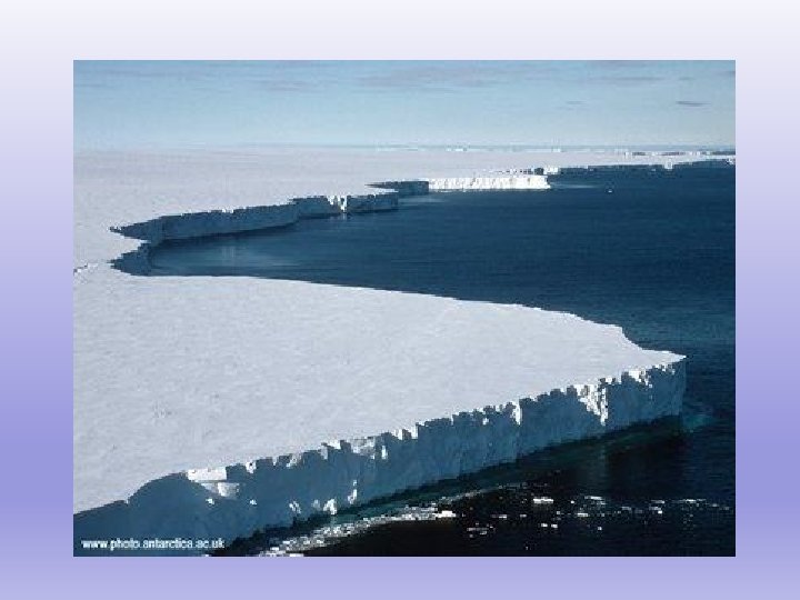
Glaciers • A large amount of ice that is constantly moving under its own weight. • A glacier forms when there is more snow falling over time than melting (happens over hundreds of years) • Glaciers move slowly due to their own weight (they flow) • Abrade rock and debris underneath of them, moving it in the direction they are flowing.
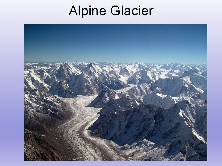
Alpine Glacier
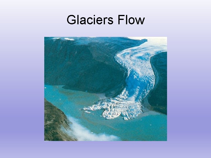
Glaciers Flow
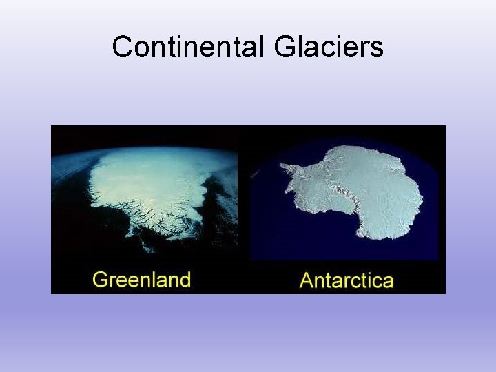
Continental Glaciers
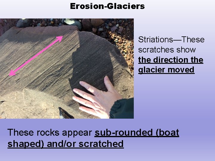
Erosion-Glaciers Striations—These scratches show the direction the glacier moved These rocks appear sub-rounded (boat shaped) and/or scratched
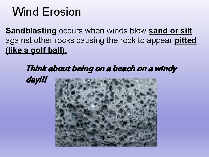
Wind Erosion Sandblasting occurs when winds blow sand or silt against other rocks causing the rock to appear pitted (like a golf ball). Think about being on a beach on a windy day!!!
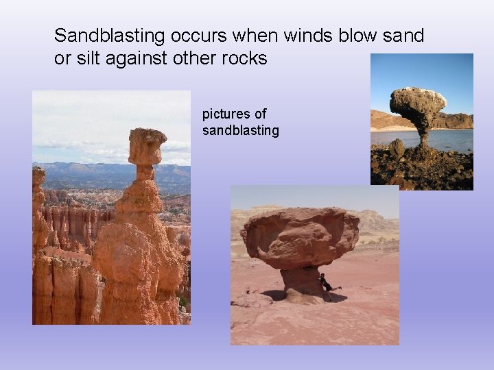
Sandblasting occurs when winds blow sand or silt against other rocks pictures of sandblasting
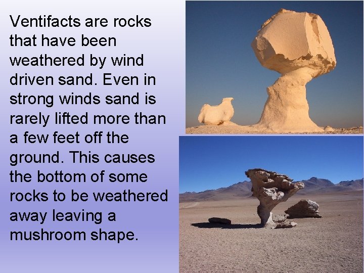
Ventifacts are rocks that have been weathered by wind driven sand. Even in strong winds sand is rarely lifted more than a few feet off the ground. This causes the bottom of some rocks to be weathered away leaving a mushroom shape.
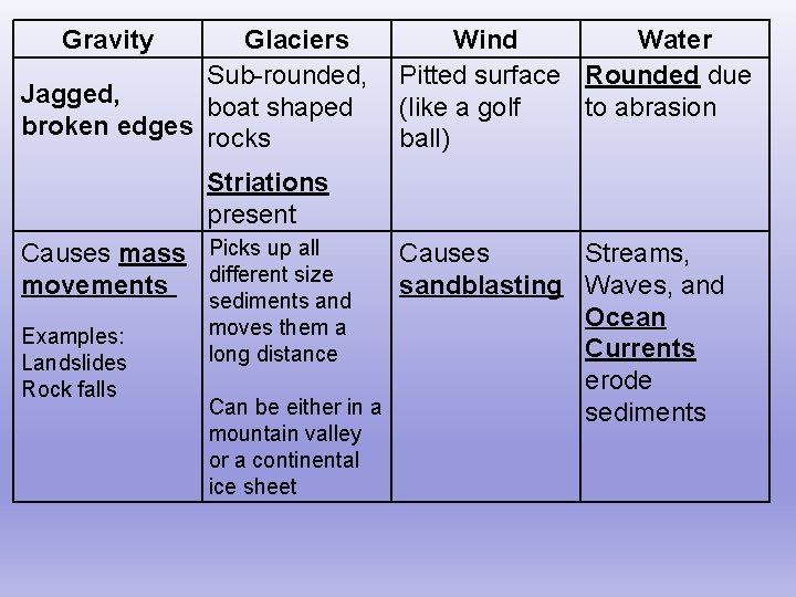
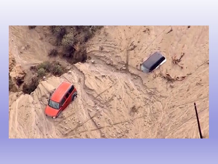
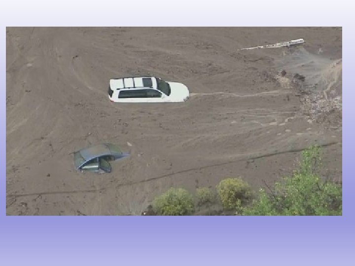
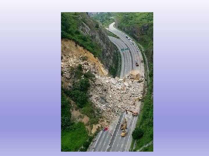
Gravity Glaciers Sub-rounded, Jagged, boat shaped broken edges rocks Wind Water Pitted surface Rounded due (like a golf to abrasion ball) Striations present Causes mass Picks up all different size movements Examples: Landslides Rock falls Causes Streams, sandblasting Waves, and sediments and Ocean moves them a Currents long distance erode Can be either in a sediments mountain valley or a continental ice sheet
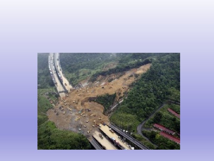
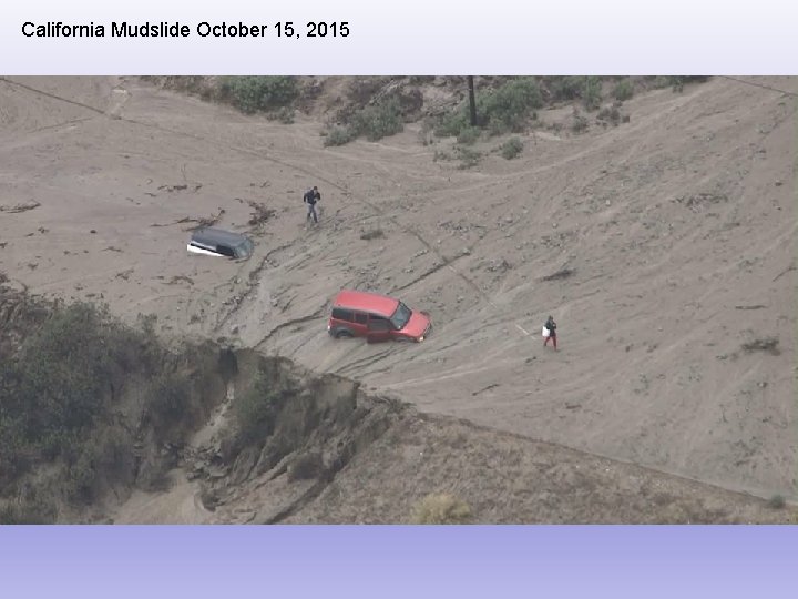
California Mudslide October 15, 2015
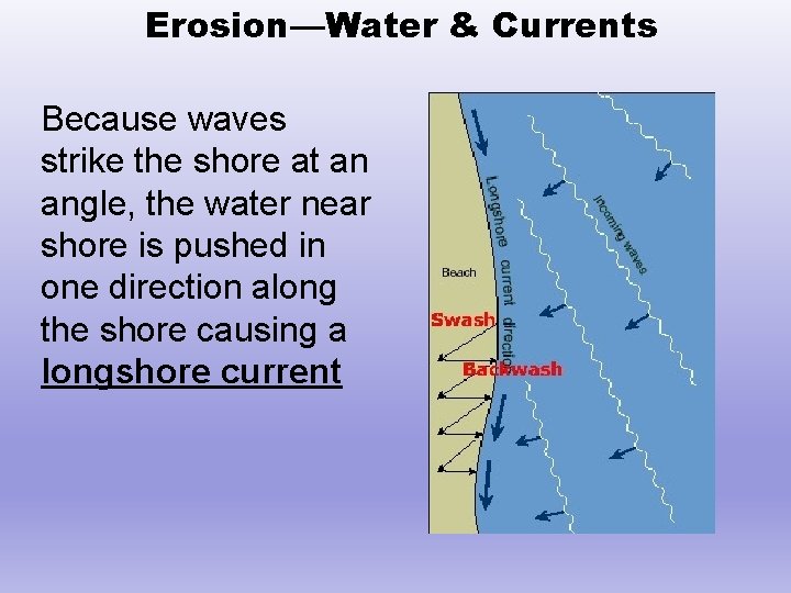
Erosion—Water & Currents Because waves strike the shore at an angle, the water near shore is pushed in one direction along the shore causing a longshore current
Factors that Affect Stream Velocity Discharge— the volume (amount of water) the stream carries over time
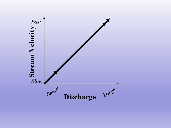
Stream Velocity Fast Slow S ll a m Discharge L e g r a
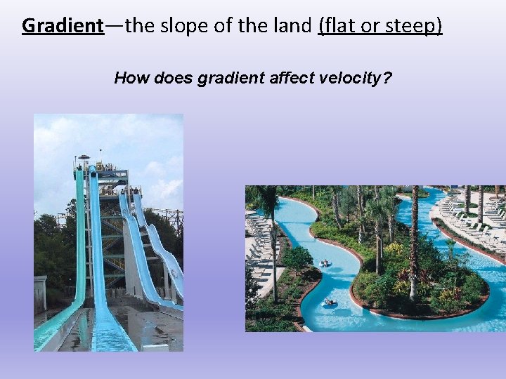
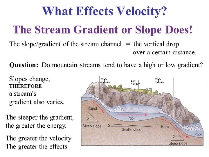
Gradient—the slope of the land (flat or steep) How does gradient affect velocity?
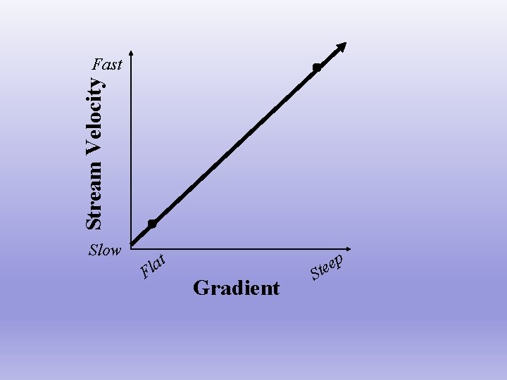
Stream Velocity Fast Slow at l F Gradient p e e St
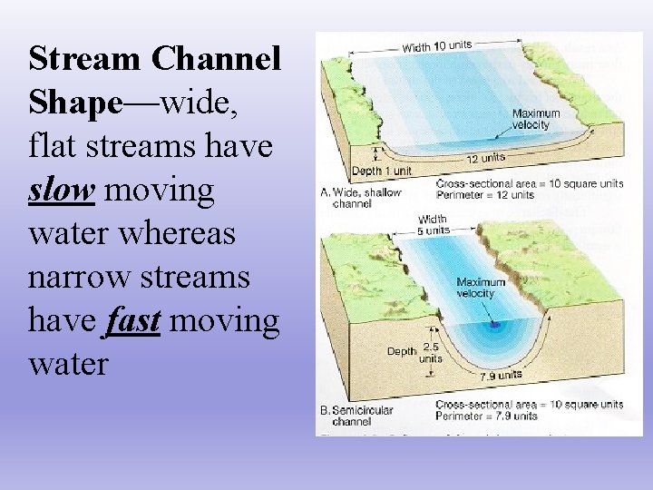
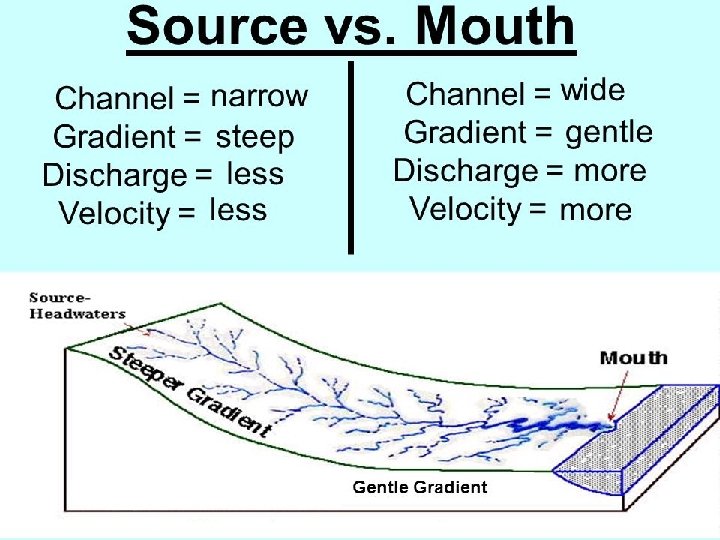
Stream Channel Shape—wide, flat streams have slow moving water whereas narrow streams have fast moving water
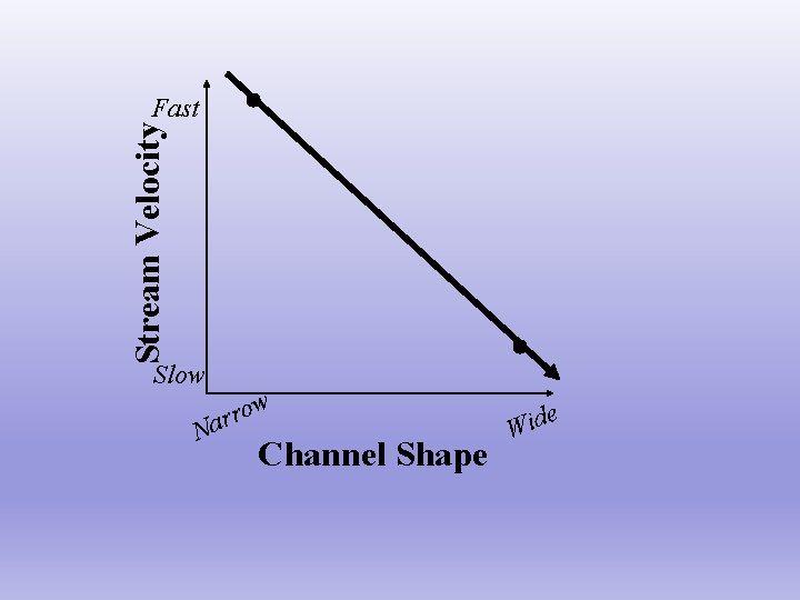
Stream Velocity Fast Slow w ro r a N Channel Shape e Wid
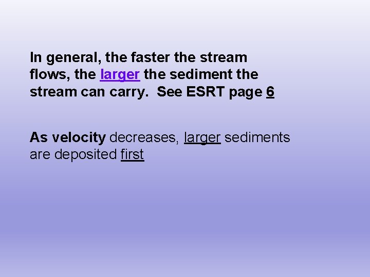
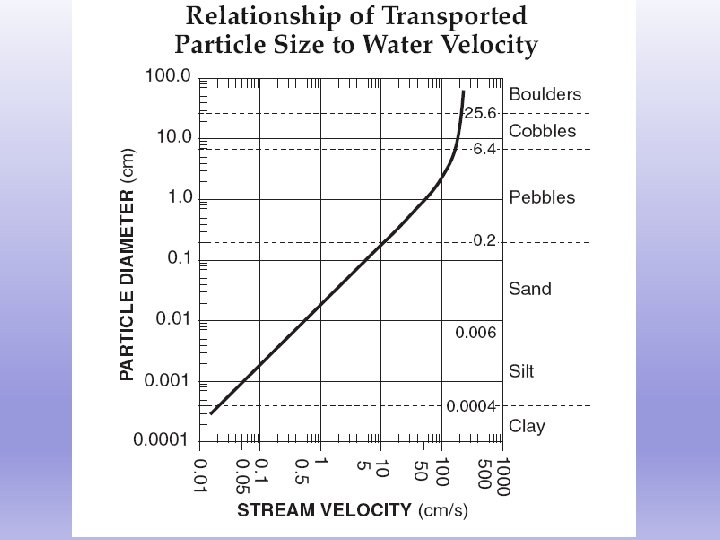
In general, the faster the stream flows, the larger the sediment the stream can carry. See ESRT page 6 As velocity decreases, larger sediments are deposited first
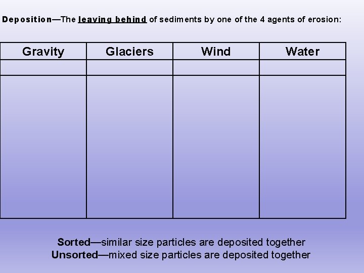
Deposition—The leaving behind of sediments by one of the 4 agents of erosion: Gravity Glaciers Wind Water Sorted—similar size particles are deposited together Unsorted—mixed size particles are deposited together
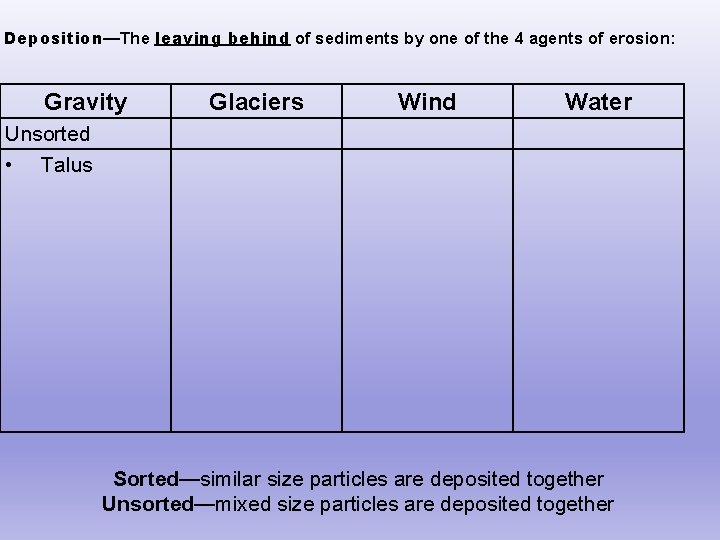
Deposition—The leaving behind of sediments by one of the 4 agents of erosion: Gravity Glaciers Wind Water Unsorted • Talus Sorted—similar size particles are deposited together Unsorted—mixed size particles are deposited together
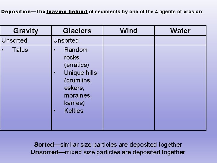
Deposition—The leaving behind of sediments by one of the 4 agents of erosion: Gravity Unsorted • Talus Glaciers Wind Water Unsorted • Random rocks (erratics) • Unique hills (drumlins, eskers, moraines, kames) • Kettles Sorted—similar size particles are deposited together Unsorted—mixed size particles are deposited together
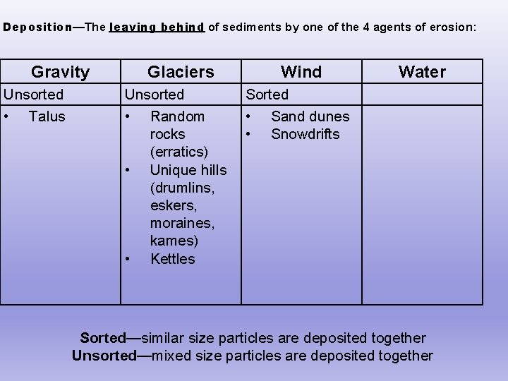
Deposition—The leaving behind of sediments by one of the 4 agents of erosion: Gravity Unsorted • Talus Glaciers Unsorted • Random rocks (erratics) • Unique hills (drumlins, eskers, moraines, kames) • Kettles Wind Water Sorted • Sand dunes • Snowdrifts Sorted—similar size particles are deposited together Unsorted—mixed size particles are deposited together
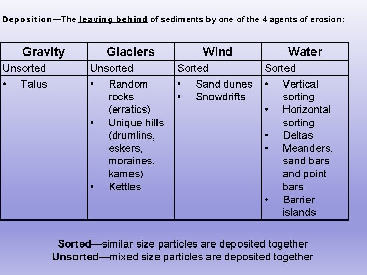
Deposition—The leaving behind of sediments by one of the 4 agents of erosion: Gravity Unsorted • Talus Glaciers Unsorted • Random rocks (erratics) • Unique hills (drumlins, eskers, moraines, kames) • Kettles Wind Sorted • Sand dunes • Snowdrifts Water Sorted • Vertical sorting • Horizontal sorting • Deltas • Meanders, sand bars and point bars • Barrier islands Sorted—similar size particles are deposited together Unsorted—mixed size particles are deposited together
Deposition—leaving behind of sediments (by one of the agents of erosion) due to: Density—sediments with greater density are deposited first Shape of sediment—round sediments are deposited before flat ones
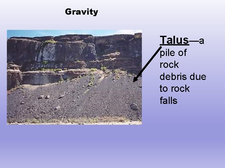
Gravity Talus—a pile of rock debris due to rock falls
Deposition-Glaciers As a glacier recedes (melts and retreats), it randomly deposits the rocks that were frozen in the ice (unsorted). Glaciers bring/deposit TRANSPORTED soils The way that glaciers deposit the sediments creates a unique landscape which we will discuss later in the unit
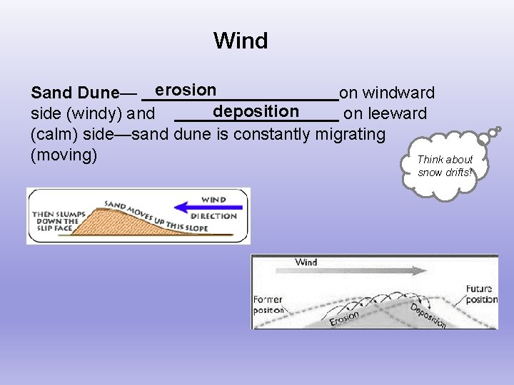
Wind Sand Dune— erosion on windward deposition side (windy) and on leeward (calm) side—sand dune is constantly migrating (moving) Think about snow drifts!
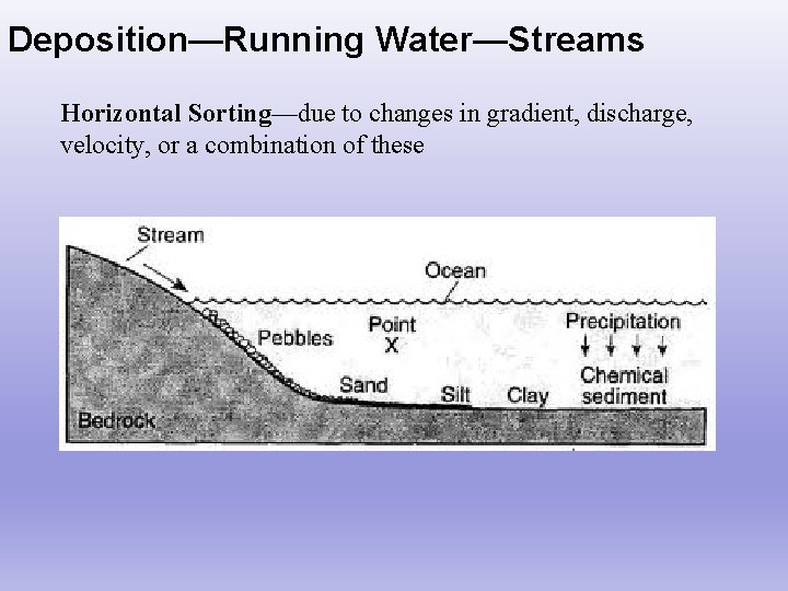
Deposition—Running Water—Streams Horizontal Sorting—due to changes in gradient, discharge, velocity, or a combination of these
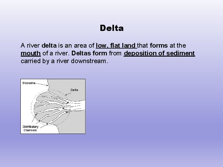
Delta A river delta is an area of low, flat land that forms at the mouth of a river. Deltas form from deposition of sediment carried by a river downstream.
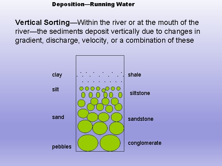
Deposition—Running Water Vertical Sorting—Within the river or at the mouth of the river—the sediments deposit vertically due to changes in gradient, discharge, velocity, or a combination of these clay silt sand pebbles . . shale siltstone sandstone conglomerate
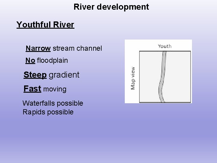
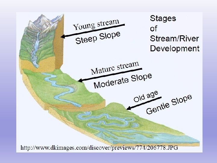
River development Youthful River Narrow stream channel No floodplain Steep gradient Fast moving Waterfalls possible Rapids possible
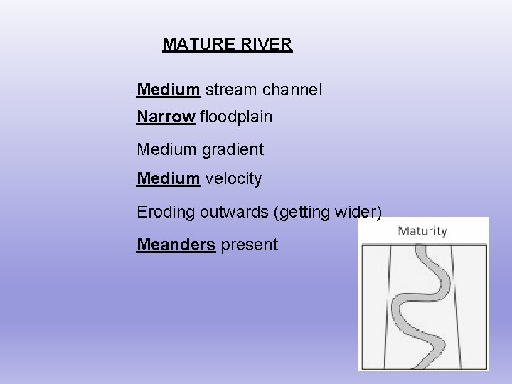
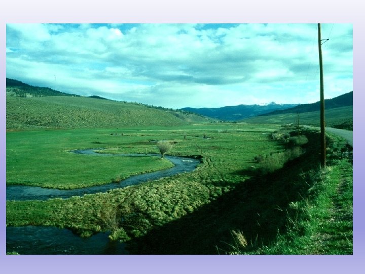
MATURE RIVER Medium stream channel Narrow floodplain Medium gradient Medium velocity Eroding outwards (getting wider) Meanders present
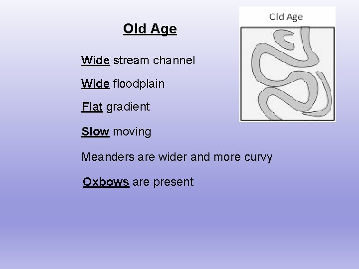
Old Age Wide stream channel Wide floodplain Flat gradient Slow moving Meanders are wider and more curvy Oxbows are present
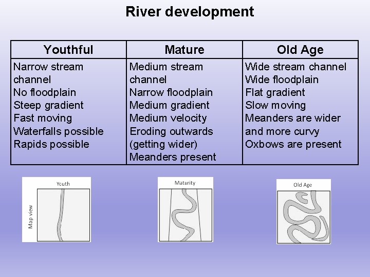
River development Youthful Narrow stream channel No floodplain Steep gradient Fast moving Waterfalls possible Rapids possible Mature Medium stream channel Narrow floodplain Medium gradient Medium velocity Eroding outwards (getting wider) Meanders present Old Age Wide stream channel Wide floodplain Flat gradient Slow moving Meanders are wider and more curvy Oxbows are present
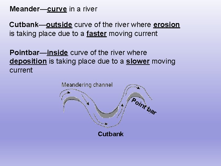
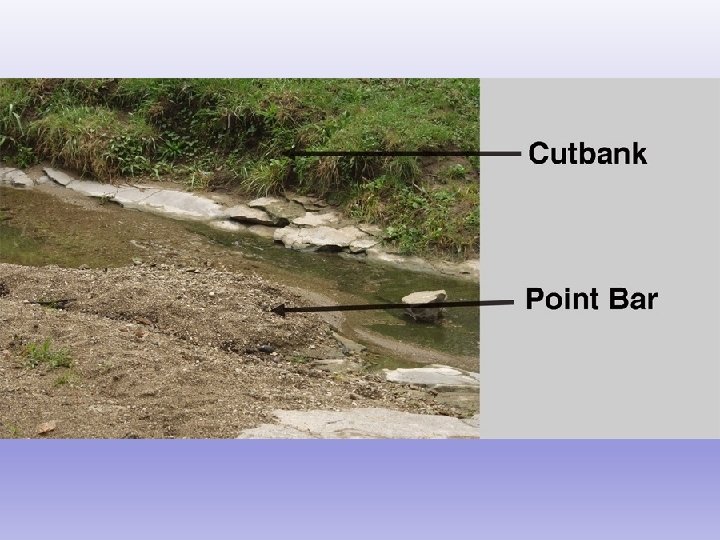
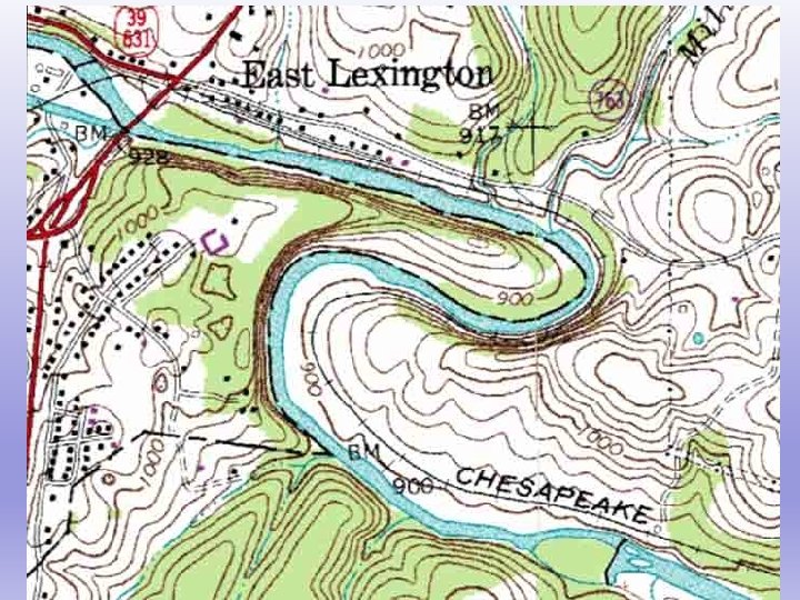
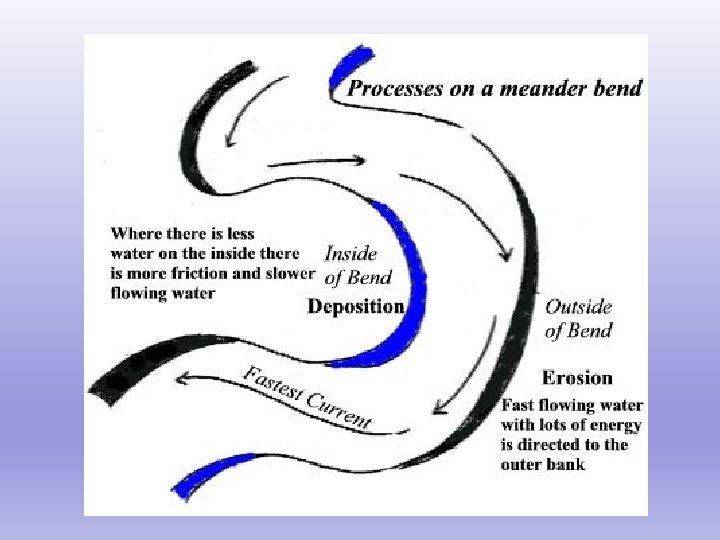
Meander—curve in a river Cutbank—outside curve of the river where erosion is taking place due to a faster moving current Pointbar—inside curve of the river where deposition is taking place due to a slower moving current Po int Cutbank ba r
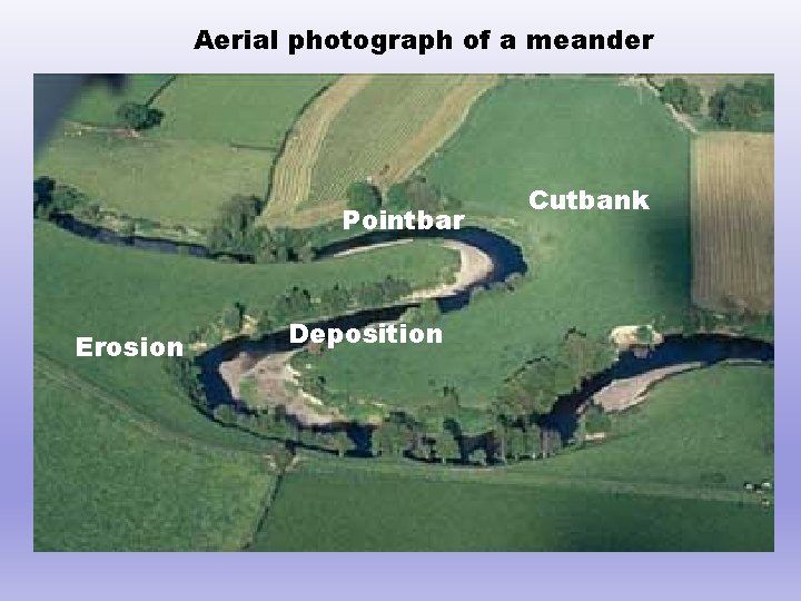
Aerial photograph of a meander Pointbar Erosion Deposition Cutbank
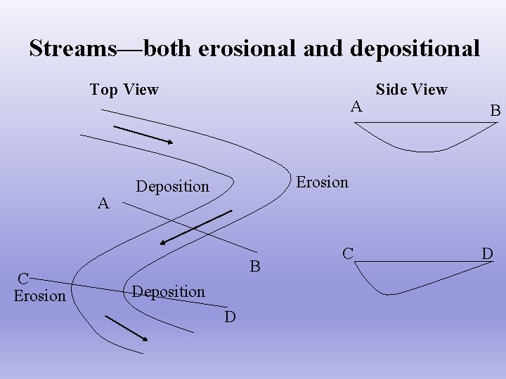
Streams—both erosional and depositional Top View A C Erosion A Side View B Erosion Deposition B Deposition D C D
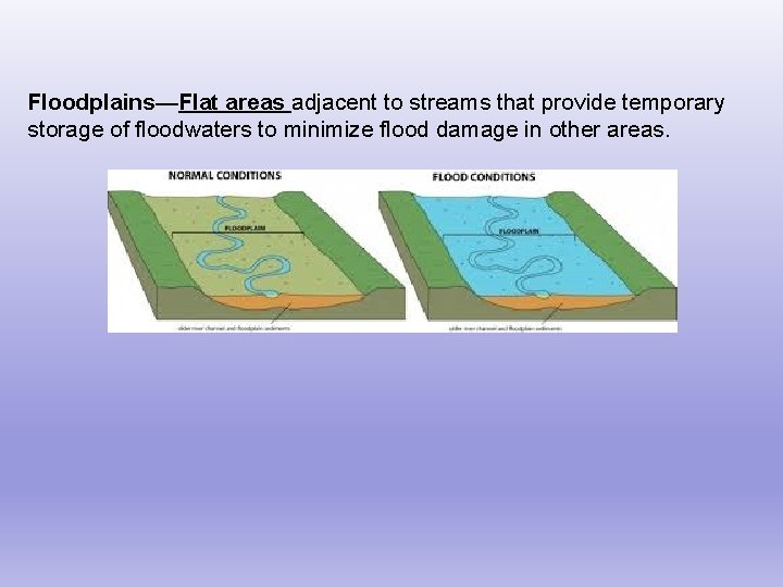
Floodplains—Flat areas adjacent to streams that provide temporary storage of floodwaters to minimize flood damage in other areas.
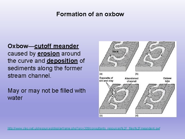
Formation of an oxbow Oxbow—cutoff meander caused by erosion around the curve and deposition of sediments along the former stream channel. May or may not be filled with water http: //www. cleo. net. uk/resources/displayframe. php? src=309/consultants_resources%2 F_files%2 Fmeander 4. swf
O e g a ld
Why are floods so dangerous? • Rapid currents occur quickly and sometimes unexpectedly • damages structures • ground beneath the flood waters becomes unstable
What causes a flood to occur? • high amounts of rainfall • already saturated ground • lots of rainfall upstream • rapid snowmelt • hurricanes • ice jam in a stream • frozen ground and rain
What should you do if there is a flood? §Don’t drive, swim, or walk through it! Even the shallowest water can have a pretty swift current and carry a car away §Climb a tree §Go to the highest point of your house and wait for help §Listen to the flood watches and warnings on TV/Radio… and FOLLOW their directions §Sandbagging can help, but may not stop the flood! §Prior to flood assemble a disaster supplies kit containing: first aid supplies, canned food, can opener, bottled water, rubber boots, battery powered radio, flashlight, and extra batteries
Landscapes Plain—low elevation, horizontal sedimentary rocks Plateau—medium elevation, horizontal sedimentary rocks Mountains—high elevation, distorted metamorphic rocks Open your ESRT to pages 2 and 3
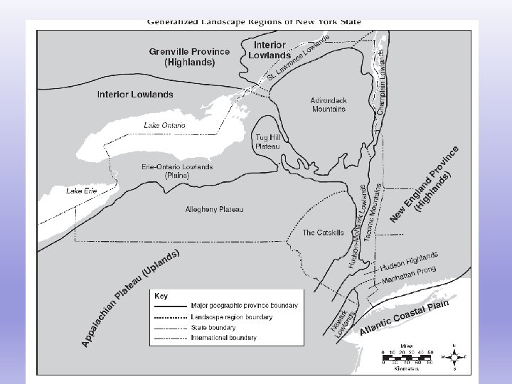
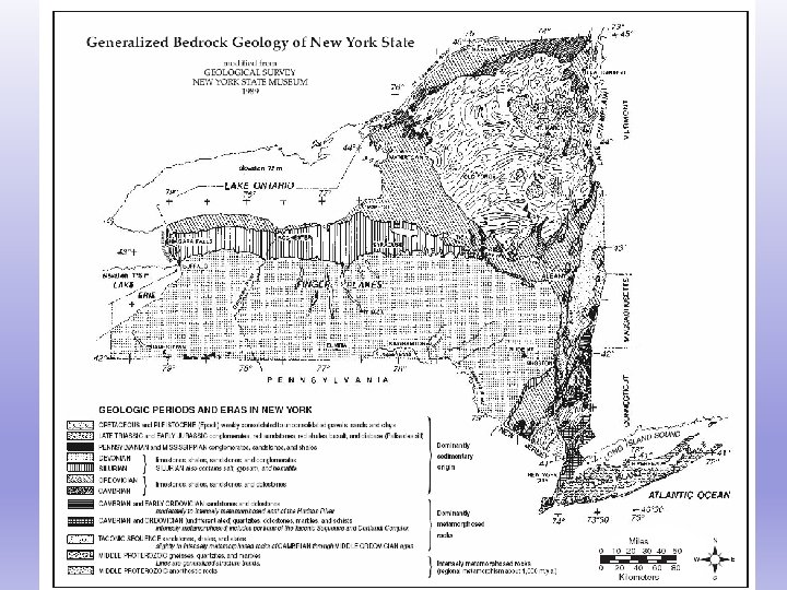
Why aren’t the Catskill Mountains really mountains? Use your ESRT pages 2 & 3!! §part of the Allegheny Plateau §they are sedimentary rocks §eroded to look like mountains
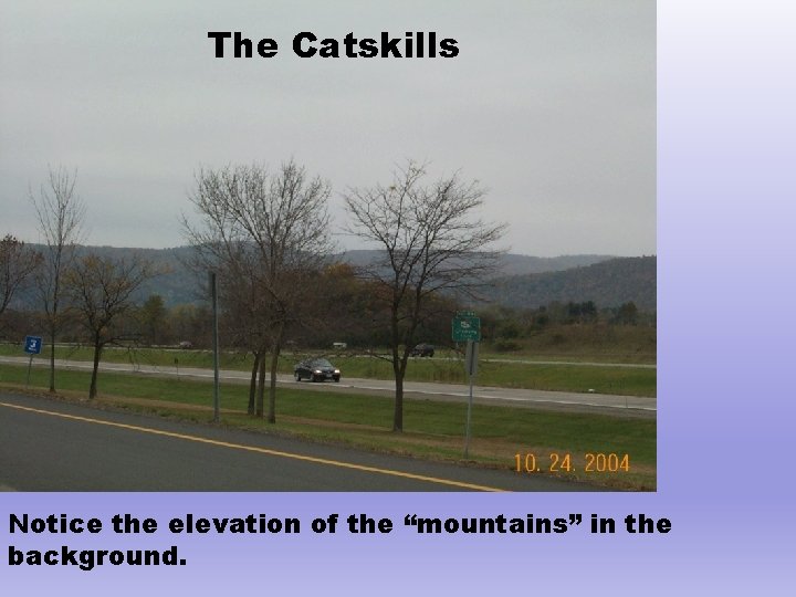
The Catskills Notice the elevation of the “mountains” in the background.
Landscapes Valley shapes are typically caused by one of two things: Rivers carve V-shaped valleys Glaciers carve U-Shaped valleys Climate shapes landscapes too * Humid climates create rounded hills
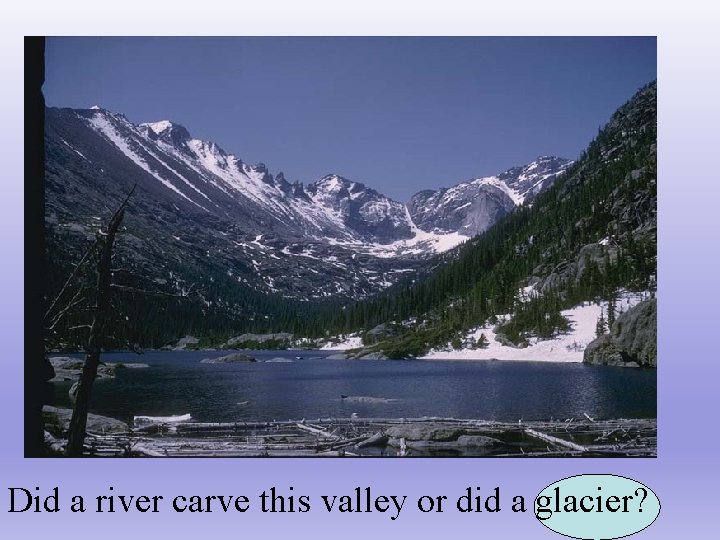
Did a river carve this valley or did a glacier?
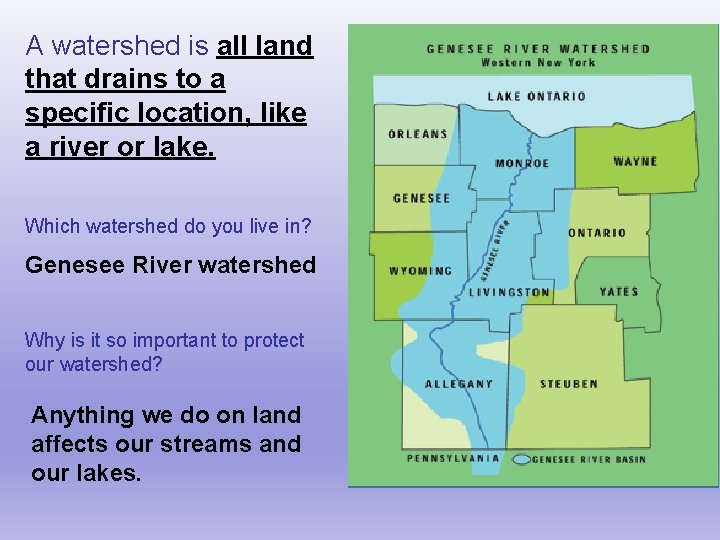
A watershed is all land that drains to a specific location, like a river or lake. Which watershed do you live in? Genesee River watershed Why is it so important to protect our watershed? Anything we do on land affects our streams and our lakes.
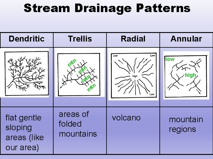
Stream Drainage Patterns Dendritic Trellis Radial Annular low tn m high tn m flat gentle sloping areas (like our area) areas of folded mountains volcano mountain regions
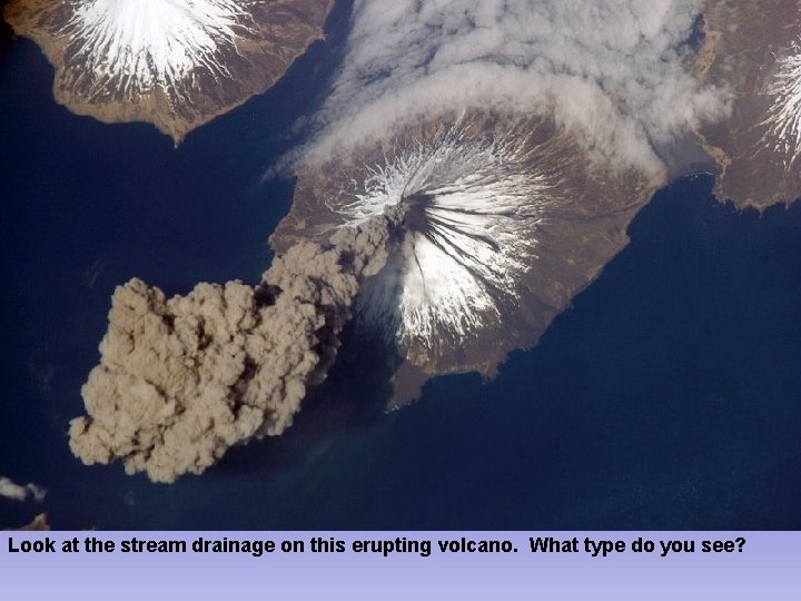
Look at the stream drainage on this erupting volcano. What type do you see?
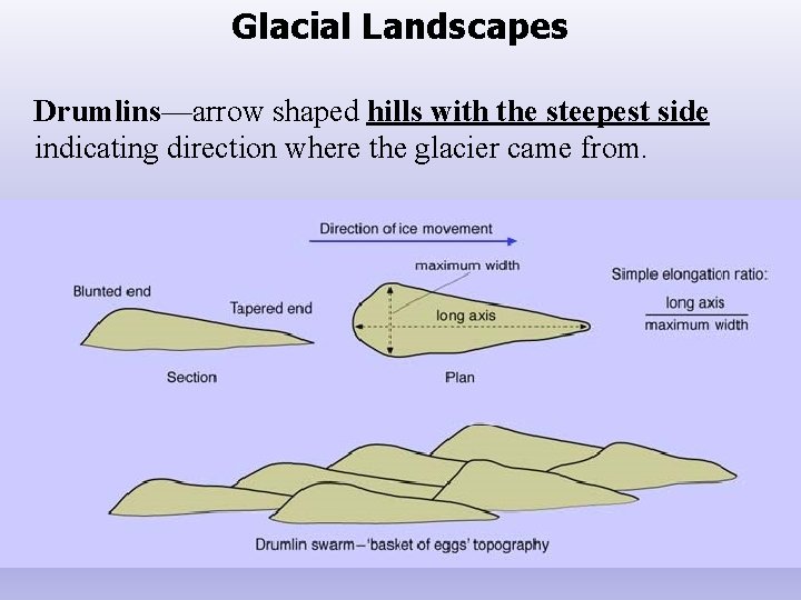
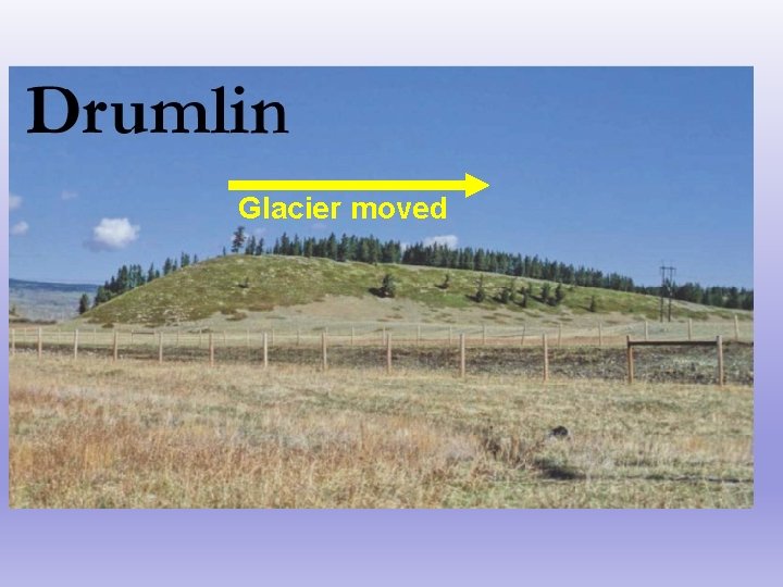
Glacial Landscapes Drumlins—arrow shaped hills with the steepest side indicating direction where the glacier came from.
Glacier moved
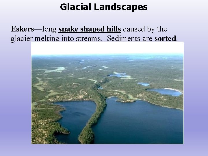
Glacial Landscapes Eskers—long snake shaped hills caused by the glacier melting into streams. Sediments are sorted.
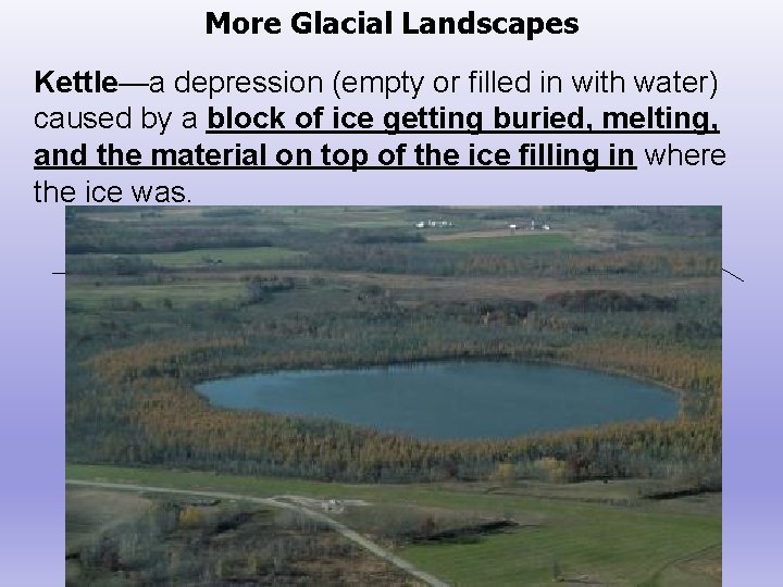
More Glacial Landscapes Kettle—a depression (empty or filled in with water) caused by a block of ice getting buried, melting, and the material on top of the ice filling in where the ice was. Ice Before After the ice melted
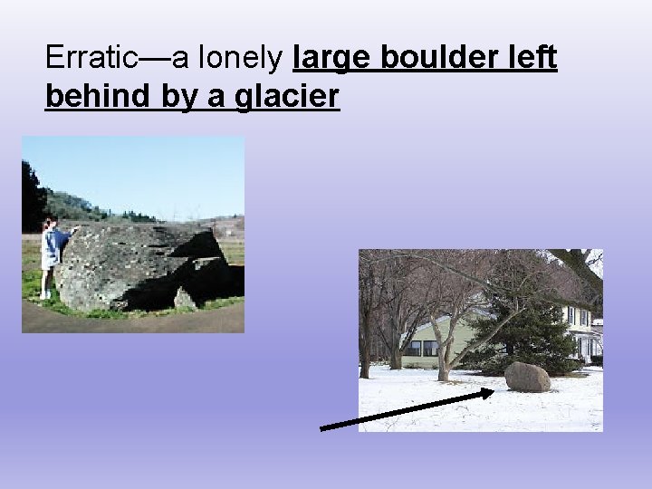
Erratic—a lonely large boulder left behind by a glacier
Look at the following pictures and determine the glacial feature you are looking at.
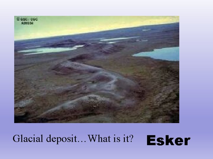
Glacial deposit…What is it? Esker
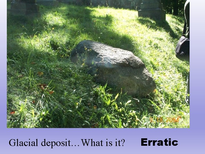
Glacial deposit…What is it? Erratic
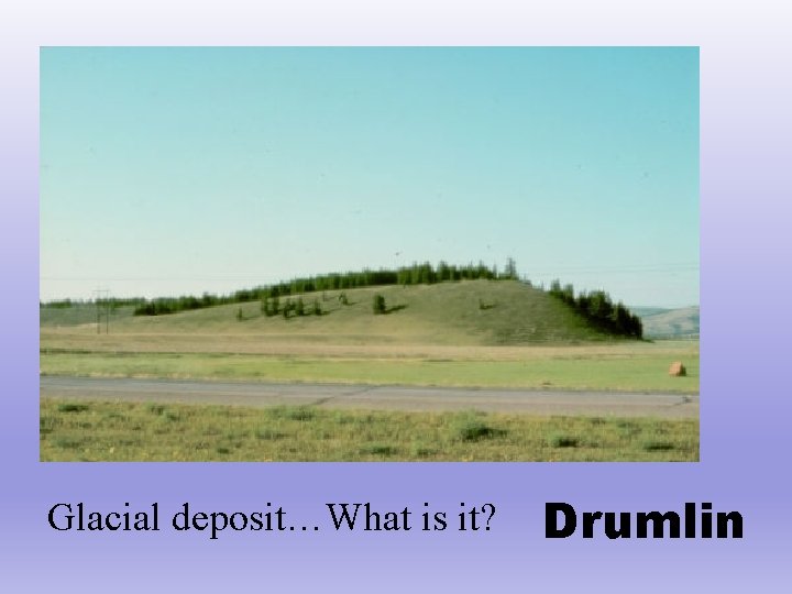
Glacial deposit…What is it? Drumlin
- Slides: 102