
Weather Prediction Center WPC 2014 Review Tony Fracasso
- Slides: 40
Weather Prediction Center (WPC) 2014 Review Tony Fracasso Acting Science and Operations Officer Contributions by Chris Bailey, Keith Brill, Jim Hayes, David Novak, Dan Petersen 2014 NCEP Production Suite Review
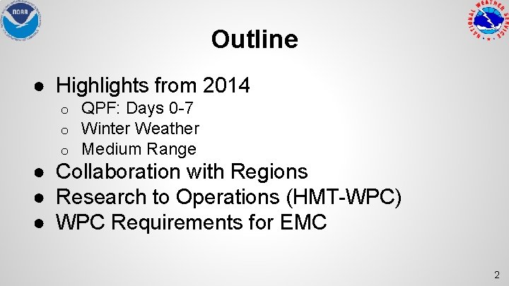
Outline ● Highlights from 2014 o o o QPF: Days 0 -7 Winter Weather Medium Range ● Collaboration with Regions ● Research to Operations (HMT-WPC) ● WPC Requirements for EMC 2
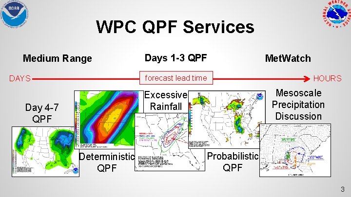
WPC QPF Services Medium Range Days 1 -3 QPF forecast lead time DAYS Deterministic QPF HOURS Mesoscale Precipitation Discussion Excessive Rainfall Day 4 -7 QPF Met. Watch Probabilistic QPF 3
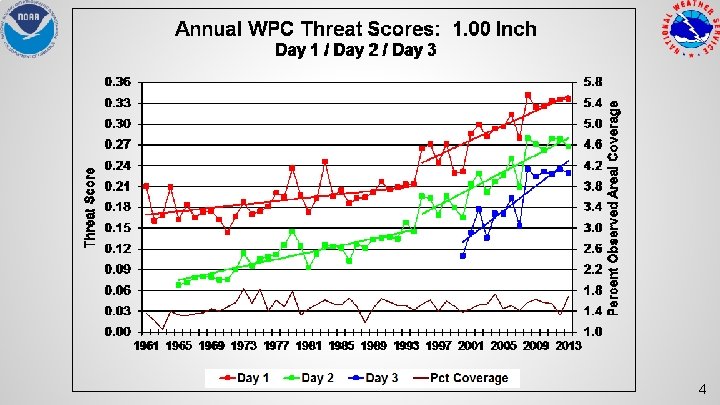
4
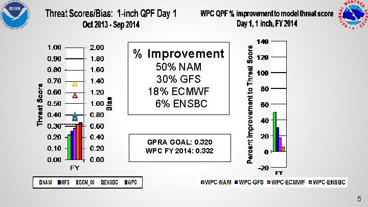
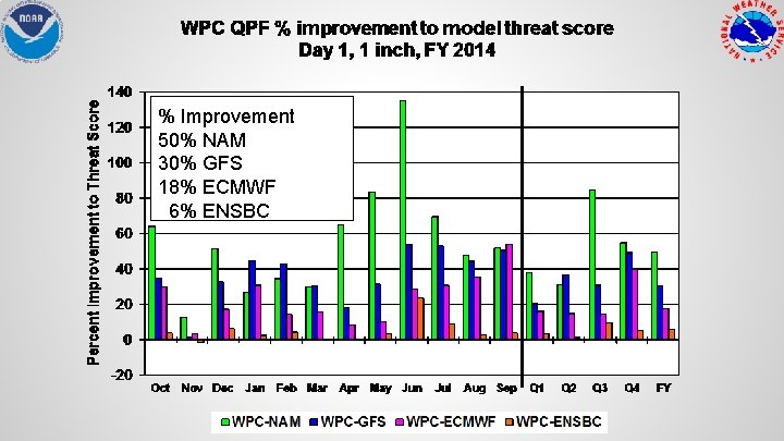
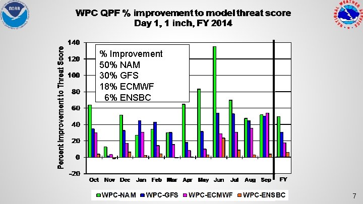
% Improvement 50% NAM 30% GFS 18% ECMWF 6% ENSBC GPRA GOAL: 0. 320 WPC FY 2014: 0. 332 5
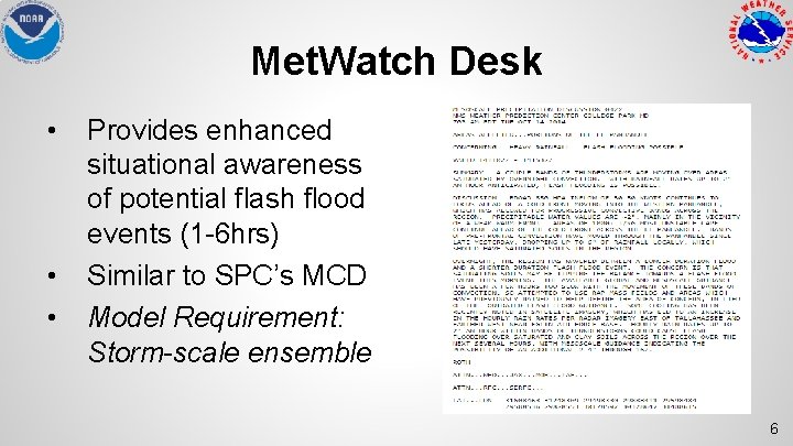
Met. Watch Desk • • • Provides enhanced situational awareness of potential flash flood events (1 -6 hrs) Similar to SPC’s MCD Model Requirement: Storm-scale ensemble 6
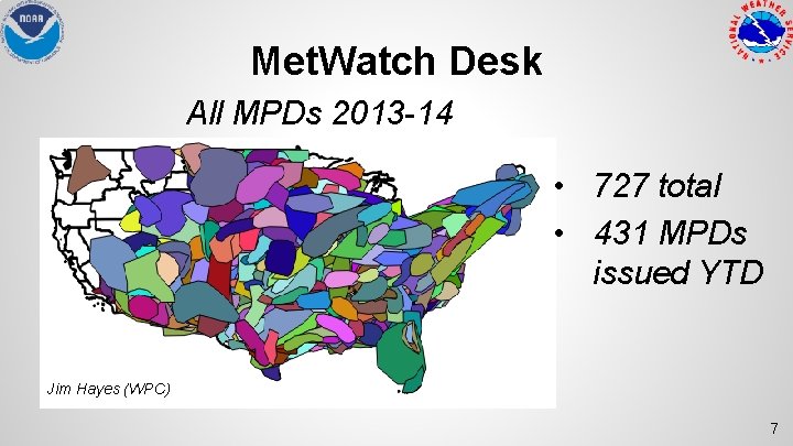
Met. Watch Desk All MPDs 2013 -14 • 727 total • 431 MPDs issued YTD Jim Hayes (WPC) 7
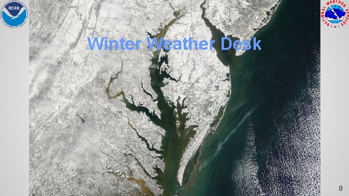
Winter Weather Desk 8
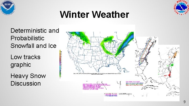
Winter Weather Deterministic and Probabilistic Snowfall and Ice Low tracks graphic Heavy Snow Discussion 9
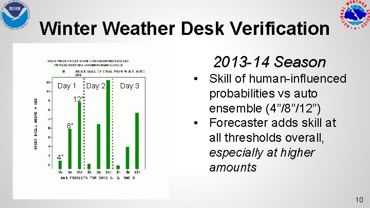
Winter Weather Desk Verification 2013 -14 Season Day 1 12” 8” 4” Day 2 Day 3 • Skill of human-influenced probabilities vs auto ensemble (4”/8”/12”) • Forecaster adds skill at all thresholds overall, especially at higher amounts 10
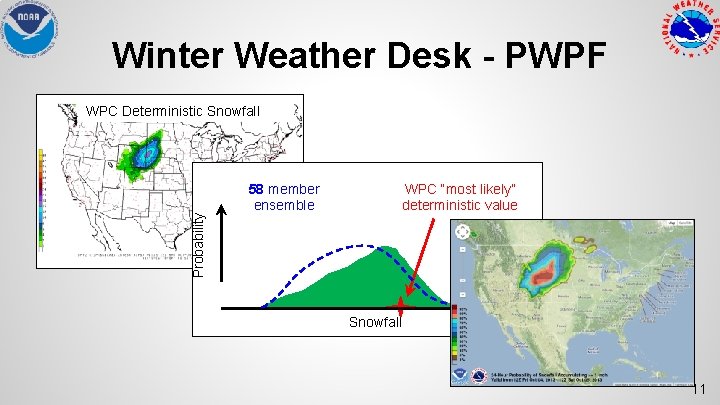
Winter Weather Desk - PWPF Probability WPC Deterministic Snowfall WPC “most likely” deterministic value 57 58 member ensemble Snowfall 11
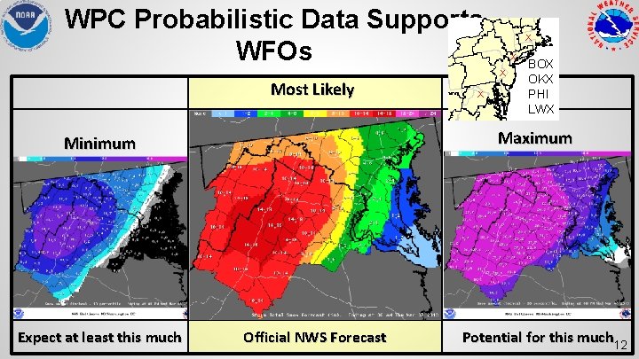
WPC Probabilistic Data Supports WFOs X X X Most Likely Maximum Minimum Expect at least this much X BOX OKX PHI LWX Official NWS Forecast Potential for this much 12
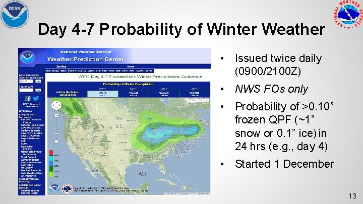
Day 4 -7 Probability of Winter Weather • Issued twice daily (0900/2100 Z) • NWS FOs only • Probability of >0. 10” frozen QPF (~1” snow or 0. 1” ice) in 24 hrs (e. g. , day 4) • Started 1 December 13
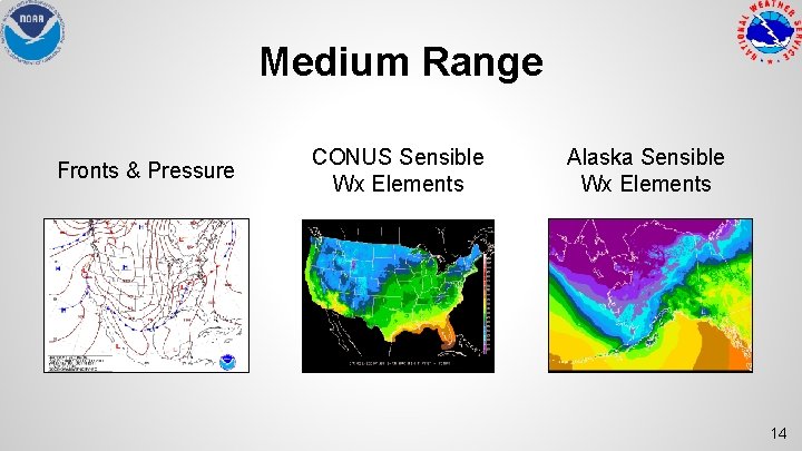
Medium Range Fronts & Pressure CONUS Sensible Wx Elements Alaska Sensible Wx Elements 14
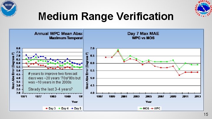
Medium Range Verification # years to improve two forecast days was ~20 years ‘ 70 s/’ 80 s but was ~10 years in the 2000 s Steady the last 3 -4 years? 15
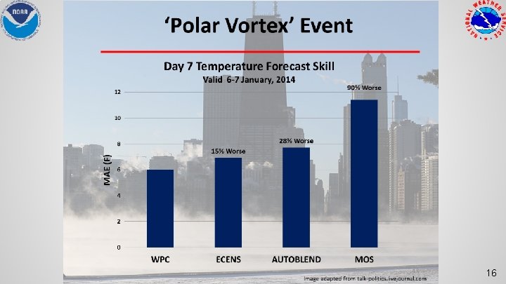
16
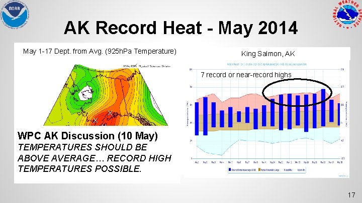
AK Record Heat - May 2014 May 1 -17 Dept. from Avg. (925 h. Pa Temperature) King Salmon, AK 7 record or near-record highs X X X WPC AK Discussion (10 May) TEMPERATURES SHOULD BE ABOVE AVERAGE… RECORD HIGH TEMPERATURES POSSIBLE. 17
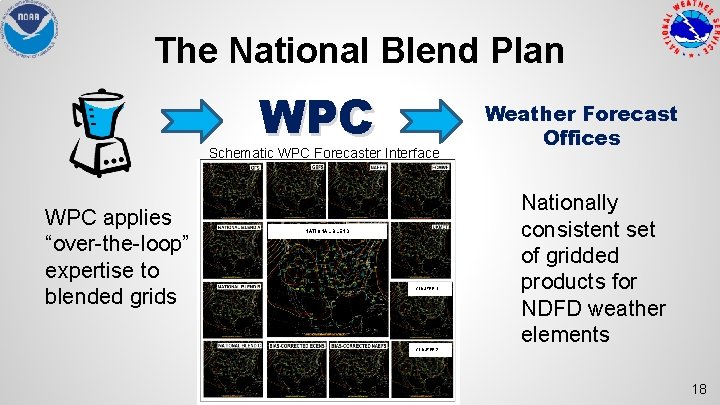
The National Blend Plan WPC Schematic WPC Forecaster Interface WPC applies “over-the-loop” expertise to blended grids NATIONAL BLEND CLUSTER 1 Weather Forecast Offices Nationally consistent set of gridded products for NDFD weather elements CLUSTER 2 18
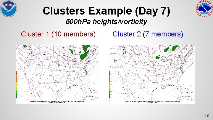
Clusters Example (Day 7) 500 h. Pa heights/vorticity Cluster 1 (10 members) Cluster 2 (7 members) H 19
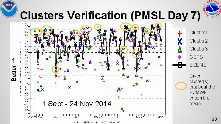
Clusters Verification (PMSL Day 7) Cluster 1 Cluster 2 Cluster 3 Better GEFS ECENS 1 Sept - 24 Nov 2014 Given cluster(s) that beat the ECMWF ensemble mean 20
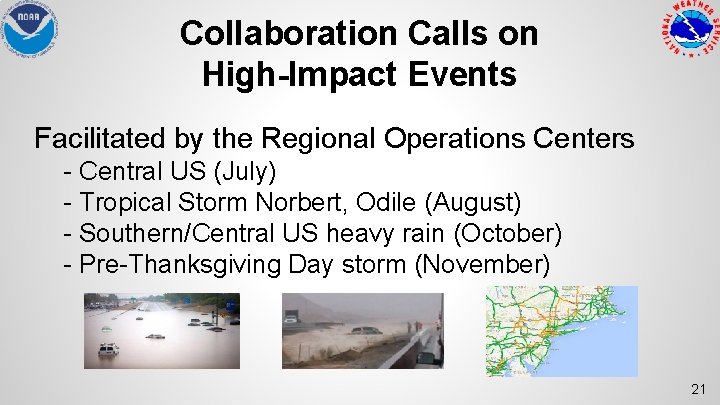
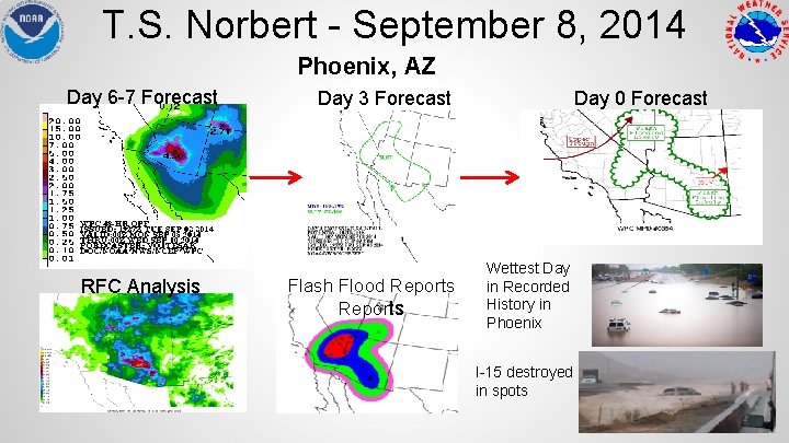
Collaboration Calls on High-Impact Events Facilitated by the Regional Operations Centers - Central US (July) - Tropical Storm Norbert, Odile (August) - Southern/Central US heavy rain (October) - Pre-Thanksgiving Day storm (November) 21
Winter Weather Desk Collaboration 2013 -14 Season • • 254 Questions from WFOs (via 12 Planet chat) 63 telephone calls 4 conference calls (33 WFOs) 3 National Go-To Meeting Winter Weather Webinars (70 WFOs, RFCs, OCCWS, regional HQ, and AWC) Dan Petersen (WPC) 22
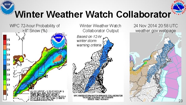
Winter Weather Watch Collaborator WPC 72 -hour Probability of >8” Snow (%) Winter Weather Watch Collaborator Output 24 Nov 2014 20: 58 UTC weather. gov webpage Based on 12 -hr winter storm warning criteria 23
Hydrometeorological Testbed • • Winter Weather Experiment (Jan - Feb 2014) o Parallel SREF (with and without rime factor) o NAM with rime factor modification o 36 participants Flash Flood and Intense Rainfall (FFa. IR) Experiment (July 2014) o Parallel NAM (now operational) o NCASE (NCEP Convection Allowing Scale Ensemble) - high resolution, multi-model, time-lagged ensemble 24
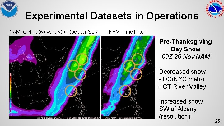
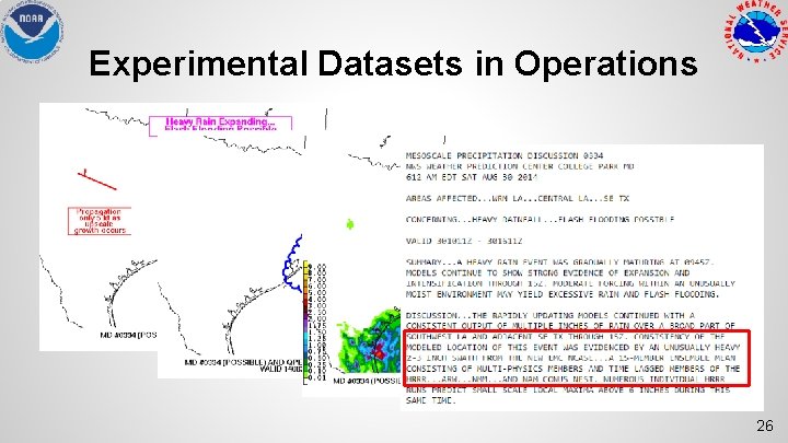
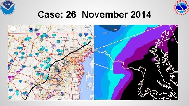
Experimental Datasets in Operations NAM: QPF x (wx=snow) x Roebber SLR NAM Rime Filter Pre-Thanksgiving Day Snow 00 Z 26 Nov NAM Decreased snow - DC/NYC metro - CT River Valley Increased snow SW of Albany (resolution) 25
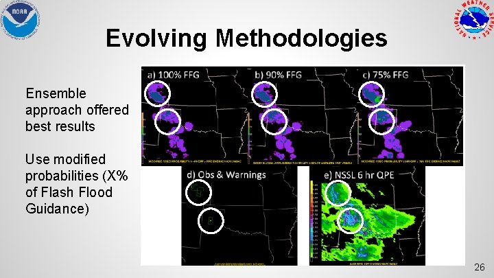
Evolving Methodologies Ensemble approach offered best results Use modified probabilities (X% of Flash Flood Guidance) 26
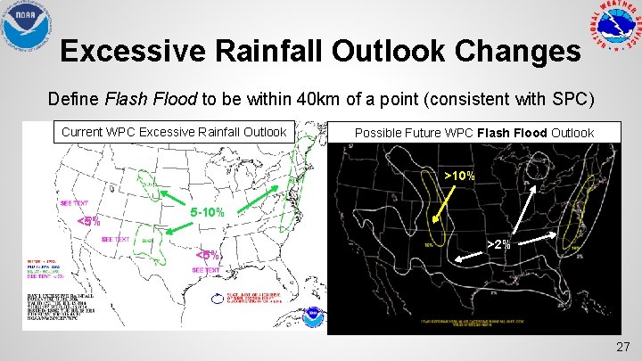
Excessive Rainfall Outlook Changes Define Flash Flood to be within 40 km of a point (consistent with SPC) Current WPC Excessive Rainfall Outlook Possible Future WPC Flash Flood Outlook >10% <5% 5 -10% <5% >2% 27
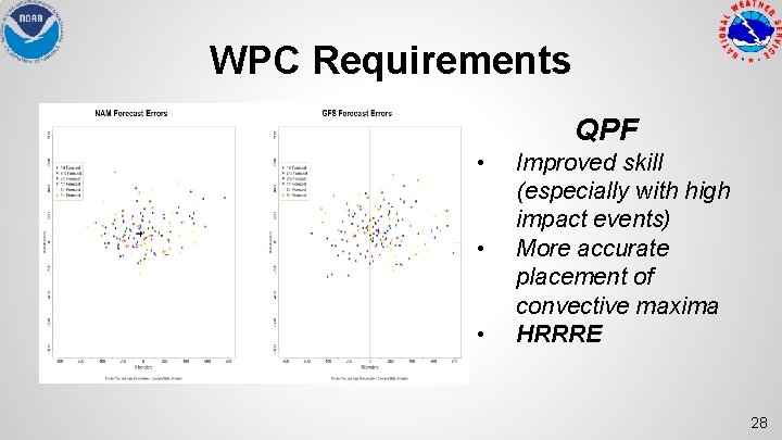
WPC Requirements QPF • • • Improved skill (especially with high impact events) More accurate placement of convective maxima HRRRE 28
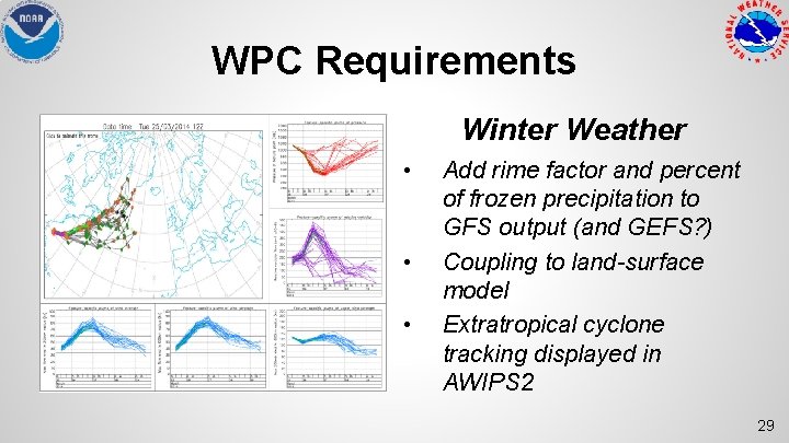
WPC Requirements Winter Weather • • • Add rime factor and percent of frozen precipitation to GFS output (and GEFS? ) Coupling to land-surface model Extratropical cyclone tracking displayed in AWIPS 2 29
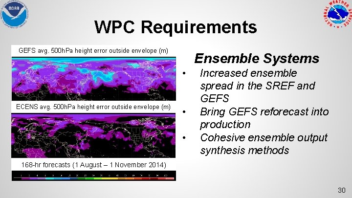
WPC Requirements GEFS avg. 500 h. Pa height error outside envelope (m) Ensemble Systems • ECENS avg. 500 h. Pa height error outside envelope (m) • • Increased ensemble spread in the SREF and GEFS Bring GEFS reforecast into production Cohesive ensemble output synthesis methods 168 -hr forecasts (1 August – 1 November 2014) 30
Extra Slides 31
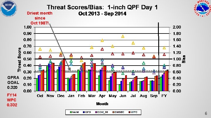
Driest month since Oct 1987! GPRA GOAL 0. 320 FY 14 WPC 0. 332 6
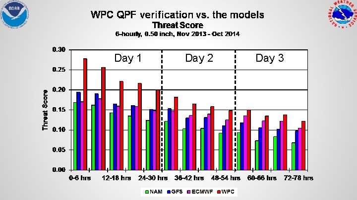
Day 1 Day 2 Day 3
% Improvement 50% NAM 30% GFS 18% ECMWF 6% ENSBC
% Improvement 50% NAM 30% GFS 18% ECMWF 6% ENSBC 7
Experimental Datasets in Operations 26
Case: 26 November 2014 NAM: QPF x (wx=snow) x Roebber SLR NAM Rime Filter 00 Z 26 Nov NAM - Decreased snow in DC/NYC metro - Increased snow in Catskills (resolution)
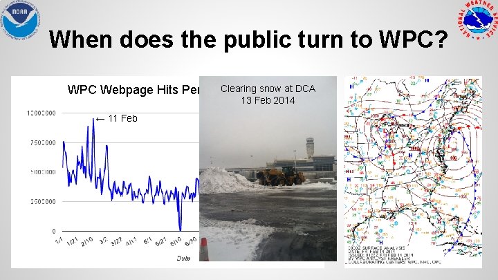
When does the public turn to WPC? Clearing snow at DCA WPC Webpage Hits Per Day (2014) 13 Feb 2014 ← 11 Feb
T. S. Norbert - September 8, 2014 Phoenix, AZ Day 6 -7 Forecast RFC Analysis Day 0 Forecast Day 3 Forecast Flash Flood Reports Wettest Day in Recorded History in Phoenix I-15 destroyed in spots 4
Quotes “An unsophisticated forecaster uses statistics as a drunken man uses lamp posts… for support rather than illumination. ” ~ Andrew Lang (1844 - 1912) “Fate laughs at probabilities. ” ~ Lytton E. G Bulwer (1803 - 1873)