
Weather Map Analysis Lab 7 Can include Frontal

Weather Map Analysis Lab 7
Can include: • • • Frontal lines Barometric pressure Isolines Temperature Frontal zones Frontal air

• • This is a surface weather chart. A weather map describing the state of the atmosphere over a large area at a given moment. Synoptic Map: map that shows weather conditions for a specific time.
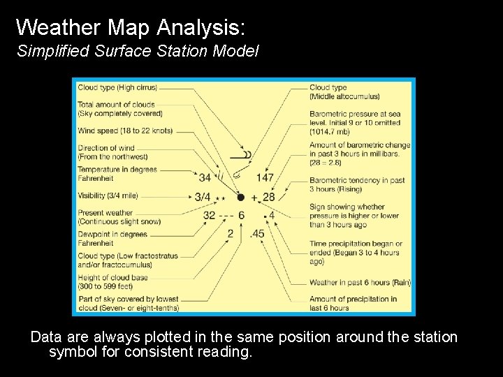
Weather Map Analysis: Simplified Surface Station Model Data are always plotted in the same position around the station symbol for consistent reading.


Barometric Pressure • NORMAL AIR PRESSURE: 950 – 1050 mb 1. insert decimal point – over 1 number from the right to the left 2. replace the missing beginning number with a 9 or 10 : a. The barometric pressure has to fall within the normal range (for our purposes) – EXAMPLE: 130 = 1013. 0 mb
Wind Direction • Measured by where wind is coming FROM • Will also determine the temperatures and moisture content of the air mass • Pressure Gradient Force
Isolines • Isolines (lines of constant value) generally used to show spatial patterns of specific variables: 1. Isotherms: temperature 2. Isodrosotherms: dew point • Typically drawn at 5° intervals 3. Isobars : barometric pressure • Typically drawn at 4 -mb intervals
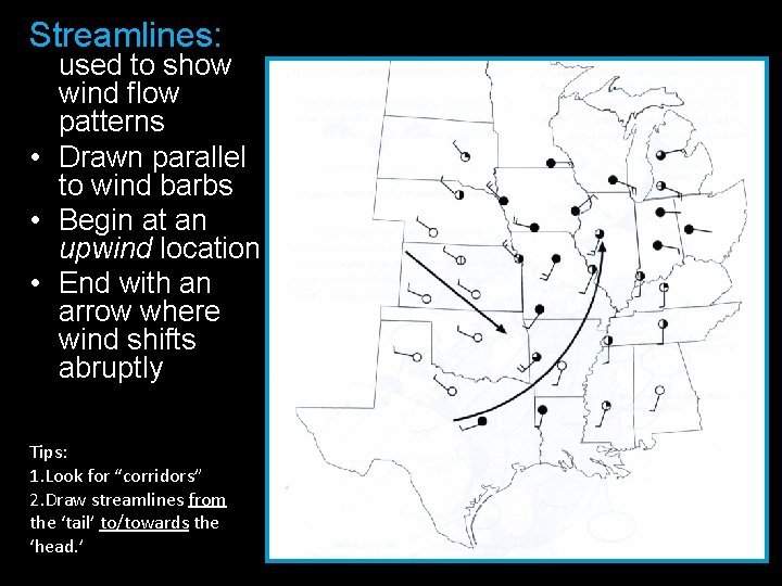
Streamlines: used to show wind flow patterns • Drawn parallel to wind barbs • Begin at an upwind location • End with an arrow where wind shifts abruptly Tips: 1. Look for “corridors” 2. Draw streamlines from the ‘tail’ to/towards the ‘head. ’
Air Masses • large body of air with relatively uniform temperature & moisture characteristics • Form over large land or water surfaces • Take on the temperature & moisture characteristics of the surfaces over which they formed. Classification depends on: 1. Latitude – determines temperature characteristic (upper-case letter_ 2. Nature of the surface – determines the moisture characteristic (lowercase letter) They are identified by two-letter codes Ex: c. P
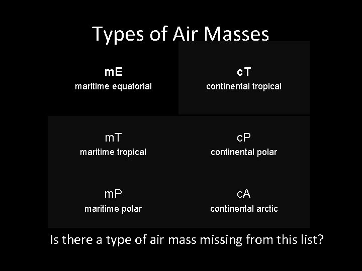
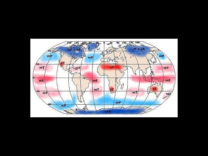
Types of Air Masses m. E c. T maritime equatorial continental tropical m. T c. P maritime tropical continental polar m. P c. A maritime polar continental arctic Is there a type of air mass missing from this list?
Fronts • boundary between two unlike air masses Identified by: 1. Sharp temperature gradient 2. Sharp moisture gradient 3. Sharp change in wind direction (in a clockwise direction)
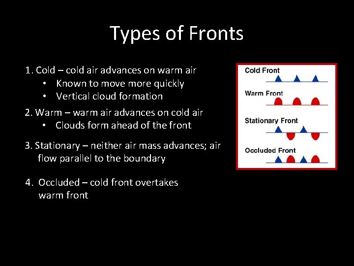
Types of Fronts 1. Cold – cold air advances on warm air • Known to move more quickly • Vertical cloud formation 2. Warm – warm air advances on cold air • Clouds form ahead of the front 3. Stationary – neither air mass advances; air flow parallel to the boundary 4. Occluded – cold front overtakes warm front
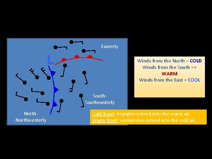
Easterly L Winds from the North = COLD Winds from the South == WARM Winds from the East = COOL Southeasterly Northwesterly Cold front: triangles extend into the warm air Warm front: semicircles extend into the cold air.
• High pressure systems are characteristic of clear skies • Low Pressure systems are characteristic of precipitation and clouds
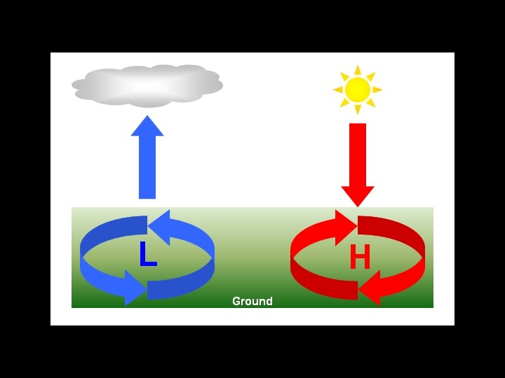
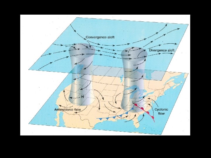
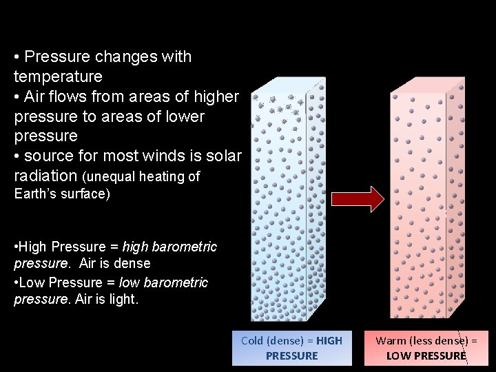
• Pressure changes with temperature • Air flows from areas of higher pressure to areas of lower pressure • source for most winds is solar radiation (unequal heating of Earth’s surface) • High Pressure = high barometric pressure. Air is dense • Low Pressure = low barometric pressure. Air is light. Cold (dense) = HIGH PRESSURE Warm (less dense) = LOW PRESSURE

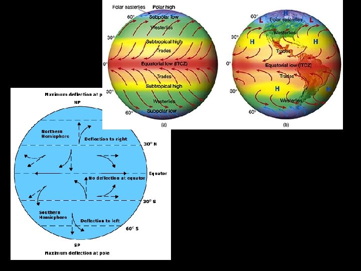
Coriollis Effect • http: //en. wikipedia. org/wiki/Coriolis_effect
- Slides: 21