WASH Infrastructure Mapping WASH Sector Coxs Bazar 01

WASH Infrastructure Mapping WASH Sector, Cox’s Bazar, 01 October 2017

OBJECTIVES

Objectives The objectives of this mapping exercise are: § To provide an initial spatial baseline of available basic services for each camp and site hosting Rohyinga refugees § To inform WASH sector gap analysis and camp-site level response planning § To regularly monitor WASH services availability through regular updates

PROCESS

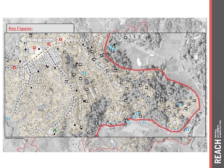
Camp/Site mapping process Collect Satellite Imagery • Every day, in Geneva, UNOSAT verify the availability and the quality of new satellite imagery Analyse Satellite Imagery • Based on the available imagery, the camp/site is analysed to identify and map all existing shelters and major constructions Collect Infrastructure Data Map and Analyse Infrastructure data • At field leve, a team of REACH enumerator « sweep » systematically the camps/sites to collect location and data on all existing infrastructures • Sat imagery analysis plus infrastructure data are overlayed through maps • Gaps are identified and inform site level planning

PRODUCTS

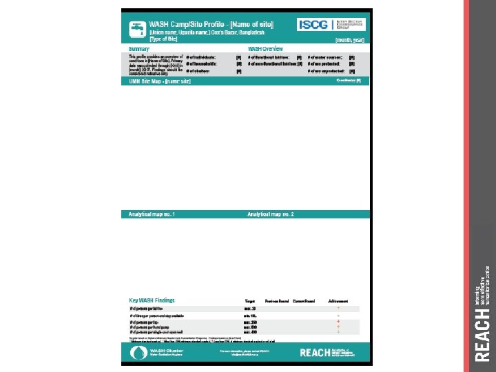
Mapping Products Baseline • • Shelter Count Map Infrastucture Map Camp/Site WASH Factsheet Other maps when relevant • Infrastructure Map • Camp/Site Factsheet Monitoring • Other maps when relevant Round

TIMEFRAME

Seq. Field Data Collection Status Imagery Analysis Status 1 Hakimpara Complete 2 Baggoha/Potibonia Complete 3 Jamtoli Complete 4 Burmapara Underway Burmapara Complete 5 Roikhong Pending Roikhong Complete 6 Leda Pending Leda Complete 7 Nayapara RC n/a UNHCR Nayapara Complete 8 Kutupalong Extension Pending Kutupalong Extension Underway 9 Shamlapur Pending 10 Mainnerghona Pending 11 Kutupalong Makeshift Pending 12 Kutupalong RC n/a UNHCR Kutupalong RC Pending

THANK YOU
- Slides: 12