Vulcanicity Intrusive Extrusive Types of Volcano Volcanoes Case


 Background Information • Location: Market Rasen, Lincolnshore (2008) •")


- Slides: 39
Vulcanicity • Intrusive • Extrusive – Types of Volcano • Volcanoes • Case Studies • Volcanoes in the UK
Intrusive
Intrusive landforms • Batholiths are large bodies of intrusive igneous rock. Formed when magma cools and crystallizes beneath Earth's surface • A laccolith is a intrusion that has been injected between two layers of sedimentary rock. • Sills: form when magma intrudes between the rock layers, forming a horizontal or gently-dipping sheet of igneous rock. • A Dyke: is a vertical intrusion a rock which carries the igneous rock upwards
Extrusive Volcanic Activity Types of Volcano
Vulcanicity- Types of Volcano
Vulcanicity- Types of Volcano
Vulcanicity- Types of Volcano
Minor forms of extrusive activity include geysers, hot springs, fumaroles, sulfatara, boiling mud and mud volcanoes. This minor activity occurs in places that are geothermal and there are normally multiple examples of different activity in the same place. Geysers for example commonly occur in clusters called geyser fields. Other forms of extrusive volcanic activity
There is currently little volcanic activity in the UK, the only form of activity is that of hot springs in bath. However there is evidence that in the past there has been extensive volcanic activity both extrusive and intrusive. When lava is forced to the surface only a limited amount of the mass actually protrudes through the surface. The rest of the mass is intruded into the crust where it solidifies into a range of features. These features can be exposed by erosion. Volcanic activity in the UK
Batholiths are formed when masses of magma cool and solidify. As the magma cools large crystals are formed in the rock like granite. Batholiths are often dome shaped and exposed by erosion. This is the case in areas such as Dartmoor and The Isle of Arran in Scotland. The areas surrounding the batholith are affected by the heat and pressure form the intrusion of the magma. This forms metamorphic aureole where rocks like limestone for example are transformed, limestone becomes marble. Batholiths are unaffected by existing rocks. Sometimes a smaller injection of magma can form a lens shape that is intruded between the layers of rock this forces the layers of rock upwards. This feature is known as a laccolith, it can also be exposed by erosion, an example of this from the UK would be the Eildon hills on the Scottish borders. Volcanic activity in the UK
A dyke is a vertical intrusion with horizontal cooling cracks. A dyke will cut across the bedding planes of the rocks into which they have intruded. Dykes often occur in groups, known as dyke swarms. Many Scottish islands such as the Isle of Mull have swarms of dykes associated with one intrusive event. Sills are the horizontal intrusions alone the lines of the bedding planes. Sills have vertical cooling cracks. Examples of sills include the Great Whin sill which is home to Hadrian’s Wall and Drumadoon on the isle of Arran. Both sills and dykes are commonly made up of dolerite. Basaltic flows can be seen where the Antrim lava plateaux formed in Northern Ireland. When the lava cooled, vertical cracks in the flow resulted in hexagonal columns. There are exposed to the coast – the Giant’s Causeway. The same volcanic feature can be seen in Fingal’s Cave on the Isle of Staffa in Scotland There are no active volcanoes left in the British Isles however there are extinct volcanoes, such as Arthur’s seat, and castle rock in Edinburgh which were formed by an extinct volcano system of Carboniferous age (approximately 350 million years old), which was then eroded by a glacier moving from west to east during the Quaternary (approximately the last two million years), exposing rocky crags to the west and leaving a trail of material swept to the east. This is how the Salisbury Crags formed and became basalt cliffs between Arthur's Seat and the city Centre. Volcanic activity in the UK
MEDC – CASE STUDY EVENT SUMMARY/INTRODUCTION • When: 27 th September 2014 • Where: the volcano is located on the Japanese island of Honshu which is around 100 km northeast of Nagoya and near 200 km southwest of Tokyo • First fatal volcanic eruption in Japan since the 1991 collapse of a lava dome at Mount Unseen • No significant earthquakes to warn • Hydrothermal explosion where ground water seeps into the volcano and gets superheated by magma and flashed to steam- phreatic eruption • Last eruption was 35 years ago • Ash cloud and low-density, low-temperature pyroclastic density currents CAUSE: Japan sits on the edge of two conservative plate boundaries which are meeting the Eurasian plate at a destructive boundary. As the Pacific plate is pushed into the Earth’s mantle, surface water and hydrated minerals heat up. Ontake's summit cone was built in a largely buried 4 x 5 km caldera. It lies at the southern end of the Norikura volcanic zone, which extends northward through Norikura volcano to Yake-dake volcano. The older volcanic complex of Ontake consists of at least 4 major stratovolcanoes that were constructed from about 680, 000 to about 420, 000 years ago, after which On-take was inactive for more than 300, 000 years. Volcano case studies Mt – Ontake
MEDC – CASE STUDY WHAT WERE THE EFFECTS/IMPACTS OF THE EVENT? Primary: • 47 people died- many who were hiking on the mountain itself • Volcanic bombs • Hydrogen sulfide gas spewed from the mountain which suspended search due to dangerous conditions • More than 24 bodies remain at the summit • Police said that 46 of the 47 victims were bludgeoned to death by falling rocks ejected by the eruption and the other victim died of burns, although no magma was observed.
MEDC – CASE STUDY RESPONSES TO THE EVENT? short term • Recovery crews have been unable to return, wary of more activity from Ontake as tremors continue to shake the region. • Japan Ground Self-Defense Force personnel and firefighters climb the ash-covered slope of Mount Ontake to rescue people who have been trapped in the mountaintop lodge during the eruption, one day after the volcano became active in central Japan, on September 28, 2014. • Day after day, bad weather has hampered the search for survivors and bodies, which may now lie beneath 30 cm or more of ash. • Rescue efforts will resume on 29/09/14 after an intense search on 28/09/14 was called off because of toxic volcanic gases in the area. • International aid was not required as Japan is an MEDC country and this didn’t affect many homes. Long term • Researchers call for better volcano prediction. • Not much else has been decided as the volcano only erupted less than a month ago. Volcano case studies Mt – Ontake
LEDC – CASE STUDY WHAT CAUSED THE EVENT? 1995: Chances Peak began giving off warning signals like small earthquakes and eruptions of dust and ash Destructive plate boundary (North American and Caribbean Plates). The oceanic plate subducts beneath the continental plate and as it does the pressure increases which triggers earthquakes due to friction and forms molten magma. The magma tries to rise to the surface and erupts as a volcano. Volcano Case Studies-MONTSERRAT
WHAT WERE THE EFFECTS/IMPACTS OF THE EVENT? LEDC – CASE STUDY Primary: 2/3 of the island were covered in ash Volcanic bombs were hurled (5 m in size) Dome collapsed and caused 5 million m 3 of ash and dust to cover the surrounding areapyroclastic flow 60% of the housing was destroyed 75% agricultural land destroyed Airport and port closed Wildlife destroyed 19 people died Secondary: Water supplies were infiltrated leaving a high demand for water Spread of disease Many people suffered from severe burns from ash deposits of 1 -2 cm 8000 refugees left the island but didn’t return Unemployment rose from 7% to 80% Population fell over half Loss of income and tourism Overcrowding in shelters Volcano Case Studies-MONTSERRAT
LEDC – CASE STUDY RESPONSES TO THE EVENT? Short term: • Evacuation to shelters • Provision of basics e. g. food and water • Capital (Plymouth)- ghost town • Unemployment • £ 41 million in aid from the British Government Long term: • Exclusion zone set up around the volcano • Montserrat police force were sent in to try and find survivors • 1996: Montserrat Volcano Observatory (MVO) was set up to monitor volcanic activity and provide future warning systems • Risk assessment was completed to help islanders understand which areas are at risk and reduce problems for the future • New infrastructure was built • Use of the volcano as a tourist attraction • Services in the north of the island were expanded Volcano Case Studies-MONTSERRAT
MEDC – CASE STUDY • The Yellowstone Caldera is the volcanic caldera and Supervolcano located in Yellowstone National Park in the United States. The caldera and most of the park is located in the northwest corner of Wyoming. The major features of the caldera measure about 34 by 45 miles. The caldera formed during the last of three super eruptions over the past 2. 1 million years. • There about 40 super volcanoes are dotted across the globe. There are two in Britain – one in Glencoe, Scotland, the other in Scafell in the Lake District. However, most super volcanoes, including those in Britain, burned out long ago. • Yellowstone is a dormant Supervolcano, which means a major eruption could happen in the future. However most volcano experts say a Yellowstone super-eruption is probably a long way off, or it may never happen at all. • About 2. 1 m years ago the Yellowstone super volcano erupted 2, 500 times more ash than Mount St Helens • "It's far more likely, if there is an eruption, it'll be on a small scale, perhaps comparable to Mt St Helens, " says volcano expert Prof. Steve Sparks of the University of Bristol. • Their main feature is a large magma chamber, which is an underground reservoir filled with flowing, hot rock under huge pressures. • A super-eruption would equal the force of 1, 000 Hiroshima atomic bombs exploding every second. • You could fit Tokyo, the world's biggest city, in Yellowstone's super-volcanic crater. • Three super-eruptions at Yellowstone appear to have occurred on a 600, 000 -700, 000 year cycle starting 2. 1 million years ago. The most recent took place 640, 000 years ago – suggesting Yellowstone is overdue for an eruption Yellowstone Supervolcano
YELLOWSTONE MEDC – CASE STUDY
YELLOWSTONE MEDC – CASE STUDY
Vulcanicity Quotes • Mount Aso rumbles to life, sending ash over Kyushu – Japan Times • Japan volcano eruption hits flights – SKY News AUS • Nuclear Power Facility To Be Reopened In Japan Despite Volcano Warnings, Could Cause 'Nationwide Disaster' • Cape Verde volcano threatens to destroy villages, • The ash cloud produced by the eruption of a sub-glacial volcano in Iceland brought chaos to the European air industry (mount E) • thousands of passengers have had to make their way home overland • A new eruption at Mount Etna eruption has forced the closure of Catania Airport in Sicily. • The beast is risen: Mount Etna's latest eruptive episode • Europe's most active volcano, Mount Etna, erupts • Powerful Mount Etna Eruption / Sicily Airport Closed • Mount Etna Erupts in Fiery Display • Magnificent Mount Etna Volcano Roaring Lava
• An earthquake is the shaking and vibration of the Earth's crust due to movement of the Earth's tectonic plates. • Earthquakes can happen along any type of plate boundary. • Earthquakes occur when tension is released from inside the crust. Plates do not always move smoothly alongside each other and sometimes get stuck. When this happens pressure builds up. When this pressure is eventually released, an earthquake tends to occur. • The point inside the crust where the pressure is released is called the focus. The point on the Earth's surface above the focus is called the epicentre. • Earthquake energy is released in seismic waves. These waves spread out from the focus. The waves are felt most strongly at the epicentre, becoming less strong as they travel further away. The most severe damage caused by an earthquake will happen close to the epicentre. Check out this guys beard Music makes you want to cry 2 G 2 – Earthquakes (HOW)
2 G 2 – Earthquakes Richter The magnitude value is proportional to the logarithm of the amplitude of the strongest wave during an earthquake. A recording of 7, for example, indicates a disturbance with ground motion 10 times as large as a recording of 6. The energy released by an earthquake increases by a factor of 30 for every unit increase in the Richter scale.
The Mercalli intensity scale is a seismic scale used for measuring the intensity of an earthquake. It measures the effects of an earthquake, and is distinct from the moment magnitude usually reported for an earthquake 2 G 2 – Earthquakes Mercalli
2 G 2 – Earthquakes – Case studies
A long, high sea wave caused by an earthquake or other disturbance. A tsunami is a huge wave, usually caused by volcanic or earthquake activity under the ocean, which can eventually crash onto the shoreline. The effects on a community can be devastating. When an earthquake, volcano or landslide happens on the ocean floor, water is displaced. This water forms the start of the tsunami. When the waves reach shallower water: their height can increase by several metres the shallow water slows the waves get closer together It is hard to see that a tsunami is approaching. The most obvious sign is the coastal water retreats just before the waves reach the shore. This is actually the trough of the wave following behind. Tsunami Source
LEDC Tsunami LEDC – CASE STUDY A decade ago, one of the largest earthquakes ever recorded struck off the coast of Indonesia, triggering a tsunami that swept away entire communities around the Indian Ocean. The quake ruptured the greatest fault length of any recorded, spanning a distance of an estimated 1, 500 km (900 miles) - longer than the US state of California. The rupture started beneath the quake's epicentre and progressed northward along the fault at about 2 km/sec (1. 2 miles/second) - lasting about 10 minutes - according to the Tectonics Observatory at the California Institute of Technology The length of the rupture meant that the waves reached a wider geographical area - as far afield as Mexico, Chile, and the Arctic. The waves travelled at speeds of up to 800 km/h (500 mph). Computer modelling after the tsunami, estimated that waves had reached a height of almost 20 m (65 ft) in some areas. However, scientists investigating damage in Aceh, Indonesia found subsequent evidence that waves had reached 20 -30 m (65 -100 ft) in places.
LEDC – CASE STUDY • The Indian Ocean Tsunami made landfall on 26 th December 2004. It was unprecedented in its scale, destroying parts of Sri Lanka, Indonesia and Thailand resulting in over 250, 000 deaths within the region. • The involvement of 30 independent national disaster victim identification teams placed a strain on the command structure and process and the necessity to standardize the victim identification process. • The overall scope of the disaster and the large number of deceased was overwhelming. • There was no data management system within Thailand capable of recording the ante mortem and post mortem information on the deceased. • There was pressure either direct or indirect on the various national DVI teams to expedite the identification of their nationals killed in the incident. • The Thai National Police had 3, 737 people officially recorded as missing/deceased. • Over 30 different countries lost citizens as a result of the tsunami.
LEDC – CASE STUDY • A quarter of a million people died. • Two million people were made homeless. • People were swept away in the waters, which arrived rapidly and with little warning. • Thirteen countries were affected, the worst being Indonesia. • Indonesia was hit by the tsunami first. Fourty-five minutes later the tsunami reached Thailand. • Mangrove swamps helped to act as a barrier to reduce the energy of the water in some areas. • Short-term aid, such as water purification tablets, temporary housing and medical supplies were given from international countries. • Islands reliant on tourism and fishing, such as the Maldives, had to rebuild their industries. • An early warning system between countries surrounding the Indian Ocean has been set up.
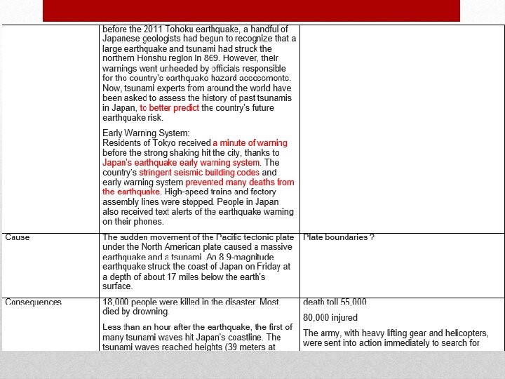
MEDC – CASE STUDY • The 9. 0 -magnitude earthquake struck off the coast of Japan on The 11 th March 2011 at 0546 GMT • The quake’s focus was 130 kilometres to the east of the prefecture’s capital, Sendai. • The resulting tsunami was sent crashing into the country’s north-eastern coast. • It was originally reported at a magnitude of 7. 9, but later was upgraded to 8. 9 and then to a 9. 0. • Which makes it the fifth largest recorded Earthquake worldwide since 1900. • Japan is located on the plate Margin of the Eurasian Plate and the oceanic Pacific Plate. • This plate margin is destructive, friction is present and the plates stick as the Pacific Plate subducts under the Eurasian Plate. • When the plates stick, tension builds up. When this pressure builds up and is released, it causes a rapid shift in the plates (causing the earthquake) and a lot of energy to be release, in this case about the same as the annual energy output of the UK MEDC Tsunami – Japan 2011
MEDC – CASE STUDY • Japan was largely prepared for the earthquake and many buildings remained standing afterwards, but it was not prepared for the subsequent Tsunami. • A tsunami warning extended to at least 50 nations and territories, as far away as South America. • The yen fell sharply but recouped most of its decline several hours later. Tokyo stocks fell. • 2, 000 people confirmed dead • 10, 000 more people expected to be confirmed dead • 2, 000 people injured • 530, 000 people displaced, staying in 2, 500 evacuation centres, such as schools and public halls • 24, 000 people still completely isolated and cannot be reached • 1. 2 million homes without power • 1. 4 million homes without water • 4, 700 destroyed houses • 50, 000 damaged houses • 582 roads cut off • 32 bridges destroyed • Tokyo’s major airports halted flights, • All Tokyo area trains were halted, while The Shinkansen Bullet train service was suspended. MEDC Tsunami – Japan 2011
MEDC – CASE STUDY MEDC Tsunami – FUKUSHIMA • Two nuclear plants on the Pacific coast in Fukushima were automatically shut down. • At Fukushima the subsequent tsunami disabled emergency generators required to cool the reactors. • Over the following three weeks there was evidence of a partial nuclear meltdown in units 1, 2 and 3; visible explosions, suspected to be caused by hydrogen gas, in units 1 and 3; a suspected explosion in unit 2, that may have damaged the primary containment vessel; and a possible uncovering of the units 1, 3 and 4 spent fuel pools. • Radiation releases caused large evacuations, concern over food and water supplies, and treatment of nuclear workers. • The IAEA has rated the events at level 7, the same as Chenobyl, and the highest on the scale – meaning that there is a major release of radio active material with widespread health and environmental effects. MEDC Tsunami – Japan 2011 Source
MEDC – CASE STUDY
Market Rasen Earthquake, Lincolnshire (2008) Background Information • Location: Market Rasen, Lincolnshore (2008) • Date 27 Feb 2008 • Time 0057 • Magnitude 5. 2 MEDC – CASE STUDY Causes of the Earthquake • Why did it happen • The Earthquake was the result of an old fault line deep below Lincolnshire, it was caused by a sudden movement along a strike-slip fault. • What fault line was it on? • Strike Slip Fault Impact of the earthquake • What damage was done • There were 9 aftershocks, damage included roof tiles coming off, chimney pots falling down and some unsafe walls/ roofs. Masonry fell from St Thomas church. No one was killed and one man went to hospital with a suspected broken pelvis (when he was pinned under masonry in his bedroom) • Market Rasen now got its very own earthquake monitoring station
Earthquake Management Prediction: There is currently no reliable, accurate way to predict an earthquake. Scientists can however indicate where an earthquake is likely to be found. Current methods include: - levelling/ laser reflector – which surveys the movement at a fault line - Seismometer – which records the shock waves from the epicentre. - Gravity meter, magnetometer and electrical resistivity meter – properties of rocks change under stress - Water table level meter – sudden rise or fall could be caused by deformation of ground - Radon gas detector – radon gas is released when rocks such as granite are deformed - Satellite surveying - Seismic records can give us an idea of what to expect in the region. Earthquakes can only be predicted via observation and in some cases estimation. Therefore it is unreliable and the best way to mange an earthquake at the moment is to be prepared for it.
Earthquake Management Protection/Preparation Earthquakes can not be predicted accurately or stopped. An earthquake is a force of nature which we have no power over. Therefore we have to work to protect and prepare for an earthquake. In earthquake prone regions like Japan many systems have be implemented to reduce the consequences of an earthquake. There are 3 main areas of protection: 1. Making buildings and urban areas more earthquake resistant 2. Education 3. Prediction and warning systems In Japan there are strict building codes in forced by law (2007) to reduce damage during an earthquake, all buildings must be fire proof. All buildings are also double checked for safety. In some cities smart metes have been introduced which shut off gas supplies automatically during an earthquake or increased seismic activity. Land use: schools and hospitals are located in safer areas.
Earthquake Management