
Verification of wave forecast models Martin Holt Jim
- Slides: 24
Verification of wave forecast models Martin Holt Jim Gunson Damian Holmes-Bell 1
Verification 2 n Models are verified against in-situ observations. n Observations from moored buoys and platforms: wave height, wind speed, wave period. n Observations from satellites: wave height, wind speed, wave energy spectrum n Monthly performance statistics are produced and monitored. n International collaboration to validate ERS-2 and Envisat missions.
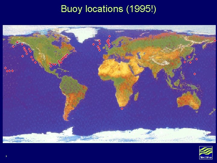
Buoy locations (1995!) 3
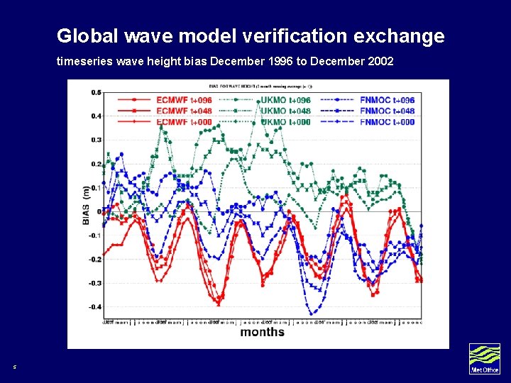
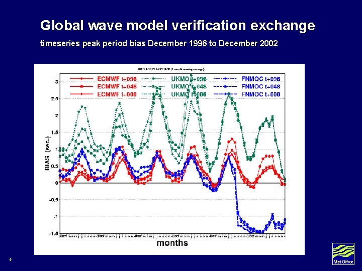
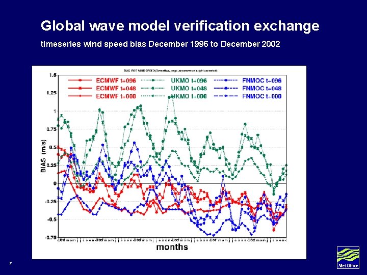
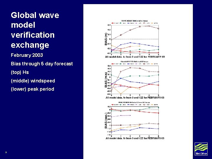
Global wave model verification exchange • Started 1995 • Met Office, ECMWF, NCEP, FNMOC, Canada, Meteo. France • Each centre co-locates model and moored buoy data in agreed format and exchanges monthly by ftp. • Datasets collated and statistics prepared • Published results: Bidlot, Holmes, Wittmann, Lalbeharry, Chen 2002, Weather and Forecasting 17 4
Global wave model verification exchange timeseries wave height bias December 1996 to December 2002 5
Global wave model verification exchange timeseries peak period bias December 1996 to December 2002 6
Global wave model verification exchange timeseries wind speed bias December 1996 to December 2002 7
Global wave model verification exchange February 2003 Bias through 5 day forecast (top) Hs (middle) windspeed (lower) peak period 8
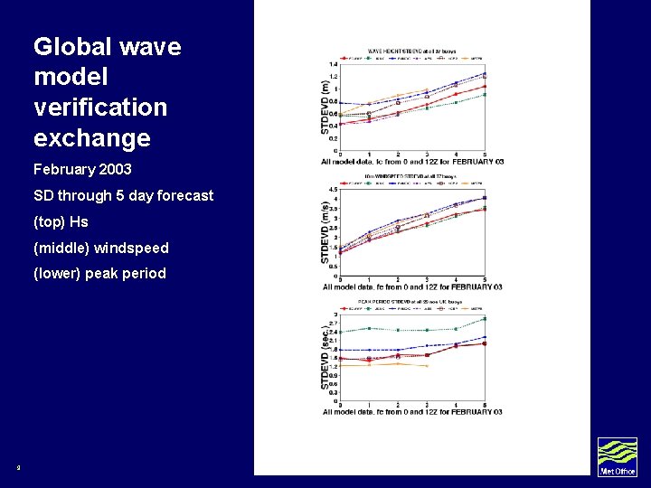
Global wave model verification exchange February 2003 SD through 5 day forecast (top) Hs (middle) windspeed (lower) peak period 9
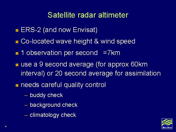
Satellite radar altimeter n ERS-2 (and now Envisat) n Co-located wave height & wind speed n 1 observation per second =7 km n use a 9 second average (for approx 60 km interval) or 20 second average for assimilation n needs careful quality control – buddy check – background check – climatology check 10
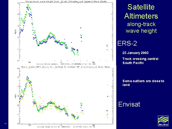
Satellite Altimeters along-track wave height ERS-2 23 January 2003 Track crossing central South Pacific Some outliers are close to land Envisat 11
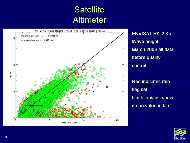
Satellite Altimeter ENVISAT RA-2 Ku Wave height March 2003 all data before quality control. Red indicates rain flag set black crosses show mean value in bin 12
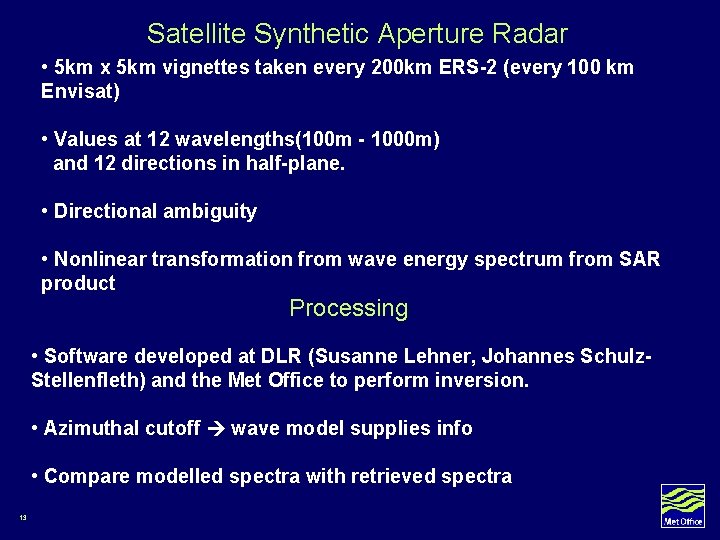
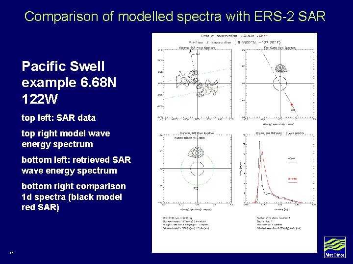
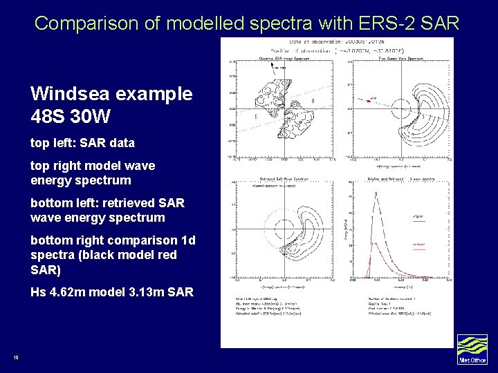
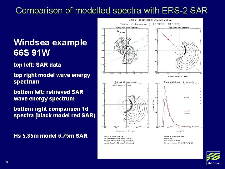
Satellite Synthetic Aperture Radar • 5 km x 5 km vignettes taken every 200 km ERS-2 (every 100 km Envisat) • Values at 12 wavelengths(100 m - 1000 m) and 12 directions in half-plane. • Directional ambiguity • Nonlinear transformation from wave energy spectrum from SAR product Processing • Software developed at DLR (Susanne Lehner, Johannes Schulz. Stellenfleth) and the Met Office to perform inversion. • Azimuthal cutoff wave model supplies info • Compare modelled spectra with retrieved spectra 13
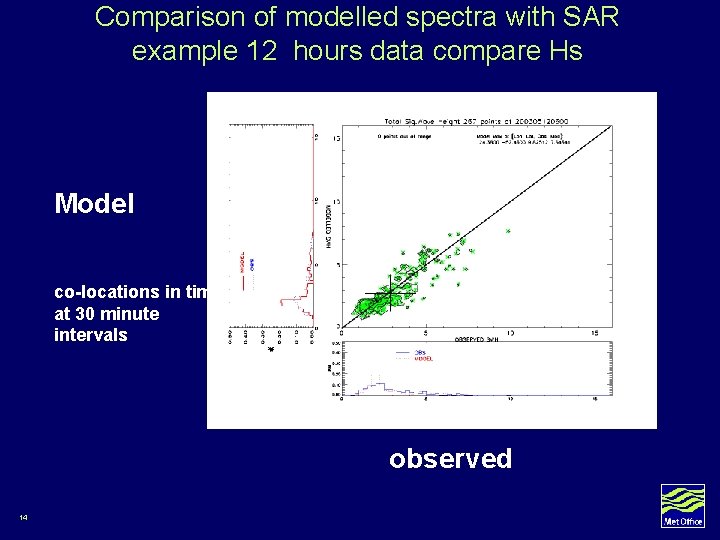
Comparison of modelled spectra with SAR example 12 hours data compare Hs Model co-locations in time at 30 minute intervals observed 14
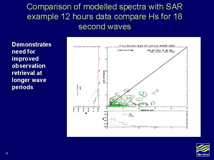
Comparison of modelled spectra with SAR example 12 hours data compare Hs for 18 second waves Demonstrates need for improved observation retrieval at longer wave periods 15
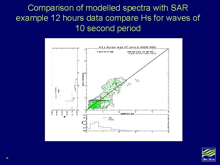
Comparison of modelled spectra with SAR example 12 hours data compare Hs for waves of 10 second period 16
Comparison of modelled spectra with ERS-2 SAR Pacific Swell example 6. 68 N 122 W top left: SAR data top right model wave energy spectrum bottom left: retrieved SAR wave energy spectrum bottom right comparison 1 d spectra (black model red SAR) 17
Comparison of modelled spectra with ERS-2 SAR Windsea example 48 S 30 W top left: SAR data top right model wave energy spectrum bottom left: retrieved SAR wave energy spectrum bottom right comparison 1 d spectra (black model red SAR) Hs 4. 62 m model 3. 13 m SAR 18
Comparison of modelled spectra with ERS-2 SAR Windsea example 66 S 91 W top left: SAR data top right model wave energy spectrum bottom left: retrieved SAR wave energy spectrum bottom right comparison 1 d spectra (black model red SAR) Hs 5. 85 m model 6. 75 m SAR 19
SUMMARY • For global and regional wave models, validation is carried out againstrumented moored buoy observations of wave height, wave period and windspeed. • Validation against altimeter data requires careful quality control when used in near-real time. • Validation against satellite retrieved wave spectra needs further development of the retrieval scheme 20
SPARE SLIDES FOLLOW 21
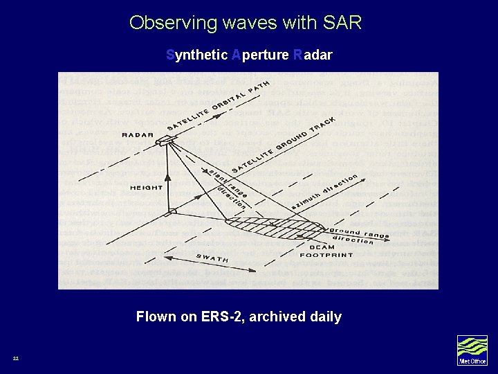
Observing waves with SAR Synthetic Aperture Radar Flown on ERS-2, archived daily 22
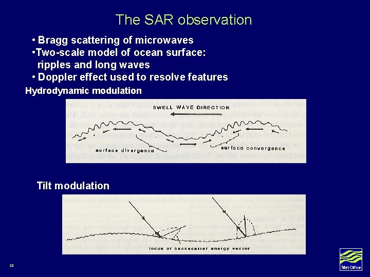
The SAR observation • Bragg scattering of microwaves • Two-scale model of ocean surface: ripples and long waves • Doppler effect used to resolve features Hydrodynamic modulation Tilt modulation 23
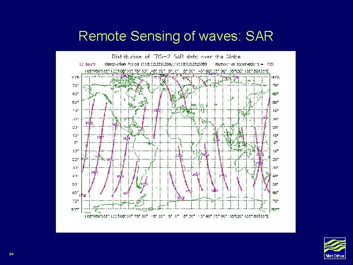
Remote Sensing of waves: SAR 24