Verification of model wind structure and rainfall forecasts

- Slides: 33

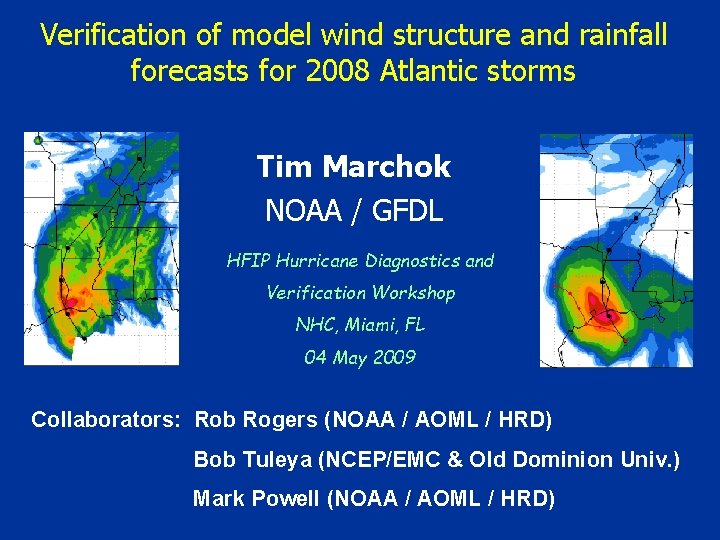
Verification of model wind structure and rainfall forecasts for 2008 Atlantic storms Tim Marchok NOAA / GFDL HFIP Hurricane Diagnostics and Verification Workshop NHC, Miami, FL 04 May 2009 Collaborators: Rob Rogers (NOAA / AOML / HRD) Bob Tuleya (NCEP/EMC & Old Dominion Univ. ) Mark Powell (NOAA / AOML / HRD)

Motivation • Inland flooding from TC rainfall accounts for a significant percentage of deaths from U. S. landfalling TCs. • Storm size / structure has a major impact on the amount of damage at landfall. …both aspects have only recently begun to receive attention in terms of model evaluation

Outline • Rainfall validation & techniques • Application of TC QPF validation techniques to 2008 U. S. landfalling storms • Development of model wind structure validation techniques • Application of wind structure validation techniques to 2008 Atlantic TCs

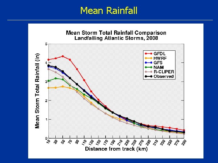
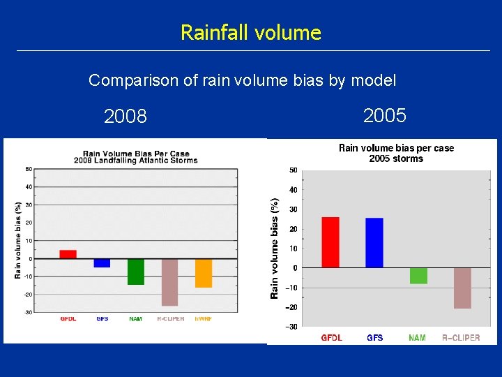
Rainfall validation: What to focus on? • Rainfall patterns • Rainfall mean & volume • Extreme amounts

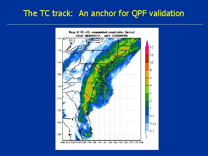
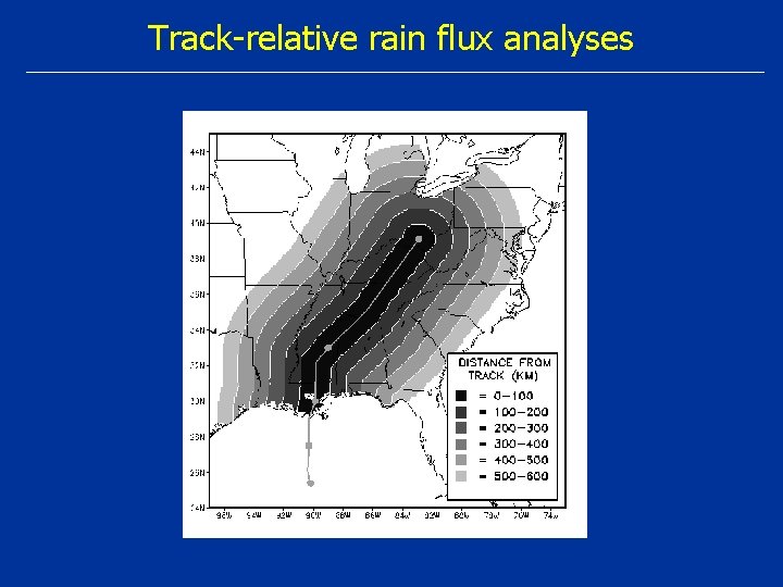
The TC track: An anchor for QPF validation

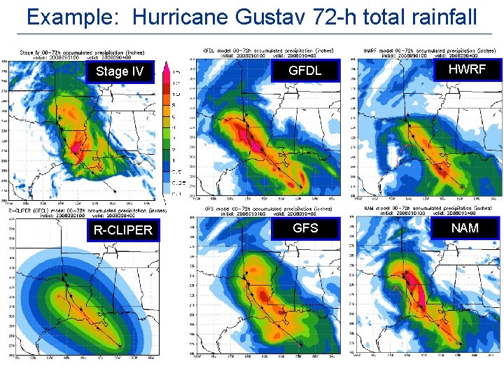
Example: Hurricane Gustav 72 -h total rainfall Stage IV GFDL HWRF R-CLIPER GFS NAM

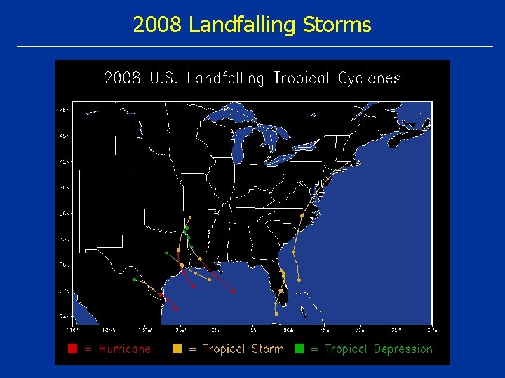
2008 Landfalling Storms

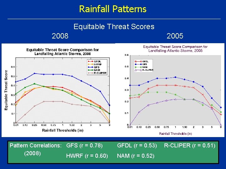
Rainfall Patterns Equitable Threat Scores 2008 Pattern Correlations: GFS (r = 0. 78) (2008) HWRF (r = 0. 60) 2005 GFDL (r = 0. 53) NAM (r = 0. 52) R-CLIPER (r = 0. 51)

Mean Rainfall

Rainfall volume Comparison of rain volume bias by model 2008 2005

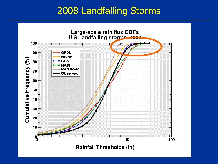
2008 Landfalling Storms 50% level Difference between obs rain value and fcst rain value at 50% level determines index

Track-relative rain flux analyses

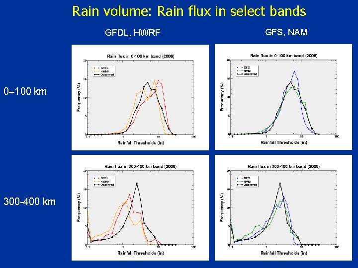
Rain volume: Rain flux in select bands GFDL, HWRF 0– 100 km 300 -400 km GFS, NAM

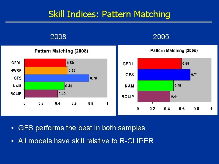
Skill Indices: Pattern Matching 2008 2005 • GFS performs the best in both samples • All models have skill relative to R-CLIPER

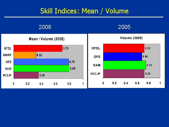
Skill Indices: Mean / Volume 2008 2005

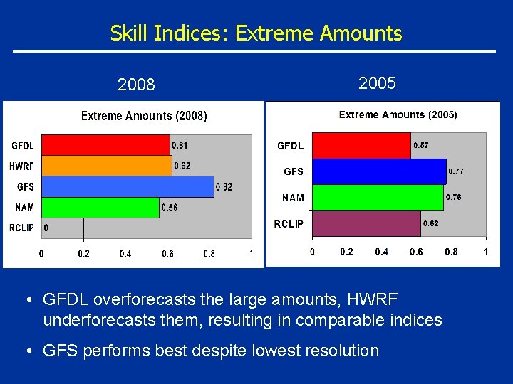
Skill Indices: Extreme Amounts 2008 2005 • GFDL overforecasts the large amounts, HWRF underforecasts them, resulting in comparable indices • GFS performs best despite lowest resolution

Rainfall Summary • Validation techniques address unique TC rainfall attributes: Ø Pattern matching Ø Rainfall volume Ø Extreme amounts • TC QPF skill indices for operational forecast evaluation • GFS most skillful in 2008 (similar to 2005)

Outline • Rainfall validation & techniques • Application of TC QPF validation techniques to 2008 U. S. landfalling storms • Development of model wind structure validation techniques • Application of wind structure validation techniques to 2008 Atlantic TCs

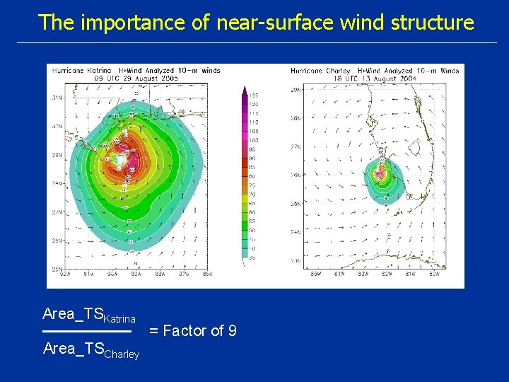
The importance of near-surface wind structure Area_TSKatrina Area_TSCharley = Factor of 9

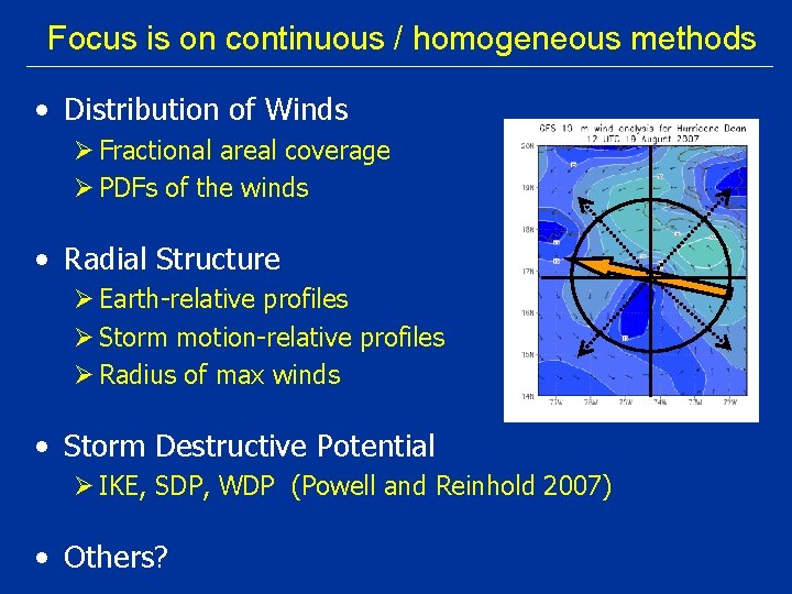
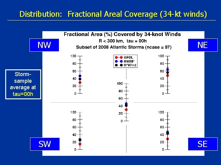
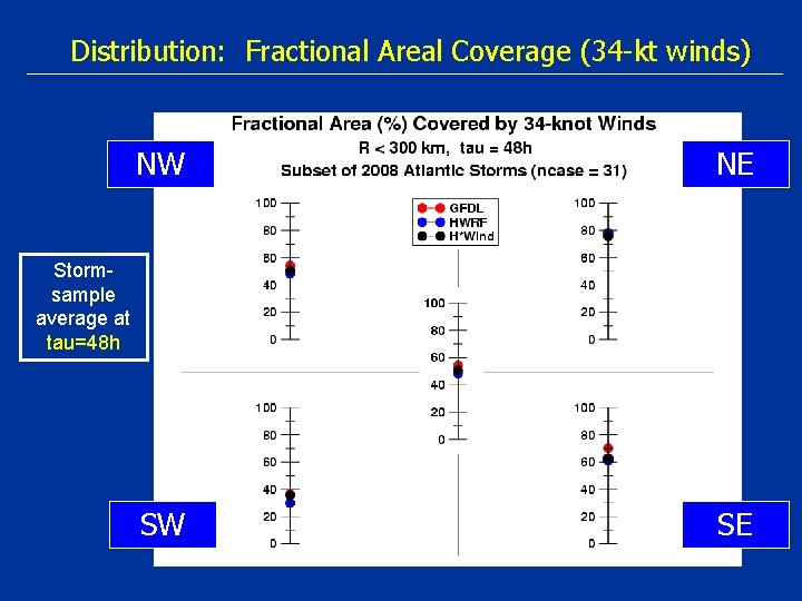
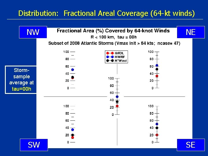
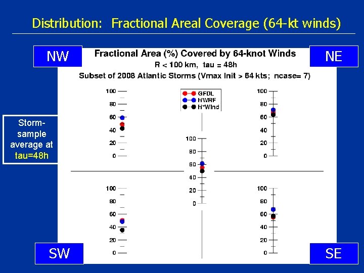
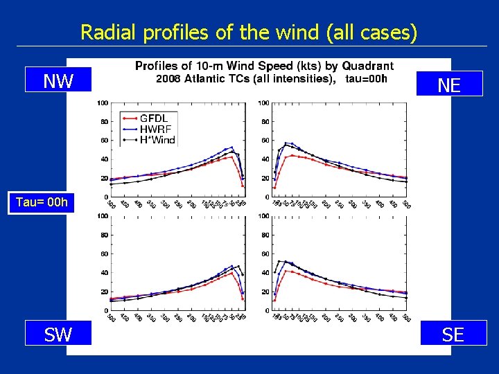
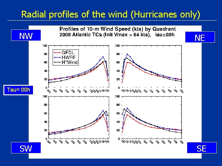
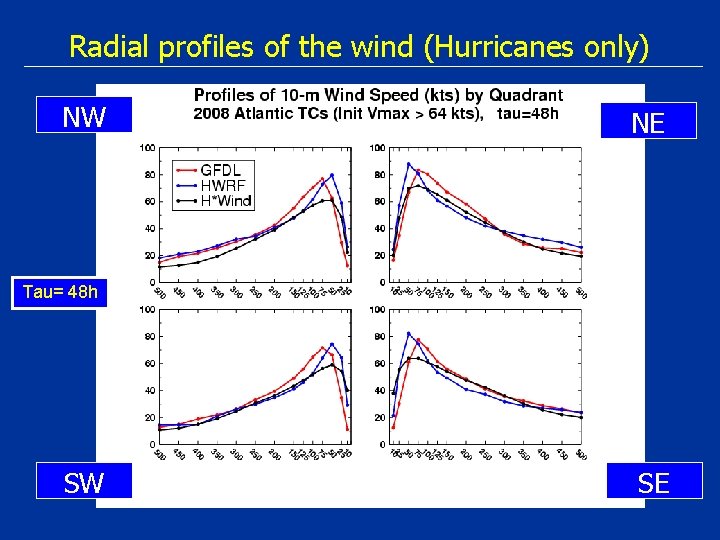
Focus is on continuous / homogeneous methods • Distribution of Winds Ø Fractional areal coverage Ø PDFs of the winds • Radial Structure Ø Earth-relative profiles Ø Storm motion-relative profiles Ø Radius of max winds • Storm Destructive Potential Ø IKE, SDP, WDP (Powell and Reinhold 2007) • Others?

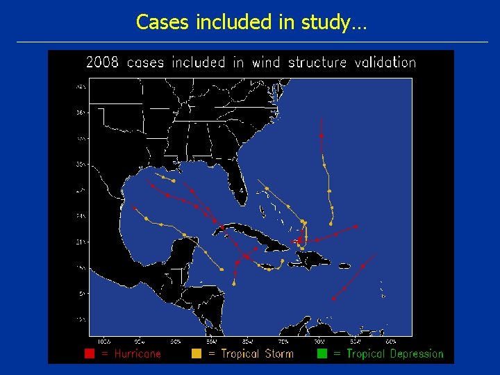
Cases included in study…

Distribution: Fractional Areal Coverage (34 -kt winds) NW NE SW SE Stormsample average at tau=00 h

Distribution: Fractional Areal Coverage (34 -kt winds) NW NE SW SE Stormsample average at tau=48 h

Distribution: Fractional Areal Coverage (64 -kt winds) NW NE Stormsample average at tau=00 h SW SE

Distribution: Fractional Areal Coverage (64 -kt winds) NW NE Stormsample average at tau=48 h SW SE

Radial profiles of the wind (all cases) NW NE Tau= 00 h SW SE

Radial profiles of the wind (all cases) NW NE Tau= 48 h SW SE

Radial profiles of the wind (Hurricanes only) NW NE Tau= 00 h SW SE

Radial profiles of the wind (Hurricanes only) NW NE Tau= 48 h SW SE

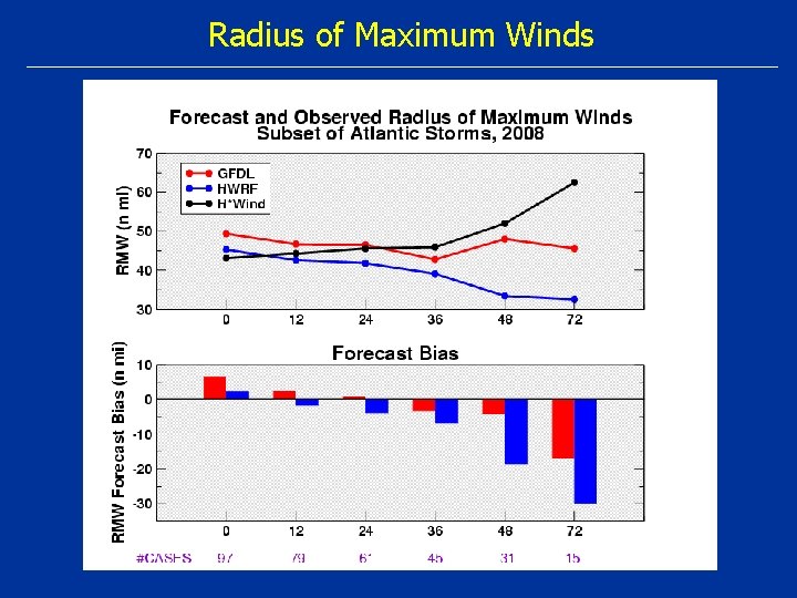
Radius of Maximum Winds

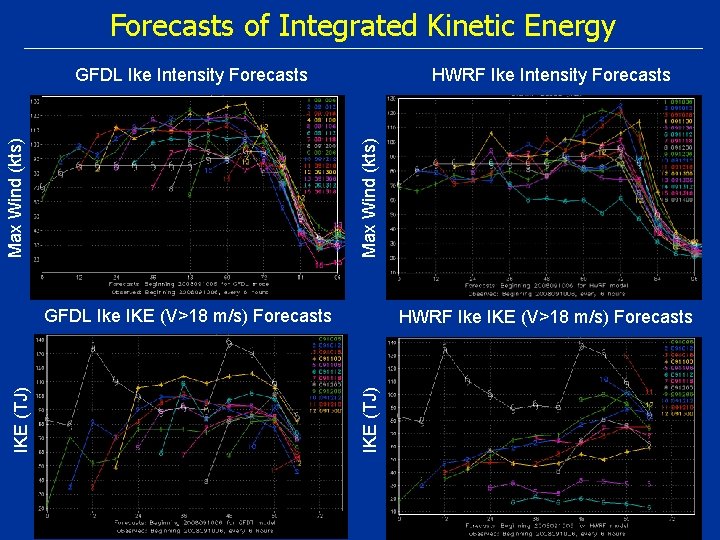
Forecasts of Integrated Kinetic Energy HWRF Ike Intensity Forecasts Max Wind (kts) GFDL Ike Intensity Forecasts HWRF Ike IKE (V>18 m/s) Forecasts IKE (TJ) GFDL Ike IKE (V>18 m/s) Forecasts

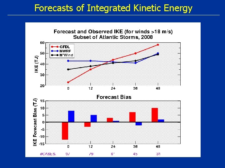
Forecasts of Integrated Kinetic Energy

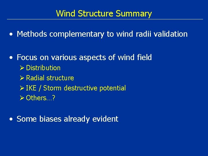
Wind Structure Summary • Methods complementary to wind radii validation • Focus on various aspects of wind field Ø Distribution Ø Radial structure Ø IKE / Storm destructive potential Ø Others…? • Some biases already evident