Vegetation Indices Monitoring using VIs Basis Why VIs

Vegetation Indices

Monitoring using. VIs • Basis:

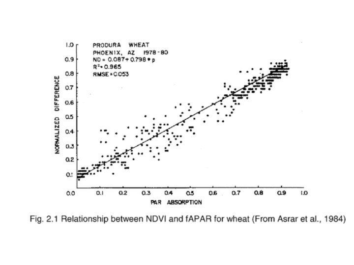
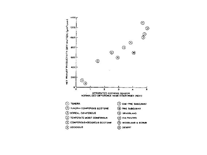
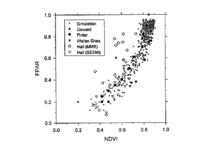
Why VIs? • empirical relationships with range of vegetation / climatological parameters · APAR · NPP · simple (understand/implement) · fast (ratio, difference etc. )

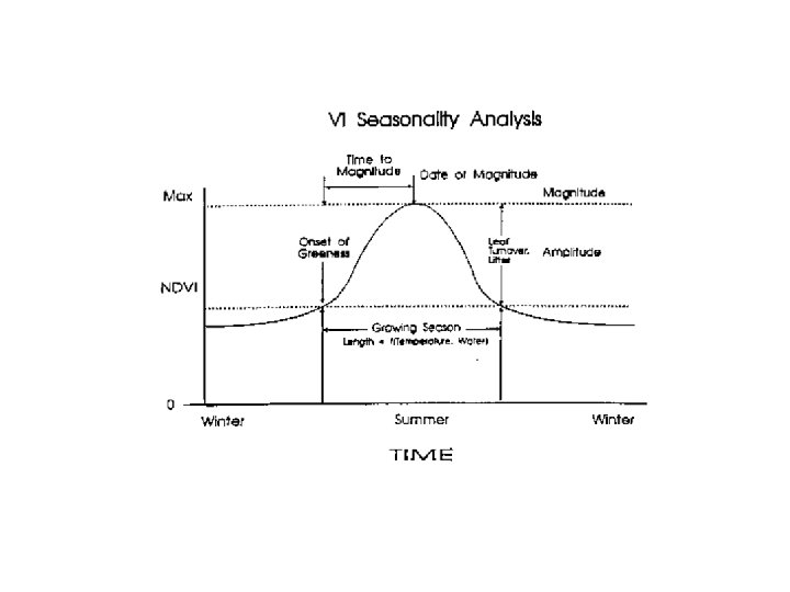
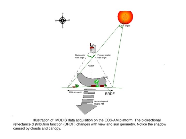
Why VIs? · tracking of temporal characteristics / seasonality · can reduce sensitivity to: · · topographic effects (soil background) (view/sun angle (? )) (atmosphere) · whilst maintaining sensitivity to vegetation

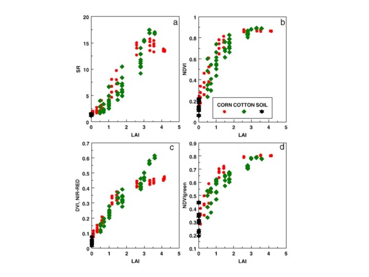
Some VIs • RVI • DVI • NDVI

functional equivalency RVI-NDVI not so for DVI, NDVI
")
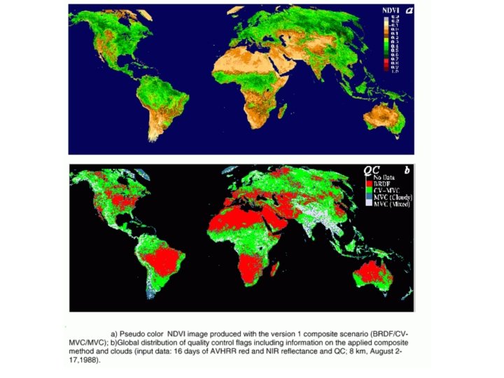
why NDVI? · continuity (17 years of AVHRR NDVI)
 · direct")
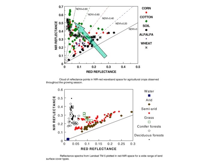
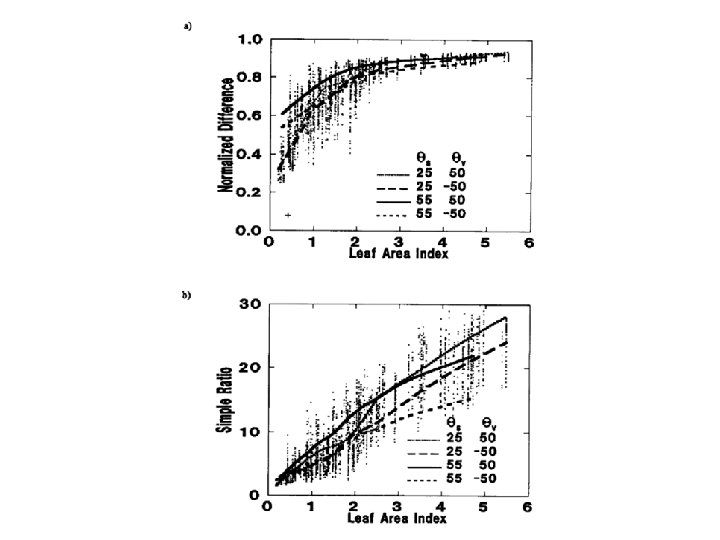
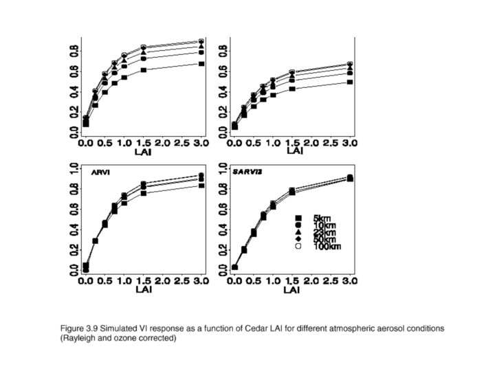
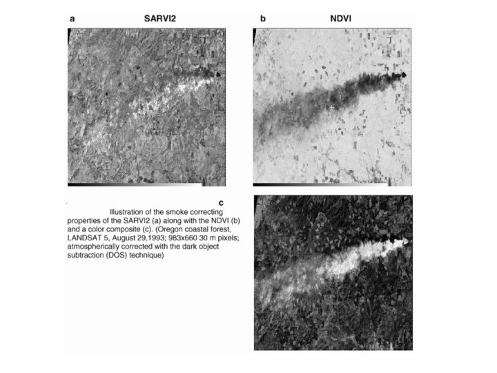
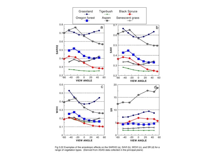
limitations of NDVI · atmospheric effects: · esp. aerosols (turbid - decrease) · direct means - atmospheric correction · indirect means: atmos. -resistant VI (ARVI/GEMI) · sun-target-sensor effects (BRDF): · MVC ? - ok on cloud, not so effective on BRDF · saturation problems: · saturates at VI of 2 -3

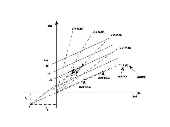
limitations of NDVI · non-linear relationships to f. APAR, LAI · saturation / more complex (? ) model · use RVI? · background effects · soil line concept · canopy structural effects (LAD) · empirical relationships site/crop specific · relationship with cover type? · residual topographic effects · DEM correction?
 · k - RVI of background")
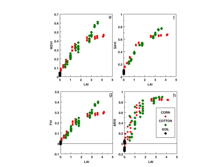
‘New’ indices · WDVI (Clevers, 1989) · k - RVI of background
 · L - soil adjustment factor")
‘New’ indices · SAVI (Huete, 1988) · L - soil adjustment factor
 • a - soil line slope,")
‘New’ indices · PVI (Richardson and Wiegand, 1977) • a - soil line slope, b - soil line intercept
")
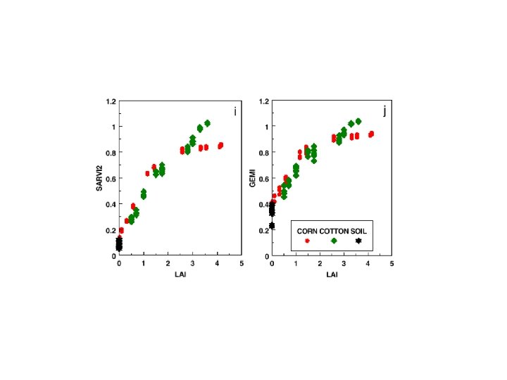
‘New’ indices · GEMI (Pinty and Verstraete, 1992)
")
‘New’ indices · Green NDVI: · better satn. properties than using red (? )
 · L - background term as before ·")
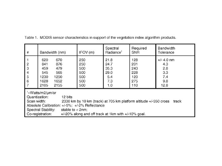
‘New’ indices · SARVI (Huete, 1996) · L - background term as before · C 1, 2 - weights blue in aerosol correction · designed for use on MODIS
- Slides: 31