Validation of Satellite Precipitation Estimates using HighResolution Surface


- Slides: 25

Validation of Satellite Precipitation Estimates using High-Resolution Surface Rainfall Observations in West Africa Paul A. Kucera and Andrew J. Newman NCAR/RAL Workshop on the Evaluation of High Resolution Precipitation Products 3 -5 December 2007 2/20/2021 1

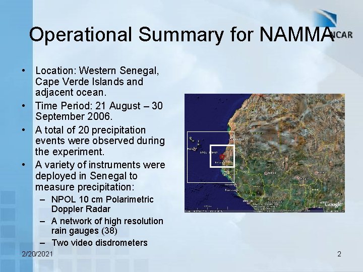
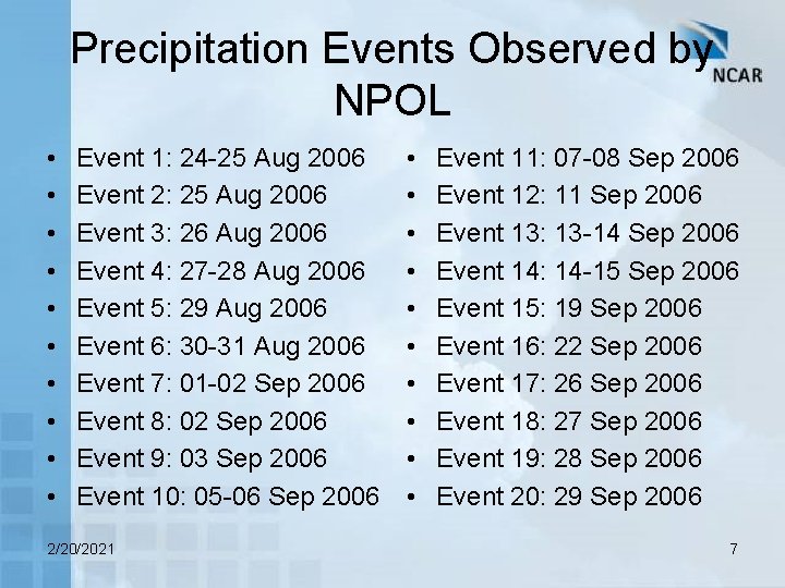
Operational Summary for NAMMA • Location: Western Senegal, Cape Verde Islands and adjacent ocean. • Time Period: 21 August – 30 September 2006. • A total of 20 precipitation events were observed during the experiment. • A variety of instruments were deployed in Senegal to measure precipitation: – NPOL 10 cm Polarimetric Doppler Radar – A network of high resolution rain gauges (38) – Two video disdrometers 2/20/2021 2

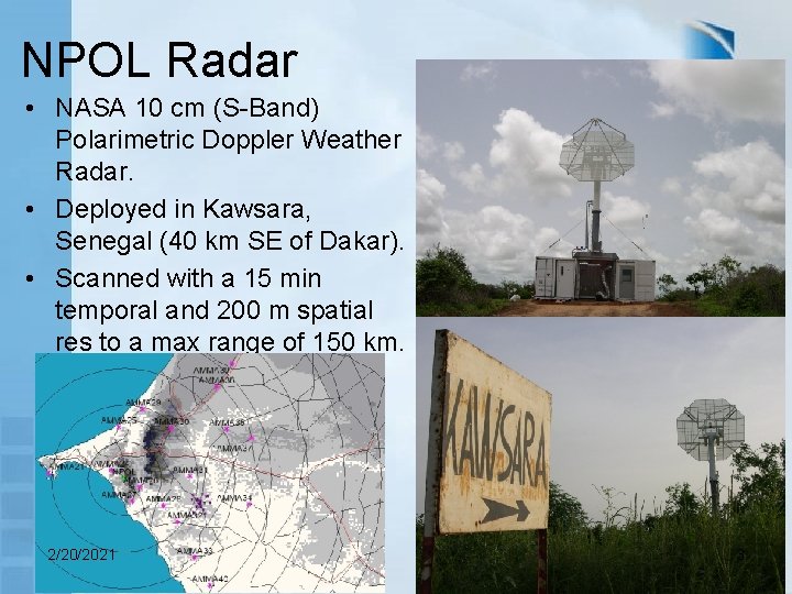
NPOL Radar • NASA 10 cm (S-Band) Polarimetric Doppler Weather Radar. • Deployed in Kawsara, Senegal (40 km SE of Dakar). • Scanned with a 15 min temporal and 200 m spatial res to a max range of 150 km. 2/20/2021 3

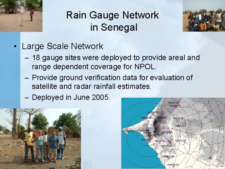
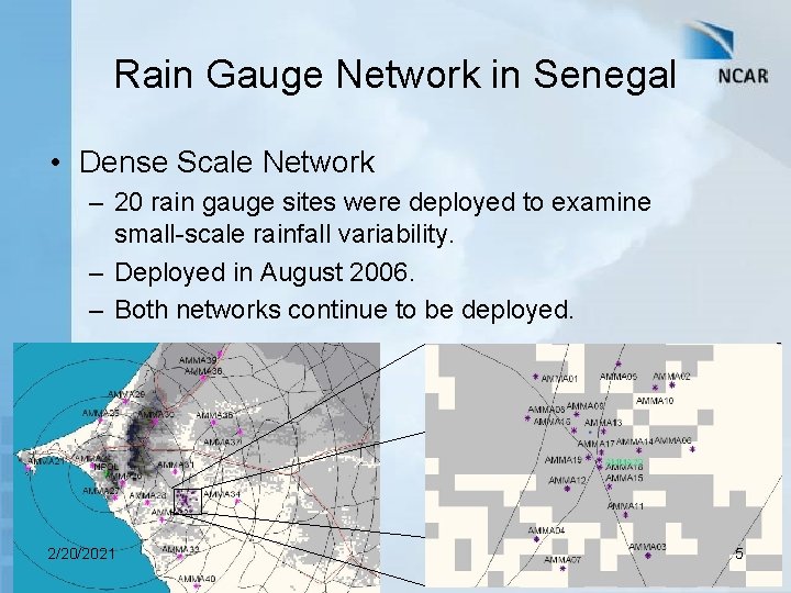
Rain Gauge Network in Senegal • Large Scale Network – 18 gauge sites were deployed to provide areal and range dependent coverage for NPOL. – Provide ground verification data for evaluation of satellite and radar rainfall estimates. – Deployed in June 2005. 2/20/2021 4

Rain Gauge Network in Senegal • Dense Scale Network – 20 rain gauge sites were deployed to examine small-scale rainfall variability. – Deployed in August 2006. – Both networks continue to be deployed. 2/20/2021 5

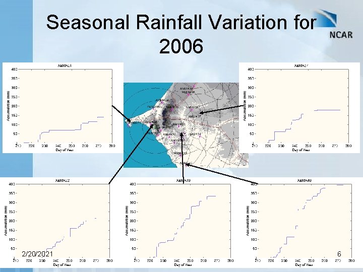
Seasonal Rainfall Variation for 2006 2/20/2021 6

Precipitation Events Observed by NPOL • • • Event 1: 24 -25 Aug 2006 Event 2: 25 Aug 2006 Event 3: 26 Aug 2006 Event 4: 27 -28 Aug 2006 Event 5: 29 Aug 2006 Event 6: 30 -31 Aug 2006 Event 7: 01 -02 Sep 2006 Event 8: 02 Sep 2006 Event 9: 03 Sep 2006 Event 10: 05 -06 Sep 2006 2/20/2021 • • • Event 11: 07 -08 Sep 2006 Event 12: 11 Sep 2006 Event 13: 13 -14 Sep 2006 Event 14: 14 -15 Sep 2006 Event 15: 19 Sep 2006 Event 16: 22 Sep 2006 Event 17: 26 Sep 2006 Event 18: 27 Sep 2006 Event 19: 28 Sep 2006 Event 20: 29 Sep 2006 7

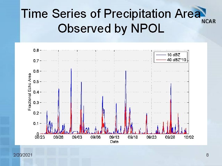
Time Series of Precipitation Area Observed by NPOL 2/20/2021 8

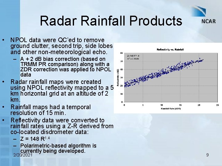
Radar Rainfall Products • NPOL data were QC’ed to remove ground clutter, second trip, side lobes and other non-meteorological echo. – A + 2 d. B bias correction (based on TRMM PR comparison) along with a ZDR correction was applied to NPOL data • Radar rainfall maps were created using NPOL reflectivity mapped to a 5 km horizontal grid at an altitude of 2 km. • Rainfall maps had a temporal resolution of 15 min. • Reflectivity data were converted to rainfall rates using a Z-R derived from co-located disdrometer data: – Z = 148 R 1. 4 – Polarimetric-based algorithm is currently being developed. 2/20/2021 9

Satellite-Rainfall Comparisons • Radar rainfall estimates were averaged to the 0. 25 x 0. 25 deg grids and accumulated to 3 h resolution. • Comparisons were made with the following algorithms: – – TRMM Multi-satellite Precipitation Analysis (TMPA) CPC Morphing technique (CMORPH) NRL-Blended (NRLB) Precipitation Estimation from Remotely Sensed Information using Artificial Neural Networks (PERSIANN) – Hydro. Estimator (HE) (Was not analyzed because of problems with the product files) • The high resolution products (0. 10 deg x 1 h) were not analyzed in the present study, but is planned for future analysis. 2/20/2021 10

Results 2/20/2021 11

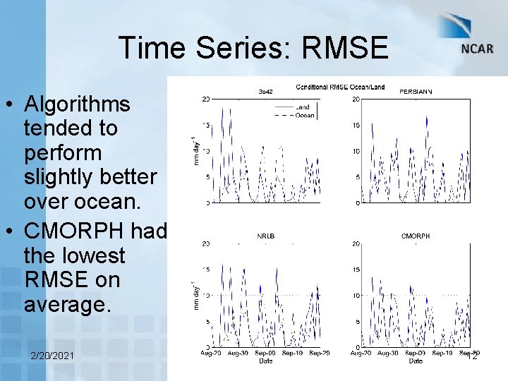
Time Series: RMSE • Algorithms tended to perform slightly better over ocean. • CMORPH had the lowest RMSE on average. 2/20/2021 12

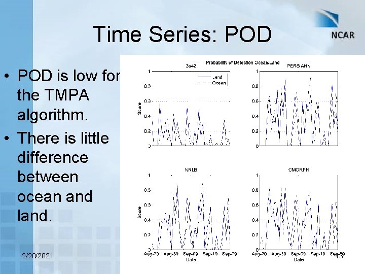
Time Series: POD • POD is low for the TMPA algorithm. • There is little difference between ocean and land. 2/20/2021 13

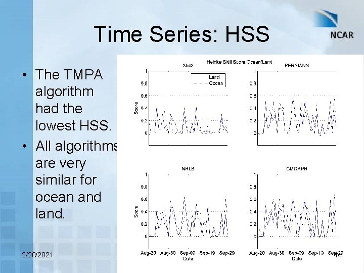
Time Series: HSS • The TMPA algorithm had the lowest HSS. • All algorithms are very similar for ocean and land. 2/20/2021 14

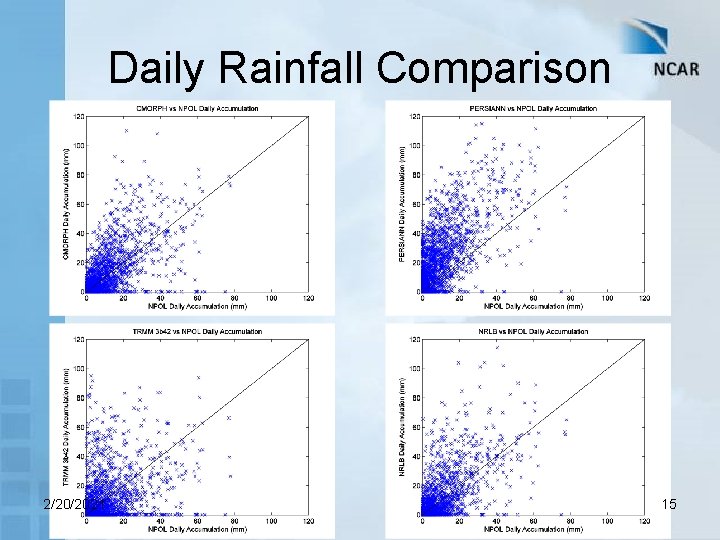
Daily Rainfall Comparison 2/20/2021 15

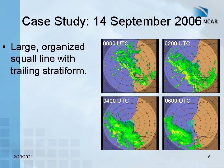
Case Study: 14 September 2006 • Large, organized squall line with trailing stratiform. 2/20/2021 0000 UTC 0200 UTC 0400 UTC 0600 UTC 16

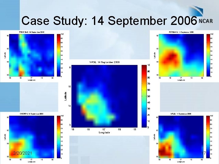
Case Study: 14 September 2006 2/20/2021 17

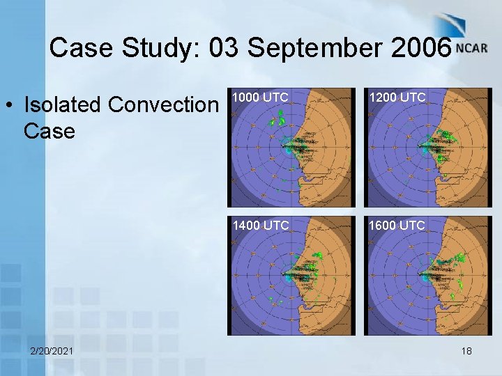
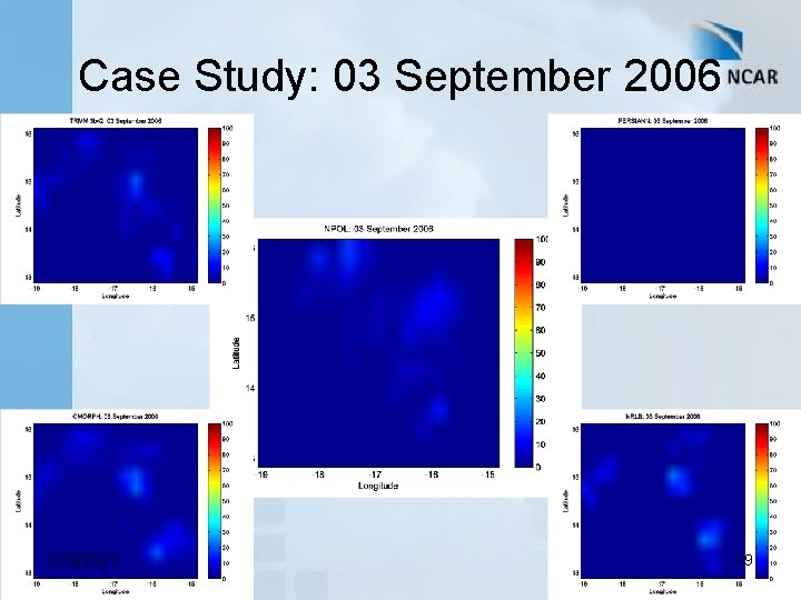
Case Study: 03 September 2006 • Isolated Convection Case 2/20/2021 1000 UTC 1200 UTC 1400 UTC 1600 UTC 18

Case Study: 03 September 2006 2/20/2021 19

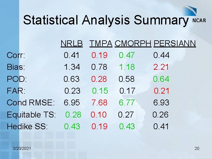
Statistical Analysis Summary NRLB TMPA CMORPH PERSIANN Corr: 0. 41 0. 19 0. 47 0. 44 Bias: 1. 34 0. 78 1. 18 2. 21 POD: 0. 63 0. 28 0. 58 0. 64 FAR: 0. 23 0. 15 0. 17 0. 21 Cond RMSE: 6. 95 7. 68 6. 77 6. 93 Equitable TS: 0. 28 0. 10 0. 27 0. 26 Hedike SS: 0. 43 0. 19 0. 43 0. 41 2/20/2021 20

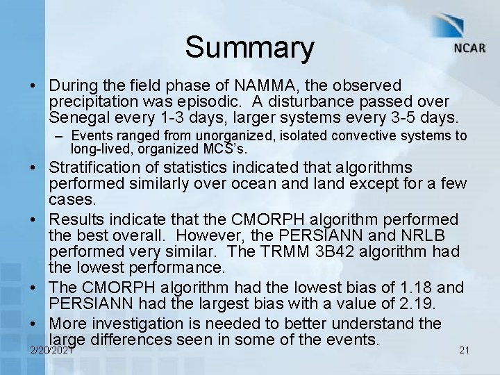
Summary • During the field phase of NAMMA, the observed precipitation was episodic. A disturbance passed over Senegal every 1 -3 days, larger systems every 3 -5 days. – Events ranged from unorganized, isolated convective systems to long-lived, organized MCS’s. • Stratification of statistics indicated that algorithms performed similarly over ocean and land except for a few cases. • Results indicate that the CMORPH algorithm performed the best overall. However, the PERSIANN and NRLB performed very similar. The TRMM 3 B 42 algorithm had the lowest performance. • The CMORPH algorithm had the lowest bias of 1. 18 and PERSIANN had the largest bias with a value of 2. 19. • More investigation is needed to better understand the large differences seen in some of the events. 2/20/2021 21

Future Work • Short-term: – Continue to develop and evaluate NPOL radar rainfall products. – Validation of high(er) resolution precipitation products. – Spatial validation analysis. • Long-term: – Regional validation analysis in West Africa. 2/20/2021 22

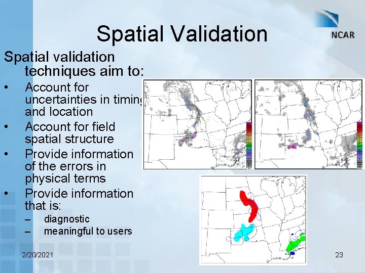
Spatial Validation Spatial validation techniques aim to: • • Account for uncertainties in timing and location Account for field spatial structure Provide information of the errors in physical terms Provide information that is: – – diagnostic meaningful to users 2/20/2021 23

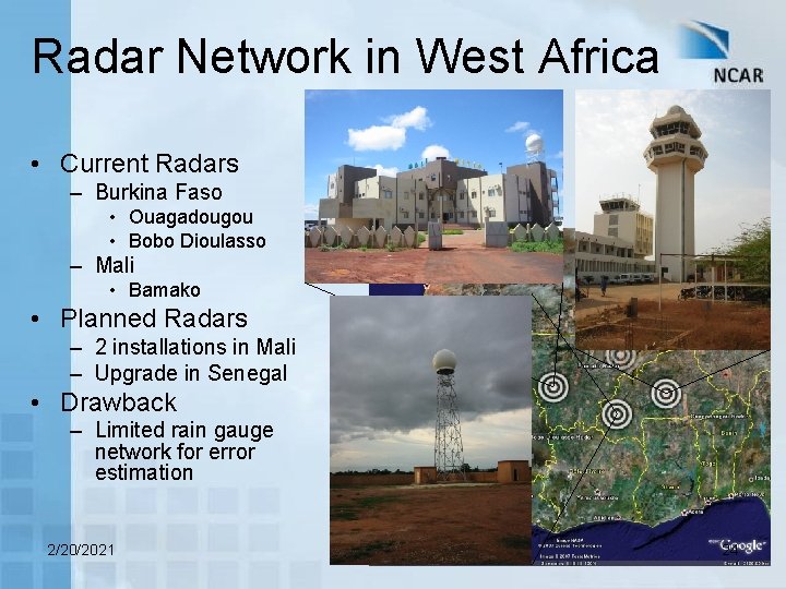
Radar Network in West Africa • Current Radars – Burkina Faso • Ouagadougou • Bobo Dioulasso – Mali • Bamako • Planned Radars – 2 installations in Mali – Upgrade in Senegal • Drawback – Limited rain gauge network for error estimation 2/20/2021 24

Thank You 2/20/2021 25