UTM Universal Transverse Mercator Coordinates UTM Exercise Locating


 Coordinates")


- Slides: 26
UTM Universal Transverse Mercator Coordinates UTM Exercise Locating the Grid UTM Guide
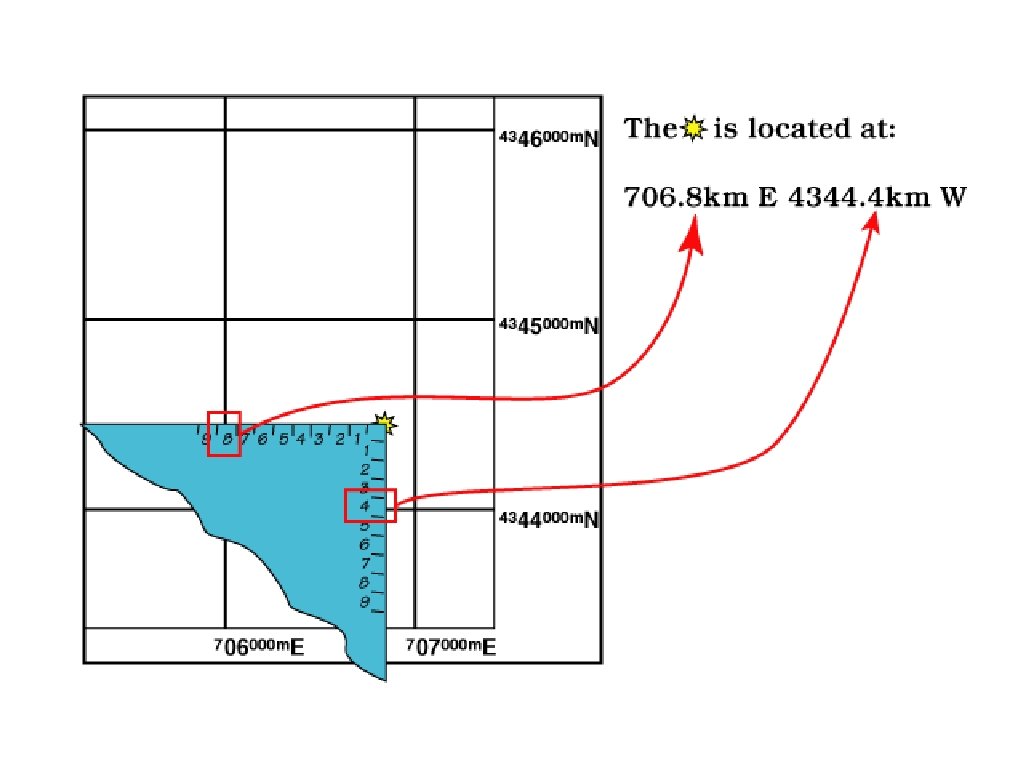
• This 1 km square is located at 706 km E 4344 km N • Usually we need to be a bit more precise about a location!
Using UTM is Easy • Take a look at the “UTM Practice Map” handout. • Can you quickly determine what map feature is at: 755. 2 km E 4255. 4 km N
100 m square example
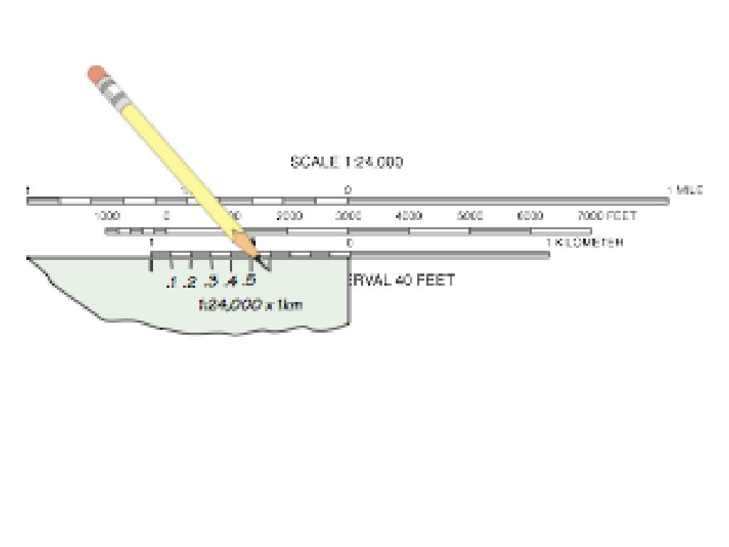
Using a distance scale, marked in meters, to measure UTM coordinates
P r e c i s i o n | | V There are many ways to write the same position. . . Kilometers Meters 755 km E 4255 km N 755000 m E 4255000 m N 755. 2 km E 4255. 4 km N 755200 m E 4255400 m N 755. 23 km E 4255. 48 km N 755230 m E 4255480 m N 755. 234 km E 4255. 483 km N 755234 m E 4255483 m N 755. 200 km 755 200 m
UTM Display on a GPS Receiver
Reporting your position in UTM kilometers
This is a Township & Range Section, NOT a UTM Grid
U. S. National Grid (USNG) Coordinates
Printed Grid Reference Box
U. S. National Grid could make many location signs “GPS Compatible” House Numbers Upgraded Highway Mile Post Trail Markers Rural Fire Numbers
UTM Coordinate Markings on USGS Topographic Maps
Make a mark between digits from the grid within the grid USGS 1: 24, 000 1000 m grid Campus Air Photo 1: 5490 100 m grid 755230 m E 4255480 m N 587460 m E 4124620 m N 755. 23 km E 4255. 48 km N 587. 46 km E 4124. 62 km N
Plotting and Reading UTM Classroom Exercise
More about UTM
Transverse Mercator Projection • Central meridian is selected by the map maker and touches the cylinder. • Maps using the projection can show the whole Earth, but directions, distances, and areas are reasonably accurate only within 15° of the central meridian.
UTM Zones • World is divided into 60 zones. • Each zone is 6° of longitude wide. • Zones are numbered 1 to 60, starting at 180° and progressing to the east.
UTM Zones
UTM Zone Details
Boundary between UTM zones
Converting Lat/Lon to UTM
Converting UTM to Lat/Lon
Converting between Lat/Lon and UTM • Save a waypoint in the position format you have the coordinate in. • Switch to the position format you want to convert to. • Recall the waypoint