
UTAH PRAIRIE DOG OCCUPANCY AND HABITAT SURVEY PROTOCOL
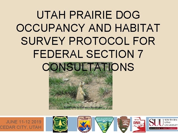
UTAH PRAIRIE DOG OCCUPANCY AND HABITAT SURVEY PROTOCOL FOR FEDERAL SECTION 7 CONSULTATIONS JUNE 11 -12 2019 CEDAR CITY, UTAH BLM/Photo by Rebecca Bonebrake
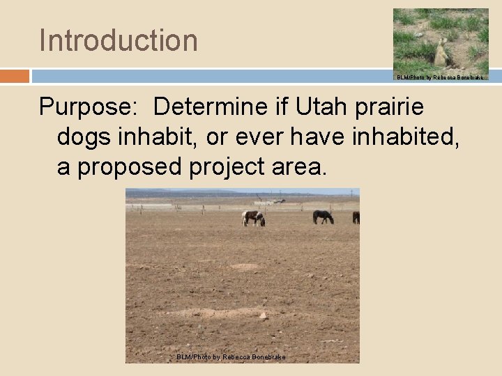
Introduction BLM/Photo by Rebecca Bonebrake Purpose: Determine if Utah prairie dogs inhabit, or ever have inhabited, a proposed project area. BLM/Photo by Rebecca Bonebrake
Introduction BLM/Photo by Rebecca Bonebrake Why/What info are we trying to obtain? To be in compliance with the Endangered Species Act. Determine the status of Utah prairie dogs and their habitat in relation to a proposed project. Provide information necessary to devise and implement actions that will avoid and/or minimize impacts to Utah prairie dogs.
Introduction BLM/Photo by Rebecca Bonebrake Adaptability Our knowledge is continuously developing and changing. This protocol is a work in progress and will be modified as new information becomes available. (Please note 2018 modifications) Special conditions might dictate that surveys be conducted differently in rare instances. Any deviation from the approved survey protocol MUST be approved by Utah Ecological Services Field Office AND the Authorizing Federal Agency prior to survey
Surveyor Qualifications All Surveyors must be certified. Certified = Successful completion of a USFWS approved UPD Training. Survey results from non-certified surveyors will not be used for assessing impacts to UPD’s.
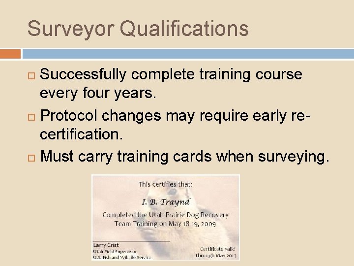
Surveyor Qualifications Successfully complete training course every four years. Protocol changes may require early recertification. Must carry training cards when surveying.
Pre-Survey Coordination Don’t miss this critical step: Pre. Survey Coordination! This section of the protocol contains important directions for conducting a survey. We will discuss them in the following slides. Please follow these steps in order. Authorizing federal agency Federal nexus Action area Mapped habitat GRAMA Private land access
Pre-Survey Coordination Prior to conducting surveys Certified Surveyors must coordinate with the Authorizing Federal Agency Example Authorizing Federal Agents USFWS BLM, USFS, etc.
Authorizing Federal Agency For projects on federal lands; the authorizing agency is the agency which administers the lands where the proposed project occurs and from whom a permit or other authorization is needed before the project may be implemented. Examples of Authorizing Federal Agencies: BLM, USFS, NPS
Pre-Survey Coordination The role of the authorizing agency is to determine what areas need to be surveyed and what areas would be exempt from surveys; they are also responsible for validating the survey results and ensuring that the protocol is followed during data collection. DON’T ASSUME YOU KNOW WHAT NEEDS TO BE DONE – CONSULT WITH THE AUTHORIZING FEDERAL AGENCY PRIOR TO STARTING SURVEYS!!
Authorizing Federal Agency If the authorizing federal agency is not a land management agency, coordinate all survey details with the U. S. Fish and Wildlife Service. For projects on private lands with a federal nexus, the authorizing federal agency is the federal agency connected to the private lands action.

What’s a Federal Nexus? ? ?
What’s a Federal Nexus? ? ? A. A newly discovered galaxy.
What’s a Federal Nexus? ? ? A. A newly discovered galaxy. B. A hair-care product.
What’s a Federal Nexus? ? ? A. A newly discovered galaxy. B. A hair-care product. C. Any private actions that are: federalized for purposes of NEPA through a key federal decision and considered as a connected action and included within the scope of the federal agency’s decision making.
What’s a Federal Nexus? ? ? A. A newly discovered galaxy. B. A hair-care product. C. Any private actions that are: federalized for purposes of NEPA through a key federal decision and considered as a connected action and included within the scope of the federal agency’s decision making. D. A luxury sedan.
What’s a Federal Nexus? ? ? A. A newly discovered galaxy. B. A hair-care product. C. Any private actions that are: federalized for purposes of NEPA through a key federal decision and considered as a connected action and included within the scope of the federal agency’s decision making. D. A luxury sedan.
Federal Nexus: A “federalized” project is one for which the agency has discretion to authorize or permit the action, or proposes to contribute substantial funds, equipment or staff to implement.
To Determine Authorizing Agency: Ask Yourself: 1. Does the project involve private, state, or federal lands? 2. Does the project have any federal funding or permits? 3. Is this a private or federally sponsored project?
What is an Action Area? q ACTION AREA: The entire right-of-way or exterior boundary of a proposed action plus the appropriate Buffer Type: 1000 -foot buffer for projects that do or do not permanently alter or substantially impact habitat, or include surface occupancy, extending from the proposed project footprint. (2018 change)

What’s my buffer? The buffer type will be determined by the authorizing federal agency in coordination with the U. S. Fish and Wildlife Service.
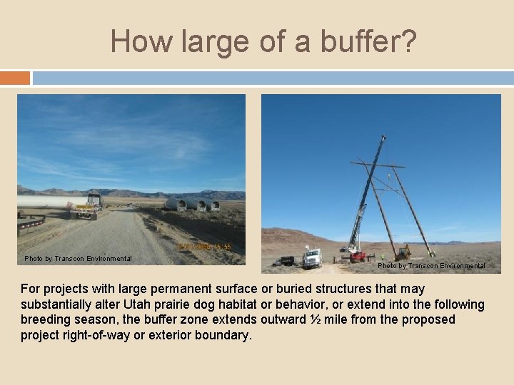
How large of a buffer? Photo by Transcon Environmental For projects with large permanent surface or buried structures that may substantially alter Utah prairie dog habitat or behavior, or extend into the following breeding season, the buffer zone extends outward ½ mile from the proposed project right-of-way or exterior boundary.
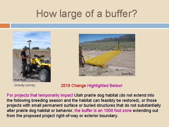
How large of a buffer? BLM Photo Gravity survey 2018 Change Highlighted Below! For projects that temporarily impact Utah prairie dog habitat (do not extend into the following breeding season and the habitat can feasibly be restored), or those projects with small permanent surface or buried structures that do not substantially alter prairie dog habitat or behavior, the buffer is an 1000 foot zone extending out from the proposed project right-of-way or exterior boundary.
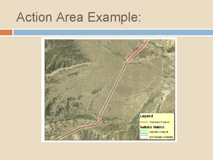
Action Area Example:
Pre-Survey Coordination Mapped habitat within the Action Area can be obtained from UDWR. You must submit a Government Records Access and Management Act (GRAMA) request. The authorizing federal agency may provide additional maps of suspected Utah prairie dog habitats. The authorizing federal agency can also identify areas that will be exempt from surveys based on habitat suitability.
Rules for Private Land Access: q Written permission from the legal landowner or lessee is required to legally access privately owned lands. q If access cannot be obtained to privately owned lands in the Action Area, the surveyor must use other accessible vantage points, optics, aerial photos, audio cues, other technology, and interviews of knowledgeable land managers and agency biologists to assess prairie dog occupancy and extent of suitable habitat.
Rules for Private Land Access: q If other survey methods are not available on inaccessible private lands or do not provide adequate data for the federal authorizing agency to make a conclusive decision concerning occupancy, then the inaccessible land in question must be assumed occupied by Utah prairie dogs.
Summary/Key Points: 1. Prior to conducting surveys, certified surveyors must coordinate with the authorizing federal agency of the land parcel.
Summary/Key Points: 1. 2. Prior to conducting surveys, certified surveyors must coordinate with the authorizing federal agency of the land parcel. A project that occurs on private land, but is being funded by a federal agency, requires Section 7 consultation.
Summary/Key Points: 1. 2. 3. Prior to conducting surveys, certified surveyors must coordinate with the authorizing federal agency of the land parcel. A project that occurs on private land, but is being funded by a federal agency, requires Section 7 consultation. The Action Area is defined as "the entire right-of-way or exterior boundary of a proposed action plus the appropriate Buffer Type. ”
Summary/Key Points: 1. 2. 3. 4. Prior to conducting surveys, certified surveyors must coordinate with the authorizing federal agency of the land parcel. A project that occurs on private land, but is being funded by a federal agency, requires Section 7 consultation. The Action Area is defined as "the entire right-of-way or exterior boundary of a proposed action plus the appropriate Buffer Type. ” The two sizes of project buffers, based on project type, are 1000 feet and ½ mile. 2018 Change
Summary/Key Points: 1. 2. 3. 4. 5. Prior to conducting surveys, certified surveyors must coordinate with the authorizing federal agency of the land parcel. A project that occurs on private land, but is being funded by a federal agency, requires Section 7 consultation. The Action Area is defined as "the entire right-of-way or exterior boundary of a proposed action plus the appropriate Buffer Type. ” The two sizes of project buffers, based on project type, are 1000 feet and ½ mile. 2018 Change If written permission from the legal landowner or lessee to access privately owned lands cannot be obtained to
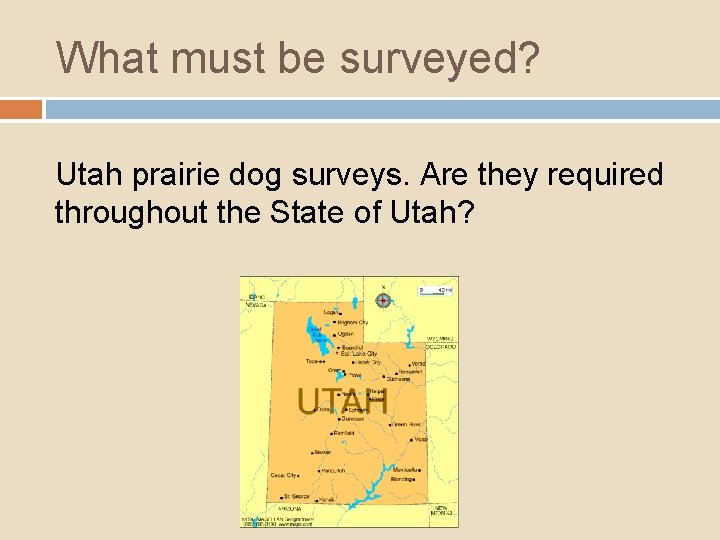
What must be surveyed? Utah prairie dog surveys. Are they required throughout the State of Utah?
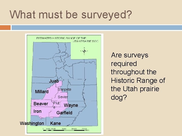
What must be surveyed? Juab Millard Sanpete Sevier Beaver Iron Washington Piut e Wayne Garfield Kane Are surveys required throughout the Historic Range of the Utah prairie dog?
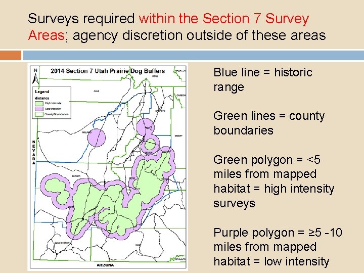
Surveys required within the Section 7 Survey Areas; agency discretion outside of these areas Blue line = historic range Green lines = county boundaries Green polygon = <5 miles from mapped habitat = high intensity surveys Purple polygon = ≥ 5 -10 miles from mapped habitat = low intensity
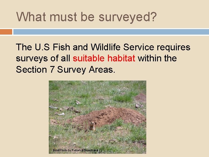
What must be surveyed? The U. S Fish and Wildlife Service requires surveys of all suitable habitat within the Section 7 Survey Areas. BLM/Photo by Rebecca Bonebrake
Suitable Habitat BLM/Photo by Rebecca Bonebrake Habitat capable of supporting Utah prairie dogs includes: - grassland or low density sagebrush sites - agricultural fields - vacant lots - other areas as identified by the authorizing Federal agency. Habitat previously mapped by the Utah Division of Wildlife Resources must be treated as suitable, and occupancy status must be determined regardless of current vegetative status.
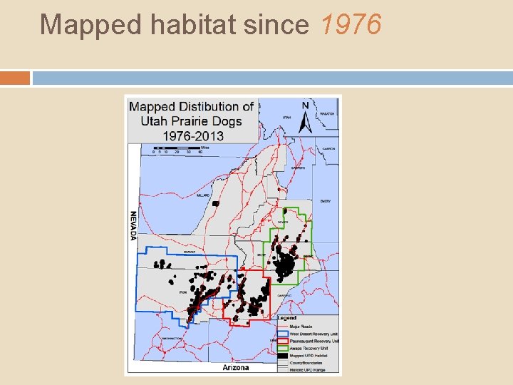
Mapped habitat since 1976
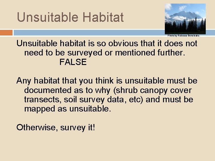
Unsuitable Habitat Photo by Rebecca Bonebrake Unsuitable habitat is so obvious that it does not need to be surveyed or mentioned further. FALSE Any habitat that you think is unsuitable must be documented as to why (shrub canopy cover transects, soil survey data, etc) and must be mapped as unsuitable. Otherwise, survey it!
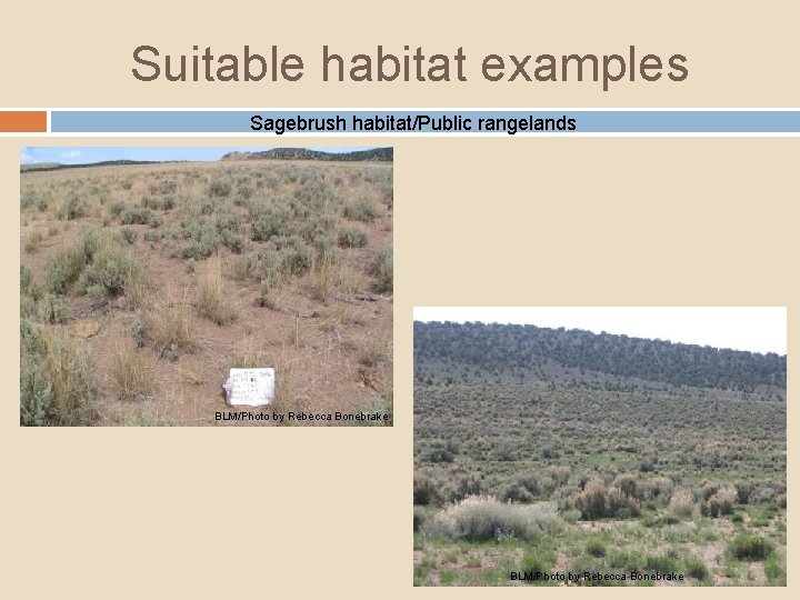
Suitable habitat examples Sagebrush habitat/Public rangelands BLM/Photo by Rebecca Bonebrake
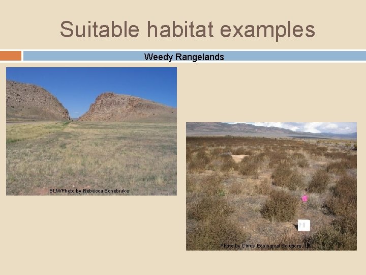
Suitable habitat examples Weedy Rangelands BLM/Photo by Rebecca Bonebrake Photo by Cirrus Ecological Solutions, LC
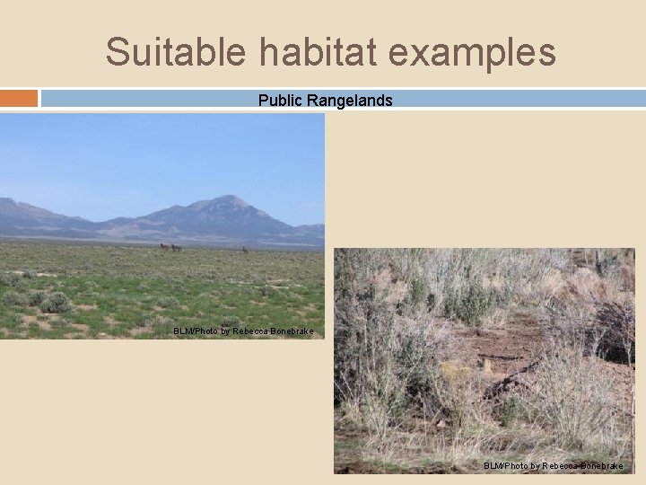
Suitable habitat examples Public Rangelands BLM/Photo by Rebecca Bonebrake
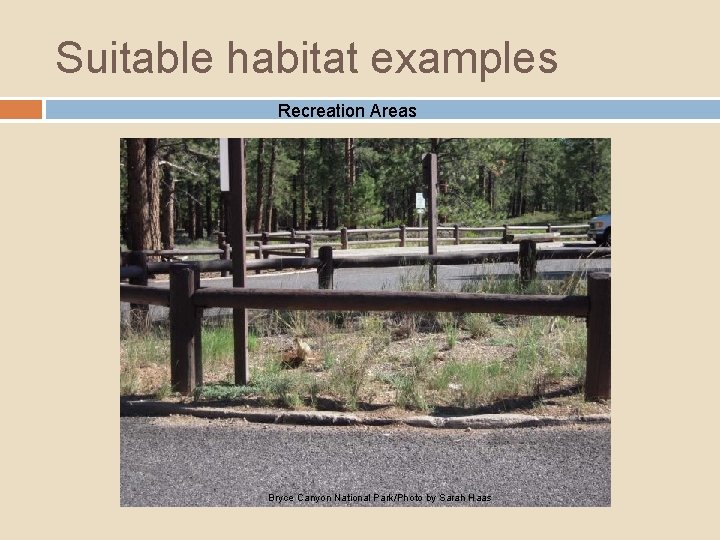
Suitable habitat examples Recreation Areas Bryce Canyon National Park/Photo by Sarah Haas
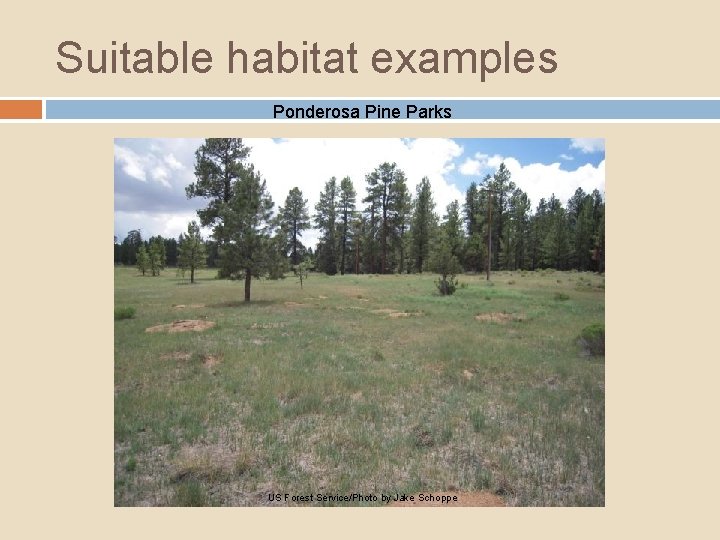
Suitable habitat examples Ponderosa Pine Parks US Forest Service/Photo by Jake Schoppe
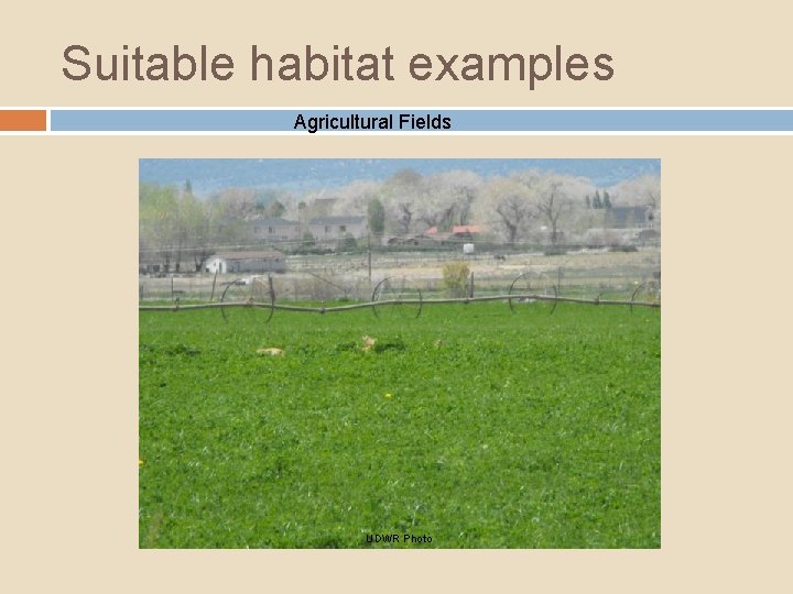
Suitable habitat examples Agricultural Fields UDWR Photo
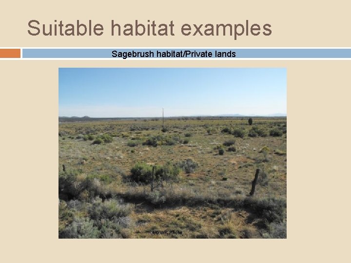
Suitable habitat examples Sagebrush habitat/Private lands UDWR Photo
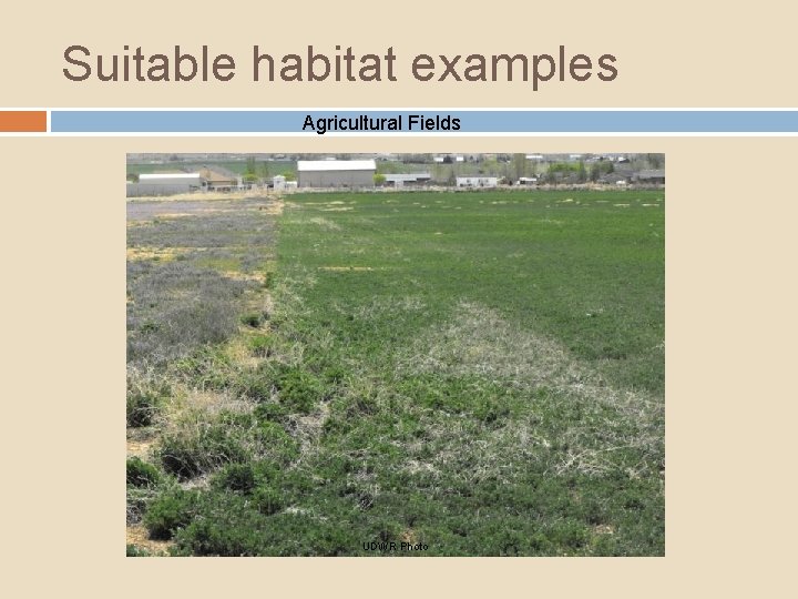
Suitable habitat examples Agricultural Fields UDWR Photo
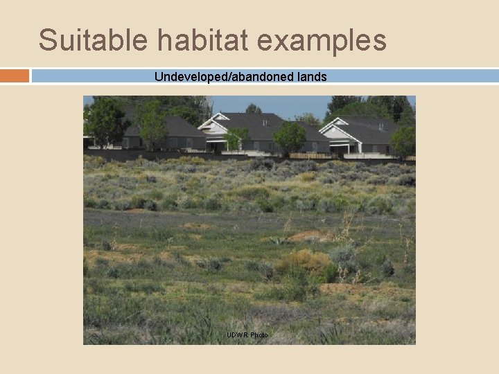
Suitable habitat examples Undeveloped/abandoned lands UDWR Photo
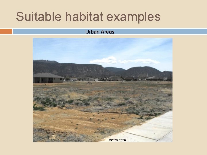
Suitable habitat examples Urban Areas UDWR Photo
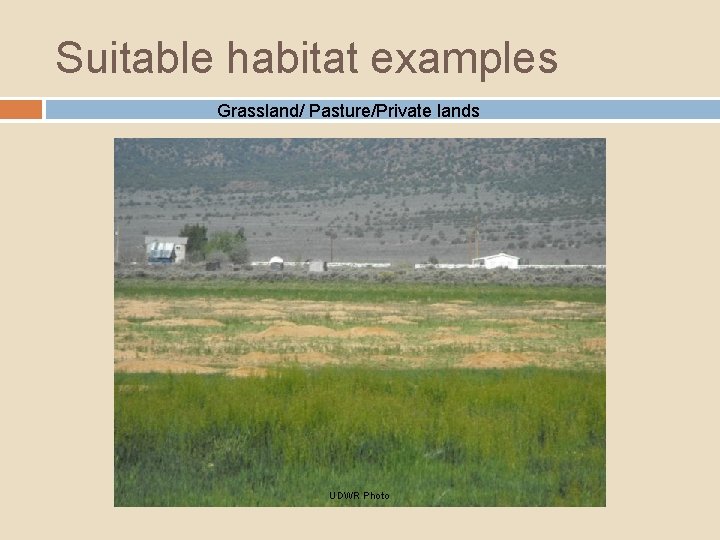
Suitable habitat examples Grassland/ Pasture/Private lands UDWR Photo
Survey Season Active Season – April 1 through August 31 -Ground must be snow free. Dormant season – September 1 - March 31 -Ground must be snow free. The Authorizing Federal Agency will determine applicable season.
Dormant Season Surveys When not to survey during dormant season? Final decision to be made by the Authorizing Federal Agency Site conditions may not be conducive to accurate and reliable dormant season surveys Large project areas Weather conditions: snow or mud Presence of many burrows and/or species of burrowing mammals
Summary/Key Points: 1. Survey all suitable habitat within the Section 7 Survey Areas.
Summary/Key Points: 1. 2. Survey all suitable habitat within the Section 7 Survey Areas. Utah prairie dogs occur in a variety of habitats, including colonization of areas in and among trees.
Summary/Key Points: 1. 2. 3. Survey all suitable habitat within the Section 7 Survey Areas. Utah prairie dogs occur in a variety of habitats, including colonization of areas in and among trees. You are required to survey for Utah prairie dogs in areas previously mapped by the Utah Division of Wildlife Resources as prairie dog habitat. You must determine if it is occupied or unoccupied.
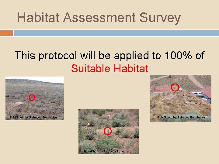
Habitat Assessment Survey This protocol will be applied to 100% of Suitable Habitat BLM/Photo by Rebecca Bonebrake
How do I do this? There are two types of surveys: (1) Low Intensity Level Surveys (2) High Intensity Level Surveys The required survey level will be determined by the authorizing federal agency.
How do I do this? (1) Low Intensity Level Surveys: q Surveys of suitable habitat that are intended to identify any previously unknown Utah prairie dog habitat areas. Generally conducted in locations ≥ 5 miles from any known and/or mapped Utah prairie dog habitat where previous surveys or professional knowledge of the local management biologists indicate that the likelihood of occupied prairie dog habitat is low.
How do I do this? (1) Low Intensity Level Surveys Methods: 1. 100% visual coverage - All suitable habitat in the Action Area must be surveyed by foot and/or vehicle. 2. Aerial methods are not allowed. 3. Vehicle surveyors must: stop every ¼ mile (400 m), or more frequently q exit vehicle and scan surrounding areas, listen for vocalizations q scans should not attempt to clear more than 200 m in either direction q The surveyor should spend a minimum of 5 minutes at each observation point
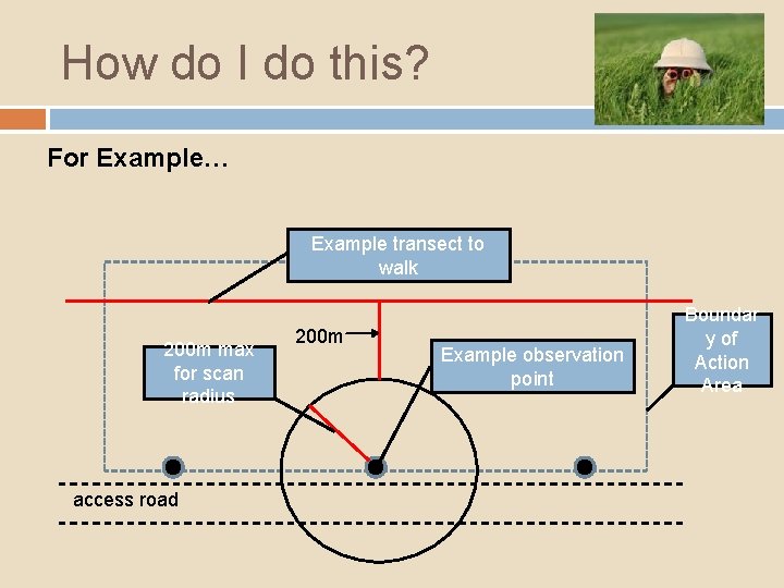
How do I do this? For Example… Example transect to walk 200 m max for scan radius access road 200 m Example observation point Boundar y of Action Area
How do I do this? (1) Low Intensity Level Surveys Methods: 4. If no Utah prairie dogs or their sign are observed within the entire Action Area, the results of the Low Intensity Level survey will be considered valid for two years from the following March 31 For Example: If a survey is completed May 15, 2018, the survey is valid until March 31, 2019 5. If any Utah prairie dogs or their sign are observed anywhere within the Action Area during the Low Intensity Level Survey, then High Intensity Level Surveys will be required in those areas.
How do I do this? (2) High Intensity Level Surveys: Surveys of suitable habitat intended to identify the extent of Utah prairie dog habitat in areas suspected of containing Utah prairie dogs. Generally conducted within 5 miles of known and/or mapped Utah prairie dog habitat areas where previous surveys or professional knowledge of the local management biologists indicate that occupied prairie dog habitat may occur.
How do I do this? (2) High Intensity Level Surveys Methods: 1. All (100%) suitable habitat in the Action Area must be surveyed. 2. The surveyor must walk parallel transects no more than 30 meters apart through the entire area of suitable habitat searching 15 m on both sides of the transect for burrows and other prairie dog sign. Surveyors must walk transects using a compass or GPS unit for orientation, ensuring that all suitable habitat within the entire action area is adequately surveyed. Care must be taken to not trample burrows or twist your ankle.
How do I do this? (2) High Intensity Level Surveys Methods: 3. Surveyors must stop periodically and scan surrounding areas with suitable optics for the presence of prairie dogs. The surveyor must also listen for Utah prairie dog vocalizations throughout the survey to locate prairie dogs. 4. The results of the High Intensity Level survey are only valid from the date conducted through to the following March 31 For Example: If a survey is completed May 15, 2018, the survey is valid until March 31, 2019 If a project is not implemented until after the following March 31, and/or if there are gaps in construction activity within the same year (generally one week or more), new surveys may be required.
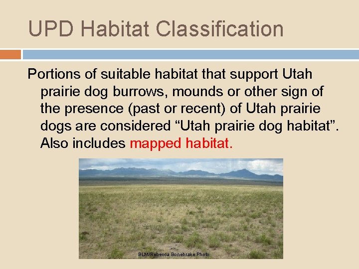
UPD Habitat Classification Portions of suitable habitat that support Utah prairie dog burrows, mounds or other sign of the presence (past or recent) of Utah prairie dogs are considered “Utah prairie dog habitat”. Also includes mapped habitat. BLM/Rebecca Bonebrake Photo
UPD Habitat Classification Utah prairie dog habitat will be classified as unoccupied or occupied. Unoccupied = evidence that Utah prairie dogs once occupied the site, but no conclusive evidence of current occupancy (No time frame is specified) Occupied = evidence of current occupancy
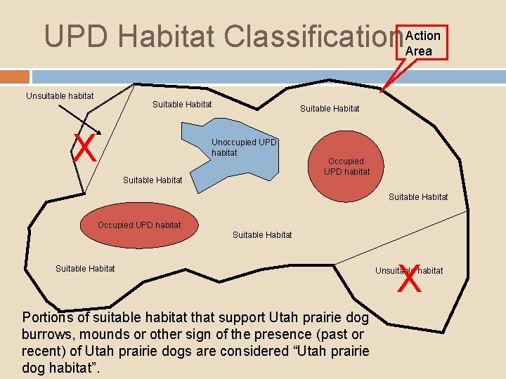
UPD Habitat Classification. Action Area Unsuitable habitat Suitable Habitat X Suitable Habitat Unoccupied UPD habitat Suitable Habitat Occupied UPD habitat Suitable Habitat Portions of suitable habitat that support Utah prairie dog burrows, mounds or other sign of the presence (past or recent) of Utah prairie dogs are considered “Utah prairie dog habitat”. X Unsuitable habitat
Unoccupied Utah Prairie Dog Habitat Active Season : Functional Utah prairie dog burrows or mound systems are found but there is no evidence of prairie dogs = No Utah prairie dogs seen or heard, no fresh digging, no scat or tracks OR Utah prairie dog burrows are found but are not Functional
Unoccupied Utah Prairie Dog Habitat Dormant Season: Because Utah prairie dogs hibernate, the “Unoccupied” habitat classification cannot be applied to dormant season surveys. Any Utah prairie dog burrows found (functional or not functional), or any evidence of a prairie dog mound system, must be documented and will be assumed to be occupied.
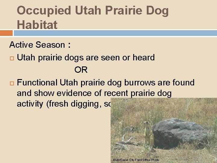
Occupied Utah Prairie Dog Habitat Active Season : Utah prairie dogs are seen or heard OR Functional Utah prairie dog burrows are found and show evidence of recent prairie dog activity (fresh digging, scat, fresh tracks). BLM/Cedar City Field Office Photo
Occupied Utah Prairie Dog Habitat Dormant Season: Utah prairie dog burrows (functional or not functional) or mound systems are found, even if no other signs of Utah prairie dogs are present. In other words, any area with Utah prairie dog sign must be classified as occupied during the Dormant Season.
Functional Burrow Definition Functional burrow: Any Utah prairie dog burrow that is structurally suitable to house Utah prairie dogs (entirely open, partially filled with dirt, or open but blocked by sticks, weeds, cobwebs, or other debris). Burrows that are less than 3” in diameter are not considered potential prairie dog burrows.
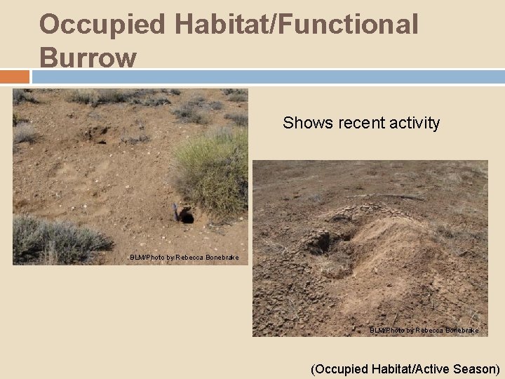
Occupied Habitat/Functional Burrow Shows recent activity BLM/Photo by Rebecca Bonebrake (Occupied Habitat/Active Season)
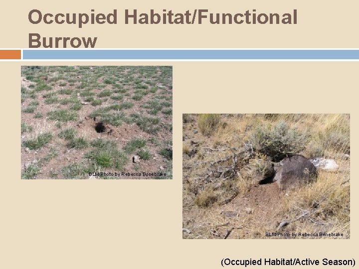
Occupied Habitat/Functional Burrow BLM/Photo by Rebecca Bonebrake (Occupied Habitat/Active Season)
Functional Burrow Definition cont. Whenever a surveyor is uncertain of the species of origin when identifying burrows or mounds, they MUST err on the side of the Utah prairie dog and report the site. Follow-up visits may be made at any time by the U. S. Fish and Wildlife Service, Utah Division of Wildlife Resources, and/or the Authorizing Federal Agency to verify the species.
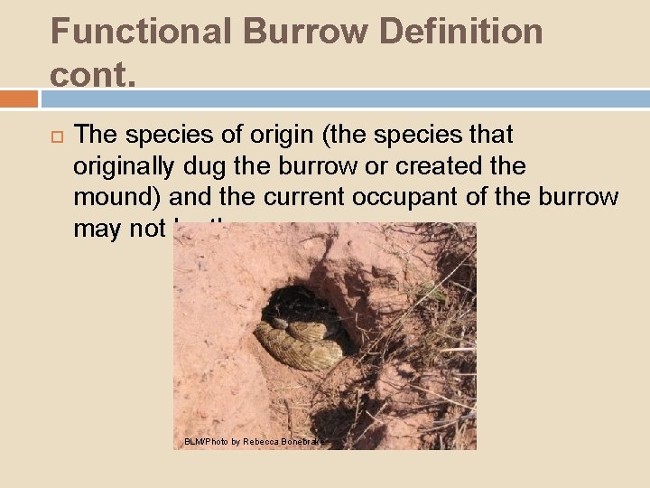
Functional Burrow Definition cont. The species of origin (the species that originally dug the burrow or created the mound) and the current occupant of the burrow may not be the same. BLM/Photo by Rebecca Bonebrake
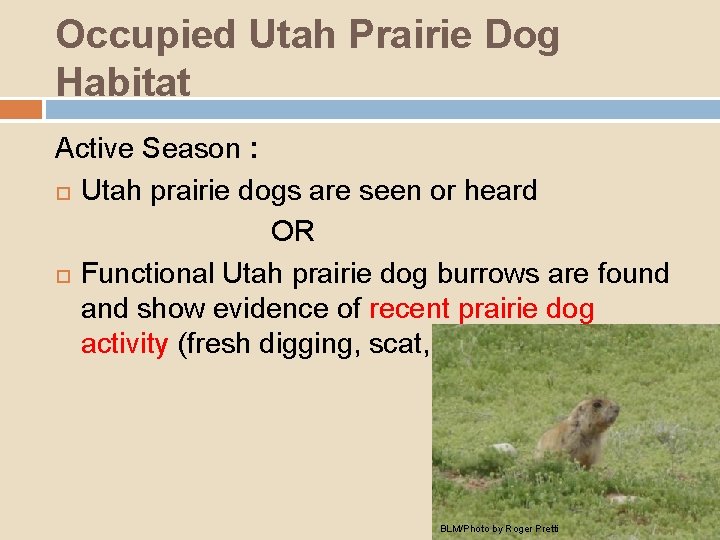
Occupied Utah Prairie Dog Habitat Active Season : Utah prairie dogs are seen or heard OR Functional Utah prairie dog burrows are found and show evidence of recent prairie dog activity (fresh digging, scat, fresh tracks). BLM/Photo by Roger Pretti
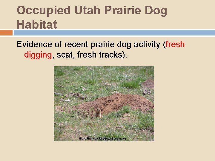
Occupied Utah Prairie Dog Habitat Evidence of recent prairie dog activity (fresh digging, scat, fresh tracks). BLM/Photo by Rebecca Bonebrake
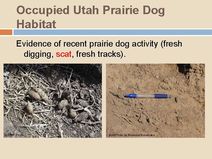
Occupied Utah Prairie Dog Habitat Evidence of recent prairie dog activity (fresh digging, scat, fresh tracks). UDWR Photo BLM/Photo by Rebecca Bonebrake
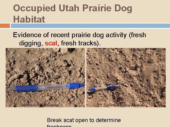
Occupied Utah Prairie Dog Habitat Evidence of recent prairie dog activity (fresh digging, scat, fresh tracks). BLM/Photo by Rebecca Bonebrake Break scat open to determine
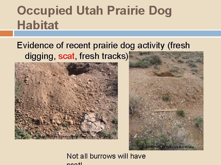
Occupied Utah Prairie Dog Habitat Evidence of recent prairie dog activity (fresh digging, scat, fresh tracks). BLM/Photo by Rebecca Bonebrake Not all burrows will have
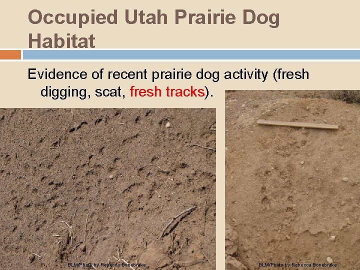
Occupied Utah Prairie Dog Habitat Evidence of recent prairie dog activity (fresh digging, scat, fresh tracks). BLM/Photo by Rebecca Bonebrake
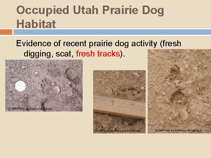
Occupied Utah Prairie Dog Habitat Evidence of recent prairie dog activity (fresh digging, scat, fresh tracks). UDWR/Photo by Adam Kavalunas BLM/Photo by Rebecca Bonebrake
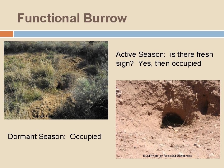
Functional Burrow Active Season: is there fresh sign? Yes, then occupied UDWR Photo Dormant Season: Occupied BLM/Photo by Rebecca Bonebrake
Mound System: A mound is the pile of earth, gravel, sand, rocks, or debris associated with making a burrow hole in the ground. A Utah prairie dog mound system is identified as 3 or more prairie dog mounds clustered within a 10 m diameter space. If any evidence of a Utah prairie dog mound system is found, the area must be mapped and reported as Utah prairie dog habitat.
Mound System: Whenever a surveyor is uncertain of the species of origin when identifying burrows or mounds, they MUST err on the side of the Utah prairie dog and report the site. Follow-up visits may be made at any time by the USFWS, UDWR, and/or the Authorizing Federal Agency to verify the species. Note: The species of origin (the species that originally dug the burrow or created the mound) and the current occupant of the burrow may not be the same.
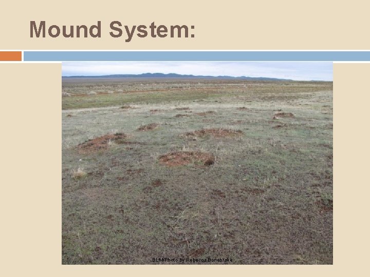
Mound System: BLM/Photo by Rebecca Bonebrake
Summary/Key Points: 1. With High Level Intensity Surveys, all (100%) suitable habitat in the Action Area must be surveyed, the surveyor must walk parallel transects no more than 30 meters apart through the entire area of suitable habitat searching 15 m on both sides of the transect for burrows and other prairie dog sign, and surveyors must stop periodically and scan surrounding areas with suitable optics for the presence of prairie dogs.
Summary/Key Points: 1. 2. With High Level Intensity Surveys, all (100%) suitable habitat in the Action Area must be surveyed, the surveyor must walk parallel transects no more than 30 meters apart through the entire area of suitable habitat searching 15 m on both sides of the transect for burrows and other prairie dog sign, and surveyors must stop periodically and scan surrounding areas with suitable optics for the presence of prairie dogs. Utah prairie dog habitat, found during a Section 7 protocol level survey, is classified as either “occupied” or “unoccupied. ”
Summary/Key Points: 1. 2. 3. With High Level Intensity Surveys, all (100%) suitable habitat in the Action Area must be surveyed, the surveyor must walk parallel transects no more than 30 meters apart through the entire area of suitable habitat searching 15 m on both sides of the transect for burrows and other prairie dog sign, and surveyors must stop periodically and scan surrounding areas with suitable optics for the presence of prairie dogs. Utah prairie dog habitat, found during a Section 7 protocol level survey, is classified as either “occupied” or “unoccupied. ” Surveyors only need to map occupied and unoccupied Utah prairie dog habitat.
Summary/Key Points (cont): 4. Suitable and unsuitable habitat cannot always be determined from aerial photos.
Summary/Key Points (cont): 4. 5. Suitable and unsuitable habitat cannot always be determined from aerial photos. Utah prairie dog habitat cannot be classified as “unoccupied” during the dormant season.
Summary/Key Points (cont): 4. 5. 6. Suitable and unsuitable habitat cannot always be determined from aerial photos. Utah prairie dog habitat cannot be classified as “unoccupied” during the dormant season. During the active season, it is not necessary to see a Utah prairie dog in order to determine whether or not an area is occupied Utah prairie dog habitat.
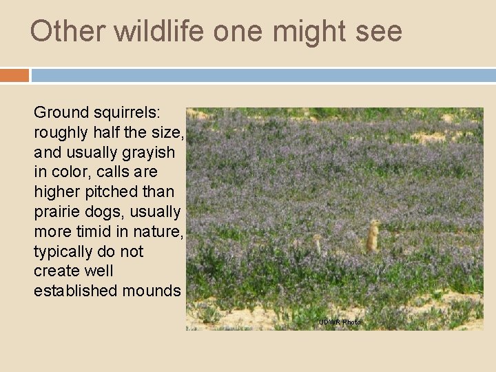
Other wildlife one might see Ground squirrels: roughly half the size, and usually grayish in color, calls are higher pitched than prairie dogs, usually more timid in nature, typically do not create well established mounds UDWR Photo
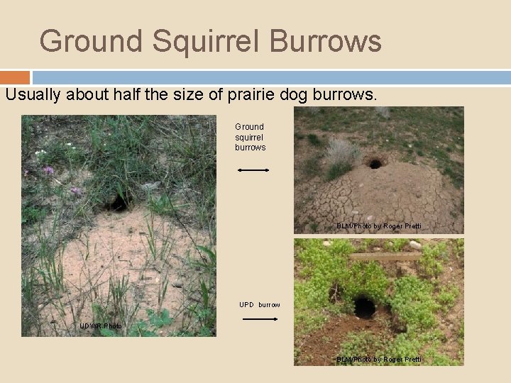
Ground Squirrel Burrows Usually about half the size of prairie dog burrows. Ground squirrel burrows BLM/Photo by Roger Pretti UPD burrow UDWR Photo BLM/Photo by Roger Pretti
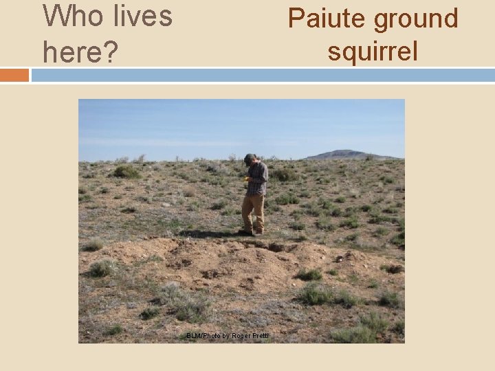
Who lives here? Paiute ground squirrel BLM/Photo by Roger Pretti
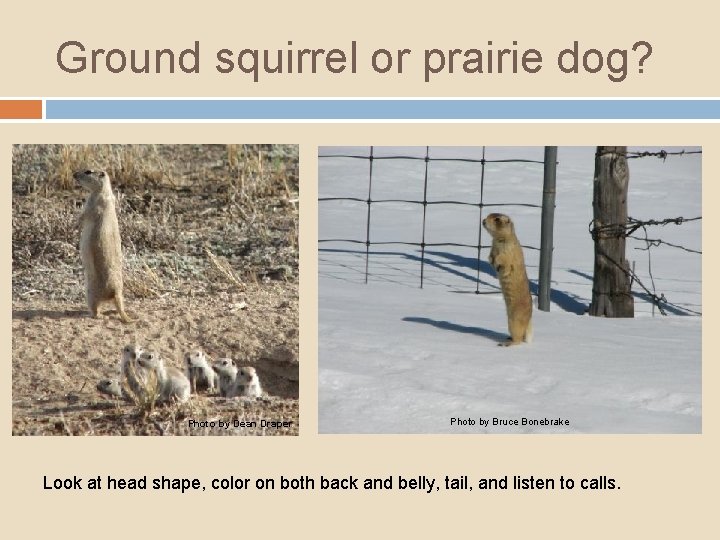
Ground squirrel or prairie dog? Photo by Dean Draper Photo by Bruce Bonebrake Look at head shape, color on both back and belly, tail, and listen to calls.
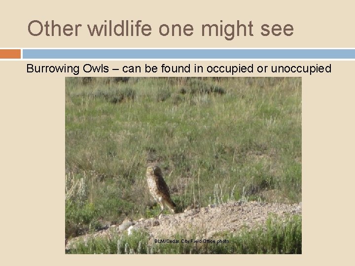
Other wildlife one might see Burrowing Owls – can be found in occupied or unoccupied colonies BLM/Cedar City Field Office photo
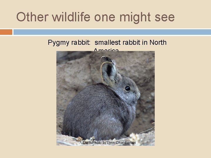
Other wildlife one might see Pygmy rabbit: smallest rabbit in North America. UDWR/Photo by Lynn Chamberlain
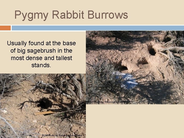
Pygmy Rabbit Burrows Usually found at the base of big sagebrush in the most dense and tallest stands. BLM/Photo by Rebecca Bonebrake
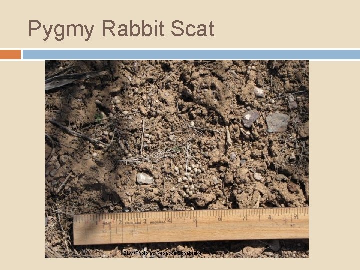
Pygmy Rabbit Scat BLM/Photo by Rebecca Bonebrake
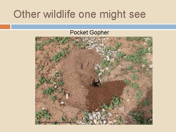
Other wildlife one might see Pocket Gopher BLM/Photo by Rebecca Bonebrake
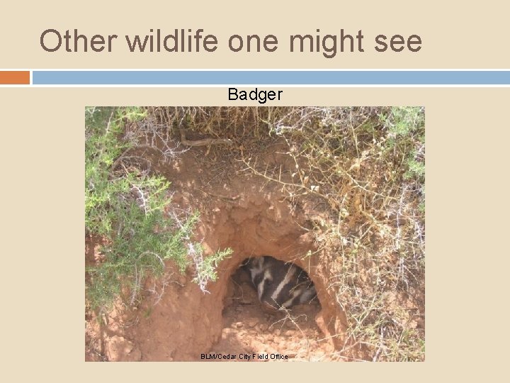
Other wildlife one might see Badger BLM/Cedar City Field Office
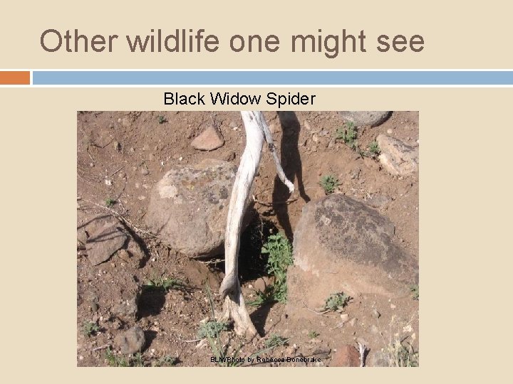
Other wildlife one might see Black Widow Spider BLM/Photo by Rebecca Bonebrake
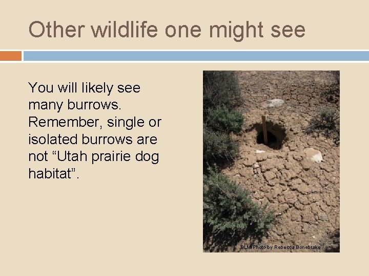
Other wildlife one might see You will likely see many burrows. Remember, single or isolated burrows are not “Utah prairie dog habitat”. BLM/Photo by Rebecca Bonebrake
UPD Counts Parameters -Ground is snow free -Calm/sunny day, <40% cloud cover -Winds <3 (12 mph) on Beaufort scale -Avoid extremes of heat and cold -Between 8: 00 am and 6: 00 pm
UPD Count Techniques Count from an unobstructed vantage point Count from multiple vantage points if needed. Binoculars, spotting scopes, vocalizations Take care not to overlap counts Count minimum of 3 times, recording highest count.
UPD Count Techniques Avoid disturbing UPD’s if possible Habituated UPDs will often re-surface after initial disturbance Non-habituated UPD’s – approach cautiously, count immediately, re-count, move closer
UPD Habitat Mapping The surveyor must determine the extent of all Utah prairie dog habitat encountered, whether occupied or unoccupied. GIS polygons must be created by marking the locations of all perimeter burrows within the Action Area. The surveyor shall assign each new Utah prairie dog habitat polygon a unique Polygon ID # (see glossary). Mapped habitat polygons received from UDWR should be identified by their existing UDWR assigned colony identifier. Individual habitat polygons are those areas in which all
UPD Habitat Mapping All data pertaining to a habitat polygon and recorded on the Survey Data Form and subsequent GIS attribute data will be referenced by its unique Polygon ID# or UDWR colony ID. All survey results will be provided to the authorizing agency as an ESRI compatible product (shapefile or personal Geodatabase) in NAD 1983 UTM Zone 12 North datum. Spatial data must be attributed in a table (see Table 1 for example attribute table) and include metadata following ESRI standards.
UPD Habitat Mapping What to map All Utah prairie dog habitat, occupied or unoccupied. How to map With your GPS unit set in polygon mode, circumscribe the habitat unit by walking around the perimeter burrows. OR Record point locations for each perimeter burrow and create a polygon therefrom.
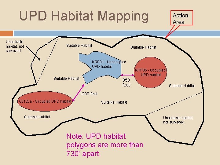
UPD Habitat Mapping Unsuitable habitat, not surveyed Suitable Habitat KRP 01 - Unoccupied UPD habitat Suitable Habitat KRP 05 - Occupied UPD habitat 850 feet Suitable Habitat 1200 feet C 0122 a - Occupied UPD habitat Suitable Habitat Unsuitable habitat, not surveyed Note: UPD habitat polygons are more than 730’ apart.
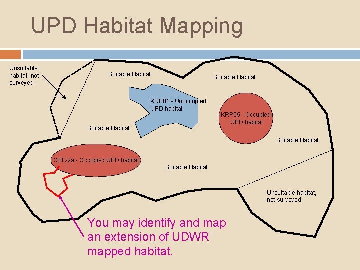
UPD Habitat Mapping Unsuitable habitat, not surveyed Suitable Habitat KRP 01 - Unoccupied UPD habitat Suitable Habitat KRP 05 - Occupied UPD habitat Suitable Habitat C 0122 a - Occupied UPD habitat Suitable Habitat Unsuitable habitat, not surveyed You may identify and map an extension of UDWR mapped habitat.
UPD Habitat Mapping Required data Unique Polygon ID Numbers Attribute Tables GIS data in NAD 1983 UTM Zone 12 North datum E = Easting, 6 digits N = Northing, 7 digits Metadata Remember to coordinate with the Authorizing Federal Agency!
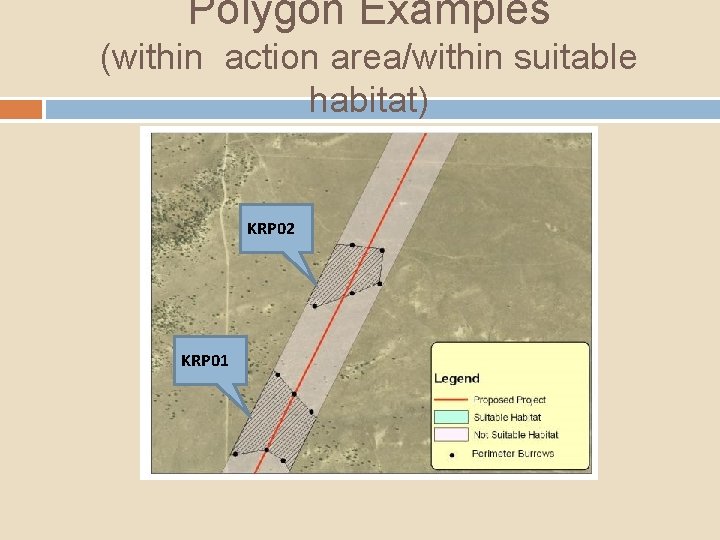
Polygon Examples (within action area/within suitable habitat) KRP 02 KRP 01
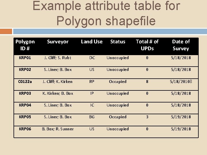
Example attribute table for Polygon shapefile Polygon ID # Surveyor Land Use Status Total # of UPDs Date of Survey KRP 01 J. Cliff; S. Rubt DC Unoccupied 0 5/18/2018 KRP 02 S. Liner; B. Box US Unoccupied 0 5/18/2018 C 0122 a J. Cliff; K. Kirken RP Occupied 8 5/18/20108 KRP 03 K. Kirken; B. Box IP Unoccupied 0 5/18/2018 KRP 04 S. Liner; B. Box IC Unoccupied 0 5/18/2018 KRP 05 S. Liner; B. Box BG Occupied 3 5/19/2018 KRP 06 B. Box; R. Sunner US Unoccupied 0 5/19/2018
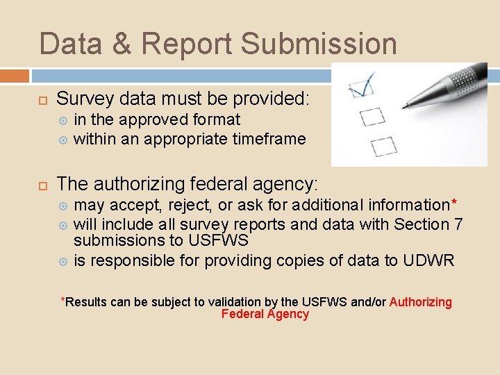
Data & Report Submission Survey data must be provided: in the approved format within an appropriate timeframe The authorizing federal agency: may accept, reject, or ask for additional information* will include all survey reports and data with Section 7 submissions to USFWS is responsible for providing copies of data to UDWR *Results can be subject to validation by the USFWS and/or Authorizing Federal Agency
Data & Report Submission q Complete data/report submission includes: a written report summarizing methodology and results completed survey forms, maps and geospatial data clear indication where low vs high intensity level survey performed clear indication where vehicle vs foot survey performed within low intensity survey areas clear indication of the action area, all suitable habitat that was surveyed, and the presence of all Utah prairie habitat areas (occupied and unoccupied)
Data & Report Submission q Complete data/report submission includes: both positive and negative survey results: Negative data = all areas in the Action Area that were determined to be unsuitable habitat; and suitable habitat that was surveyed but showed no evidence of Utah prairie dogs or their burrows. Survey forms submitted with negative data only need the top portion of the form completed.
Useful Definitions: The Polygon ID number is a unique identifier for each Utah prairie dog habitat polygon that is defined by the surveyor and provides a means to link the spatial data of that polygon with the data captured on the survey form. Mapped habitat from UDWR will have a colony ID already assigned. Polygon Status indicates whether Utah prairie dog habitat polygons are classified as occupied or unoccupied.

Here it is…the Data Sheet! Form Revise d May 2014
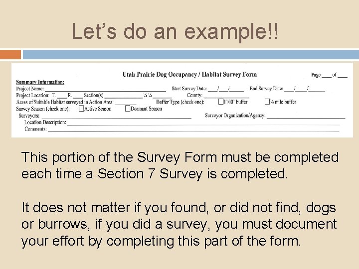
Let’s do an example!! This portion of the Survey Form must be completed each time a Section 7 Survey is completed. It does not matter if you found, or did not find, dogs or burrows, if you did a survey, you must document your effort by completing this part of the form.
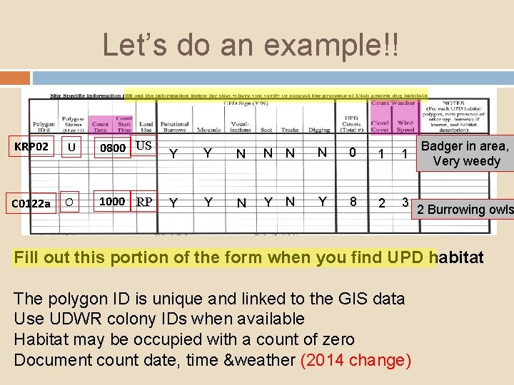
Let’s do an example!! KRP 02 U 0800 US Y Y N N 0 1 1 C 0122 a O 1000 RP Y Y N Y 8 2 3 Badger in area, Very weedy 2 Burrowing owls Fill out this portion of the form when you find UPD habitat The polygon ID is unique and linked to the GIS data Use UDWR colony IDs when available Habitat may be occupied with a count of zero Document count date, time &weather (2014 change)
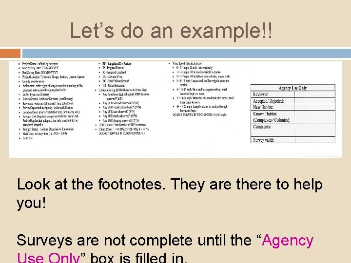
Let’s do an example!! Look at the footnotes. They are there to help you! Surveys are not complete until the “Agency
Hints for Data Sheet Success! q q Buffer Type: Consult with the Authorizing Federal Agency Survey Seasons: Active Season = April 1 – August 31 Dormant Season = September 1 – March 31 Count Start Time - use military time (i. e. 0900, 1600) UPD Counts = Number of prairie dogs observed: boys and girls, big and small! Other Species: burrowing owl, pygmy rabbit, other or unknown DO NOT SURVEY IF CLOUD COVER >40% DO NOT SURVEY IF WIND SPEED >12 mph
Summary/Key Points: 1. Counts of Utah prairie dogs can be conducted when all parameters are met: ground is snow free, calm/sunny day with <40% cloud cover, winds <3 (12 mph) on Beaufort scale, heat and cold extremes are avoided, counts are conducted between 8: 00 am and 6: 00 pm
Summary/Key Points: 1. 2. Counts of Utah prairie dogs can be conducted when all parameters are met: ground is snow free, calm/sunny day with <40% cloud cover, winds <3 (12 mph) on Beaufort scale, heat and cold extremes are avoided, counts are conducted between 8: 00 am and 6: 00 pm Counts should be conducted from multiple vantage points if needed for complete coverage of area.
Summary/Key Points: 1. 2. 3. Counts of Utah prairie dogs can be conducted when all parameters are met: ground is snow free, calm/sunny day with <40% cloud cover, winds <3 (12 mph) on Beaufort scale, heat and cold extremes are avoided, counts are conducted between 8: 00 am and 6: 00 pm Counts should be conducted from multiple vantage points if needed for complete coverage of area. If a Utah prairie dog burrow has been dug out by other wildlife, it can still be classified as Utah prairie dog habitat.
Summary/Key Points: 1. 2. 3. 4. Counts of Utah prairie dogs can be conducted when all parameters are met: ground is snow free, calm/sunny day with <40% cloud cover, winds <3 (12 mph) on Beaufort scale, heat and cold extremes are avoided, counts are conducted between 8: 00 am and 6: 00 pm Counts should be conducted from multiple vantage points if needed for complete coverage of area. If a Utah prairie dog burrow has been dug out by other wildlife, it can still be classified as Utah prairie dog habitat. When mapping Utah prairie dog habitat, the surveyor should take a point reading on the GPS unit at perimeter burrows only (not at every burrow in a colony!).
Summary/Key Points: 1. 2. 3. 4. 5. Counts of Utah prairie dogs can be conducted when all parameters are met: ground is snow free, calm/sunny day with <40% cloud cover, winds <3 (12 mph) on Beaufort scale, heat and cold extremes are avoided, counts are conducted between 8: 00 am and 6: 00 pm Counts should be conducted from multiple vantage points if needed for complete coverage of area. If a Utah prairie dog burrow has been dug out by other wildlife, it can still be classified as Utah prairie dog habitat. When mapping Utah prairie dog habitat, the surveyor should take a point reading on the GPS unit at perimeter burrows only (not at every burrow in a colony!). GIS data should consist of points or polygons as well as the metadata!.
Summary/Key Points: 1. 2. 3. 4. 5. 6. Counts of Utah prairie dogs can be conducted when all parameters are met: ground is snow free, calm/sunny day with <40% cloud cover, winds <3 (12 mph) on Beaufort scale, heat and cold extremes are avoided, counts are conducted between 8: 00 am and 6: 00 pm Counts should be conducted from multiple vantage points if needed for complete coverage of area. If a Utah prairie dog burrow has been dug out by other wildlife, it can still be classified as Utah prairie dog habitat. When mapping Utah prairie dog habitat, the surveyor should take a point reading on the GPS unit at perimeter burrows only (not at every burrow in a colony!). GIS data should consist of points or polygons as well as the metadata!. Complete data/report submission includes positive and negative data.
Enjoy your surveys!! Any Questions? Bryce Canyon National Park Photo
- Slides: 132