
USING OPEN DATA TO DEVELOP MULTIMODAL TRIP PLANNERS




- Slides: 40
USING OPEN DATA TO DEVELOP MULTIMODAL TRIP PLANNERS FOR LIVABLE COMMUNITIES Sean J. Barbeau Edward L. Hillsman Center for Urban Transportation Research @ University of South Florida GIS in Transit Conference St. Petersburg, Florida September 14, 2011 Funded by the Florida Department of Transportation and the National Center for Transit Research
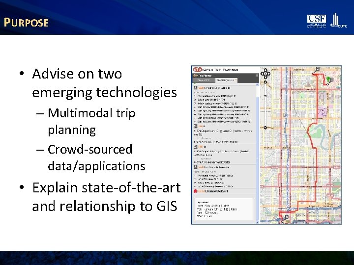
PURPOSE • Advise on two emerging technologies – Multimodal trip planning – Crowd-sourced data/applications • Explain state-of-the-art and relationship to GIS
WHY MULTIMODAL TRIP PLANNERS? • If you want to drive, the question is “How do I get there? ” – Road networks are dense, connected, complete – Google, Mapquest, Yahoo can easily tell you • For bike/walk/bus, the question is “Can I get there (by a safe route)? ” – Networks are sparse, incomplete, or both – Route-specific info is more important than when driving
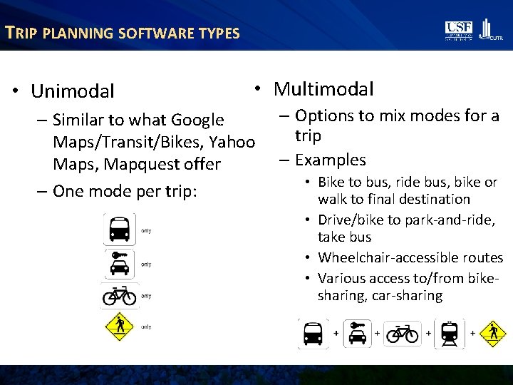
TRIP PLANNING SOFTWARE TYPES • Unimodal • Multimodal – Similar to what Google Maps/Transit/Bikes, Yahoo Maps, Mapquest offer – One mode per trip: – Options to mix modes for a trip – Examples • Bike to bus, ride bus, bike or walk to final destination • Drive/bike to park-and-ride, take bus • Wheelchair-accessible routes • Various access to/from bikesharing, car-sharing
PROPRIETARY TRIP-PLANNING SOFTWARE • Custom-built software and data are expensive – Goroo® in Chicago cost more than $1 million and is still being improved • Web-based software is proprietary and closed – Google, Yahoo, etc. are free to use, but • Services depend on the needs and desires of the providers • Providers limit use and presentation of their systems (frequency, branding)
OPENTRIPPLANNER • Free, open-source software - opentripplanner. org • Development spearheaded by Tri-Met in Portland, with grant funding (2009 -present) • Active worldwide developers’ group • Available for anyone to download, install, modify – (and, with approval, contribute back) • Non-profit Open. Plans can provide installation, customization, maintenance support • Open. Plans will be giving Keynote on OTP status and roadmap on Thurs. morning at 8: 30 am
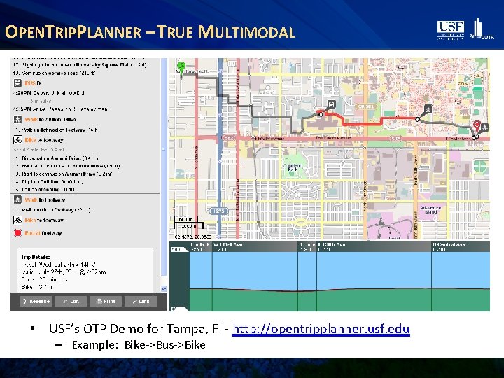
OPENTRIPPLANNER – TRUE MULTIMODAL • USF’s OTP Demo for Tampa, Fl - http: //opentripplanner. usf. edu – Example: Bike->Bus->Bike
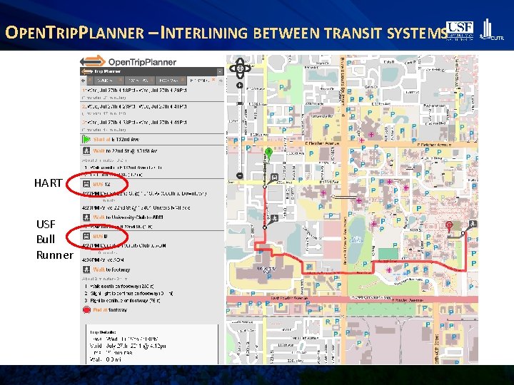
OPENTRIPPLANNER – INTERLINING BETWEEN TRANSIT SYSTEMS HART USF Bull Runner
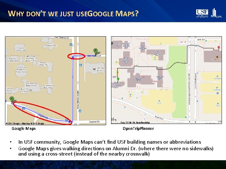
WHY DON’T WE JUST USEGOOGLE MAPS? © 2011 Google – Map data © 2011 Google Maps • • Data CC-By-SA Open. Street. Map Open. Trip. Planner In USF community, Google Maps can’t find USF building names or abbreviations Google Maps gives walking directions on Alumni Dr. (where there were no sidewalks) and using a cross-street (instead of the nearby crosswalk)
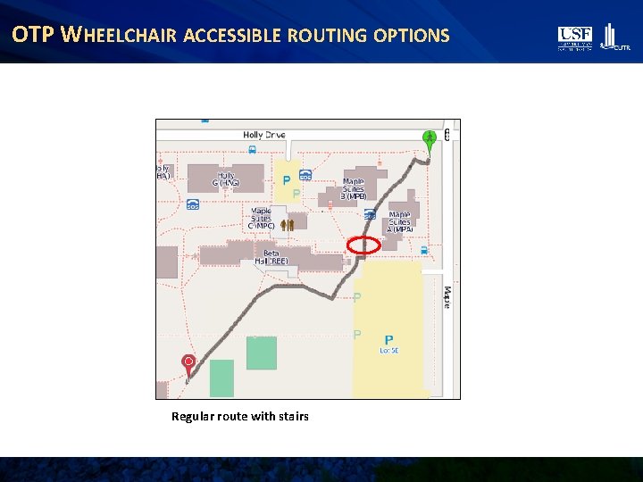
OTP WHEELCHAIR ACCESSIBLE ROUTING OPTIONS Regular route with stairs
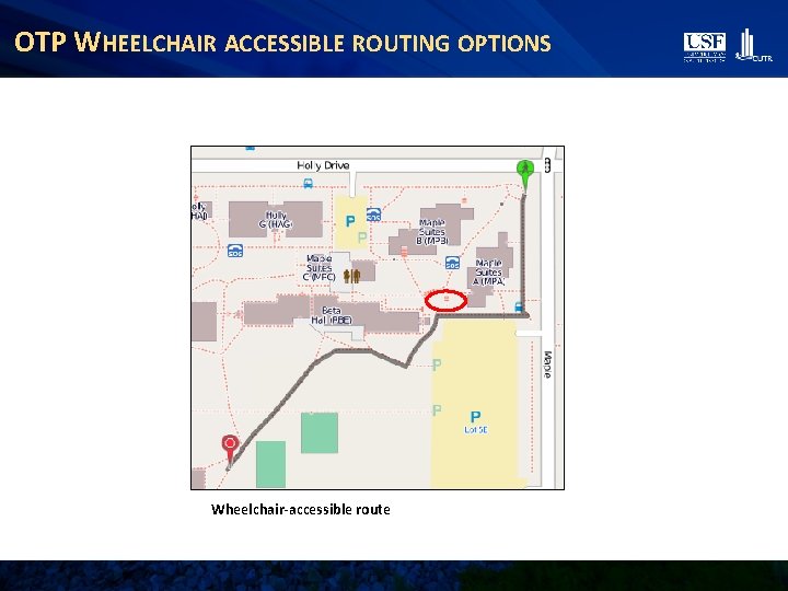
OTP WHEELCHAIR ACCESSIBLE ROUTING OPTIONS Wheelchair-accessible route
GIS DATA • To provide this kind of service, you need data – Transit routes and schedules – Street network • (plus addresses, points of interest for geocoding) – Bicycling facilities • (lanes, routes, parking) – Sidewalks, crosswalks, and other pedestrian infrastructure – Future: Park-and-ride lots, car-sharing, and/or bike -sharing stations 12
OPEN DATA SOURCES FOR OPENTRIPPLANNER General Transit Feed Specification (GTFS) – Over 140 agencies in US have transit data in this format, more than 447 world-wide – Most agencies did this to get on Google Transit – But, GTFS is open-data format that anyone can use • Used by many mobile apps • Open. Trip. Planner • Becoming a de facto standard – See “GTFS Data Exchange” for list of agencies with GTFS data • http: //www. gtfs-data-exchange. com/ • Or, ask your local agency – Major transit scheduling software packages can prepare GTFS
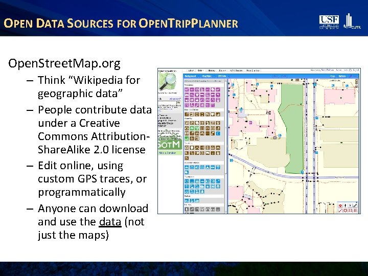
OPEN DATA SOURCES FOR OPENTRIPPLANNER Open. Street. Map. org – Think “Wikipedia for geographic data” – People contribute data under a Creative Commons Attribution. Share. Alike 2. 0 license – Edit online, using custom GPS traces, or programmatically – Anyone can download and use the data (not just the maps)
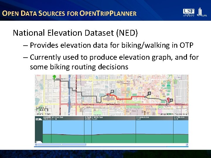
OPEN DATA SOURCES FOR OPENTRIPPLANNER National Elevation Dataset (NED) – Provides elevation data for biking/walking in OTP – Currently used to produce elevation graph, and for some biking routing decisions
OPEN DATA SOURCES FOR OPENTRIPPLANNER Geographic Information Systems (GIS) files – Open. Trip. Planner can also support loading GIS (e. g. , . shp) files – Local government sources: • City • County • Special Districts (parks, etc. ) • Ask your local government what data might be available – Especially if there isn’t much Open. Street. Map activity in your area
Multimodal trip planning is a new field, and there are still. . . OPEN ISSUES 17
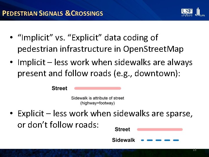
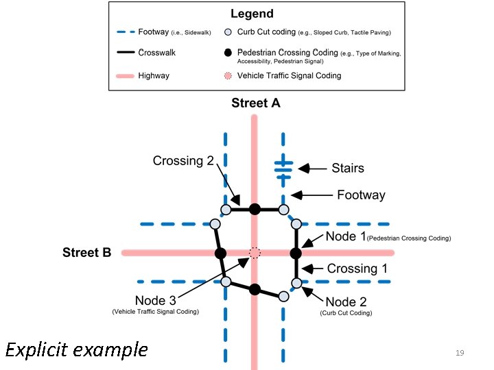
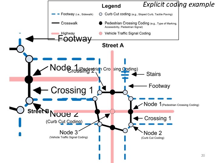
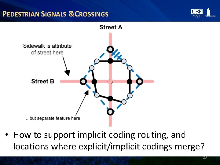
PEDESTRIAN SIGNALS &CROSSINGS • “Implicit” vs. “Explicit” data coding of pedestrian infrastructure in Open. Street. Map • Implicit – less work when sidewalks are always present and follow roads (e. g. , downtown): • Explicit – less work when sidewalks are sparse, or don’t follow roads: 18
Explicit example 19
Explicit coding example 20
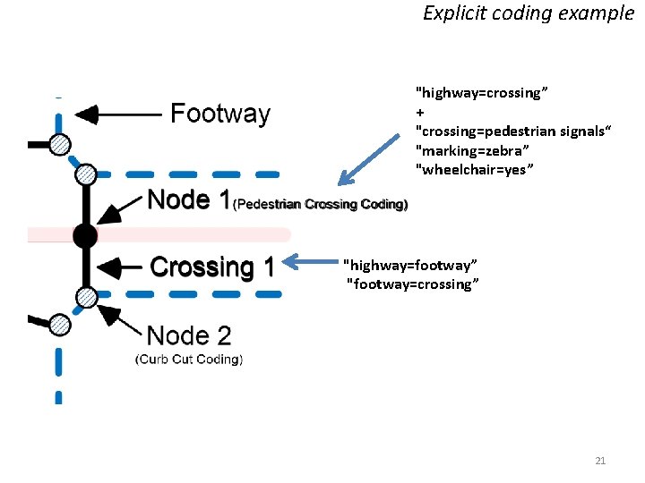
Explicit coding example "highway=crossing” + "crossing=pedestrian signals“ "marking=zebra” "wheelchair=yes” "highway=footway” "footway=crossing” 21
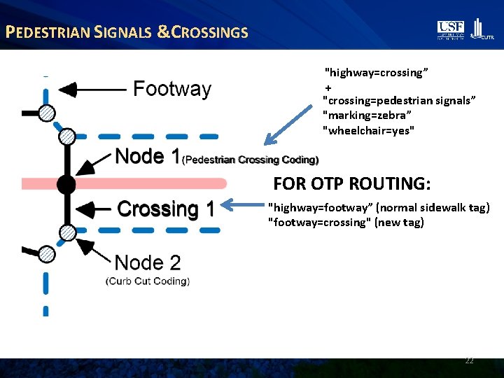
PEDESTRIAN SIGNALS &CROSSINGS "highway=crossing” + "crossing=pedestrian signals” "marking=zebra” "wheelchair=yes" FOR OTP ROUTING: "highway=footway” (normal sidewalk tag) "footway=crossing" (new tag) 22
PEDESTRIAN SIGNALS &CROSSINGS • How to support implicit coding routing, and locations where explicit/implicit codings merge? 23
OPEN ISSUES – CROWD-SOURCING LEVEL OF SERVICE • Having traffic characteristics for roads would help in pedestrian/biking routing decisions • However, traditional road traffic metrics (i. e. , traffic volume, width of lanes) are difficult/dangerous to crowd-source • Need better objective metrics to define bike and walk "level-of-service" (i. e. , how "good" an OSM way is for walking or biking) that can easily be recorded by a casual observer 24
OPEN ISSUES – PERSONALIZING BIKING DIRECTIONS • Level-of-service metrics must translate to subjective judgments for whether a cyclist would be comfortable riding on a specific road • Different for every cyclist: – Some expert cyclists would be comfortable riding on high traffic roads where other beginner cyclists would not – Also depends on presence of bike lanes, shoulder, etc. • What does an “ideal” user interface look like to meet everyone’s needs, but not be overwhelming? • Should we customize based on some selfassessment of skill/comfort level? 25
OPEN ISSUES – SPARSENESS OF OSM DATA • Many areas of U. S. are still sparsely populated in OSM • We believe OTP is a “game-changer” – now OSM contributors can see direct benefits of their work in OTP routing • What are the motivations/profiles of current U. S. contributors? • How can we leverage this knowledge, and visibility of benefits in OTP, to motivate a larger crowd of OSM contributors? 26
GO-Sync A Software Tool to Synchronize Transit Agency GTFS Datasets with Open. Street. Map Coded by Khoa Tran
GO-SYNC MOTIVATION • Shortcomings of official transit GTFS datasets – Inaccurate bus stop locations • Lack of transit data in OSM for many U. S. cities • Goal – create a tool that can: – Share transit agency data with Open. Street. Map community – Leverage social mapping model to improve bus stop inventory, and allow agency to retrieve these improvements
CHALLENGES • Need to respect work by other OSM users – Avoid overwriting existing OSM data • Lack of a strict tagging system in OSM – Ex: “route”, “routes”, “route_id” “route_ref” • Need to avoid duplicating OSM data • Ongoing updates to GTFS data • Integration of crowd-sourced data into transit agency internal datasets
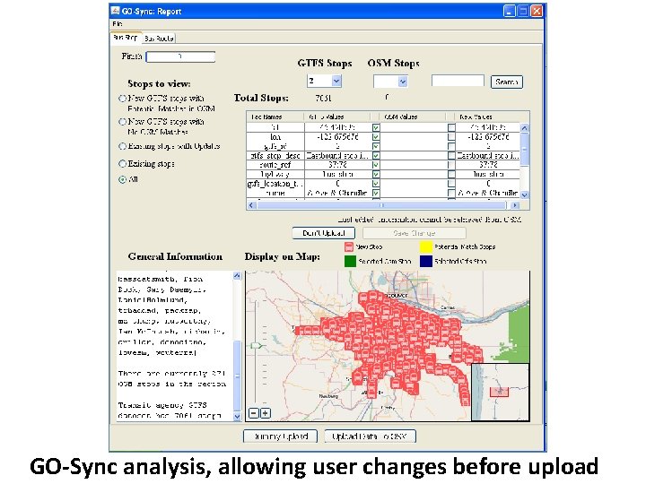
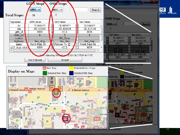
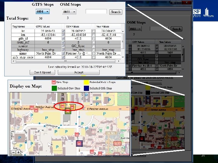
GO-SYNC • General Transit Feed Specification (GTFS) – Open. Street. Map (OSM) Synchronization – http: //code. google. com/p/gtfs-osm-sync/ – Open-source, under Apache 2. 0 • GO-Sync is an open-source tool that can synchronize GTFS datasets with OSM – Performs “Point-conflation”, or merging, for bus stops in OSM
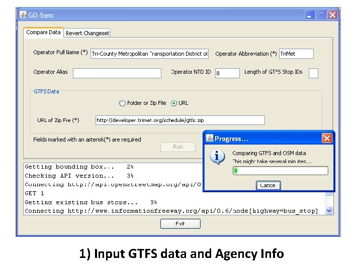
1) Input GTFS data and Agency Info
GO-Sync analysis, allowing user changes before upload
33
34
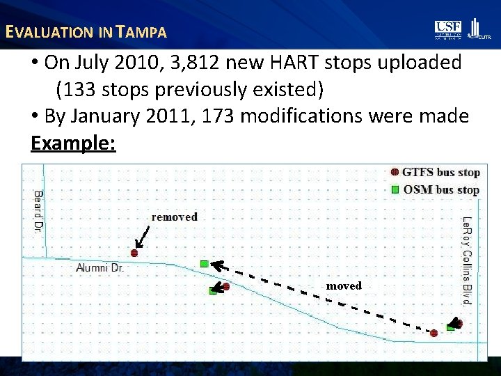
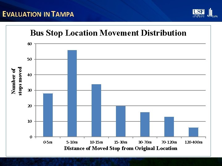
EVALUATION IN TAMPA • On July 2010, 3, 812 new HART stops uploaded (133 stops previously existed) • By January 2011, 173 modifications were made Example: moved
EVALUATION IN TAMPA Bus Stop Location Movement Distribution 60 Number of stops moved 50 40 30 20 10 0 0 -5 m 5 -10 m 10 -15 m 15 -30 m 30 -70 m 70 -120 m Distance of Moved Stop from Original Location 120 -400 m
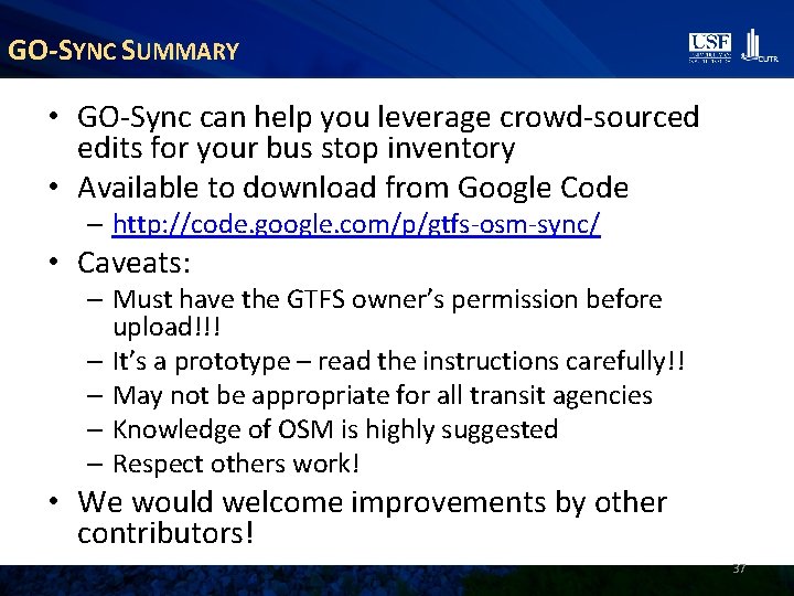
GO-SYNC SUMMARY • GO-Sync can help you leverage crowd-sourced edits for your bus stop inventory • Available to download from Google Code – http: //code. google. com/p/gtfs-osm-sync/ • Caveats: – Must have the GTFS owner’s permission before upload!!! – It’s a prototype – read the instructions carefully!! – May not be appropriate for all transit agencies – Knowledge of OSM is highly suggested – Respect others work! • We would welcome improvements by other contributors! 37
What should I take away from today’s presentation? CONCLUSIONS 38
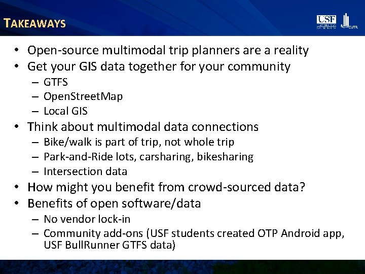
TAKEAWAYS • Open-source multimodal trip planners are a reality • Get your GIS data together for your community – GTFS – Open. Street. Map – Local GIS • Think about multimodal data connections – Bike/walk is part of trip, not whole trip – Park-and-Ride lots, carsharing, bikesharing – Intersection data • How might you benefit from crowd-sourced data? • Benefits of open software/data – No vendor lock-in – Community add-ons (USF students created OTP Android app, USF Bull. Runner GTFS data)
CONTACT INFORMATION • Project Website: – http: //www. locationaware. usf. edu/ongoingresearch/projects/open-transit-data/ • Open. Trip. Planner Tampa Demo: – Opentripplanner. usf. edu Sean Barbeau, M. S. (Open. Trip. Planner/Android) barbeau@cutr. usf. edu (813) 974 -7208 Ed Hillsman, Ph. D. (Open. Street. Map) hillsman@cutr. usf. edu (813) 974 -2977 40