USGS Earthquake Hazards Program Earthquakes U S Department


 - Converted S & P wave energy - Slowest")


- Slides: 44
USGS Earthquake Hazards Program Earthquakes U. S. Department of the Interior U. S. Geological Survey
Plate Boundaries
Plate Tectonics USGS Earthquake Hazards Program Lisa Wald USGS Pasadena U. S. Department of the Interior U. S. Geological Survey
Global Distribution of Earthquakes
Pacific-North American Plate Boundary
The San Andreas Fault
Three Types of Faults Strike-Slip Reverse Normal
Strike-slip Fault Example
Strike-slip Fault Example 1906 San Francisco Earthquake
Normal Fault Example Dixie Valley-Fairview Peaks, Nevada earthquake December 16, 1954
Reverse Fault Example
Is there such a thing as “Earthquake Weather”? ? ?
Bigger Faults Make Bigger Earthquakes
Bigger Earthquakes Last a Longer Time
View EQ Damage • http: //www. youtube. com/watch? v=d. LWN 7 AHft. Bo&feature=related • http: //www. youtube. com/watch? v=_Ktx. Cc. S 7 NNw&feature=related Questions to think about while viewing: • What is released when an EQ occurs? • Where does this energy go? • How do we record the information about this energy?
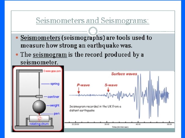
Seismic Waves
Primary Wave - Fast wave!
Secondary Waves Can only travel through solid material
Long Wave (or L wave) - Converted S & P wave energy - Slowest wave
Summary • Secondary waves do not travel through liquids, only solids • Primary waves arrive first, followed by Secondary waves. • Seismologists know how fast seismic waves travel, and this helps locate earthquakes.
Earthquake Effects - Ground Shaking Northridge, CA 1994
Earthquake Effects Ground Shaking Northridge, CA 1994
Earthquake Effects - Ground Shaking Loma Prieta, CA 1989 KGO-TV News ABC-7
Earthquake Effects - Ground Shaking Kobe, Japan 1995
Earthquake Effects - Ground Shaking Kobe, Japan 1995
Earthquake Effects - Surface Faulting Landers, CA 1992
Earthquake Effects - Liquefaction Source: National Geophysical Data Center Niigata, Japan 1964
Earthquake Effects - Landslides Source: National Geophysical Data Center Turnnagin Heights, Alaska, 1964
Earthquake Effects - Fires Loma Prieta, CA 1989 KGO-TV News ABC-7
Earthquake Effects - Tsunamis 1957 Aleutian Tsunami Photograph Credit: Henry Helbush. Source: National Geophysical Data Center
Lag Time!
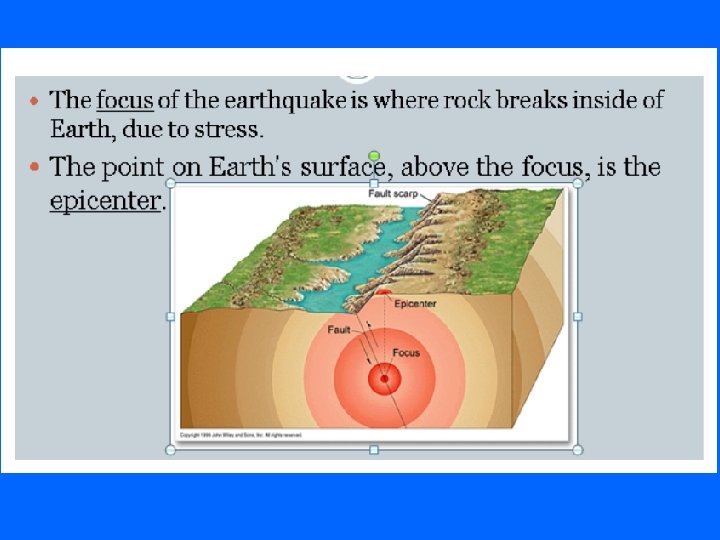
Earthquake Location
Locating an EQ epicenter
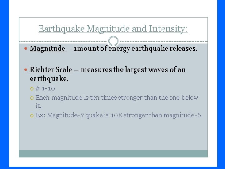
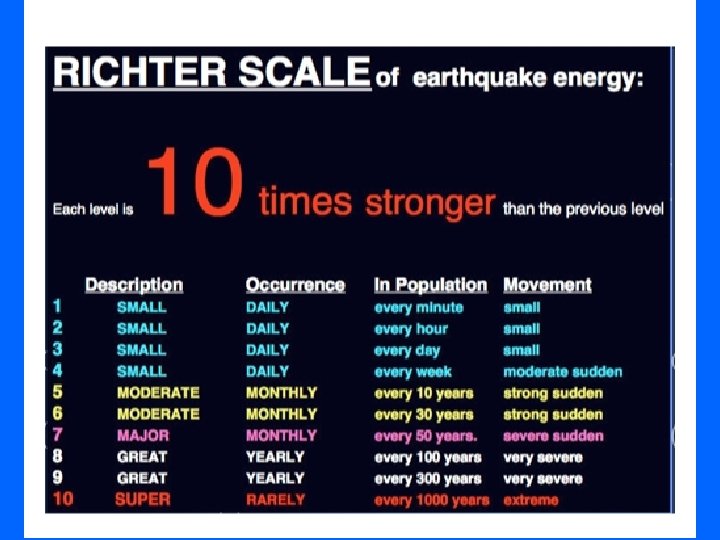
Earthquake Magnitude M 5 M 6 M 7