Urban Land Use LOs To no and explain

Urban Land Use L/Os: To no and explain different land use models To understand why land use varys within an urban area Starter: What is this diagram showing?

H/W – Due in next Tuesday – 2 hours work! You could work in twos and share information To research and write background information on Triana and Tomares. How are they significant/important? Key questions: Key Words: Political – what does the local authority provide? Why is this needed? Social – How do people socialise? Cultural – Ethnic diversity? Environmental – Green issues and solutions Economic – How wealthy is the area? Why? Physical - The land surroundings, green space

STARTER - Land use models Why do geographers study models? Geographers use models to help them understand reality. Land use models tell us where we might expect to find different land uses like high quality housing or industry. They also help to explain the pattern of growth of a city.

Concentric Model This inner city area is also known as the ‘Zone of Transition’ or the ‘Twilight Zone’. inner city Inner and outer suburbs


Urban growth: What zones can you see appearing? What type of housing is in each zone?

Simple transect across a city suburbs inner city CBD inner city suburbs

Concentric Model inner city Inner and outer suburbs Your Task: Study the model For the 3 outer zones, explain what kind of housing you might expect to find in each.

Watch the James Bond Burgess Clip Can you recognise the zones? ! inner city Inner and outer suburbs https: //www. youtube. com/watch? v=RPtvc 8 a 8 wic
 One student has")
HOYT URBAN LAND USE MODEL YOUR TASK: BACK TO BACK 1) One student has a diagram of Hoyt’s model 2) Task of student with diagram is to describe image to partner 3) Student with blank piece of paper to draw what is being said 4) After 3 -4 minutes swap roles

Land use models – Sector Model Hoyt developed his model after the introduction of public transport. He believed urban areas developed in sectors alongside main transport routes into and out of a city.

Land use models – Sector Model Hoyt developed his model after the introduction of public transport. He believed urban areas developed in sectors alongside main transport routes into and out of a city.

Hoyt’s land use model Your Task: Study the model Hoyt proposed his model after the development of public transport. He believed urban areas developed in sectors alongside main transport routes into and out of a city. 1)Which zones have been influenced by public transport e. g. roads and trains? How can you tell? 2)Why was it important for these zones to be close to transport?

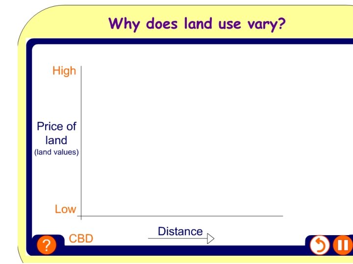
Why does land use vary? Retail, Industry and Housing Land values are a major influence on land use patterns.
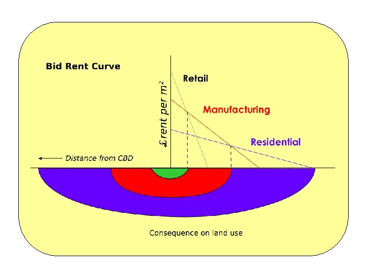

Why does land use vary? Land values are a major influence on land use patterns, but they are not the only factor: Land values Space Age Accessibility Wealth of the inhabitants Planning policies
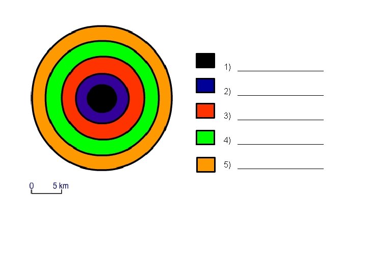
 Which urban land use model is this? !? 2) Name the different")
PLENARY 1) Which urban land use model is this? !? 2) Name the different land use zones
 Which urban land use model is this? !? 2) Name the different")
PLENARY 1) Which urban land use model is this? !? 2) Name the different land use zones

Brainstorm Where do you think that Triana and Tomares may fit into these models? Why?

Concentric Model This inner city area is also known as the ‘Zone of Transition’ or the ‘Twilight Zone’. inner city Inner and outer suburbs

Land use models – Sector Model Hoyt developed his model after the introduction of public transport. He believed urban areas developed in sectors alongside main transport routes into and out of a city.

This is a more realistic model showing land use patterns and functional zones in a British city.
- Slides: 27