Upper Air Soundings How to understand use radiosonde


- Slides: 43

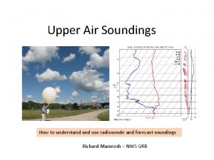
Upper Air Soundings How to understand use radiosonde and forecast soundings Richard Mamrosh – NWS GRB

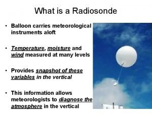
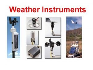
The Basics • Weather balloons measure temperature, air pressure, relative humidity, and wind as they ascend to around 100, 000 feet. • They are launched at 1100 and 2300 UTC at around 70 locations in the United States. • The data are used by forecasters in National Weather Service offices and in Numerical Weather Prediction models.

Skew – T Plots Winds are plotted here Temperature (C) – red slanted lines Dry Adiabats – blue lines Winds are plotted Moist Adiabats – orange lines on scale to the right Mixing Ratio – gray lines Remember – data are plotted to pressure altitude, not to height AGL!!!

Upper Air Data – Soundings Upper air data from stations can be displayed as a sounding (or skew-t) plot. They display temperature, dewpoint, and wind speed and direction.

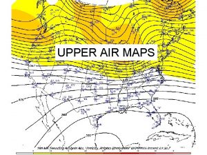
Upper Air Data – Standard Level Plots Upper air data from many stations can be plotted on maps at standard pressure levels and analyzed to show features such as jets and fronts.

Where to Find Soundings • Soundings just from radiosondes can be found at http: //www. spc. noaa. gov/exper/soundings/

Where to Find Soundings • Radiosonde and Forecast soundings can be found at http: //rucsoundings. noaa. gov/gwt/? start=latest We will look at some soundings from this web site.

The web page will start with a blank sounding background.

If you want to see a radiosonde sounding, type in an upper air location, select 11 z or 23 z as the start time, and choose RAOB from the menu. Radiosonde locations nearby include DVN, MPX, INL, ILX, DTX, APX

If you want to see a forecast sounding, type in an airport, select the current or a future time, the number of forecast hours, and the forecast model.

If you would like to superimpose two or more soundings, hold down the shift key and click on the gray tabs at the bottom.

How Can We Use Soundings? • Real time or forecast soundings can be useful in flight planning, and possibly during flight. • Soundings can help a pilot determine where there might be clouds, precipitation, icing potential, and turbulence.

Sky Cover • Real time and forecast soundings can be useful to determine where clouds might be. • Radiosondes have difficulty measuring 100% relative humidity at cold temperatures. • Clouds are not always present at 100 % measured relative humidity. • Virga may be present below saturated layers. • Forecast soundings are not perfect.

Desert Type Sounding 9, 700’ Tuscon, Arizona Station Elevation 2643 Feet METAR KTUS 292253 Z 27012 KT 10 SM CLR 32/03 A 2987

Fog at ground, clear above 492’ Vandenburg AFB Station Elevation 368 Feet KVBG 091055 Z AUTO 00000 KT 1/4 SM FG VV 001 13/13 A 2990

Shallow Level Moisture Remember that the levels depicted in soundings are pressure altitude, and you need to subtract airport elevation to achieve approximate height AGL. 3, 400’ Minneapolis, MN Station Elevation 842 Feet METAR KMSP 292255 Z 06011 KT 10 SM BKN 025 13/07 A 3011

Cloudy and Light Snow 2, 467’ Barrow, Alaska Station Elevation 49 Feet METAR PABR 091153 Z 35015 KT 9 SM –SN OVC 026 M 02/M 06 A 3003

A Few Middle Clouds Quiz? 12, 740’ Raleigh Durham Station Elevation 435 Feet KRDU 271151 Z 00000 KT 10 SM FEW 120 M 04/M 08 A 3023

Sky Quiz Low level moisture - cumulus

Sky Quiz Low and upper level moisture – cumulus and cirrus

shallow level moisture – stratus Sky Quiz

Sky Quiz Very dry air – sunny skies

Sky Quiz High thin moisture – ice crystals

Flying between cloud layers Sky Quiz

Virga falling from middle clouds Sky Quiz Next Precipitation Type

Precipitation Type • Soundings can help a pilot determine what kind of precipitation might occur by showing – The freezing level – Presence of warm layers aloft – Depth of cold air near the ground – Probability of ice crystals – Amount of moisture

Precipitation Type of Winter Storms • Soundings are very useful, as knowledge of the temperature structure in the lowest 5, 000’ is necessary to successfully forecast precipitation type. 27

Precipitation Type Quiz • Temperatures usually must be -10 c or colder in order to get snow (provided it does not melt on it’s way down). Need Ice Crystals. • Moisture less than a few thousand feet deep usually produces drizzle or freezing drizzle. • Snow can usually fall about 1, 000’ through an above freezing environment before melting.

Snow, Rain, Freezing Rain, Sleet? Answer: Not cold enough for snow, cold air too shallow for sleet, too cold at surface for rain, so freezing rain likely.

Snow, Sleet or Freezing Drizzle? Answer: Not cold enough for snow, no elevated warm layer for sleet, so freezing drizzle likely.

Snow, Rain, Freezing Rain, Sleet? Answer: Cold enough aloft for snow, but it would melt on the way down. Melted snow should freeze in cold air near the ground, so sleet is likely.

Icing Possibilities • Soundings can be useful to determine where icing environments may be present. • Temperatures between -15 C and 0 C are usually most conducive to significant icing. The amount of icing partly depends on the lack or presence of ice forming nuclei, such as • When temperatures are less than -20 c there are primarily ice crystals, instead of supercooled water vapor.

Icing Possibilities

Icing Possibilities 15 -20, 000’ 10 -15, 000’ 5 -10, 000’ Sfc -5, 000’

Icing Quiz Where is the greatest icing potential? a) b) c) d) No icing above 20 k ft above 7 k ft 7 -10 k ft

Icing Quiz Where is the greatest icing potential? a) b) c) d) No icing above 14 k ft above 22 k ft 14 -25 k ft

Icing Quiz Where is the greatest icing potential? a) b) c) d) No icing above 14 k ft above 22 k ft 14 -25 k ft

Coming This Fall Soundings from commercial aircraft with water vapor sensors! 24 hours of water vapor soundings Aircraft sounding from Milwaukee last evening

Questions? Richard Mamrosh NWS Green Bay (920) 497 -8771 Richard. mamrosh@noaa. gov

Extras

Definition: Lifting Condensation Level (LCL) The lifting condensation level (LCL) is the height at which a parcel of air becomes saturated when it is lifted dryadiabatically.

Definition: Convective Condensation Level (CCL) The convective condensation level (CCL) is the height to which a parcel of air, if heated sufficiently from below, will rise adiabatically until it is just saturated. Usually, it is the height of the base of cumuliform clouds produced by thermal convection caused solely by surface heating.

Definition: Convective Temperature The convective temperature (Tc) is the surface temperature that must be reached to start the formation of convective clouds caused by solar heating of the near-surface layer.
 Freezing rain
 What is a radiosonde
 Vaisala radiosonde price
 Ruc soundings
 To understand recursion you must understand recursion
 Air higroskopis air kapiler dan air gravitasi
 Upper air report
 Upper air analysis
 850 mb chart
 Upper air 850, 700, 500 & 300 mb charts
 Radiotheodolite
 Sample and population difference
 Air di bumi selalu tersedia lantaran adanya... *
 Urutan kelarutan perak halida dalam pelarut air
 Direct pneumatic circuit
 Chapter 12 section 1
 Can you feel it in the air in the air
 A large body of air
 Two cold air masses converge on a warm air mass
 Put your right hand in the air
 Air atmosfer atau air materai
 Return air and supply air
 Right hand in the air left hand in the air
 Air payau adalah campuran dari
 Plate type exchanger
 Air masses & frontswhat is an air mass?
 Air masses & frontswhat is an air mass?
 Cop of reversed brayton cycle
 Supply air throttling and exhaust air throttling
 Supply air throttling and exhaust air throttling
 Air masses & frontswhat is an air mass?
 Air temperature
 Denah sanitasi air bersih dan air kotor
 A swirling center of low air pressure is called
 Chapter 12 air section 1 what causes air pollution
 Cold air mass overtakes warm air mass
 Air masses & frontswhat is an air mass?
 Air masses & frontswhat is an air mass?
 Stationary front
 Yesterday
 History helps us to understand other people
 Surat tasmiyah
 Understand quran
 Understand quran and salah the easy way
