Update on FIRMS Fire Information for Resource Management


- Slides: 13
Update on FIRMS Fire Information for Resource Management System Diane Davies, Greg Ederer, Gary Fu, and Otmar Olsina LANCE UWG, Boulder, Colorado 17 -18 th April 2019 1
FIRMS Improvements Based on user feedback: • Added the option of adding a KML file to the FIRMS Rapid Alerts (CSV attachments for RT, Daily and Weekly alerts) • Added JSON file option for downloads • Added a Tour and Tutorials • Added Get MAP_KEY feature to help prompt ‘fair access’ to users of the FIRMS web services (WMS, WMS-T) • Added MODIS (MCD 64) Burned Area product* to provides users with more context *not a NRT product
FIRMS Usage Alerts sent to users in over 160 countries 4, 500 Daily alerts 30, 000 Rapid alerts per day 600 Weekly alerts
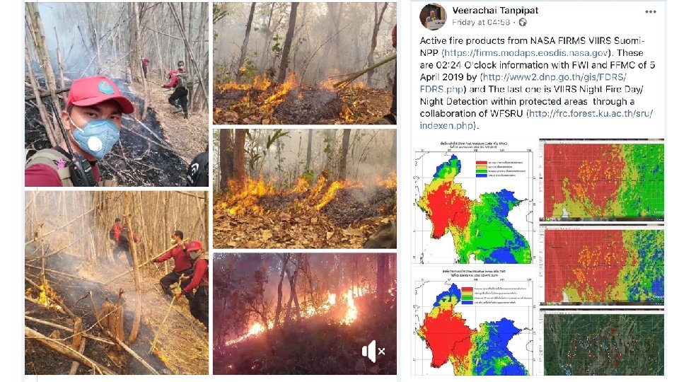
Fires shown in red detected using data from the VIIRS instrument on board the S-NPP satellite on April 1, 2019 https: //go. nasa. gov/2 YZZJz. S
FIRMS Users FIRMS - Core Services Brokers Direct users - Members of the public - Conservation groups - Strategic fire managers Re-distribute data from FIRMS e. g. - Global Wildfire Information System (JRC / EU, GEO, NASA, Copernicus - European Wildfire Information System (JRC / EU) - Fire. Cast (Conservation International) Data from FIRMS used for back up –if there is a gap in Direct Readout e. g. - Advanced Fire Information System (CSIR) - US Forest Service
Global Systems Short name Long name Organization URL / landing page Geographic coverage Instruments Data latency CLASS Comprehensive Large Array-Data Stewardship system NOAA http: //www. class. noaa. gov Global VIIRS (& GOES for North & South America and surrounding oceans) <1 day FIRMS Fire Information for Resource Management System NASA LANCE https: //firms. modaps. eosdis. nasa. gov Global MODIS, VIIRS Global Forest Watch Fires World Resources Institute https: //fires. globalforestwatch. org/map/ Global MODIS, VIIRS (& AVHRR for SE Asia) 3 -4 hours GWIS Global Wildfire Information System JRC http: //gwis. jrc. europa. eu/ Global MODIS, VIIRS 3 hours Worldview NASA EOSDIS Worldview VIIRS Active Fire Global Map 3 hours https: //worldview. earthdata. nasa. gov/ NASA EOSDIS https: //go. nasa. gov/2 Hs. Rqr. E Global MODIS, VIIRS 3 -4 hours University of Maryland http: //viirsfire. geog. umd. edu/map/viirs. Map. php Global VIIRS 24 hours https: //eogdata. mines. edu/download_viirs_fire. html Global VIIRS 3 -4 hours https: //www. star. nesdis. noaa. gov/jpss/mapper/ VIIRS and other JPSS sensors 3 -4 hours VIIRS Nigthtfire (VNF) Multispectral nighttime fire product with Earth Observation Group, temperature, source size and radiant heat. Colorado School of Mines JSTAR Mapper NOAA NESDIS STAR JPSS NOAA NESDIS Center for Data Visualization Satellite Applications and System Research (STAR) Global
Global Systems Short name Long name Organization URL / landing page Geographic coverage Instruments Data latency CLASS Comprehensive Large Array-Data Stewardship system NOAA http: //www. class. noaa. gov Global VIIRS (& GOES for North & South America and surrounding oceans) <1 day FIRMS Fire Information for Resource Management System NASA LANCE https: //firms. modaps. eosdis. nasa. gov Global MODIS, VIIRS Global Forest Watch Fires World Resources Institute https: //fires. globalforestwatch. org/map/ Global MODIS, VIIRS (& AVHRR for SE Asia) 3 -4 hours GWIS Global Wildfire Information System JRC http: //gwis. jrc. europa. eu/ Global MODIS, VIIRS 3 hours Worldview NASA EOSDIS Worldview VIIRS Active Fire Global Map 3 hours https: //worldview. earthdata. nasa. gov/ NASA EOSDIS https: //go. nasa. gov/2 Hs. Rqr. E Global MODIS, VIIRS 3 -4 hours University of Maryland http: //viirsfire. geog. umd. edu/map/viirs. Map. php Global VIIRS 24 hours https: //eogdata. mines. edu/download_viirs_fire. html Global VIIRS 3 -4 hours https: //www. star. nesdis. noaa. gov/jpss/mapper/ VIIRS and other JPSS sensors 3 -4 hours VIIRS Nigthtfire (VNF) Multispectral nighttime fire product with Earth Observation Group, temperature, source size and radiant heat. Colorado School of Mines JSTAR Mapper NOAA NESDIS STAR JPSS NOAA NESDIS Center for Data Visualization Satellite Applications and System Research (STAR) Global
Regional Systems AFIS Users select regions of the world MODIS, VIIRS, MSG 25 min ASEAN AVHRR <I hour NRSC, India http: //bhuvannoeda. nrsc. gov. in/disaster/disaster. php? id=fire India MODIS, VIIRS <I hour CWFIS-FM 3 Natural Resources Canada http: //cwfis. cfs. nrcan. gc. ca/home Canada MODIS, VIIRS, AVHRR 3 -4 hours EFFIS European Comission, JRC http: //effis. jrc. europa. eu/ Europe MODIS, VIIRS 3 -4 hours Conservation International http: //firecast. conservation. org/ Amazon, Madagascar, Suriname, Indonesia MODIS, VIIRS 3 -4 hours W Australian Landgate https: //sentinel. ga. gov. au/#/ Australia Himawari, AVHRR, MODIS, VIIRS 1 -4 hours USGS https: //www. geomac. gov/viewer. shtml USA MODIS, VIIRS 6 hours ASMC Bhuvan FIRECAST Fire Watch Geo. Mac HMS LAPAN CSIR ASEAN Specialized Meteorological Center http: //asmc. asean. org/asmc-hotspot NOAA/NESDIS Satellite Analysis Branch http: //www. ospo. noaa. gov/Products/land/hms. html N America and Canada*, C. America VIIRS MODIS (Aqua only), GOES*Alaska and N. Canada (May - Oct) West, AVHRR (METOP) <2 jhours– several hours Indonesia National Institute of Aeronautics and space http: //modiscatalog. lapan. go. id/monitoring/hotspot/index Indonesia MODIS, VIIRS 2 hours http: //geoapps. icimod. org/Nepal. Forest. Fire/# Nepal MODIS, VIIRS 3 -4 hours INPE, Brazil http: //www. inpe. br/queimadas South America AVHRR, MODIS, VIIRS, GOES, 25 min SSEC, University of Wisconsin-Madison http: //realearth. ssec. wisc. edu/ Primary focus USA / Canada GOES, COMS, GK-2 A, MET 10, MTSAT, MODIS, VIIRS 5 mins- 4 hrs USFS RSAC https: //fsapps. nwcg. gov/ USA / Canada AVHRR, GOES, MODIS, VIIRS 25 min Geoscience Australia http: //srss. landgate. wa. gov. au/fire. php Australia Himawari, MODIS, VIIRS 25 min http: //incendios. conabio. gob. mx/ Mexico MODIS, VIIRS 20 -45 mins http: //wfabba. ssec. wisc. edu/ Varies from <5 N & S America, Europe, Africa, Asia, minutes to 4 Australia GOES, COMS, GK 2 -A, MET 10, MTSAT hours Nepal Forest Fire ICIMOD / SERVIR Queimadas Real. Earth RSAC Sentinel Sistema de Alerta de Incendios CONABIO, Mexico WFABBA https: //dashboard. afis. co. za/ SSEC/ University of Wisconsin-Madison
Regional Systems AFIS Users select regions of the world MODIS, VIIRS, MSG 25 min ASEAN AVHRR <I hour NRSC, India http: //bhuvannoeda. nrsc. gov. in/disaster/disaster. php? id=fire India MODIS, VIIRS <I hour CWFIS-FM 3 Natural Resources Canada http: //cwfis. cfs. nrcan. gc. ca/home Canada MODIS, VIIRS, AVHRR 3 -4 hours EFFIS European Comission, JRC http: //effis. jrc. europa. eu/ Europe MODIS, VIIRS 3 -4 hours Conservation International http: //firecast. conservation. org/ Amazon, Madagascar, Suriname, Indonesia MODIS, VIIRS 3 -4 hours W Australian Landgate https: //sentinel. ga. gov. au/#/ Australia Himawari, AVHRR, MODIS, VIIRS 1 -4 hours USGS https: //www. geomac. gov/viewer. shtml USA MODIS, VIIRS 6 hours ASMC Bhuvan FIRECAST Fire Watch Geo. Mac HMS LAPAN CSIR ASEAN Specialized Meteorological Center http: //asmc. asean. org/asmc-hotspot NOAA/NESDIS Satellite Analysis Branch http: //www. ospo. noaa. gov/Products/land/hms. html N America and Canada*, C. America VIIRS MODIS (Aqua only), GOES*Alaska and N. Canada (May - Oct) West, AVHRR (METOP) <2 jhours– several hours Indonesia National Institute of Aeronautics and space http: //modiscatalog. lapan. go. id/monitoring/hotspot/index Indonesia MODIS, VIIRS 2 hours http: //geoapps. icimod. org/Nepal. Forest. Fire/# Nepal MODIS, VIIRS 3 -4 hours http: //www. inpe. br/queimadas South America AVHRR, MODIS, VIIRS, GOES, 25 min 5 mins- 4 hrs Nepal Forest Fire ICIMOD / SERVIR Queimadas https: //dashboard. afis. co. za/ INPE, Brazil SSEC, University of Wisconsin-Madison http: //realearth. ssec. wisc. edu/ Primary focus USA / Canada GOES, COMS, GK-2 A, MET 10, MTSAT, MODIS, VIIRS USFS RSAC https: //fsapps. nwcg. gov/ USA / Canada AVHRR, GOES, MODIS, VIIRS 25 min SAF FRP Kings College London http: //wildfire. geog. kcl. ac. uk/firemap MSG SEVIRI <30 mins Sentinel Geoscience Australia http: //srss. landgate. wa. gov. au/fire. php Australia Himawari, MODIS, VIIRS 25 min http: //incendios. conabio. gob. mx/ Mexico MODIS, VIIRS Real. Earth RSAC Sistema de Alerta de Incendios CONABIO, Mexico WFABBA SSEC/ University of Wisconsin-Madison http: //wfabba. ssec. wisc. edu/ 20 -45 mins Varies from <5 N & S America, Europe, Africa, Asia, minutes to 4 Australia GOES, COMS, GK 2 -A, MET 10, MTSAT hours
Week Ending 3 6 32 19 -0 20 31 9 30 19 -0 20 3 2 30 19 -0 20 22 6 21 9 2 20 19 -0 20 Volume Distributed (Gbytes) 4. 0 3. 0 # Files Distributed # Files 20 6 12 19 -0 20 9 2 11 19 -0 20 5 10 11 19 -0 20 9 2 22 19 -0 20 18 -1 20 5 21 22 18 -1 20 1 8 20 18 -1 20 Weekly Daily Average FIRMS Data Volume and Files Distributed by LANCE MODAPS December 1, 2018 - March 23, 2019 7. 0 Volume (GB) 18, 000 6. 0 5. 0 12, 000 6, 000 2. 0 1. 0 0
Future • Working with GIBS / Worldview team to improve the integration of FIRMS • This will benefit FIRMS site and FIRMS data brokers that use FIRMS WMS to feed their map applications. During the huge wildfires in California FIRMS struggled to support increase in map service demand. To prevent high volume WMS usage by a few users, a WMS access key was introduced to provide more balanced and “equal” access to the map server. • Since GIBS can manage large volume of map data, our goal is to integrate with their system to utilize some of their map services for FIRMS either as WMS or WMTS.