
UNITED STATES OF AMER GLOBAL POSITIONING SYSTEM Status
UNITED STATES OF AMER GLOBAL POSITIONING SYSTEM Status and U. S. Policy Update Swedish Radio Navigation Seminar Stockholm, Sweden October 21, 2008 Charles Daniels Senior Advisor, National Coordination Office United States of America

Overview • • Introduction Global Positioning System Modernization Plans U. S. Policy 2
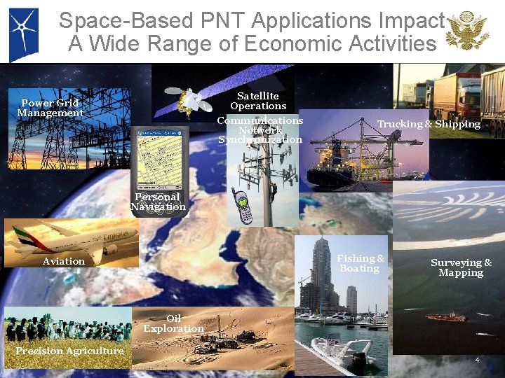
Space-Based PNT Applications Impact A Wide Range of Economic Activities Satellite Operations Power Grid Management Communications Network Synchronization Trucking & Shipping Personal Navigation Fishing & Boating Aviation Surveying & Mapping Oil Exploration Precision Agriculture 4 3
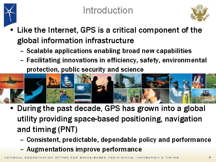
Introduction • Like the Internet, GPS is a critical component of the global information infrastructure – Scalable applications enabling broad new capabilities – Facilitating innovations in efficiency, safety, environmental protection, public security and science • During the past decade, GPS has grown into a global utility providing space-based positioning, navigation and timing (PNT) – Consistent, predictable, dependable policy and performance – Augmentations improve performance 4
GPS Introduction • Owned and operated by the U. S. Government – Funded by U. S. taxpayers – Managed at a national level as a multi-use asset – Acquired and operated by the U. S. Air Force on behalf of the U. S. Government per US Law Title 10, Section 2281 – 30 years of operation – 1 st launch February 1978 • GPS service is a one-way broadcast, like FM radio – Unlimited number of users – Civil GPS signals are free of direct user fees • Public domain documentation – Available on an equal basis to users and industry – Anyone in the world can develop GPS user equipment 5
Overview • • Introduction Global Positioning System Modernization Plans U. S. Policy 6
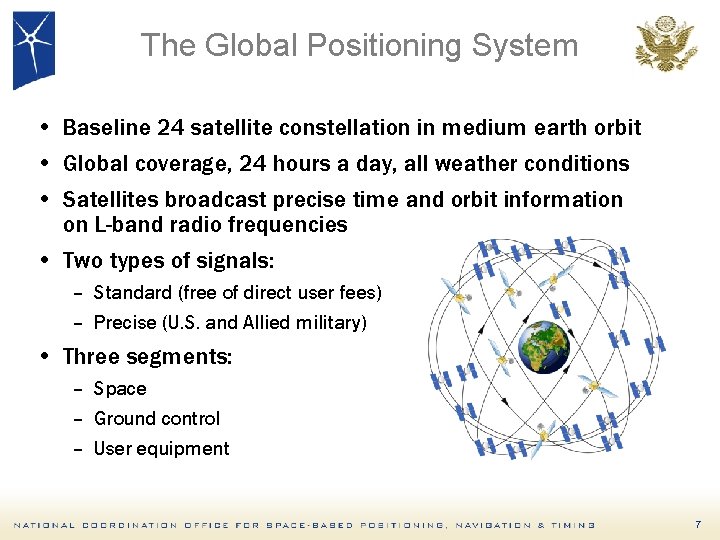
The Global Positioning System • Baseline 24 satellite constellation in medium earth orbit • Global coverage, 24 hours a day, all weather conditions • Satellites broadcast precise time and orbit information on L-band radio frequencies • Two types of signals: – Standard (free of direct user fees) – Precise (U. S. and Allied military) • Three segments: – Space – Ground control – User equipment 7

GPS Constellation Status 31 Healthy Satellites As of October 17, 2008 (Baseline Constellation: 24) • 33 Satellites on Orbit – – 13 Block IIA 12 Block IIR 6 Block IIR-M 2 Block IIA Spares • Next launchs: – March 2009 – IIR-M 20 – August 2009 – IIR-M 21 (Last IIR) – October 2009 – 1 st Launch of IIF 8
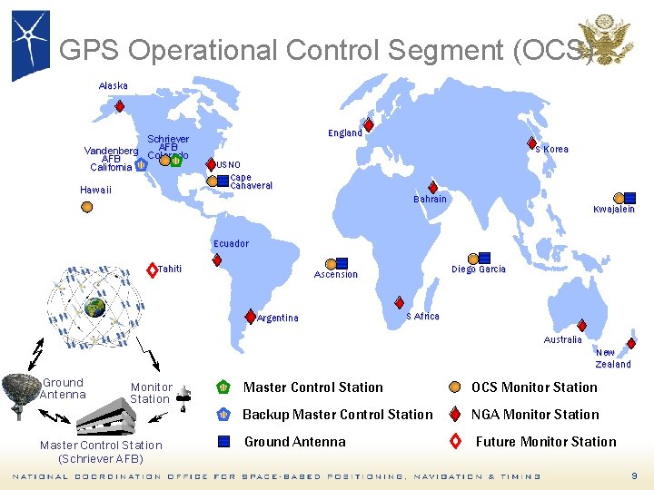
GPS Operational Control Segment (OCS) Alaska Schriever AFB Vandenberg Colorado AFB California Hawaii England S Korea USNO Cape Canaveral Bahrain Kwajalein Ecuador Tahiti Diego Garcia Ascension Argentina S Africa Australia New Zealand Ground Antenna Monitor Station Master Control Station (Schriever AFB) Master Control Station OCS Monitor Station Backup Master Control Station NGA Monitor Station Ground Antenna Future Monitor Station 9
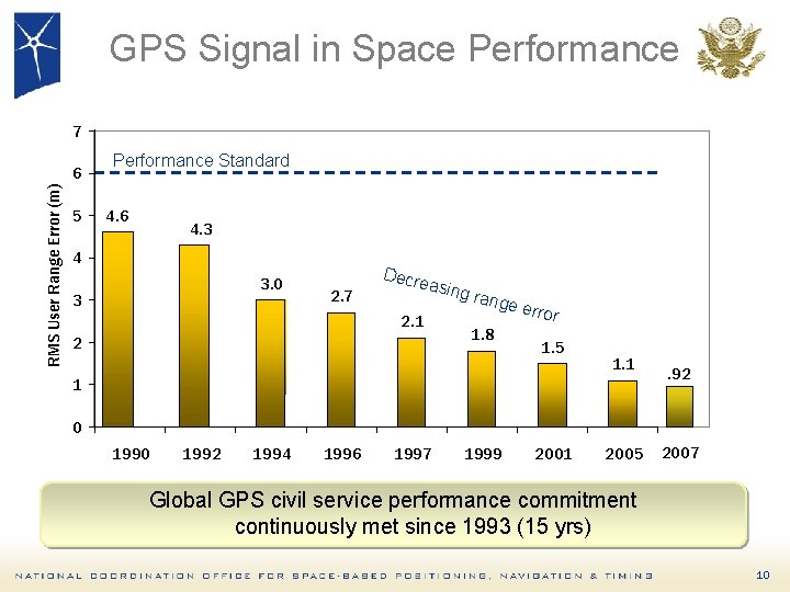
GPS Signal in Space Performance 7 RMS User Range Error (m) 6 5 Performance Standard 4. 6 4. 3 4 3. 0 3 2. 7 Decr easin 2. 1 2 g ran ge er 1. 8 ror 1. 5 1. 1 1 . 92 0 1992 1994 1996 1997 1999 2001 2005 2007 Global GPS civil service performance commitment continuously met since 1993 (15 yrs) 10
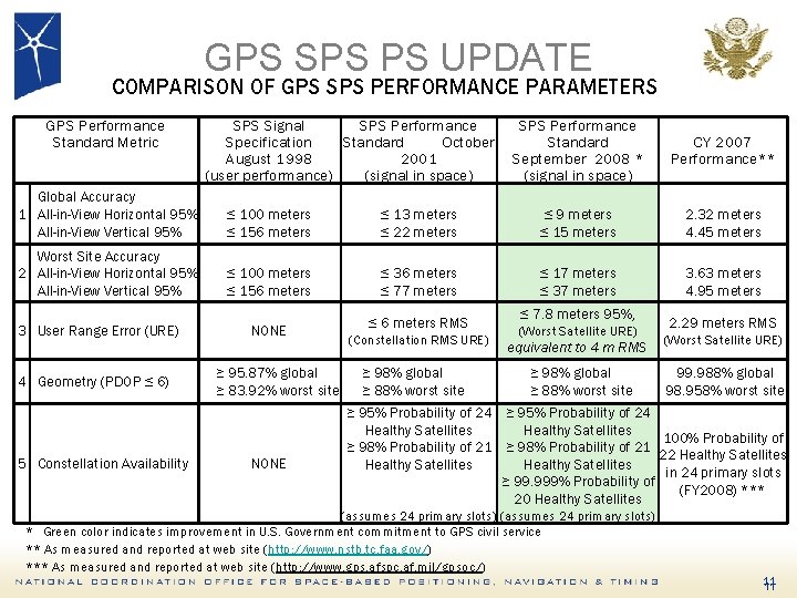
GPS SPS PS UPDATE COMPARISON OF GPS SPS PERFORMANCE PARAMETERS GPS Performance Standard Metric SPS Signal SPS Performance Specification Standard October August 1998 2001 (user performance) (signal in space) SPS Performance Standard September 2008 * (signal in space) CY 2007 Performance** Global Accuracy 1 All-in-View Horizontal 95% All-in-View Vertical 95% ≤ 100 meters ≤ 156 meters ≤ 13 meters ≤ 22 meters ≤ 9 meters ≤ 15 meters 2. 32 meters 4. 45 meters Worst Site Accuracy 2 All-in-View Horizontal 95% All-in-View Vertical 95% ≤ 100 meters ≤ 156 meters ≤ 36 meters ≤ 77 meters ≤ 17 meters ≤ 37 meters 3. 63 meters 4. 95 meters 3 User Range Error (URE) 4 Geometry (PDOP ≤ 6) 5 Constellation Availability NONE ≥ 95. 87% global ≥ 83. 92% worst site NONE ≤ 6 meters RMS (Constellation RMS URE) ≥ 98% global ≥ 88% worst site ≤ 7. 8 meters 95%, (Worst Satellite URE) equivalent to 4 m RMS ≥ 98% global ≥ 88% worst site 2. 29 meters RMS (Worst Satellite URE) 99. 988% global 98. 958% worst site ≥ 95% Probability of 24 Healthy Satellites 100% Probability of ≥ 98% Probability of 21 22 Healthy Satellites in 24 primary slots ≥ 99. 999% Probability of (FY 2008) *** 20 Healthy Satellites (assumes 24 primary slots) * Green color indicates improvement in U. S. Government commitment to GPS civil service ** As measured and reported at web site (http: //www. nstb. tc. faa. gov/) *** As measured and reported at web site (http: //www. gps. afspc. af. mil/gpsoc/) 11 11
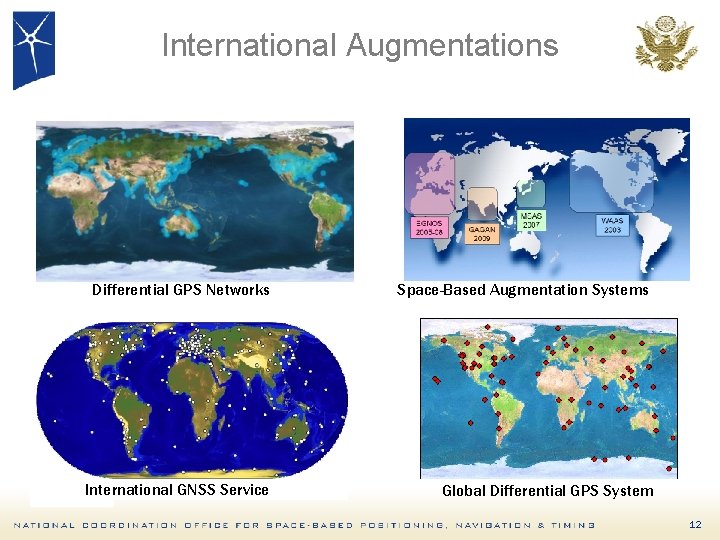
International Augmentations Differential GPS Networks Space-Based Augmentation Systems International GNSS Service Global Differential GPS System 12
Overview • • Introduction Global Positioning System Modernization Plans U. S. Policy 13
Recent GPS Improvements • Launched 3 modernized satellites in past year – Largest GPS constellation size ever – Second Civil Signal (L 2 C) now on orbit • Transitioned to modernized master control station – Improved operational flexibility and responsiveness – Added backup control station • Expanded GPS ground network to triple amount of monitor data sent to control station – 10 -15% improvement in accuracy of GPS data broadcast 14
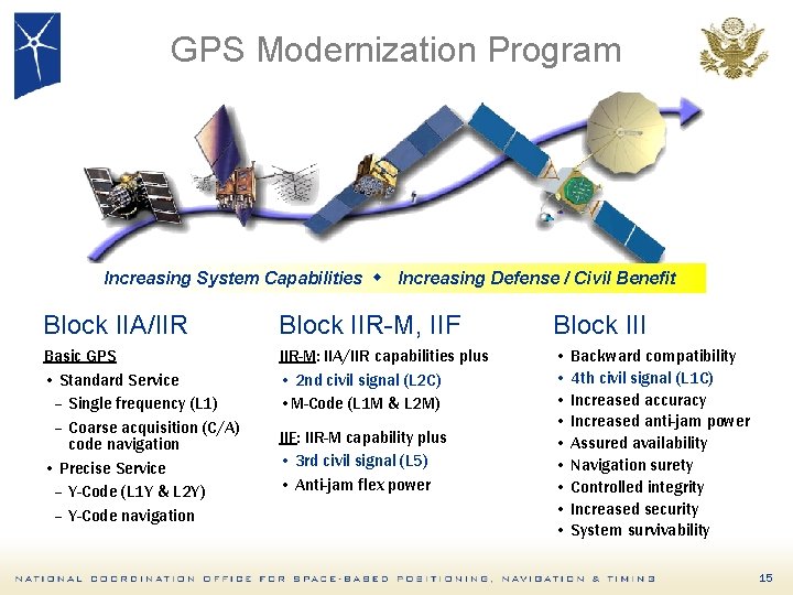
GPS Modernization Program Increasing System Capabilities w Increasing Defense / Civil Benefit Block IIA/IIR Block IIR-M, IIF Block III Basic GPS • Standard Service – Single frequency (L 1) – Coarse acquisition (C/A) code navigation • Precise Service – Y-Code (L 1 Y & L 2 Y) – Y-Code navigation IIR-M: IIA/IIR capabilities plus • 2 nd civil signal (L 2 C) • M-Code (L 1 M & L 2 M) • Backward compatibility • 4 th civil signal (L 1 C) • Increased accuracy • Increased anti-jam power • Assured availability • Navigation surety • Controlled integrity • Increased security • System survivability IIF: IIR-M capability plus • 3 rd civil signal (L 5) • Anti-jam flex power 15
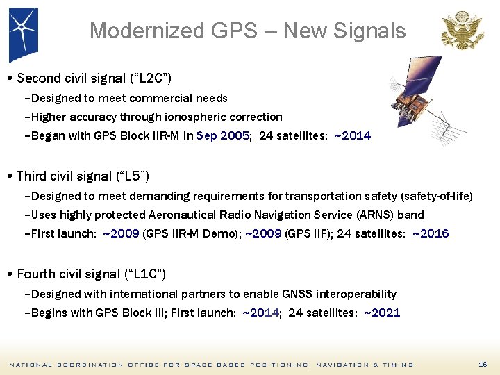
Modernized GPS – New Signals • Second civil signal (“L 2 C”) –Designed to meet commercial needs –Higher accuracy through ionospheric correction –Began with GPS Block IIR-M in Sep 2005; 24 satellites: ~2014 • Third civil signal (“L 5”) –Designed to meet demanding requirements for transportation safety (safety-of-life) –Uses highly protected Aeronautical Radio Navigation Service (ARNS) band –First launch: ~2009 (GPS IIR-M Demo); ~2009 (GPS IIF); 24 satellites: ~2016 • Fourth civil signal (“L 1 C”) –Designed with international partners to enable GNSS interoperability –Begins with GPS Block III; First launch: ~2014; 24 satellites: ~2021 16
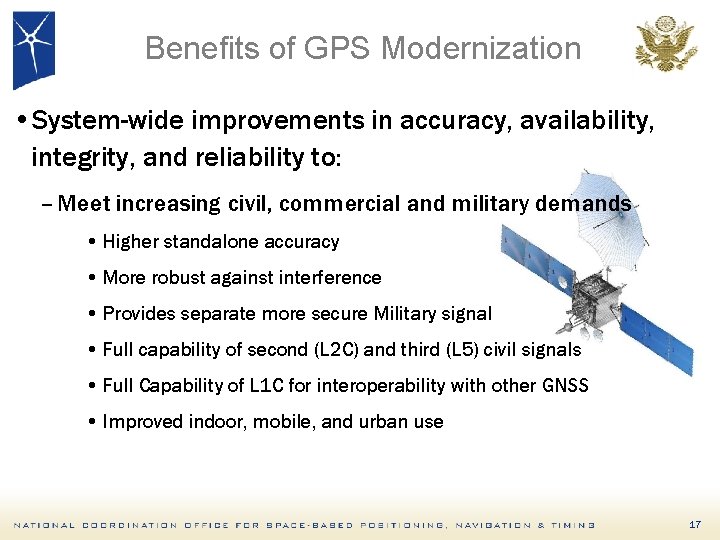
Benefits of GPS Modernization • System-wide improvements in accuracy, availability, integrity, and reliability to: – Meet increasing civil, commercial and military demands • Higher standalone accuracy • More robust against interference • Provides separate more secure Military signal • Full capability of second (L 2 C) and third (L 5) civil signals • Full Capability of L 1 C for interoperability with other GNSS • Improved indoor, mobile, and urban use 17
GPS III Update • Contract for GPS III-A satellites awarded in May 08 – Selective Availability feature to be eliminated – First Launch 2013 • Contracts for Next-Generation Operational Control Segment (OCX) awarded in January 08 – Will implement full functionality of L 2 C and L 5 • Future increments of GPS III will incorporate additional capabilities – As technology matures and new requirements are validated 18
Overview • • Introduction Global Positioning System Modernization Plans U. S. Policy 19
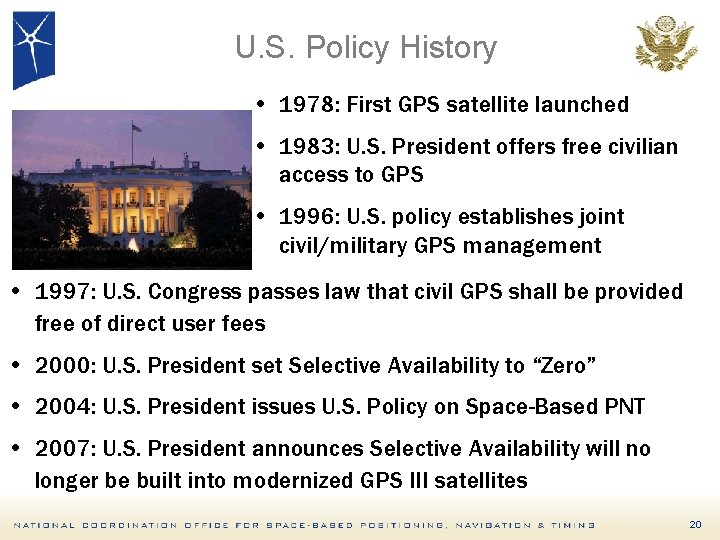
U. S. Policy History • 1978: First GPS satellite launched • 1983: U. S. President offers free civilian access to GPS • 1996: U. S. policy establishes joint civil/military GPS management • 1997: U. S. Congress passes law that civil GPS shall be provided free of direct user fees • 2000: U. S. President set Selective Availability to “Zero” • 2004: U. S. President issues U. S. Policy on Space-Based PNT • 2007: U. S. President announces Selective Availability will no longer be built into modernized GPS III satellites 20
U. S. Policy Promotes Global Use of GPS Technology • No direct user fees for civil GPS services – Provided on a continuous, worldwide basis • Open, public signal structures for all civil services – Promotes equal access for user equipment manufacturing, applications development, and valueadded services – Encourages open, market-driven competition • Global compatibility and interoperability with GPS • Service improvements for civil, commercial, and scientific users worldwide • Protection of radionavigation spectrum from disruption and interference 21
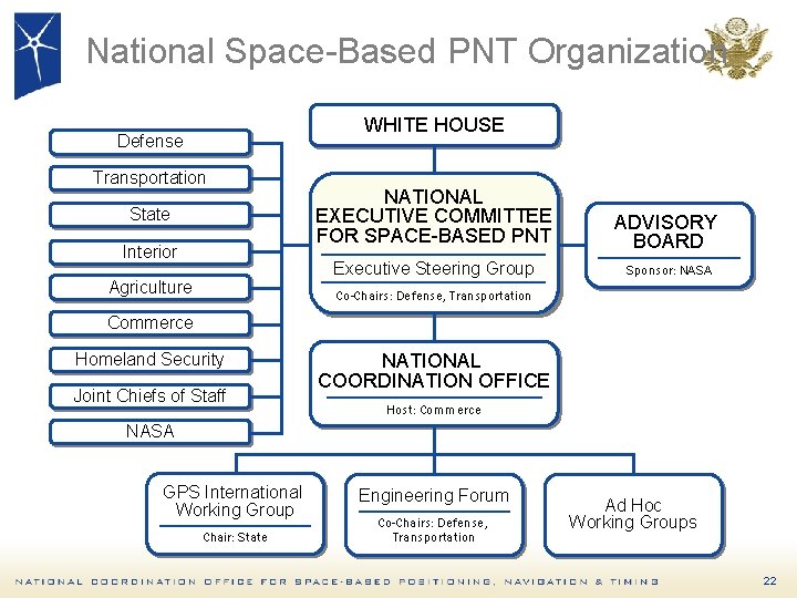
National Space-Based PNT Organization WHITE HOUSE Defense Transportation State Interior Agriculture NATIONAL EXECUTIVE COMMITTEE FOR SPACE-BASED PNT ADVISORY BOARD Executive Steering Group Sponsor: NASA Co-Chairs: Defense, Transportation Commerce Homeland Security Joint Chiefs of Staff NATIONAL COORDINATION OFFICE Host: Commerce NASA GPS International Working Group Chair: State Engineering Forum Co-Chairs: Defense, Transportation Ad Hoc Working Groups 22
Keys to the Global Success of GPS • Program Stability and Performance – Civil service performance commitment met continuously since December 1993 – Continuity of constellation and signals ensured through Air Force operation and acquisition – Continuous improvements in accuracy, availability, etc. – Funding through U. S. taxpayers • Policy Stability and Transparency – – – Open access to civil GPS signals, free of direct user fees Open, free, and stable technical documentation Market-based competition worldwide Liberal export controls on GPS user equipment National-level policy coordination including civil and military leaders • Commercial Entrepreneurship and Investment 23
U. S. Cooperation Efforts • Cooperative relationships established with Europe, Japan, Russia, India, Australia • U. S. goals: – Compatibility and interoperability – National security – Level playing field in global markets • Multilateral cooperation – International Committee on GNSS – ICAO, IMO, NATO 24
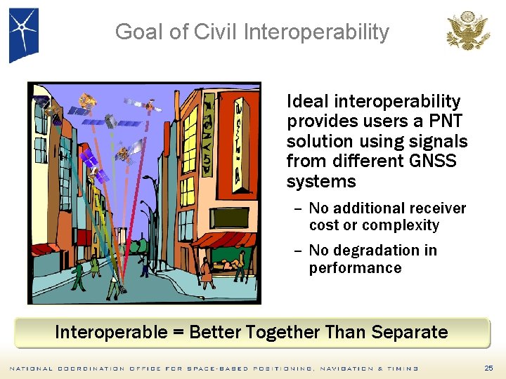
Goal of Civil Interoperability Ideal interoperability provides users a PNT solution using signals from different GNSS systems – No additional receiver cost or complexity – No degradation in performance Interoperable = Better Together Than Separate 25
Summary • GPS performance is better than designed – New Civil GPS signal (L 2 C) now available on 6 satellites – Modernization will bring additional improvements in Accurary and Availability. • Implementing U. S. National Space-Based PNT Policy – National Executive Committee directly engaged • U. S. policy encourages and promotes worldwide use of civil GPS and augmentations International cooperation through GNSS compatibility and interoperability is a U. S. priority 26
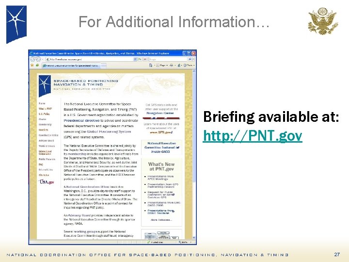
For Additional Information… Briefing available at: http: //PNT. gov 27
Contact Info Charles Daniels National Coordination Office for Space-Based PNT Washington, DC 20230 Tele: 202 -482 -6726 Email: charles. daniels@pnt. gov Web sites: http: //pnt. gov http: //gps. gov 28
- Slides: 28