UNITED STATES DENSITY AND DISTRIBUTION Population Density 87
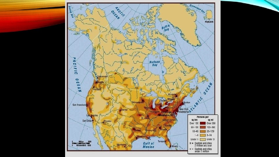

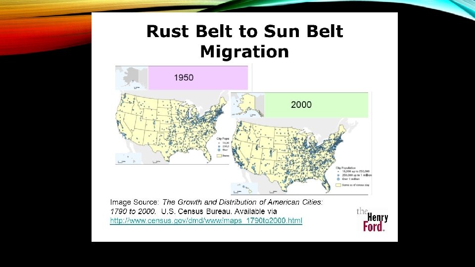
UNITED STATES: DENSITY AND DISTRIBUTION • Population Density = 87 people/sq. Mile • Northeast & Great Lakes regions = MORE densely populated • Historic centers of commerce and industry • Pacific Coast • Mild climate and economic opportunity • Subarctic region of Alaska, Great Basin, & parts of arid/semi-arid Great Plains = least densely populated • American South & Southwest = fastest growing areas (Sunbelt)

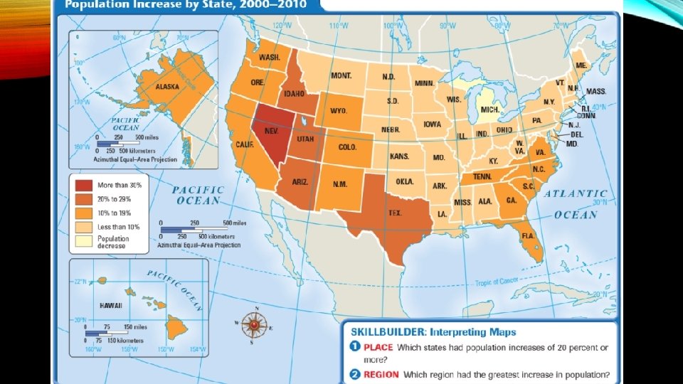
THE SUNBELT OF THE U. S. • Area nicknamed the Sunbelt because of mild climate • Draws people to growing manufacturing, service & tourism industries • Proximity to Mexico & Caribbean draws immigrants to region

URBAN AREAS OF THE U. S. • Urbanization – movement of people from rural to urban areas • Mechanized agriculture = fewer workers needed = move to cities to find job • Metropolitan Area – includes a city with a population of at least 50, 000 people & outlying communities called suburbs • Most people in the U. S. live in metropolitan areas

URBAN AREAS OF THE U. S. • Urban Sprawl – As metropolitan areas become crowded, leads to the further spread of people & suburban development • Megalopolis – a “great city” that is made up of several large & small cities • U. S. population clusters in coastal areas where strong economies are linked to world trade & can support large populations • Example – area between Boston & Washington, D. C. along Atlantic coast called Boswash megalopolis

URBAN SPRAWL • Increasing area of concern • Caused by unrestricted growth with no plans to contain it • Cheap gas = travel farther for jobs • Prefer cars to mass transit • Causing crumbling infrastructure • Sustainable Communities: turn suburbs into community where residents can live and work in harmony with the environment • Cuts down on commuting

WHERE AMERICANS LIVE • 80% of Americans live in cities or surrounding suburbs • Rural to cities to suburbs • Because of automobiles • Northeast = gateway to America b/c of its position on Atlantic Coast • South = switching from agricultural to industrial region = growing cities • West = ½ of land area, 1/5 of population • Most rapidly growing region in U. S.

CANADA: DENSITY & DISTRIBUTION • Most of Canada inhospitable due to rugged terrain and bitterly cold climate • 90% of population lives along US-Canada border • Average population density = 9 people/sq. Mile • Most densely populated areas near waterways & places that support agriculture • Past 100 years internal migrations to Prairie Provinces – Manitoba, Saskatchewan & Alberta • Due in part to discovery of oil & natural gas in 1960’s

WHERE CANADIANS LIVE • Harsh environment & accessibility to transportation routes influences population settlement • Port cities & farmland = most densely settled • 80% of Canadians live on 10% of land • Most on 100 mile-wide strip of land along border • Increasingly urban population • 75% French-Canadians = Quebec • Natives live on reserves • Canadians with Asian ancestry = West Coast
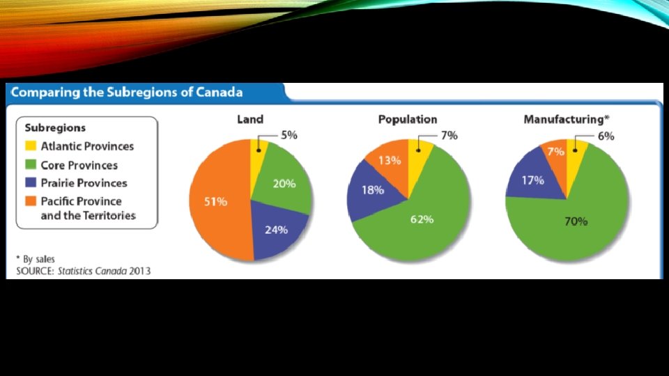

CANADA: URBAN AREAS • Most population lives in urban areas • Toronto – largest city, industrial & financial center • Montreal – industrial & shipping center, ships reach inland through St. Lawrence & Ottawa Rivers & Great Lakes • Vancouver – handles nearly all trade between Canada & Asia • Edmonton – grew with development of petroleum industry
- Slides: 14