Unit 2 Weather Systems Synoptic Weather Map weather


 Early Stage Swirl develops as winds blow in opposite directions along")

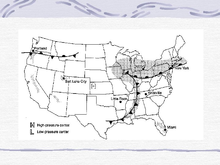
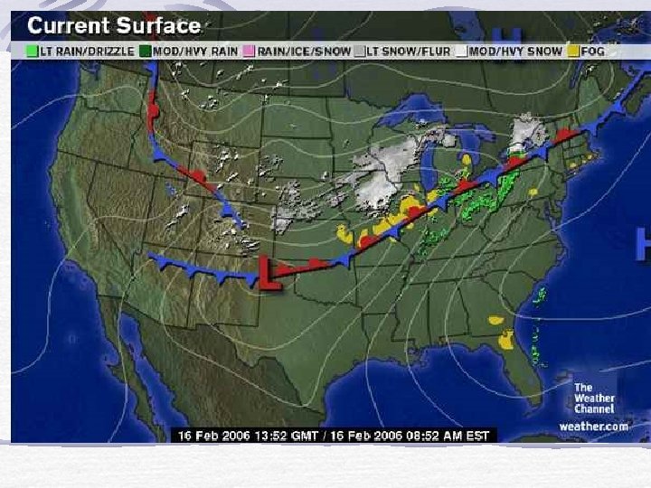
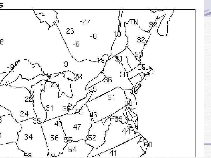
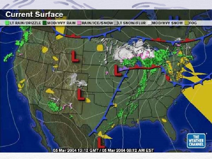
 Which cities are receiving precipitation? New York Detroit 2) Which city has")


- Slides: 40
Unit #2: Weather Systems
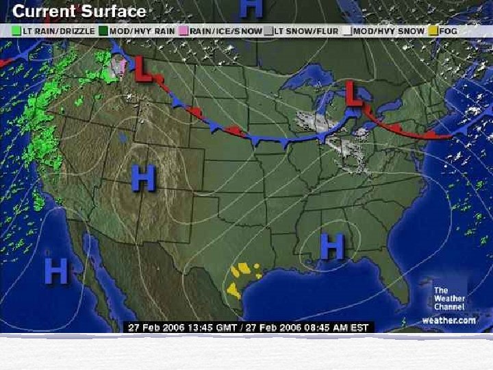
Synoptic Weather Map weather map that show a variety of atmospheric conditions Such as: temperature, pressure, precipitation, cloud cover, wind speed and direction, weather in the US moves from generally from west to east, synoptic weather maps give information to make predictions
Interpreting Information from a Surface Station
A large amount of information is display, in a specific format. 1. location shown by the circle 2. cloud cover amount of circle that is darkened 3. wind direction line indicates direction the wind is coming from 4. wind speed feathers at the end 5. air temperature in Fahrenheit (upper left) 6. dew point lower left in Fahrenheit (lower left) 7. current weather conditions middle left, check ESRT for key 8. air pressure coded* pressure, in millibars (upper right) 9. changes in air pressure increasing pressure indicates better weather, decreasing pressure indicates an approaching storm, change over past three hours 10. precipitation amount over past 6 hours in inches
Decoding and Coding Air Pressures If the coded pressure begins with a number less than 5 add a “ 10” to the front and add a decimal If the coded pressure begins with a number greater than 5 add a “ 9” to the front and add a decimal To code a pressure: Remove the “ 9” at the beginning and the decimal Remove the “ 10” at the beginning and the decimal
Examples Coded Decode 114 1011. 4 684 968. 4 020 1002. 0 368 1036. 8 995 999. 5 845 984. 5 922 992. 2 043 1004. 3 005 1000. 5 800 980. 0
Air Masses Air Mass body of air with uniform temperature, pressure, and humidity movement of air masses brings changes in the weather characteristics of an air mass is dependent upon its geographic origin
Air Mass c. A – continental arctic c. P – continental polar c. T – continental tropical Temperature Very cold Cold Warm Humidity Dry Dry m. T – maritime tropical m. P – maritime polar Warm Cold Moist
Front leading edge of an air mass when a front passes, precipitation often occurs and there is a change in temperature, humidity and pressure
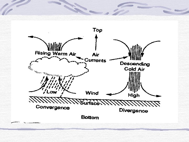
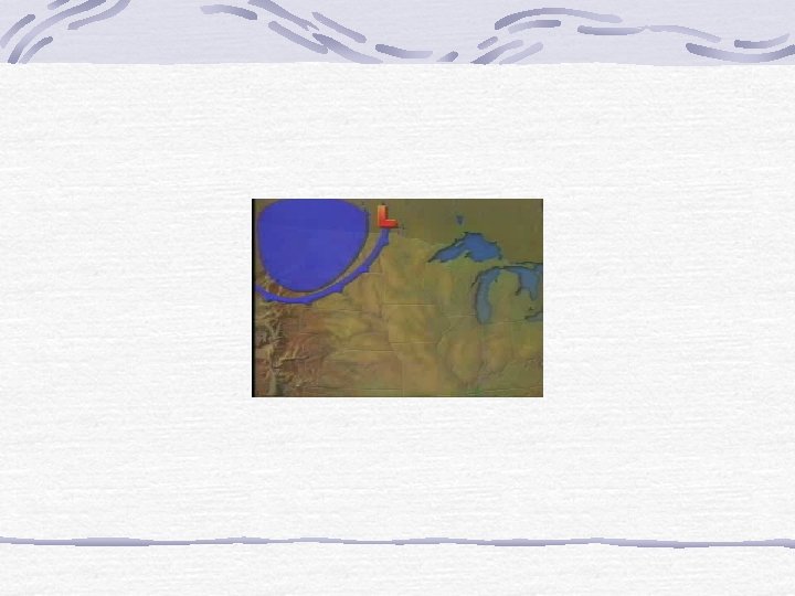
Predicting Weather High and Low Pressures center of pressure systems in which air circulates
High “H” used to represent the center of the system divergence zones, where sinking air causes winds to blow outward generally, bring cool, dry air with clear skies winds rotate clockwise around the center anticyclone
Low “L” used to represent the center of the system convergence zones, where rising air causes winds to blow inward associated with changeable weather, cloudy skies and precipitation fronts are generally associated with low pressures winds rotate counterclockwise around the center cyclone
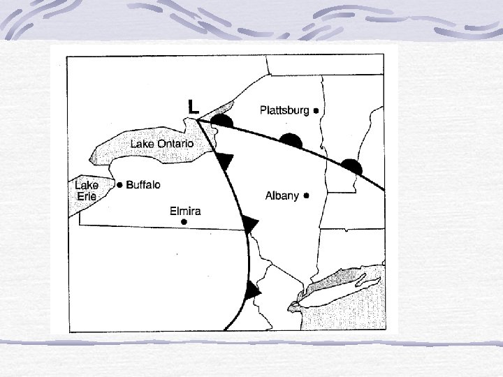
Types of Fronts Cold, warm, occluded, stationary
Cold Front leading edge of a cold air mass more dense air, makes a steep frontal profile rapid rising and cooling of air, creating cumulus clouds associated with heavy precipitation, followed by cool temperatures Precipitation occurs at the front
Warm front leading edge of a warm air mass less dense air, makes a gentle frontal profile slow rising and cooling of air, creating stratus clouds associated with light precipitation, followed by warm temperatures Precipitation occurs before the front
Occluded Front cold air mass has overtaken a warm air mass combination of both warm and cold fronts long duration of heavy precipitation
Stationary front air moves parallel to the front little rising of air and little cloud formation
Stages of Development of a Mid. Latitude Cyclone
Stage Description 1) Early Stage Swirl develops as winds blow in opposite directions along a stationary front 2) Open Stage Fronts begin to rotate counterclockwise around the low pressure, well defined warm and cold fronts are created 3) Occluded Stage Cold, dense air overtakes the warm, less dense air creating an occluded front 4) Dissolving Stage Warm air is isolated above the cold air, losing its identity, An early stage might redevelop in the quake of the dissolving stage.
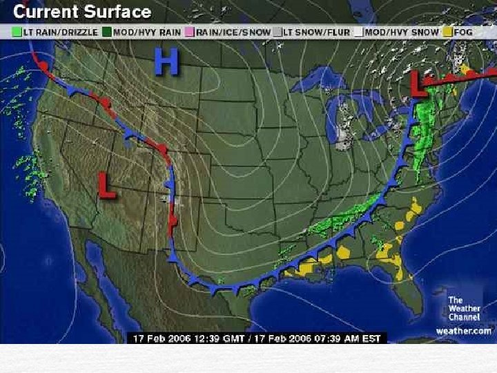
Making the Prediction Location Albany Plattsburg Prediction Increased cloud, lower pressure, heavy precipitation followed by cooler temperatures Increased cloud cover, lower pressure, light precipitation followed by warmer temperatures Reason Approaching cold front Approaching warm front
Questions: 1) Which cities are receiving precipitation? New York Detroit 2) Which city has a higher temperature? Knoxville or Little Rock 3) Match the following forecasts with the correct city. __C__ Detroit A) Few more hours of precipitation, then clearing skies leading to warmer temperatures __A_ New York B) Clear today, but increasing clouds with strong thunderstorms and high winds, followed by cooler air __B__ Knoxville C) Continued rain, sometimes heavy, temperatures remaining relatively constant
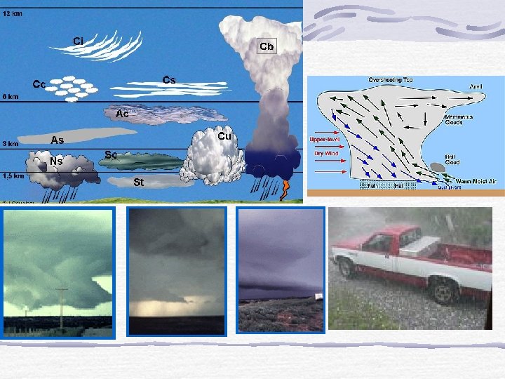
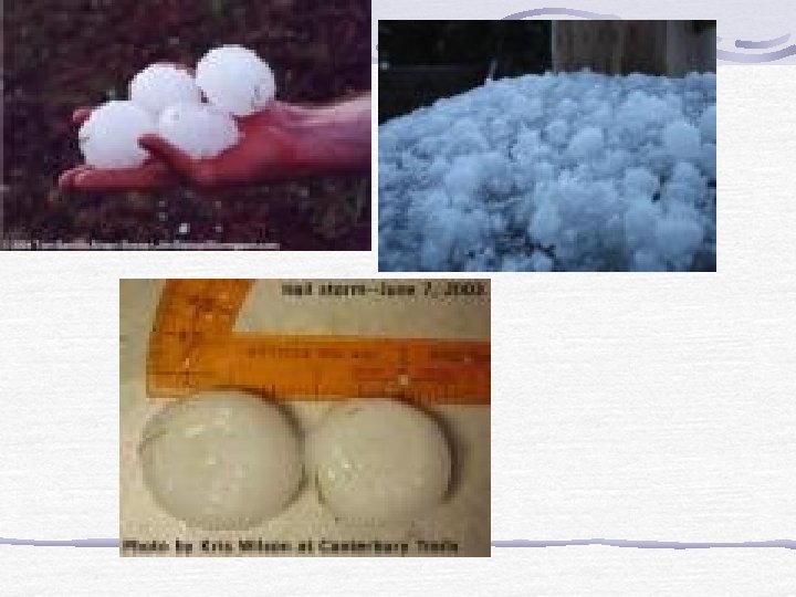
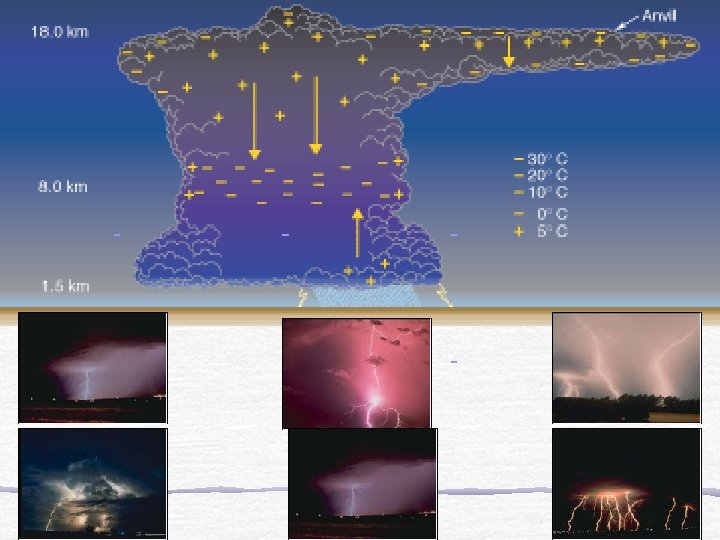
Severe Weather Thunderstorms large storms associated with fast moving cold front, containing lightening, thunder, high winds and sometimes hail Take cover, don’t stay near tall exposed objects
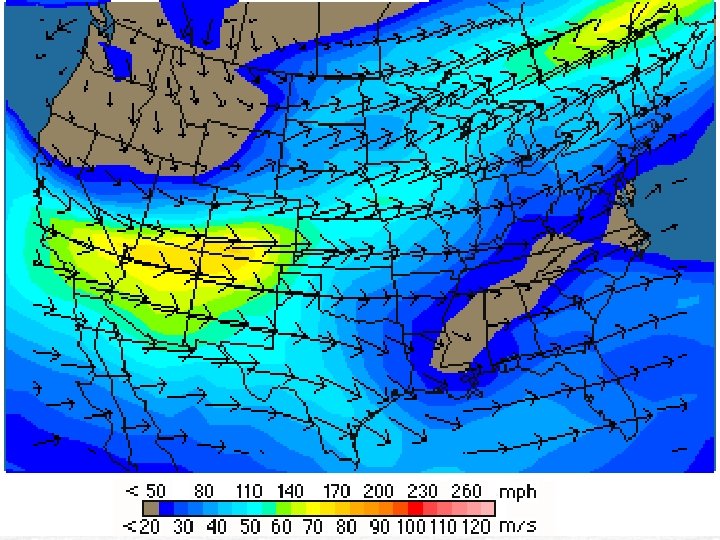
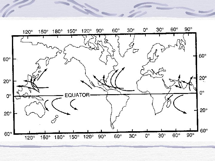
Tornados common in the spring and summer in the central US as m. T and c. P air masses collide winds can be very strong, up to 300 mph take cover in a basement of root cellar, avoid windows
Hurricanes Large tropical storms that generally move west and then north up the coast of the US strong sustained winds, and flooding are usually associated with hurricanes move inland, board up window