Unit 2 Physical Geography Climate and Landforms Read


- Slides: 11
Unit 2: Physical Geography Climate and Landforms
Read Section 2 Student Text
Thematic Maps A thematic map is a map that emphasizes a particular theme or special topic such as the average distribution of rainfall in an area. Thematic maps focus on a variety of topics-some focus on physical geography � Display physical features--landforms, bodies of water � Can also focus on climate �
Thematic Maps � Thematic maps can also focus on human geography � Examples include political maps, economic activities, natural resources, and population density
How to Read a Thematic Map �Always look at the title �Look at the map key in order to interpret the symbols or colors http: //geography. about. com/gi/o. htm? zi=1/XJ&z. Ti=1&sdn= geography&cdn=education&tm=107&f=11&su=p 284. 13. 34 2. ip_&tt=2&bts=2&zu=http%3 A//www. mapsofworld. c om/thematic-maps/
Thematic Map Activity � Create a thematic map of Warren East High School � Directions: � Decide on a theme you would like for your map. � Create your map based on that theme
How Will We Learn About Thematic Maps? This section of the unit has six phases, covering six types of thematic maps: (1) world physical features (2) world climate (3) world vegetation (4) world population density (5) world economic activity (6) world regions.
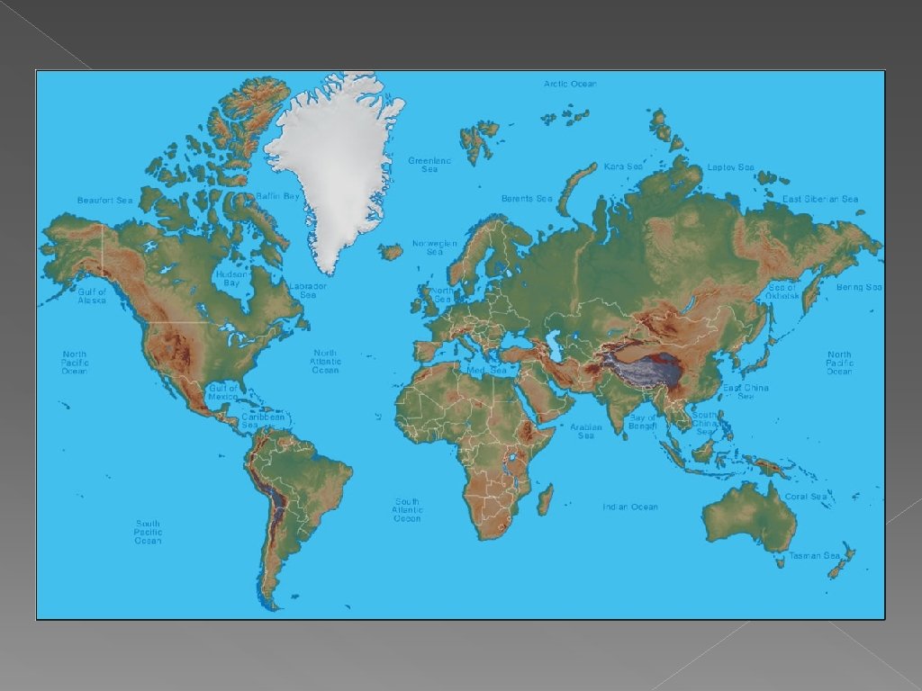
Mapping Earth’s Physical Features
Landforms � Geographers have given names to the common features � Physical features maps show the shapes of features as seen from above. They show height and elevation. › Typically use colors and shading to show elevation
Landforms � Bodies of water are also labeled on physical features maps � Examples include rivers, lakes, oceans, seas, gulfs, etc.